Esta página no es una página oficial de la aplicación ni de su desarrollador, sino una publicación editorial independiente creada con fines informativos y de comentario. Salvo que se indique expresamente lo contrario, ni la aplicación ni su desarrollador están afiliados, respaldados, patrocinados, autorizados ni conectados oficialmente con MWM, Apple, Google Play, el editor de la aplicación ni su desarrollador, y nada en esta página implica que la aplicación haya sido desarrollada utilizando los servicios de MWM. Todas las marcas comerciales, logotipos, capturas de pantalla y demás contenidos son propiedad de sus respectivos propietarios.

FlyQ+ EFB
Maximiza tu conocimiento de la situación con pronóstico meteorológico predictivo 4D, visión sintética 3D y protección contra suplantación de GPS líder en la industria. Diseñado para pilotos que exigen una experiencia de cabina potente e intuitiva con fuentes más grandes y menos toques.
Descargas
116K+Valoración
Total valoraciones
1K+Editor
Categoría
NavigationIdiomas
1Última versión
7.1.1Tamaño
494.2 MBFecha de lanzamiento
24 oct 2014Vuela Más Seguro con Claridad Absoluta
El EFB diseñado específicamente para el entorno de la cabina, con interfaces de alta legibilidad y herramientas avanzadas de seguridad que minimizan la carga de trabajo y maximizan el conocimiento de la situación.
Interfaz de Alta Visibilidad
Diseñado para el grupo demográfico de 'Alas Plateadas' con fuentes más grandes y un diseño optimizado que minimiza los toques en pantalla durante condiciones de vuelo turbulentas.
Visión Sintética 3D y RA
Experimenta 'visión de rayos X' a través de nubes o de noche con Realidad Aumentada y pantallas de terreno 3D que transforman cómo ves el mundo a tu alrededor.
Las siguientes capturas de pantalla y la descripción provienen directamente del listado oficial de la tienda de la aplicación y son propiedad del desarrollador.
App Store
Capturas
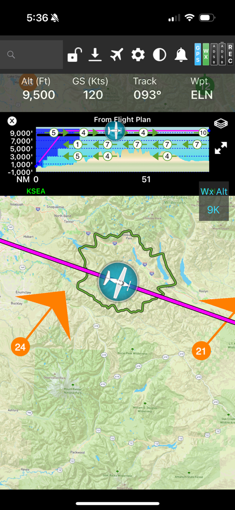
Pantalla de navegación de vuelo FlyQ plus EFB mostrando un mapa en movimiento con un anillo de planeo y perfil vertical
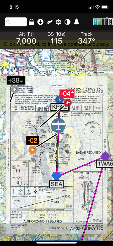
Interfaz de la aplicación FlyQ+ EFB mostrando una carta de aproximación RNAV superpuesta en un mapa seccional digital con telemetría de vuelo
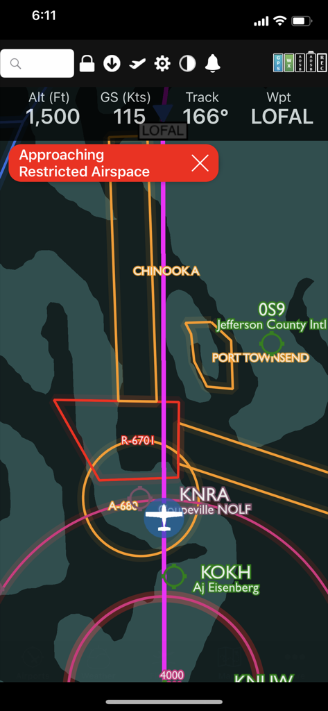
Interfaz de la aplicación FlyQ plus mostrando una advertencia de espacio aéreo restringido en un mapa de vuelo digital.
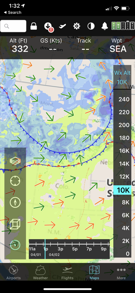
Interfaz móvil FlyQ+ EFB mostrando un mapa meteorológico predictivo con vectores de viento y control deslizante de altitud para planificación de vuelo.
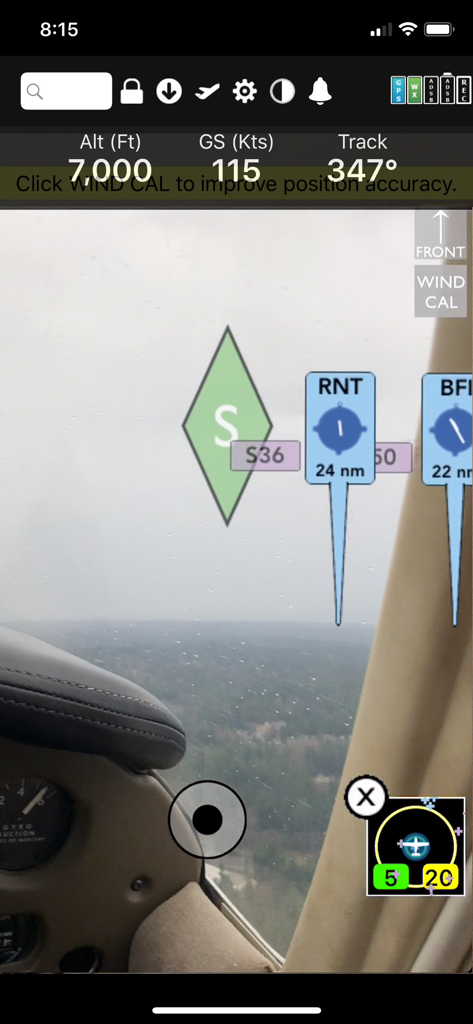
Visualización de navegación de realidad aumentada FlyQ Plus EFB mostrando altitud, velocidad terrestre y marcadores de aeropuerto sobre una vista de cabina en tiempo real
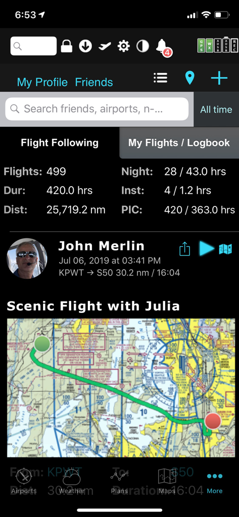
Aplicación FlyQ plus EFB que muestra estadísticas de vuelo del piloto y un mapa de vuelo escénico
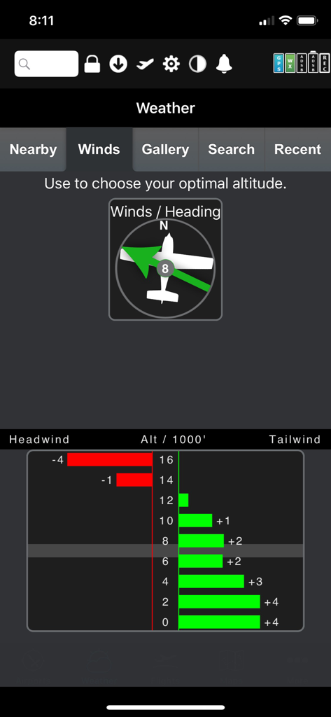
Optimizador gráfico de viento FlyQ Plus EFB que muestra datos de viento de cola y de cara por altitud
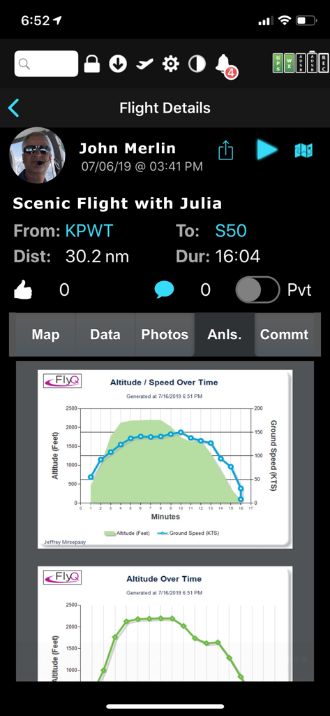
Pantalla de detalles de vuelo FlyQ EFB que muestra gráficos de análisis post-vuelo de altitud y velocidad terrestre
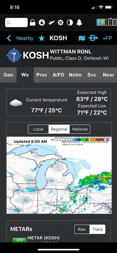
Pantalla meteorológica para el aeropuerto Wittman Regional con temperatura y radar regional en la aplicación FlyQ plus EFB
Descripción
Download
Apps Similares
Apps con características y experiencia similares

Navigraph Charts
Navigraph KB

SkyDemon
Divelements Limited

Airports
Applicate Ltd

OzRunways EFB
OzRunways Pty. Ltd.

fDeck: flight instruments
Darren Yeates

Noisy Goose
Automata Solutions Ltd.

StationWeather - METAR and TAF
Oliver Puetz

Drone UAV Fly Forecast: AirMap
MONIQ TAP COMPANY LIMITED

Airmate
Myriel Aviation SA
Esta página no es una página oficial de la aplicación ni de su desarrollador, sino una publicación editorial independiente creada con fines informativos y de comentario. Salvo que se indique expresamente lo contrario, ni la aplicación ni su desarrollador están afiliados, respaldados, patrocinados, autorizados ni conectados oficialmente con MWM, Apple, Google Play, el editor de la aplicación ni su desarrollador, y nada en esta página implica que la aplicación haya sido desarrollada utilizando los servicios de MWM. Todas las marcas comerciales, logotipos, capturas de pantalla y demás contenidos son propiedad de sus respectivos propietarios.