Cette page n'est pas une page officielle de l'application ou de son développeur, mais une publication éditoriale indépendante créée à des fins d'information et de commentaire. Sauf indication expresse contraire, ni l'application ni son développeur ne sont affiliés, approuvés, sponsorisés, autorisés ou autrement officiellement liés à MWM, Apple, Google Play, à l'éditeur de l'application ou au développeur de l'application, et rien sur cette page n'implique que l'application a été développée en utilisant les services de MWM. Toutes les marques, logos, captures d'écran et autres contenus restent la propriété de leurs propriétaires respectifs.

FlyQ+ EFB
Optimisez votre perception de l'environnement grâce à la météo prévisionnelle 4D, la vision synthétique 3D et une protection anti-usurpation GPS de pointe. Conçu pour les pilotes exigeant une expérience de pilotage à la fois performante et intuitive, avec des polices plus grandes et un nombre réduit de clics.
Téléchargements
116K+Note
Nombre d'avis
1K+Éditeur
Catégorie
NavigationLangues
1Dernière version
7.1.1Taille
494.2 MBDate de sortie
24 oct. 2014Voyagez plus en toute sécurité grâce à une clarté absolue
L'EFB est conçu spécifiquement pour l'environnement du cockpit, avec des interfaces à haute lisibilité et des outils de sécurité avancés qui minimisent la charge de travail et maximisent la conscience de la situation.
Interface à haute visibilité
Conçu pour les passagers des compagnies aériennes Silver Wings, avec des polices de caractères plus grandes et une mise en page épurée qui minimise les interactions avec l'écran en cas de turbulences en vol.
Vision synthétique 3D et réalité augmentée
Découvrez une « vision aux rayons X » à travers les nuages ou la nuit grâce à la réalité augmentée et aux affichages de terrain 3D qui transforment votre perception du monde qui vous entoure.
Les captures d'écran et la description suivantes proviennent directement de la fiche officielle de l'application sur le store et sont la propriété du développeur.
App Store
Captures
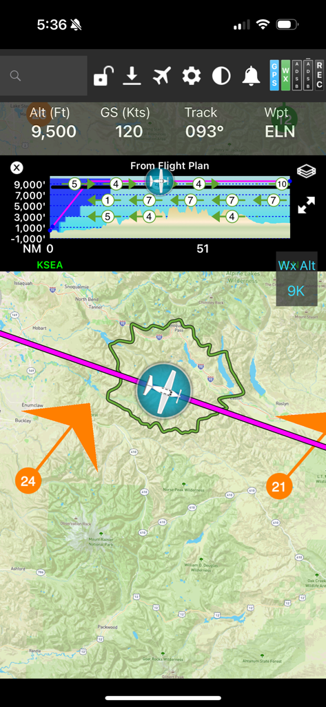
Écran de navigation de vol FlyQ plus EFB affichant une carte mobile avec un anneau de descente et un profil vertical
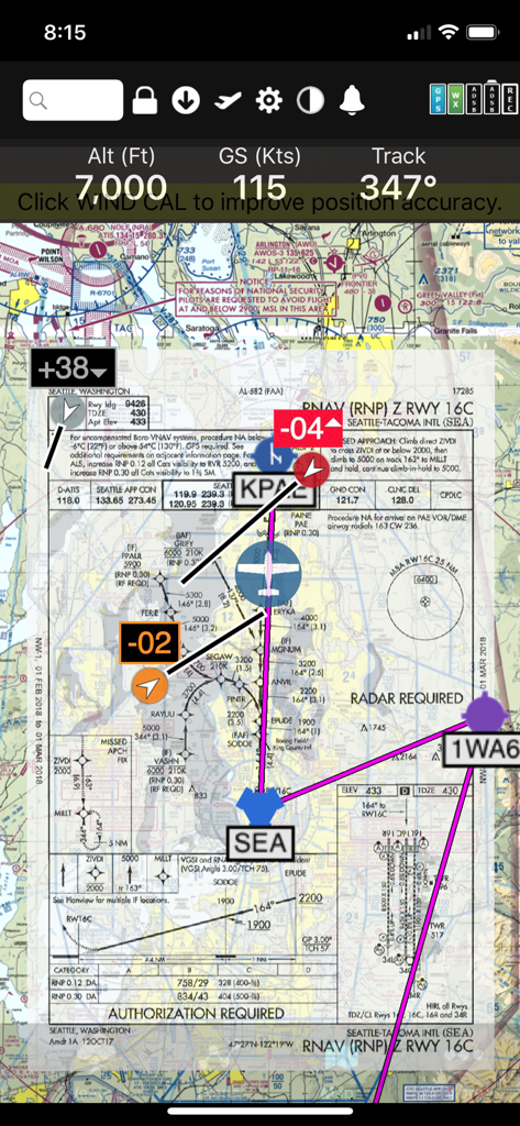
Interface de l'application FlyQ+ EFB affichant une carte d'approche RNAV superposée à une carte aéronautique numérique avec télémétrie de vol
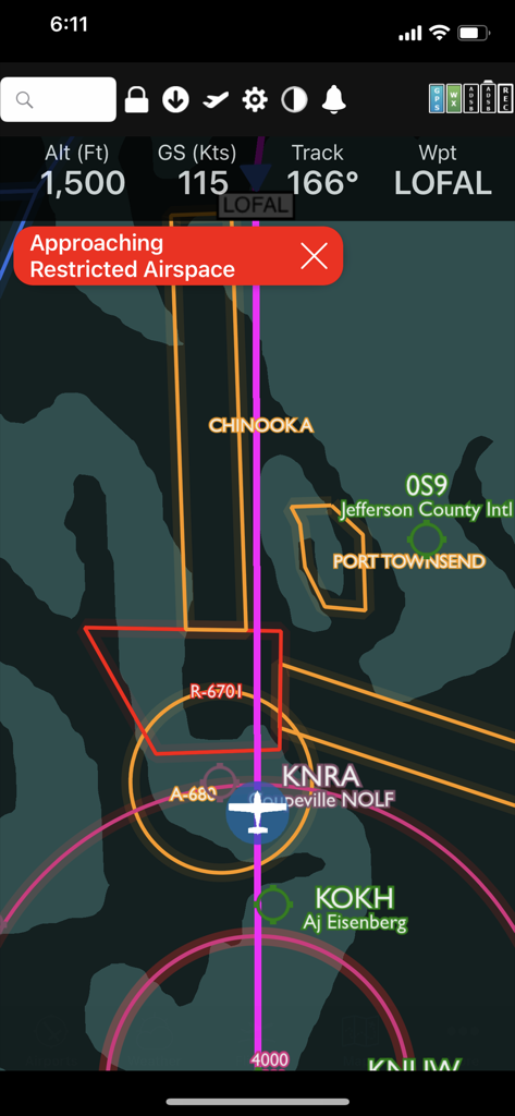
L'interface de l'application FlyQ Plus affiche un avertissement de restriction d'espace aérien sur une carte de vol numérique.
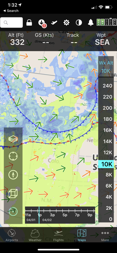
L'interface mobile FlyQ+ EFB affiche une carte météorologique prévisionnelle avec des vecteurs de vent et un curseur d'altitude pour la planification de vol.
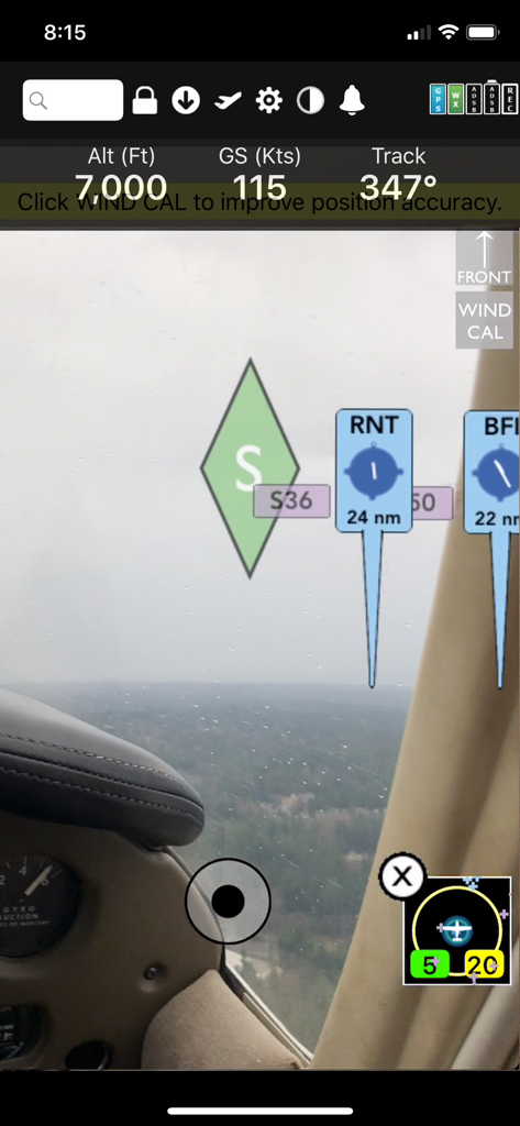
Affichage de navigation en réalité augmentée FlyQ Plus EFB affichant l'altitude, la vitesse sol et les repères d'aéroport superposés à une vue cockpit en temps réel
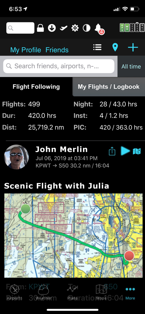
L'application FlyQ plus EFB affiche les statistiques de vol du pilote et une carte de vol panoramique.
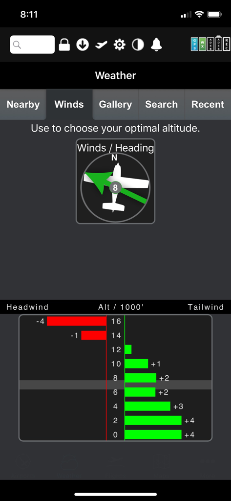
Optimiseur graphique de vent FlyQ Plus EFB affichant les données de vent arrière et de vent de face en fonction de l'altitude
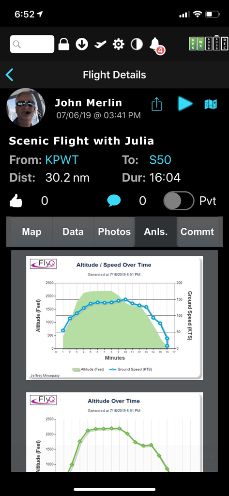
Écran de détails de vol FlyQ EFB affichant des graphiques d'analyse post-vol pour l'altitude et la vitesse sol
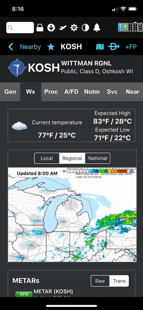
Affichage météo pour l'aéroport régional de Wittman avec la température et le radar régional dans l'application FlyQ plus EFB
Description
Download
Apps Similaires
Apps avec des fonctionnalités et une expérience similaires

Navigraph Charts
Navigraph KB

SkyDemon
Divelements Limited

Airports
Applicate Ltd

OzRunways EFB
OzRunways Pty. Ltd.

fDeck: flight instruments
Darren Yeates

Noisy Goose
Automata Solutions Ltd.

StationWeather - METAR and TAF
Oliver Puetz

Drone UAV Fly Forecast: AirMap
MONIQ TAP COMPANY LIMITED

Airmate
Myriel Aviation SA
Cette page n'est pas une page officielle de l'application ou de son développeur, mais une publication éditoriale indépendante créée à des fins d'information et de commentaire. Sauf indication expresse contraire, ni l'application ni son développeur ne sont affiliés, approuvés, sponsorisés, autorisés ou autrement officiellement liés à MWM, Apple, Google Play, à l'éditeur de l'application ou au développeur de l'application, et rien sur cette page n'implique que l'application a été développée en utilisant les services de MWM. Toutes les marques, logos, captures d'écran et autres contenus restent la propriété de leurs propriétaires respectifs.