Cette page n'est pas une page officielle de l'application ou de son développeur, mais une publication éditoriale indépendante créée à des fins d'information et de commentaire. Sauf indication expresse contraire, ni l'application ni son développeur ne sont affiliés, approuvés, sponsorisés, autorisés ou autrement officiellement liés à MWM, Apple, Google Play, à l'éditeur de l'application ou au développeur de l'application, et rien sur cette page n'implique que l'application a été développée en utilisant les services de MWM. Toutes les marques, logos, captures d'écran et autres contenus restent la propriété de leurs propriétaires respectifs.

Flyskyhy
Transformez votre appareil en un puissant GPS-vario avec analyse du vent en temps réel, affichages personnalisables dans le cockpit et suivi en direct. Volez plus loin, plus sûrement et plus intelligemment grâce à la cartographie thermique avancée et à la protection de l'espace aérien.
Téléchargements
198K+Note
Nombre d'avis
600Éditeur
Catégorie
SportsLangues
8Dernière version
9.4Taille
22.6 MBDate de sortie
17 avr. 2012Améliorez votre intelligence de vol
La référence pour les pilotes de parapente et de deltaplane. Transformez votre iPhone en un cockpit numérique haute précision conçu pour la sécurité, la performance et la communauté.
Données de vol de précision
Accédez en temps réel à l'altitude, à la vitesse sol et à la force du vent. Notre carte intuitive vous aide à exploiter les ascendances thermiques et à vérifier la distance de plané jusqu'aux zones d'atterrissage.
Sécurité de l'espace aérien et points de passage
Volez en toute confiance grâce aux données de l'espace aérien de 30 pays. Recevez des alertes visuelles et sonores pour rester en conformité et en sécurité à proximité des zones réglementées.
Les captures d'écran et la description suivantes proviennent directement de la fiche officielle de l'application sur le store et sont la propriété du développeur.
App Store
Captures
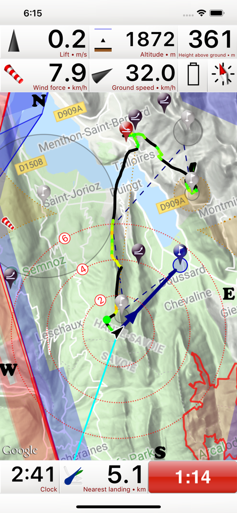
L'application Flyskyhy propose une interface d'instruments de vol affichant l'altitude, la vitesse sol et une carte mobile pour le parapente.
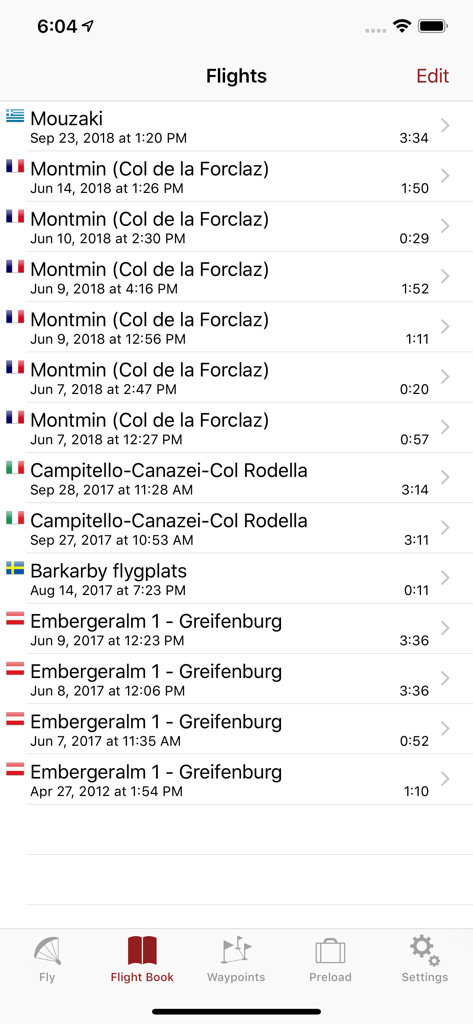
Liste des vols de parapente enregistrés dans l'application Flyskyhy, indiquant le lieu, la date et la durée.
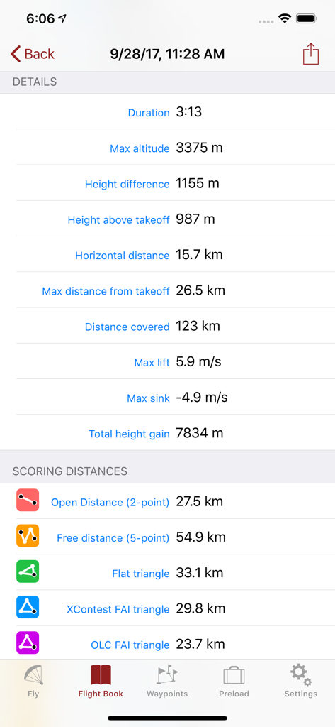
L'application Flyskyhy affiche des statistiques détaillées sur les vols et les distances de score en parapente.
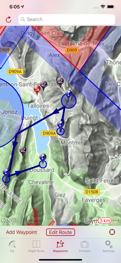
Carte topographique dans l'application Flyskyhy affichant un itinéraire de vol planifié avec des points de passage et des espaces aériens.
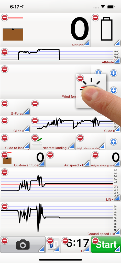
Interface de l'application Flyskyhy affichant des widgets et des graphiques de données de vol personnalisables pour les pilotes
Description
Download
Apps Similaires
Apps avec des fonctionnalités et une expérience similaires

Saki - Connect & Share
潇泳 庄

Gaggle Paragliding, Ultralight
Viszen Pty Ltd

AvTraffic
Tailwind Software

Paragliding Tracker: Wingman
iSolid SPRL

Skida: Alpine Adventures
Mountainsnow AS

Relief Maps : backcountry gps
Batiste Vonderweidt

RealityMaps 3D tour planner
3D RealityMaps GmbH

Spot Assist Skydiving Tool
Andrey Kan

iGlide Advanced
Logic Design
Cette page n'est pas une page officielle de l'application ou de son développeur, mais une publication éditoriale indépendante créée à des fins d'information et de commentaire. Sauf indication expresse contraire, ni l'application ni son développeur ne sont affiliés, approuvés, sponsorisés, autorisés ou autrement officiellement liés à MWM, Apple, Google Play, à l'éditeur de l'application ou au développeur de l'application, et rien sur cette page n'implique que l'application a été développée en utilisant les services de MWM. Toutes les marques, logos, captures d'écran et autres contenus restent la propriété de leurs propriétaires respectifs.