Cette page n'est pas une page officielle de l'application ou de son développeur, mais une publication éditoriale indépendante créée à des fins d'information et de commentaire. Sauf indication expresse contraire, ni l'application ni son développeur ne sont affiliés, approuvés, sponsorisés, autorisés ou autrement officiellement liés à MWM, Apple, Google Play, à l'éditeur de l'application ou au développeur de l'application, et rien sur cette page n'implique que l'application a été développée en utilisant les services de MWM. Toutes les marques, logos, captures d'écran et autres contenus restent la propriété de leurs propriétaires respectifs.

Geo Tracker - GPS Tracker
Enregistrez vos randonnées les plus ambitieuses avec des cartes hors ligne, des statistiques de haute précision et une efficacité énergétique de pointe. Pas d'abonnements, pas de publicité, et pas de suivi de données — vos données de localisation restent exactement là où elles doivent être : sur votre appareil.
Téléchargements
100K+Note
Nombre d'avis
300Éditeur
Catégorie
TravelLangues
15Dernière version
5.5.0Taille
135.2 MBDate de sortie
15 oct. 2024Conçu pour le chemin inexploré
Un GPS tracker professionnel pour ceux qui apprécient les données précises, une batterie longue durée et une confidentialité absolue. Pas de publicité, pas d'abonnements — juste les outils dont vous avez besoin pour le sentier.
Vos données, votre appareil
Nous ne croyons pas au suivi dans le cloud. Votre historique de localisation reste 100 % local, garantissant que votre vie privée n'est jamais compromise ou vendue à des tiers.
Efficacité énergétique supérieure
Notre technologie spécialisée de suivi en arrière-plan minimise la consommation, vous permettant d'enregistrer des expéditions d'une journée complète sans avoir besoin d'une batterie externe.
Les captures d'écran et la description suivantes proviennent directement de la fiche officielle de l'application sur le store et sont la propriété du développeur.
App Store
Captures
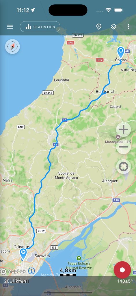
Écran de l'application Geo Tracker affichant un itinéraire GPS enregistré sur une carte topographique
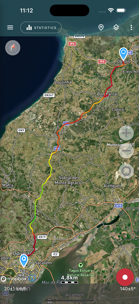
Carte satellite montrant une trace GPS enregistrée avec des indicateurs de vitesse
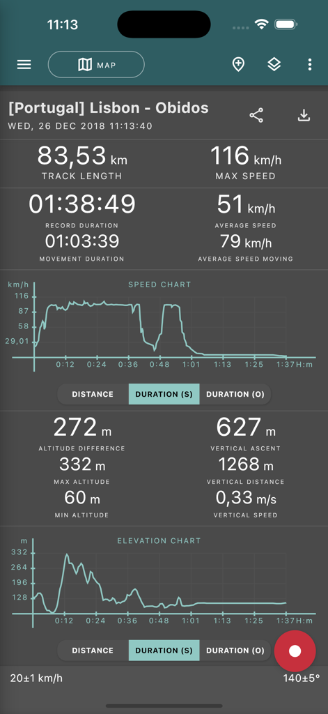
Statistiques de voyage GPS détaillées et graphiques dans l'application Geo Tracker
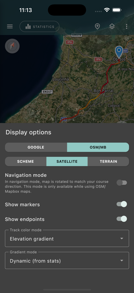
Interface des options d'affichage de carte de l'application Geo Tracker montrant une vue satellite avec une trace GPS enregistrée.
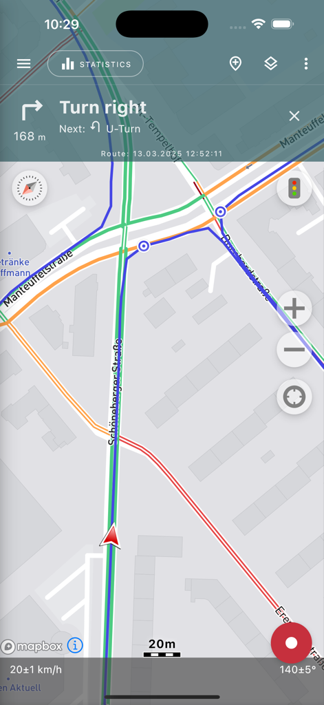
Écran de navigation de l'application Geo Tracker affichant un itinéraire sur une carte avec des instructions détaillées et des statistiques de vitesse
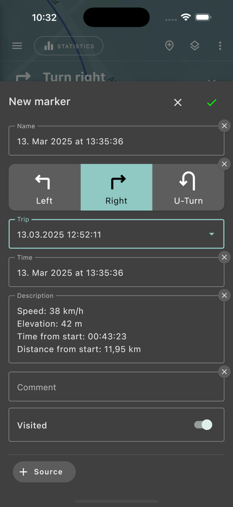
Interface de création de nouveau marqueur dans l'application Geo Tracker montrant les statistiques du voyage et la sélection de la direction de navigation
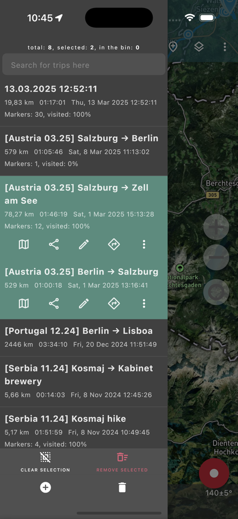
Liste des traces GPS enregistrées et des statistiques de voyage dans l'application Geo Tracker
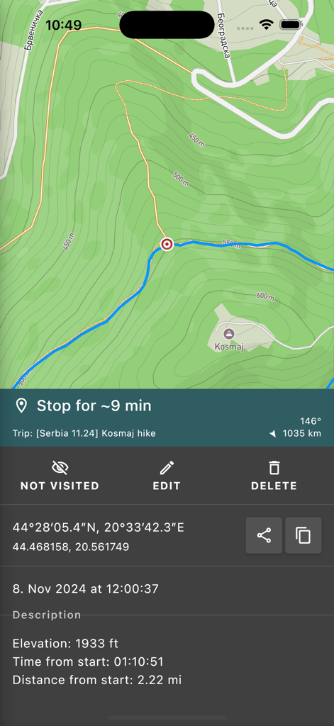
Application GPS tracker montrant les statistiques de randonnée et les coordonnées sur une carte topographique
Description
Download
Apps Similaires
Apps avec des fonctionnalités et une expérience similaires

AllTrails: Hike, Bike & Run
AllTrails, Inc.

Pedometer++
Cross Forward Consulting, LLC

Organic Maps: Offline Map
Organic Maps OU

Gaia GPS: Mobile Trail Maps
Trailbehind, INC.

Offline hiking maps: Mapy.com
Seznam.cz a.s.

Hiking Map Poland
Mapa Turystyczna sp. z o.o.

MapOut
Valnova GmbH

FarOut: Offline GPS Trail Maps
Atlas Guides DE, Inc.

Norgeskart
Norgeskart AS
Cette page n'est pas une page officielle de l'application ou de son développeur, mais une publication éditoriale indépendante créée à des fins d'information et de commentaire. Sauf indication expresse contraire, ni l'application ni son développeur ne sont affiliés, approuvés, sponsorisés, autorisés ou autrement officiellement liés à MWM, Apple, Google Play, à l'éditeur de l'application ou au développeur de l'application, et rien sur cette page n'implique que l'application a été développée en utilisant les services de MWM. Toutes les marques, logos, captures d'écran et autres contenus restent la propriété de leurs propriétaires respectifs.