Cette page n'est pas une page officielle de l'application ou de son développeur, mais une publication éditoriale indépendante créée à des fins d'information et de commentaire. Sauf indication expresse contraire, ni l'application ni son développeur ne sont affiliés, approuvés, sponsorisés, autorisés ou autrement officiellement liés à MWM, Apple, Google Play, à l'éditeur de l'application ou au développeur de l'application, et rien sur cette page n'implique que l'application a été développée en utilisant les services de MWM. Toutes les marques, logos, captures d'écran et autres contenus restent la propriété de leurs propriétaires respectifs.

WHIP LIVE Moto, Bike, Trekking
Planifiez votre prochaine escapade avec des cartes 3D de haute précision, restez connecté grâce au suivi en direct en temps réel et conquérez les sentiers les plus reculés avec une navigation virage par virage conçue pour la nature.
Téléchargements
298K+Note
Nombre d'avis
1K+Éditeur
Catégorie
NavigationLangues
11Dernière version
3.0.26Taille
167.8 MBDate de sortie
26 juil. 2018Maîtrisez chaque sentier et terrain
De l'Enduro moto à haut indice d'octane aux descentes techniques en VTT, WHIP LIVE fournit les outils de planification, de sécurité et de performance conçus pour vos aventures les plus ambitieuses.
Planification hors route de précision
Créez des itinéraires personnalisés pour le VTT, l'Enduro ou le Gravel en utilisant des cartes topographiques 3D détaillées et plus de 60 millions de points d'intérêt.
Sécurité et suivi en direct
Partez hors réseau en toute confiance. Partagez votre position GPS en temps réel avec vos contacts et accédez à un bouton de sécurité d'urgence même dans les zones isolées.
Les captures d'écran et la description suivantes proviennent directement de la fiche officielle de l'application sur le store et sont la propriété du développeur.
App Store
Captures

Capture d'écran de l'application WHIP LIVE présentant un itinéraire détaillé sur carte topographique et un motocycliste pour la planification d'aventures en plein air.
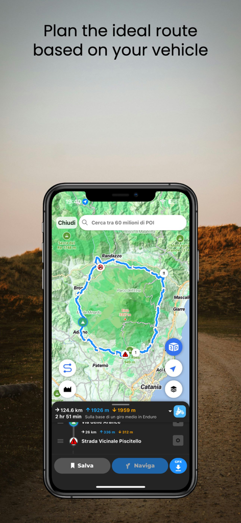
Interface du planificateur d'itinéraires WHIP LIVE pour planifier des itinéraires en plein air en fonction du type de véhicule.
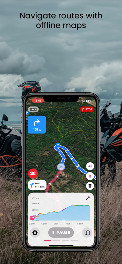
Application mobile WHIP LIVE affichant des cartes hors ligne et une navigation virage par virage pour les itinéraires hors route
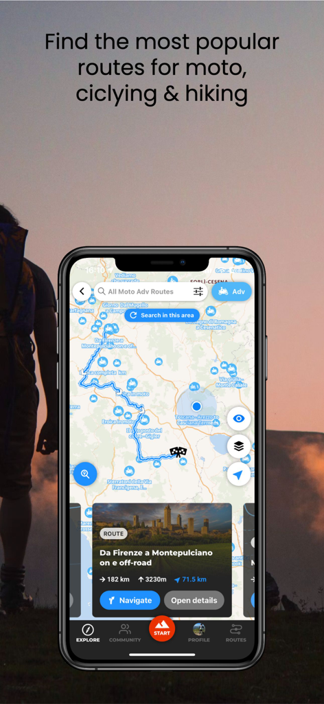
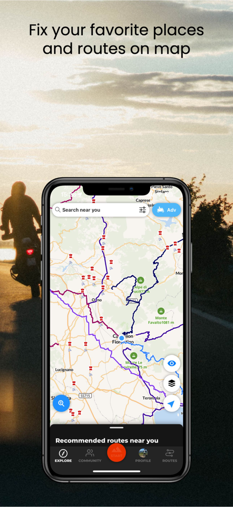
Interface de l'application WHIP LIVE montrant une carte avec des itinéraires populaires pour moto, vélo et randonnée
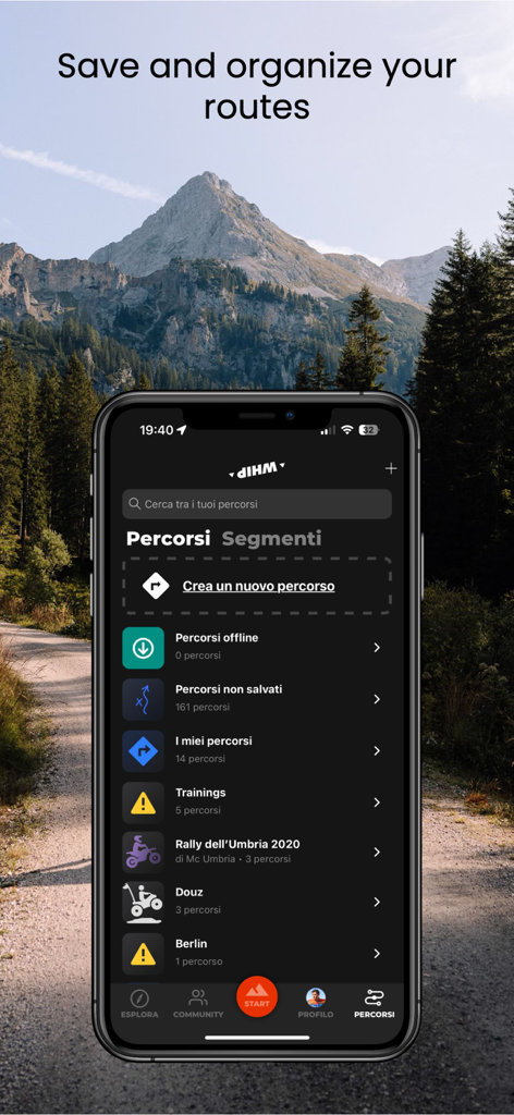
Un smartphone montrant l'écran d'organisation des itinéraires de l'application WHIP LIVE avec un arrière-plan de paysage de montagne.
Smartphone affichant l'application WHIP LIVE avec divers itinéraires et sentiers en plein air sur une carte topographique

Cycliste en plein air sur un sentier avec le suivi de sécurité WHIP LIVE et une invite d'ajout de contact de sécurité.
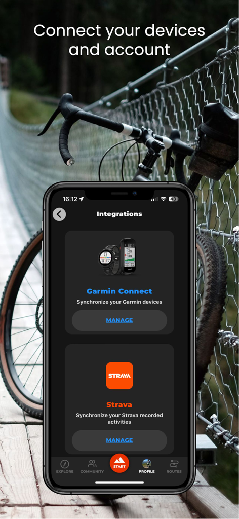
Écran de smartphone affichant les intégrations de l'application WHIP LIVE avec Garmin Connect et Strava.
Description
Download
Apps Similaires
Apps avec des fonctionnalités et une expérience similaires

AllTrails: Hike, Bike & Run
AllTrails, Inc.

Pedometer++
Cross Forward Consulting, LLC

Organic Maps: Offline Map
Organic Maps OU

Gaia GPS: Mobile Trail Maps
Trailbehind, INC.

Offline hiking maps: Mapy.com
Seznam.cz a.s.

Hiking Map Poland
Mapa Turystyczna sp. z o.o.

MapOut
Valnova GmbH

FarOut: Offline GPS Trail Maps
Atlas Guides DE, Inc.

Norgeskart
Norgeskart AS
Cette page n'est pas une page officielle de l'application ou de son développeur, mais une publication éditoriale indépendante créée à des fins d'information et de commentaire. Sauf indication expresse contraire, ni l'application ni son développeur ne sont affiliés, approuvés, sponsorisés, autorisés ou autrement officiellement liés à MWM, Apple, Google Play, à l'éditeur de l'application ou au développeur de l'application, et rien sur cette page n'implique que l'application a été développée en utilisant les services de MWM. Toutes les marques, logos, captures d'écran et autres contenus restent la propriété de leurs propriétaires respectifs.