Cette page n'est pas une page officielle de l'application ou de son développeur, mais une publication éditoriale indépendante créée à des fins d'information et de commentaire. Sauf indication expresse contraire, ni l'application ni son développeur ne sont affiliés, approuvés, sponsorisés, autorisés ou autrement officiellement liés à MWM, Apple, Google Play, à l'éditeur de l'application ou au développeur de l'application, et rien sur cette page n'implique que l'application a été développée en utilisant les services de MWM. Toutes les marques, logos, captures d'écran et autres contenus restent la propriété de leurs propriétaires respectifs.

WingX®
Améliorez votre perception de l'environnement grâce à la vision synthétique primée, aux données météo ADS-B en temps réel et à la planification de vol avancée. Un choix de confiance pour l'aviation générale, offrant des performances exceptionnelles et des abonnements gratuits exclusifs pour les pilotes VFR et militaires.
Téléchargements
116K+Note
Nombre d'avis
1K+Éditeur
Catégorie
NavigationLangues
1Dernière version
9.2.6.206Taille
80.4 MBDate de sortie
30 juin 2010Navigation de précision pour pilote professionnel
Découvrez un sac de vol électronique riche en fonctionnalités, conçu pour améliorer la sécurité et l'efficacité, de la planification du vol à l'approche finale.
Conscience situationnelle de nouvelle génération
Volez en toute confiance grâce à la vision synthétique, aux alertes de terrain GPWS et aux superpositions en temps réel du trafic ADS-B et des conditions météorologiques sur une carte mobile haute performance.
Valeur axée sur le militaire et le vol à vue
Accédez à des outils aéronautiques de pointe grâce à des abonnements gratuits dédiés au personnel militaire actif ou retraité et aux pilotes VFR uniquement.
Les captures d'écran et la description suivantes proviennent directement de la fiche officielle de l'application sur le store et sont la propriété du développeur.
App Store
Captures
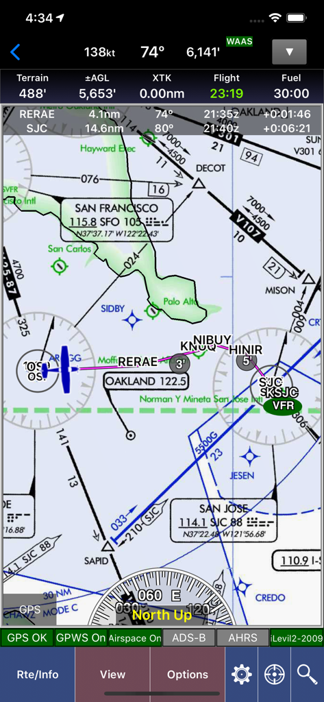
Carte de navigation aérienne WingX affichant les données de vol et les cartes aéronautiques de la région de San Francisco.
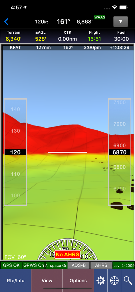
Capture d'écran de l'application WingX montrant la vision synthétique avec cartographie du terrain en 3D et superposition d'instruments de vol.
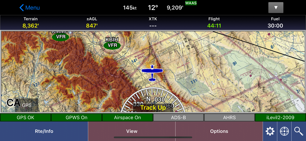
L'interface de carte mobile de l'application aéronautique WingX affiche les détails du terrain et les données de vol.
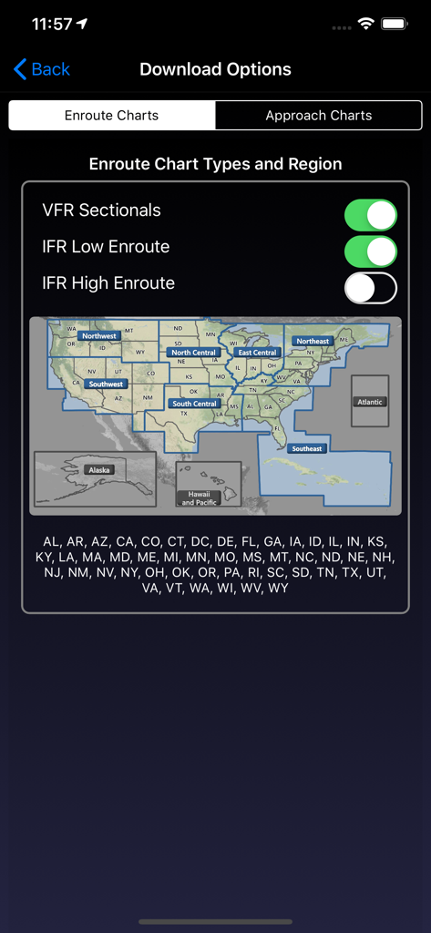
Écran des options de téléchargement de l'application WingX pour la sélection des cartes de navigation et des régions américaines
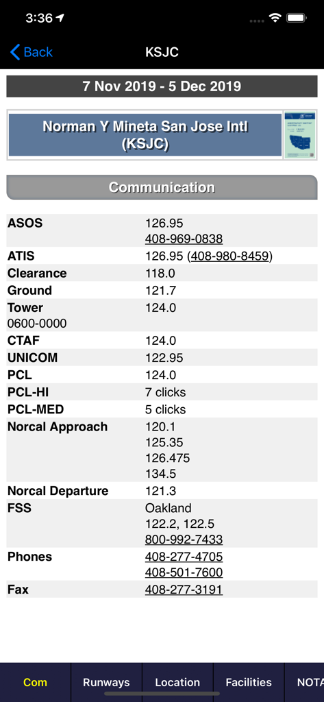
Fréquences de communication aéronautique pour l'aéroport international de San José sur l'application WingX
Description
Download
Apps Similaires
Apps avec des fonctionnalités et une expérience similaires

Navigraph Charts
Navigraph KB

SkyDemon
Divelements Limited

Airports
Applicate Ltd

OzRunways EFB
OzRunways Pty. Ltd.

fDeck: flight instruments
Darren Yeates

Noisy Goose
Automata Solutions Ltd.

StationWeather - METAR and TAF
Oliver Puetz

Drone UAV Fly Forecast: AirMap
MONIQ TAP COMPANY LIMITED

Airmate
Myriel Aviation SA
Cette page n'est pas une page officielle de l'application ou de son développeur, mais une publication éditoriale indépendante créée à des fins d'information et de commentaire. Sauf indication expresse contraire, ni l'application ni son développeur ne sont affiliés, approuvés, sponsorisés, autorisés ou autrement officiellement liés à MWM, Apple, Google Play, à l'éditeur de l'application ou au développeur de l'application, et rien sur cette page n'implique que l'application a été développée en utilisant les services de MWM. Toutes les marques, logos, captures d'écran et autres contenus restent la propriété de leurs propriétaires respectifs.