Questa pagina non è una pagina ufficiale dell'app o del suo sviluppatore, ma una pubblicazione editoriale indipendente creata a scopo informativo e di commento. Salvo espressa indicazione contraria, né l'app né il suo sviluppatore sono affiliati, approvati, sponsorizzati, autorizzati o altrimenti ufficialmente collegati a MWM, Apple, Google Play, all'editore dell'app o allo sviluppatore dell'app, e nulla in questa pagina implica che l'app sia stata sviluppata utilizzando i servizi di MWM. Tutti i marchi, loghi, screenshot e altri contenuti rimangono di proprietà dei rispettivi proprietari.

FarOut: Offline GPS Trail Maps
Naviga oltre 80.000 km di sentieri di classe mondiale con dati ufficiali verificati da esperti che funzionano al 100% offline. Costruito per escursionisti, bikepacker ed esploratori che richiedono affidabilità nei terreni più selvaggi.
Download
515K+Valutazione
Valutazioni totali
25K+Editore
Categoria
NavigationLingue
4Ultima versione
15.0.3Dimensione
182.1 MBData di lancio
8 mar 2013Progettato per il Viaggio dell'Escursionista
Più di una semplice mappa: è la tua guida digitale essenziale per escursioni, ciclismo e canoa a lunga percorrenza su oltre 80.000 km di natura selvaggia.
Navigazione 100% Offline
Lascia la rete. Accedi a mappe topografiche dettagliate e al tracciamento GPS che funzionano perfettamente in modalità aereo, preservando la batteria e l'indipendenza dal segnale.
Waypoint Critici Verificati
Smetti di indovinare. Accedi a dati affidabili su fonti d'acqua, chiusure di sentieri e punti di rifornimento forniti da partner ufficiali dei sentieri e da esperti verificati della comunità.
Gli screenshot e la descrizione seguenti provengono direttamente dall'elenco ufficiale dello store dell'app e sono di proprietà dello sviluppatore.
App Store
Screenshot
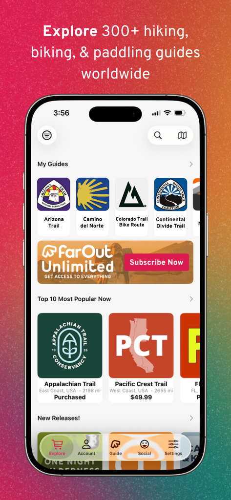
Interfaccia dell'app mobile FarOut che mostra una libreria di guide per sentieri escursionistici e ciclabili come l'Appalachian Trail e il Pacific Crest Trail
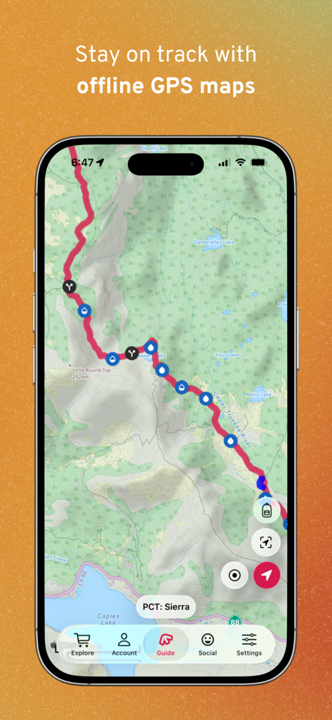
App FarOut che visualizza una mappa topografica offline del sentiero PCT Sierra con waypoint per acqua e incroci
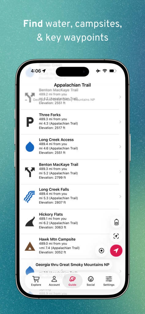
Schermata mobile che mostra waypoint del sentiero per fonti d'acqua e campeggi sull'Appalachian Trail nell'app FarOut
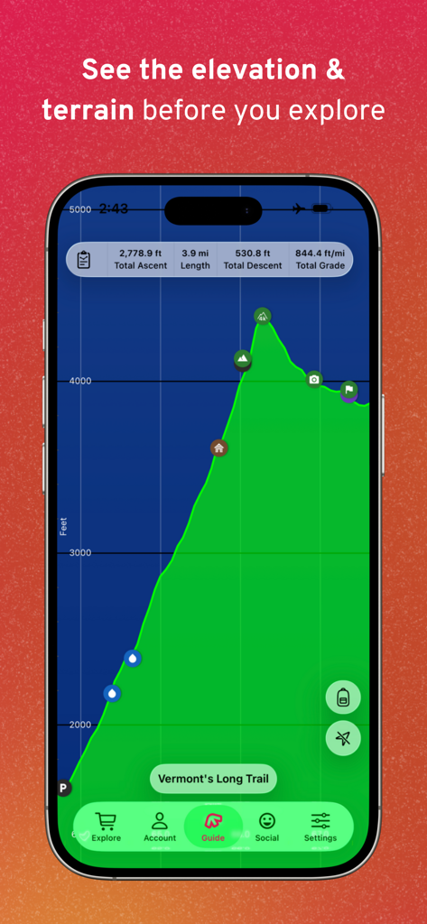
App FarOut che visualizza un profilo altimetrico e una panoramica del terreno per il Long Trail del Vermont

Interfaccia dell'app FarOut che mostra commenti e aggiornamenti della community in tempo reale per waypoint del sentiero come ostelli e panetterie
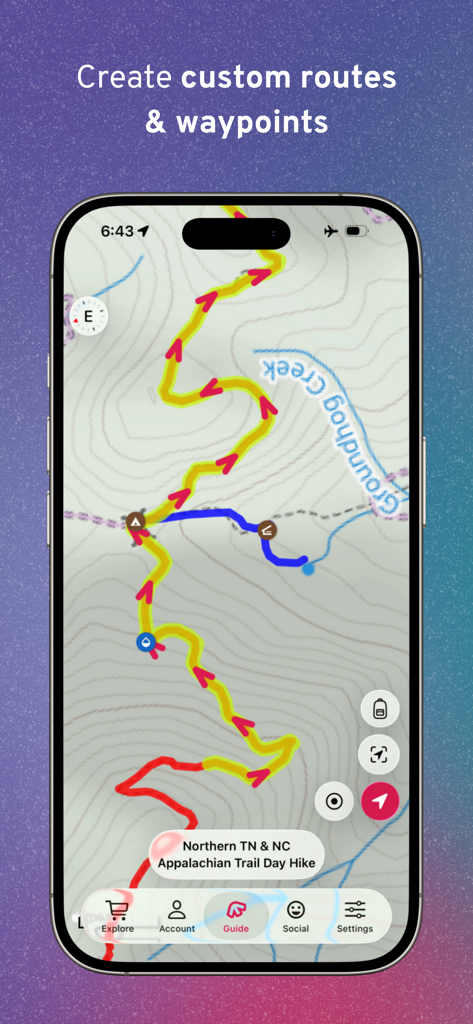
Schermata dell'app FarOut che mostra percorsi e waypoint personalizzati su una mappa topografica escursionistica
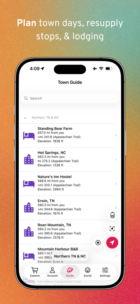
Display dello smartphone dell'app FarOut Town Guide per pianificare soste di rifornimento e alloggi.
App FarOut che visualizza una mappa GPS topografica del sentiero con altitudine e waypoint per il thru-hiking

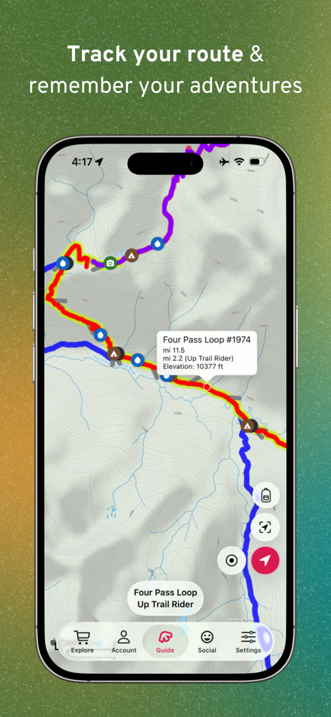
Un post di check-in dell'escursionista su una mappa topografica del sentiero all'interno dell'app mobile FarOut
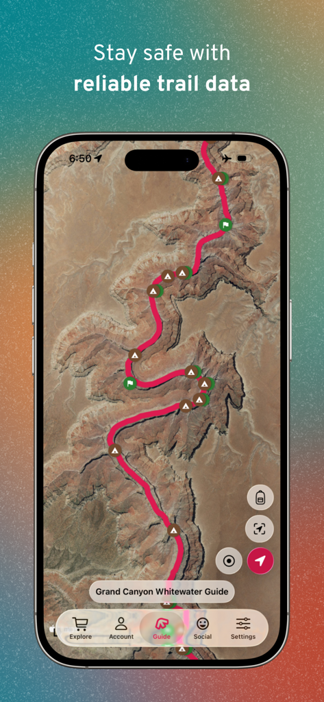
Mappa satellitare della guida per acque bianche del Grand Canyon nell'app di navigazione del sentiero FarOut.
Descrizione
Download
App Simili
App con funzionalità ed esperienza simili

AllTrails: Hike, Bike & Run
AllTrails, Inc.

Pedometer++
Cross Forward Consulting, LLC

Organic Maps: Offline Map
Organic Maps OU

Gaia GPS: Mobile Trail Maps
Trailbehind, INC.

Offline hiking maps: Mapy.com
Seznam.cz a.s.

Hiking Map Poland
Mapa Turystyczna sp. z o.o.

MapOut
Valnova GmbH

Norgeskart
Norgeskart AS

GPX viewer - map
Lucas den Otter
Questa pagina non è una pagina ufficiale dell'app o del suo sviluppatore, ma una pubblicazione editoriale indipendente creata a scopo informativo e di commento. Salvo espressa indicazione contraria, né l'app né il suo sviluppatore sono affiliati, approvati, sponsorizzati, autorizzati o altrimenti ufficialmente collegati a MWM, Apple, Google Play, all'editore dell'app o allo sviluppatore dell'app, e nulla in questa pagina implica che l'app sia stata sviluppata utilizzando i servizi di MWM. Tutti i marchi, loghi, screenshot e altri contenuti rimangono di proprietà dei rispettivi proprietari.