Questa pagina non è una pagina ufficiale dell'app o del suo sviluppatore, ma una pubblicazione editoriale indipendente creata a scopo informativo e di commento. Salvo espressa indicazione contraria, né l'app né il suo sviluppatore sono affiliati, approvati, sponsorizzati, autorizzati o altrimenti ufficialmente collegati a MWM, Apple, Google Play, all'editore dell'app o allo sviluppatore dell'app, e nulla in questa pagina implica che l'app sia stata sviluppata utilizzando i servizi di MWM. Tutti i marchi, loghi, screenshot e altri contenuti rimangono di proprietà dei rispettivi proprietari.

Fires: Wildfire News and Atlas
Proteggi la tua casa e la tua famiglia con lo strumento di livello professionale scelto da milioni di utenti. Monitora i roghi attivi con il tracciamento degli aerei in 3D dal vivo, gli avvisi ufficiali di evacuazione e le mappe offline ad alta risoluzione.
Download
349K+Valutazione
Valutazioni totali
100Editore
Categoria
NewsLingue
1Ultima versione
4.7.0Dimensione
54.6 MBData di lancio
8 set 2016Intelligence di Livello Professionale per la tua Sicurezza
Accedi agli stessi dati in tempo reale utilizzati dai primi soccorritori per proteggere la tua casa, la tua famiglia e le tue avventure all'aria aperta con il tracker di incendi boschivi più affidabile al mondo.
Tracciamento Aereo in 3D dal Vivo
Monitora aerei ed elicotteri antincendio in tempo reale con rotte di volo in 3D per vedere esattamente dove si concentrano gli sforzi di spegnimento.
Atlante Offline Professionale
Naviga in sicurezza fuori rete con l'accesso a oltre 80 mappe ad alta risoluzione delle Foreste Nazionali e del BLM che funzionano senza copertura cellulare.
Gli screenshot e la descrizione seguenti provengono direttamente dall'elenco ufficiale dello store dell'app e sono di proprietà dello sviluppatore.
App Store
Screenshot
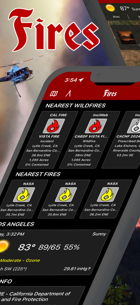
Interfaccia dell'app Incendi che mostra il monitoraggio degli incendi in tempo reale e i dati meteo locali
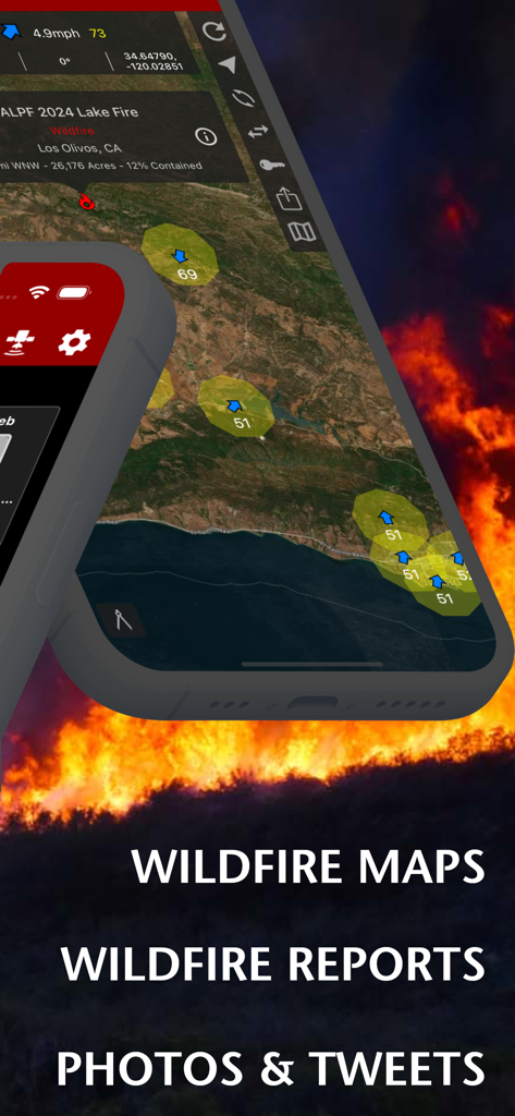
Interfaccia dell'app Incendi che mostra mappe degli incendi e rapporti sugli incidenti su uno sfondo di fiamme
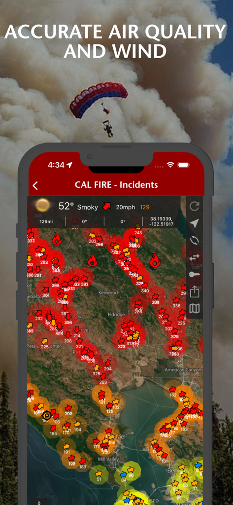
App di notizie sugli incendi che mostra la qualità dell'aria e le condizioni del vento su una mappa interattiva degli incidenti.
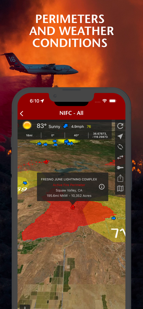
Uno schermo di smartphone che mostra i perimetri degli incendi e le condizioni meteorologiche su una mappa dall'app Incendi

Interfaccia di app mobile che mostra i dettagli di un incidente di incendio boschivo, inclusi un perimetro sulla mappa e una foto del Lake Fire del 2024
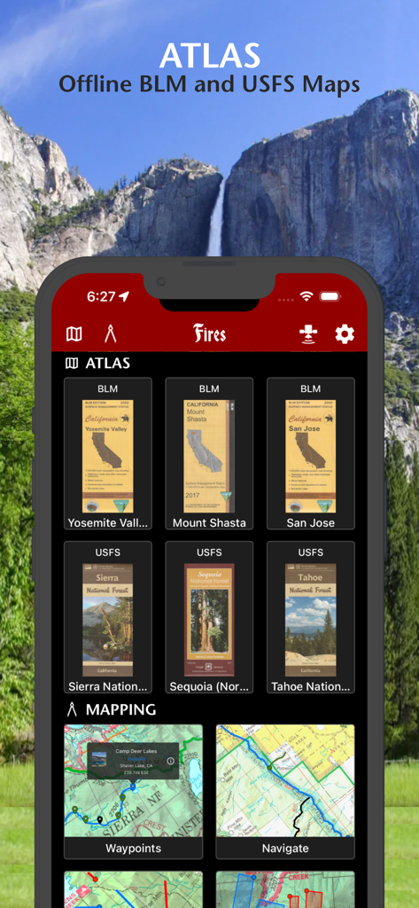
Interfaccia dell'app Incendi che mostra mappe offline BLM e USFS per foreste e parchi nazionali
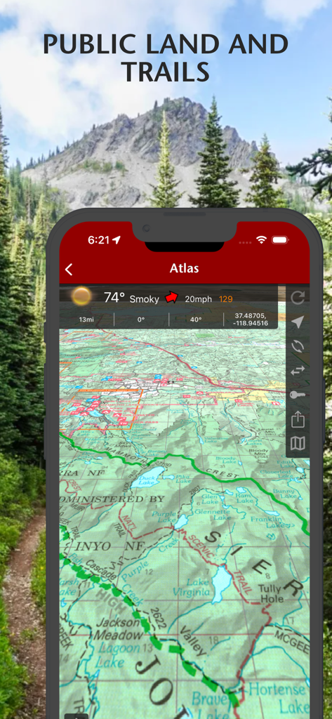
Vista mappa topografica che mostra terreni pubblici e sentieri escursionistici con dati meteo nell'app Incendi.
Descrizione
Download
App Simili
App più classificate nella stessa categoria

X
X Corp.

REDDIT, INC.

Substack
Substack Inc.

NYTimes: US and Global News
The New York Times Company

Nextdoor: Neighborhood Network
Nextdoor.com, Inc.

CrimeRadar Dispatch Audio
Scoopz Inc.

NewsBreak: Local News & Alerts
Particle Media Inc.

Ground News
Snapwise Inc.

Google News
Google LLC
Questa pagina non è una pagina ufficiale dell'app o del suo sviluppatore, ma una pubblicazione editoriale indipendente creata a scopo informativo e di commento. Salvo espressa indicazione contraria, né l'app né il suo sviluppatore sono affiliati, approvati, sponsorizzati, autorizzati o altrimenti ufficialmente collegati a MWM, Apple, Google Play, all'editore dell'app o allo sviluppatore dell'app, e nulla in questa pagina implica che l'app sia stata sviluppata utilizzando i servizi di MWM. Tutti i marchi, loghi, screenshot e altri contenuti rimangono di proprietà dei rispettivi proprietari.