Questa pagina non è una pagina ufficiale dell'app o del suo sviluppatore, ma una pubblicazione editoriale indipendente creata a scopo informativo e di commento. Salvo espressa indicazione contraria, né l'app né il suo sviluppatore sono affiliati, approvati, sponsorizzati, autorizzati o altrimenti ufficialmente collegati a MWM, Apple, Google Play, all'editore dell'app o allo sviluppatore dell'app, e nulla in questa pagina implica che l'app sia stata sviluppata utilizzando i servizi di MWM. Tutti i marchi, loghi, screenshot e altri contenuti rimangono di proprietà dei rispettivi proprietari.

GoGoEarth - Custom map source
Accedi a fonti satellitari premium da NASA, Maxar e Nearmap. Dai modelli di città in 3D all'altitudine in tempo reale, sperimenta la mappatura di livello professionale e l'esplorazione virtuale a portata di mano.
Download
427K+Valutazione
Valutazioni totali
8K+Editore
Categoria
NavigationLingue
2Ultima versione
3.2.3Dimensione
155.6 MBData di lancio
11 mag 2022Esplora la Terra con Dettagli Sbalorditivi
Dalle immagini satellitari ad alta risoluzione ai modelli architettonici 3D, GoGoEarth fornisce gli strumenti professionali di cui hai bisogno per scoprire il mondo dal palmo della tua mano.
Viste Satellitari Ultra-HD
Sperimenta il mondo con immagini cristalline basate su NASA e Maxar, fornendo livelli di dettaglio che vanno ben oltre le mappe standard.
Turismo Globale Virtuale
Viaggia attraverso oltre 200 regioni con viste stradali panoramiche HD ed esplora modelli 3D realistici dei siti più famosi del mondo.
Gli screenshot e la descrizione seguenti provengono direttamente dall'elenco ufficiale dello store dell'app e sono di proprietà dello sviluppatore.
App Store
Screenshot
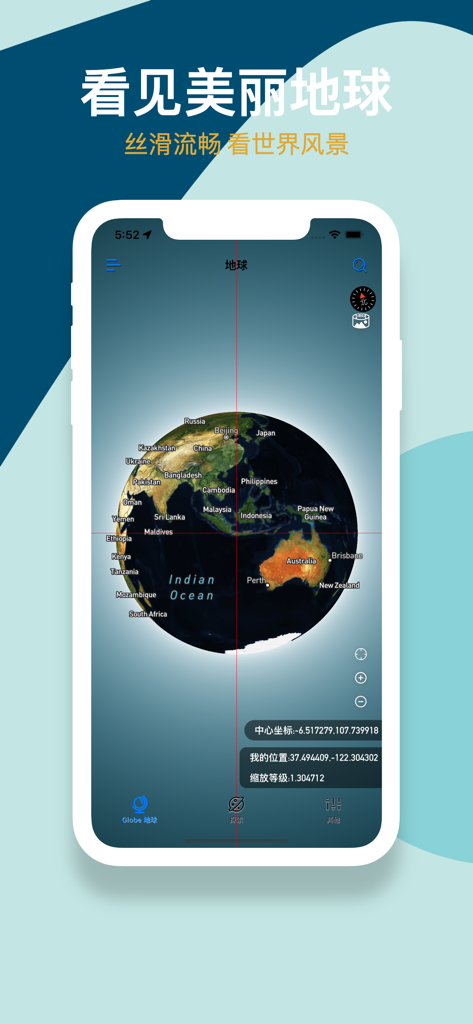
Interfaccia dell'app GoGoEarth che mostra un globo satellitare 3D con etichette geografiche e coordinate
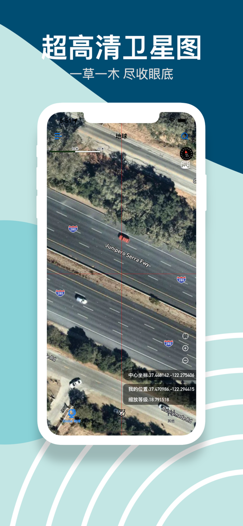
Immagine satellitare ad alta risoluzione di un'autostrada con auto e coordinate precise nell'app GoGoEarth
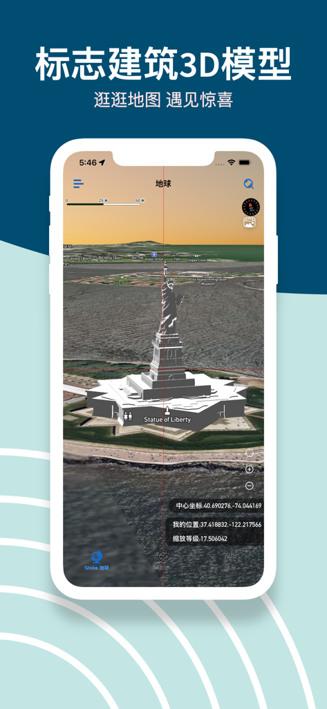
Screenshot dell'app GoGoEarth che mostra un modello 3D dettagliato della Statua della Libertà su una mappa satellitare
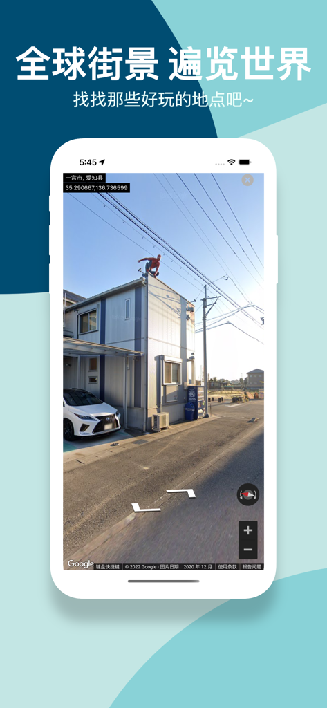
Screenshot dell'app GoGoEarth che mostra una vista stradale panoramica ad alta definizione di un quartiere in Giappone
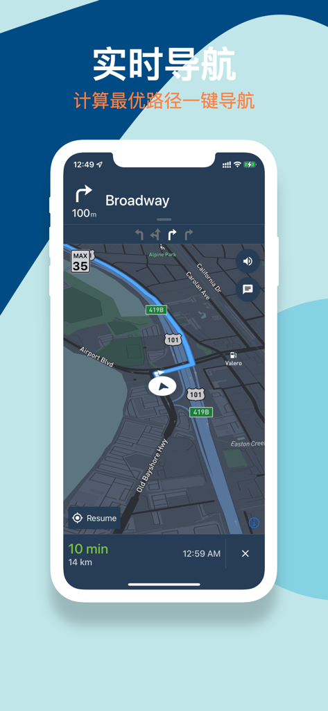
App mobile GoGoEarth che mostra l'interfaccia di navigazione in tempo reale con un percorso su una mappa satellitare scura.
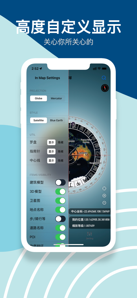
Interfaccia dell'app GoGoEarth che mostra le impostazioni della mappa per stili di proiezione e visibilità dei modelli 3D
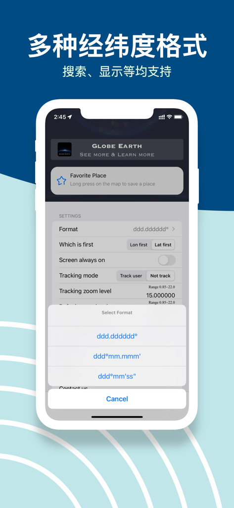
Interfaccia dell'app GoGoEarth che mostra molteplici opzioni di formato delle coordinate di latitudine e longitudine nelle impostazioni.
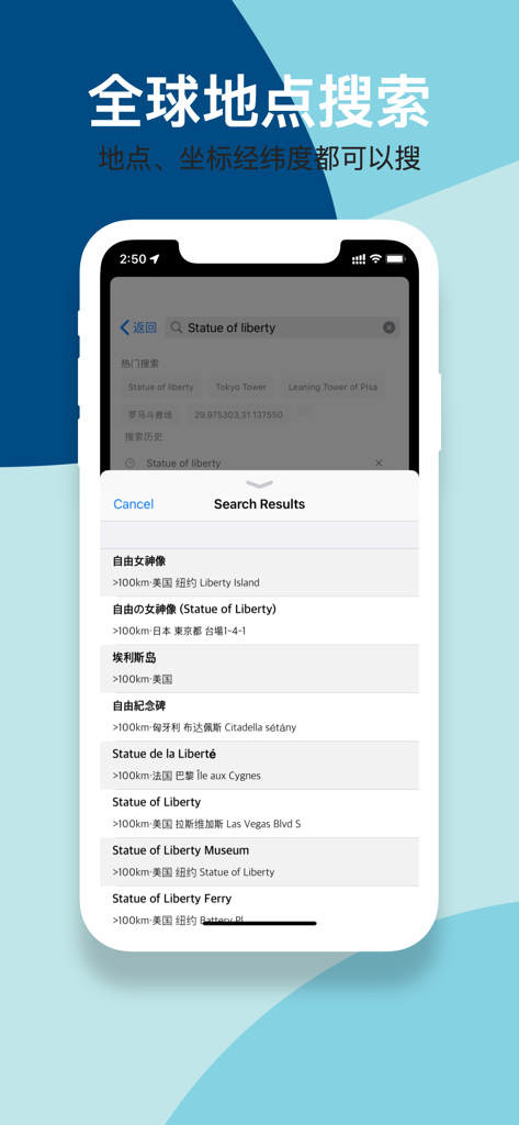
Interfaccia dell'app GoGoEarth che mostra i risultati della ricerca globale per la Statua della Libertà con supporto per latitudine e longitudine.
Descrizione
Download
App Simili
App con funzionalità ed esperienza simili

Earth Maps
FOXPOI PTE. LTD.

Satellite Map - Live Earth
慧敏 赵

Satellite Map - Earth View
ANKAGIS YAZILIM ANONIM SIRKETI

World Street 3D Panoramic Map
Beijing Zhiyue Information Technology Co., Ltd

3D Earth Map Street View
Naik Ur Rehman

Globe 3D Earth: World Map Live
Shams Alam

Street View - street view maps
国辉 满

卫星地图-高清地球探索世界
方元 朱

高清3D街景地图-地图软件手机全景版
Suzhou Caichuang Network Technology Co., Ltd.
Questa pagina non è una pagina ufficiale dell'app o del suo sviluppatore, ma una pubblicazione editoriale indipendente creata a scopo informativo e di commento. Salvo espressa indicazione contraria, né l'app né il suo sviluppatore sono affiliati, approvati, sponsorizzati, autorizzati o altrimenti ufficialmente collegati a MWM, Apple, Google Play, all'editore dell'app o allo sviluppatore dell'app, e nulla in questa pagina implica che l'app sia stata sviluppata utilizzando i servizi di MWM. Tutti i marchi, loghi, screenshot e altri contenuti rimangono di proprietà dei rispettivi proprietari.