Questa pagina non è una pagina ufficiale dell'app o del suo sviluppatore, ma una pubblicazione editoriale indipendente creata a scopo informativo e di commento. Salvo espressa indicazione contraria, né l'app né il suo sviluppatore sono affiliati, approvati, sponsorizzati, autorizzati o altrimenti ufficialmente collegati a MWM, Apple, Google Play, all'editore dell'app o allo sviluppatore dell'app, e nulla in questa pagina implica che l'app sia stata sviluppata utilizzando i servizi di MWM. Tutti i marchi, loghi, screenshot e altri contenuti rimangono di proprietà dei rispettivi proprietari.

GPS Fields Area Measure App
Misura accuratamente l'estensione dei terreni, pianifica percorsi multi-tappa e naviga in sicurezza con strumenti professionali progettati per proprietari terrieri, appaltatori e appassionati di attività all'aperto.
Download
14K+Valutazione
Valutazioni totali
0Editore
Categoria
NavigationLingue
16Ultima versione
1.0Dimensione
149.8 MBData di lancio
10 dic 2024La Cassetta degli Attrezzi Digitale Definitiva per Terreno e Strada
Dal calcolo dell'estensione dei terreni per progetti di paesaggistica alla navigazione su percorsi rurali con un HUD high-tech, forniamo ogni strumento professionale di cui hai bisogno in un'unica potente app.
Calcolo Preciso del Terreno e dell'Area
Misura facilmente acri, piedi quadrati o perimetri segnando punti sulla mappa. Ideale per recinzioni, agricoltura e gestione della proprietà.
Fotocamera GPS Geotaggata
Documenta il tuo lavoro con foto che includono automaticamente latitudine, longitudine e timestamp per una tenuta dei registri professionale.
Gli screenshot e la descrizione seguenti provengono direttamente dall'elenco ufficiale dello store dell'app e sono di proprietà dello sviluppatore.
App Store
Screenshot
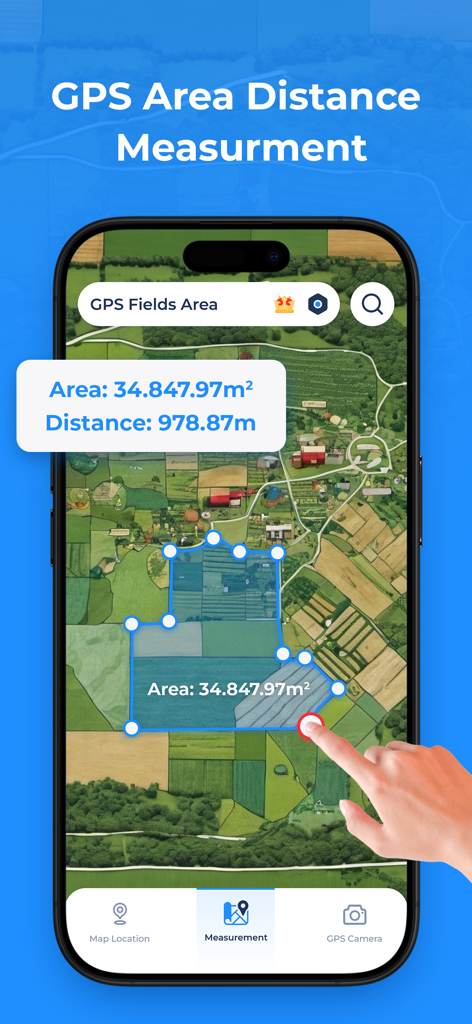
Un'app per smartphone che mostra una mappa satellitare con un'area di campo misurata e il calcolo della distanza.
App Misura Area Campi GPS che mostra la vista della mappa satellitare e gli strumenti di misurazione del terreno
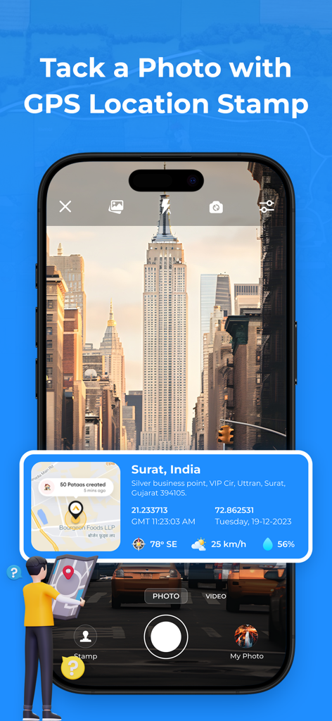
Schermata dello smartphone che mostra la funzione fotocamera GPS con una sovrapposizione di coordinate di posizione e una mappa su una foto.
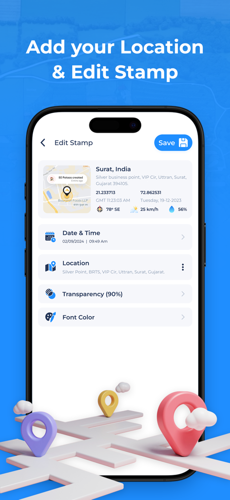
Una schermata mobile che mostra le opzioni per modificare un timbro di posizione GPS, inclusi data, ora e coordinate
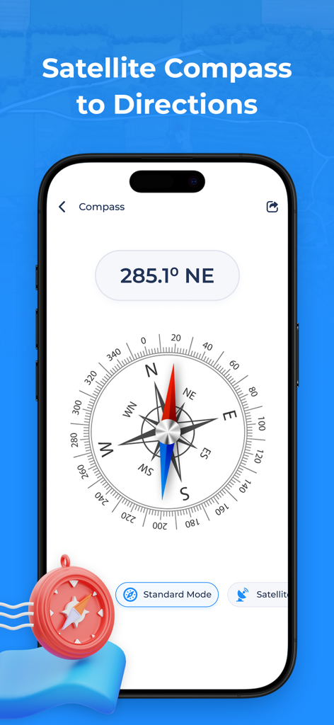
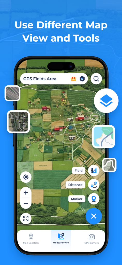
App Misura Area Campi GPS che mostra una bussola digitale con gradi direzionali e modalità satellitare
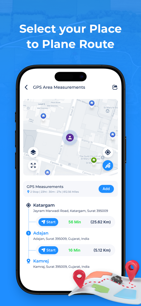
App Misura Area Campi GPS che mostra un pianificatore di percorsi multi-tappa con navigazione su mappa e tempi di percorrenza
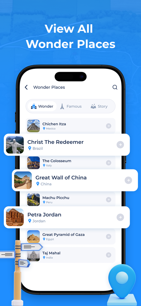
Elenco di famosi punti di riferimento mondiali come la Grande Muraglia Cinese e Petra nell'app di navigazione GPS
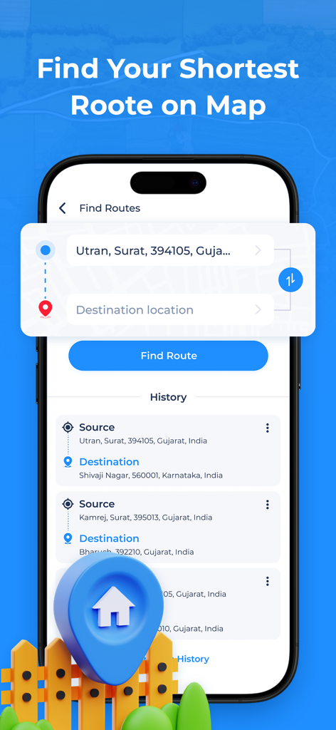
Interfaccia dell'app Misura Area Campi GPS che mostra la funzione di ricerca percorsi con input di origine e destinazione e cronologia di ricerca
Descrizione
Download
App Simili
App più classificate nella stessa categoria

Google Maps
Google LLC

Waze Navigation & Live Traffic
waze

AMap Global
AutoNavi Information Technology Co. Ltd.

百度地图-路线规划,出行必备
Beijing Baidu Netcom Science & Technology Co.,Ltd

Moovit: Bus & Transit Tracker
Moovit App Global LTD

Transit • Subway & Bus Times
9280-0366 Quebec inc.

ParkMobile: Park. Pay. Go.
Parkmobile USA, Inc

腾讯地图-路线规划,导航地铁打车出行
Shenzhen Tencent Computer Systems Company Limited

Île-de-France Mobilités
Ile de France Mobilites
Questa pagina non è una pagina ufficiale dell'app o del suo sviluppatore, ma una pubblicazione editoriale indipendente creata a scopo informativo e di commento. Salvo espressa indicazione contraria, né l'app né il suo sviluppatore sono affiliati, approvati, sponsorizzati, autorizzati o altrimenti ufficialmente collegati a MWM, Apple, Google Play, all'editore dell'app o allo sviluppatore dell'app, e nulla in questa pagina implica che l'app sia stata sviluppata utilizzando i servizi di MWM. Tutti i marchi, loghi, screenshot e altri contenuti rimangono di proprietà dei rispettivi proprietari.