Questa pagina non è una pagina ufficiale dell'app o del suo sviluppatore, ma una pubblicazione editoriale indipendente creata a scopo informativo e di commento. Salvo espressa indicazione contraria, né l'app né il suo sviluppatore sono affiliati, approvati, sponsorizzati, autorizzati o altrimenti ufficialmente collegati a MWM, Apple, Google Play, all'editore dell'app o allo sviluppatore dell'app, e nulla in questa pagina implica che l'app sia stata sviluppata utilizzando i servizi di MWM. Tutti i marchi, loghi, screenshot e altri contenuti rimangono di proprietà dei rispettivi proprietari.

Hunting Points: GPS & Hunt App
Naviga nel backcountry con sicurezza utilizzando mappe offline, identifica istantaneamente i confini terrieri e domina la tua caccia con previsioni in tempo reale sul vento e sull'attività dei cervi.
Download
371K+Valutazione
Valutazioni totali
5K+Editore
Categoria
NavigationLingue
1Ultima versione
1.8.9Dimensione
148.1 MBData di lancio
31 ago 2018Il vantaggio tattico definitivo per ogni cacciatore
Dettagliati confini della proprietà a schemi del vento in tempo reale, ottieni gli strumenti di alta precisione di cui hai bisogno per esplorare, navigare e avere successo in natura.
Domina i confini terrieri
Identifica istantaneamente i confini delle proprietà pubbliche e private con nomi dei proprietari e dati catastali per cacciare con sicurezza e rimanere legale.
Navigazione fuori rete
Perdi il segnale, non la strada. Accedi a mappe del terreno 3D offline e tracciamento GPS per tornare al campo base in sicurezza nel backcountry più profondo.
Gli screenshot e la descrizione seguenti provengono direttamente dall'elenco ufficiale dello store dell'app e sono di proprietà dello sviluppatore.
App Store
Screenshot
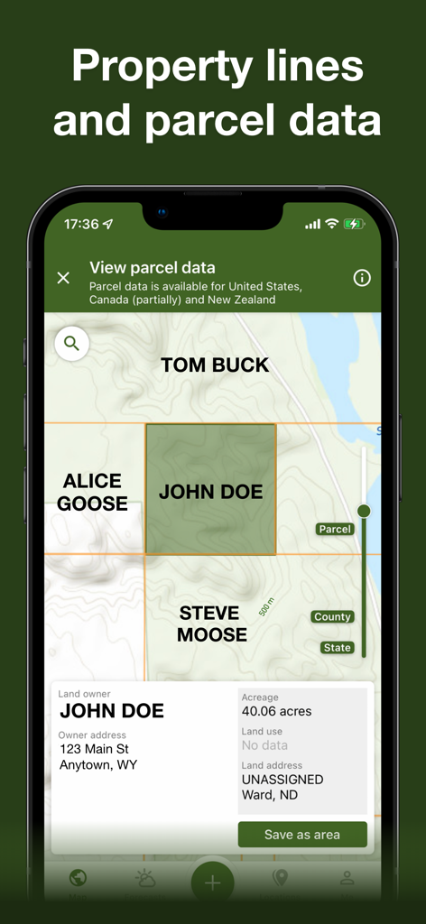
Schermata dello smartphone che mostra i confini della proprietà e i dati catastali dei proprietari terrieri su una mappa di caccia
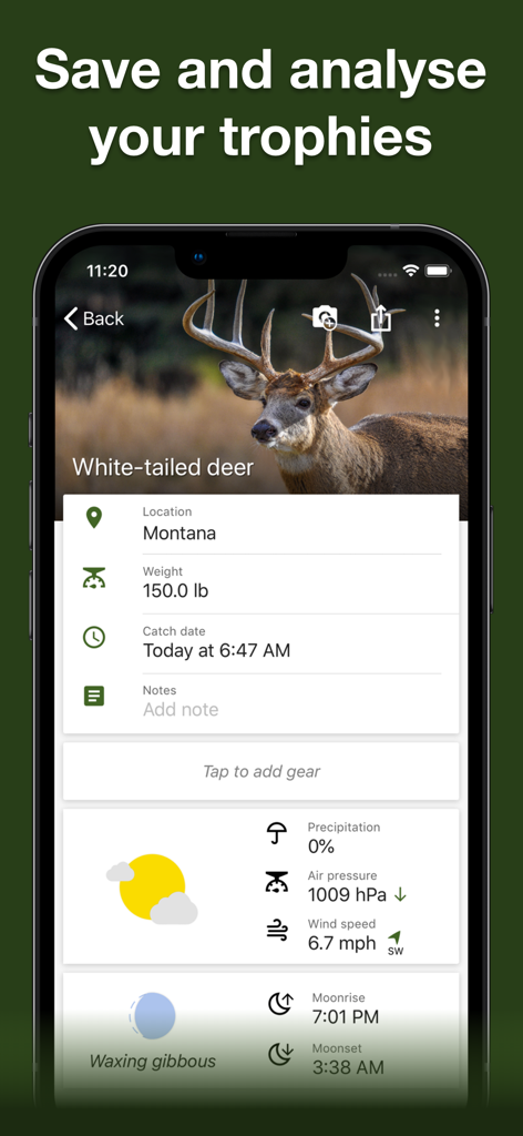
Schermata della "trophy room" dell'app Hunting Points che mostra un rapporto sulla cattura di un cervo dalla coda bianca con dati meteorologici e solunari
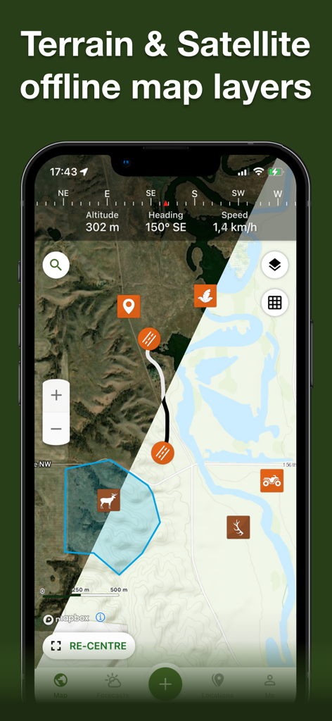
App Hunting Points che mostra una vista divisa di livelli di mappe offline del terreno e satellitari con icone di caccia e dati GPS
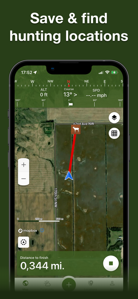
Screenshot dell'app Hunting Points che mostra una mappa satellitare con un percorso di navigazione verso un waypoint di cervo
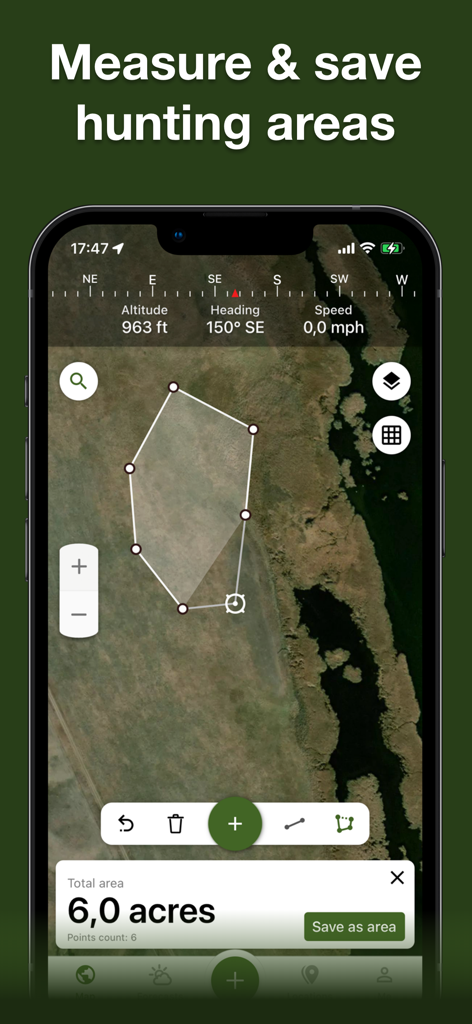
Un'interfaccia per smartphone che mostra una mappa satellitare con un poligono disegnato che misura un'area di caccia di sei acri.
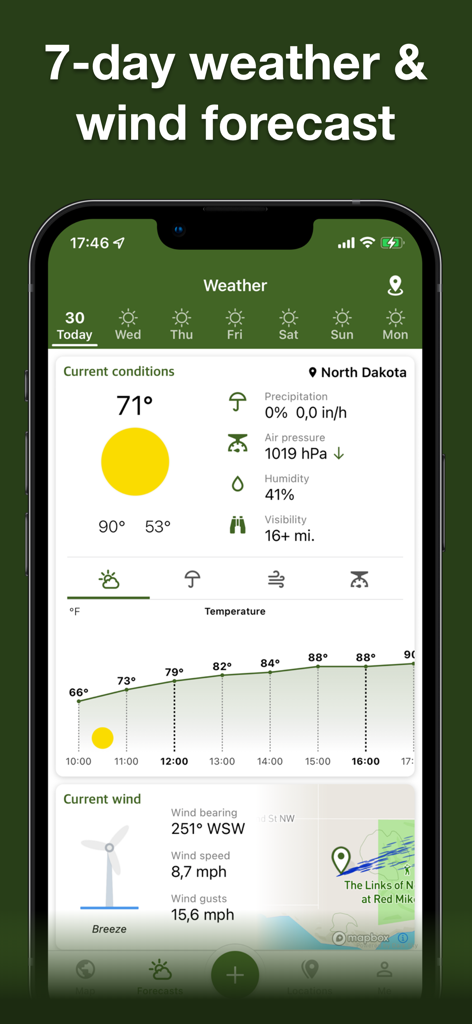
Schermata delle previsioni meteo e del vento sull'app Hunting Points
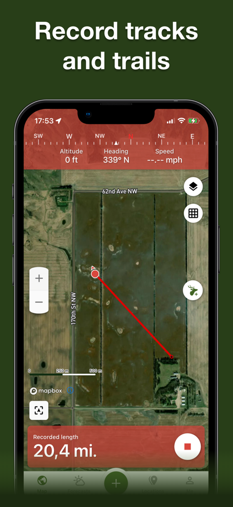
Registrazione di tracce e percorsi GPS su una mappa satellitare all'interno dell'app Hunting Points
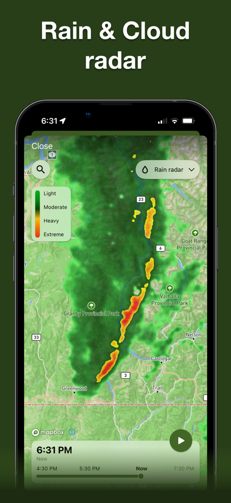
Mappa radar di pioggia e nuvole che mostra l'intensità delle precipitazioni per la pianificazione della caccia.
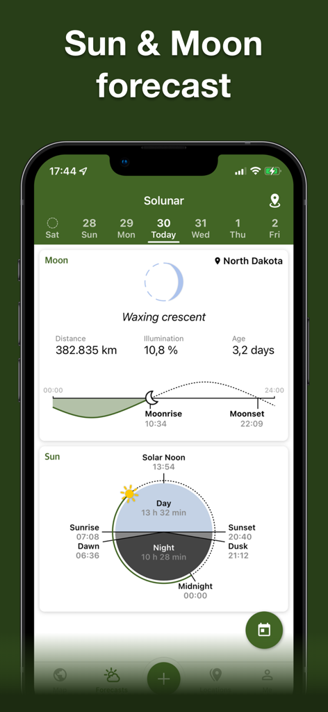
Dati solunari dettagliati e previsioni di sole e luna sull'app Hunting Points
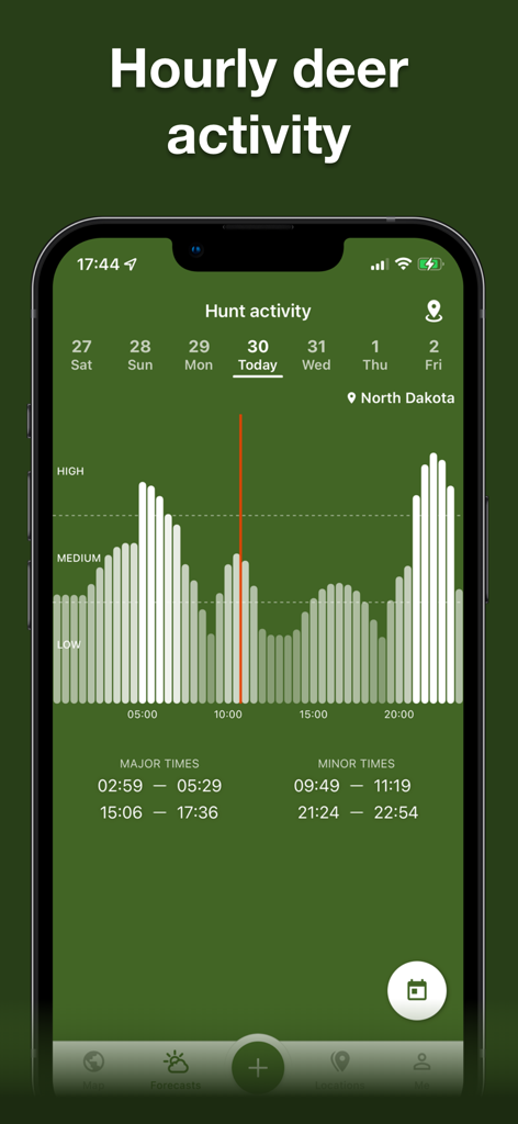
Una schermata di un'app mobile che mostra un grafico dei livelli di attività dei cervi orari e degli orari di alimentazione per la caccia nel North Dakota.
Descrizione
Download
App Simili
App con funzionalità ed esperienza simili

onX Hunt: GPS Hunting Maps
onXmaps, Inc.

GOHUNT: Research & Maps
GOHUNT, LLC

HuntWise: A Better Hunting App
Sportsman Tracker, Inc

HuntStand: GPS Maps & Tools
Good Sportsman Marketing, LLC

MyHunt: US Best Hunting App
Hunter & Companion Gesellschaft mit beschrankter Haftung

WeHunt
Natlink AB

DeerCast-Prep. Predict. Pursue
Good Sportsman Marketing, LLC

BaseMap: Hunting GPS Maps
BaseMap Inc

iHunter
Inside Outside Studios Inc.
Questa pagina non è una pagina ufficiale dell'app o del suo sviluppatore, ma una pubblicazione editoriale indipendente creata a scopo informativo e di commento. Salvo espressa indicazione contraria, né l'app né il suo sviluppatore sono affiliati, approvati, sponsorizzati, autorizzati o altrimenti ufficialmente collegati a MWM, Apple, Google Play, all'editore dell'app o allo sviluppatore dell'app, e nulla in questa pagina implica che l'app sia stata sviluppata utilizzando i servizi di MWM. Tutti i marchi, loghi, screenshot e altri contenuti rimangono di proprietà dei rispettivi proprietari.