Questa pagina non è una pagina ufficiale dell'app o del suo sviluppatore, ma una pubblicazione editoriale indipendente creata a scopo informativo e di commento. Salvo espressa indicazione contraria, né l'app né il suo sviluppatore sono affiliati, approvati, sponsorizzati, autorizzati o altrimenti ufficialmente collegati a MWM, Apple, Google Play, all'editore dell'app o allo sviluppatore dell'app, e nulla in questa pagina implica che l'app sia stata sviluppata utilizzando i servizi di MWM. Tutti i marchi, loghi, screenshot e altri contenuti rimangono di proprietà dei rispettivi proprietari.

MapCam - GPS Map Camera
Sovrapponi istantaneamente coordinate GPS, timestamp e metadati professionali alle tue foto. Lo strumento di documentazione all-in-one per professionisti sul campo ed esploratori all'aperto, costruito con il 100% di privacy in mente.
Download
2K+Valutazione
Valutazioni totali
0Editore
Categoria
NavigationLingue
12Ultima versione
1.5Dimensione
37.4 MBData di lancio
15 giu 2025Precisione Professionale in Ogni Scatto
Lo strumento di geotagging definitivo per lavoratori sul campo e avventurieri. Scatta foto con GPS automatico, timestamp e dati ambientali per documentare il tuo lavoro e il tuo mondo con assoluta accuratezza.
Geotagging Istantaneo e Prova
Apponi automaticamente alle foto latitudine, longitudine e timestamp per fornire prove inattaccabili dell'area per ispezioni, immobili o registri di viaggio.
Ricchi Sovrapposizioni di Metadati
Vai oltre la posizione con altitudine, condizioni meteorologiche, umidità e direzione della bussola integrate direttamente nelle tue immagini ad alta risoluzione per un contesto completo.
Gli screenshot e la descrizione seguenti provengono direttamente dall'elenco ufficiale dello store dell'app e sono di proprietà dello sviluppatore.
App Store
Screenshot
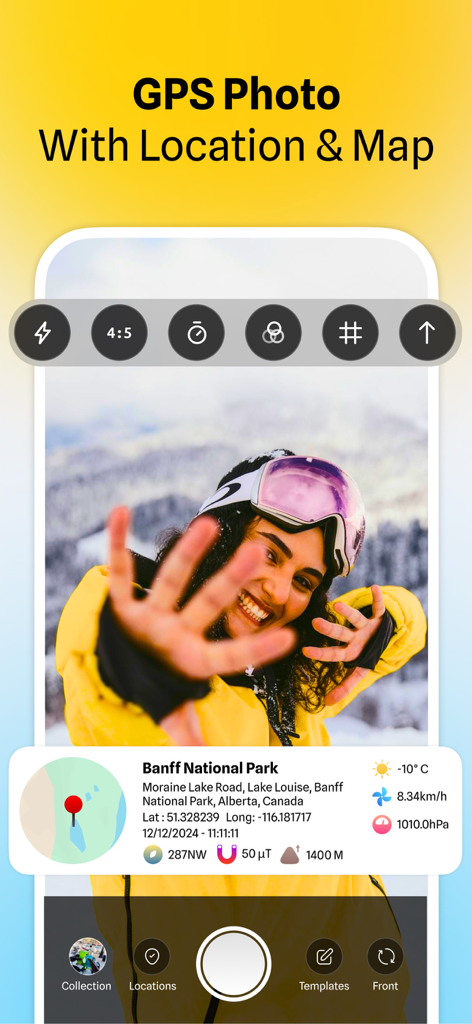
Interfaccia di MapCam che mostra una foto con mappa delle coordinate GPS e dati meteorologici
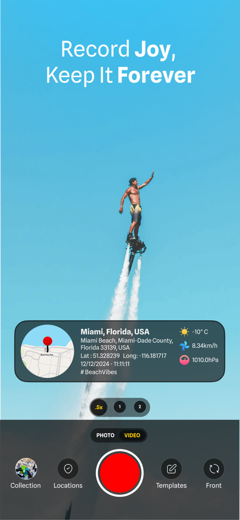
Interfaccia dell'app MapCam che mostra un flyboarder con posizione GPS e timestamp meteorologici
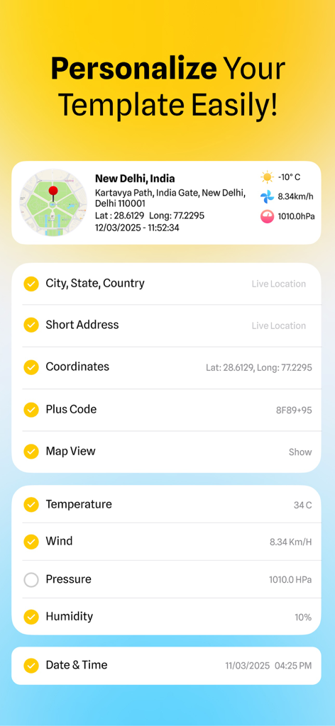
Interfaccia dell'app MapCam che mostra opzioni per personalizzare i timestamp delle foto con coordinate GPS, indirizzo e dati meteorologici
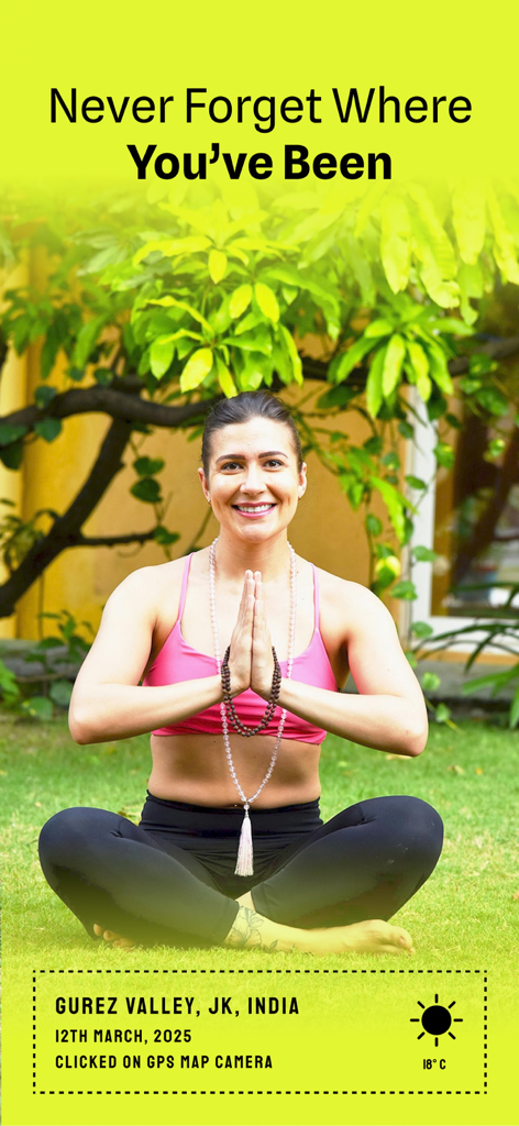
Donna che pratica yoga con sovrapposizione di timestamp e posizione GPS
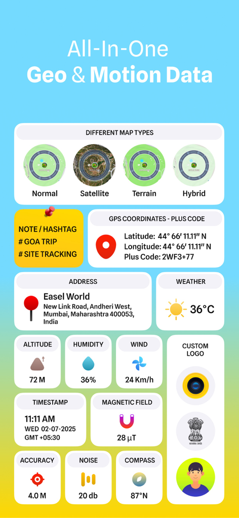
Interfaccia che mostra coordinate GPS, meteo, altitudine e tipi di mappe per foto e video.
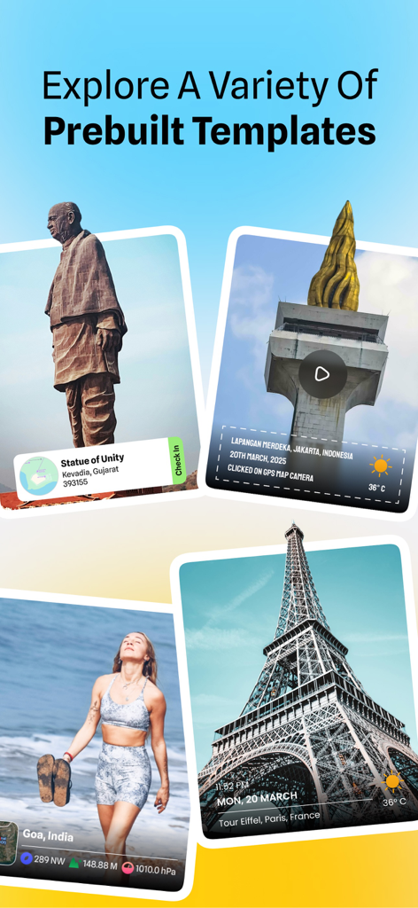
Presentazione di vari modelli predefiniti per geotaggare foto con posizione GPS e timestamp
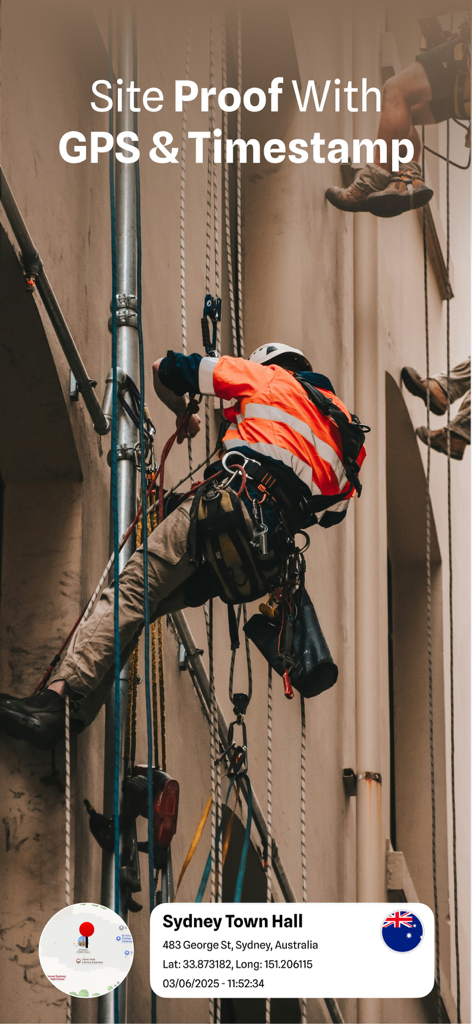
Operaio edile che documenta lo stato del cantiere con coordinate GPS e sovrapposizione di timestamp
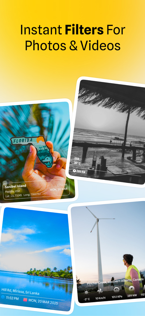
Esempi di foto con timestamp di posizione GPS e filtri visivi dall'app MapCam
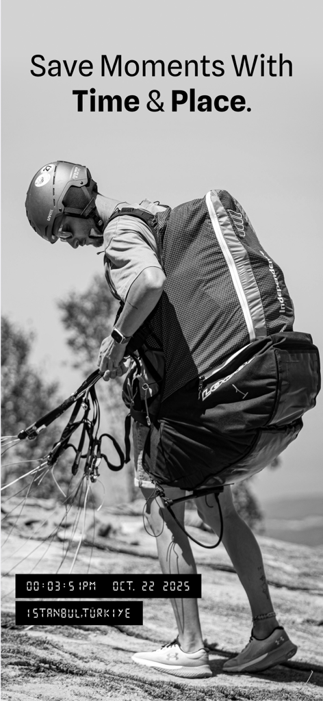
App MapCam che mostra una foto di un parapendio con tag GPS e timestamp
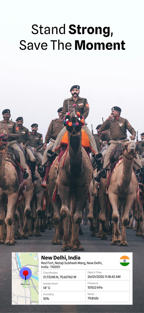
Foto geotagged di una parata di cammelli a Nuova Delhi con posizione GPS e dati ambientali
Descrizione
Download
App Simili
App più classificate nella stessa categoria

Google Maps
Google LLC

Waze Navigation & Live Traffic
waze

AMap Global
AutoNavi Information Technology Co. Ltd.

百度地图-路线规划,出行必备
Beijing Baidu Netcom Science & Technology Co.,Ltd

Moovit: Bus & Transit Tracker
Moovit App Global LTD

Transit • Subway & Bus Times
9280-0366 Quebec inc.

ParkMobile: Park. Pay. Go.
Parkmobile USA, Inc

腾讯地图-路线规划,导航地铁打车出行
Shenzhen Tencent Computer Systems Company Limited

Île-de-France Mobilités
Ile de France Mobilites
Questa pagina non è una pagina ufficiale dell'app o del suo sviluppatore, ma una pubblicazione editoriale indipendente creata a scopo informativo e di commento. Salvo espressa indicazione contraria, né l'app né il suo sviluppatore sono affiliati, approvati, sponsorizzati, autorizzati o altrimenti ufficialmente collegati a MWM, Apple, Google Play, all'editore dell'app o allo sviluppatore dell'app, e nulla in questa pagina implica che l'app sia stata sviluppata utilizzando i servizi di MWM. Tutti i marchi, loghi, screenshot e altri contenuti rimangono di proprietà dei rispettivi proprietari.