Questa pagina non è una pagina ufficiale dell'app o del suo sviluppatore, ma una pubblicazione editoriale indipendente creata a scopo informativo e di commento. Salvo espressa indicazione contraria, né l'app né il suo sviluppatore sono affiliati, approvati, sponsorizzati, autorizzati o altrimenti ufficialmente collegati a MWM, Apple, Google Play, all'editore dell'app o allo sviluppatore dell'app, e nulla in questa pagina implica che l'app sia stata sviluppata utilizzando i servizi di MWM. Tutti i marchi, loghi, screenshot e altri contenuti rimangono di proprietà dei rispettivi proprietari.

RealityMaps 3D tour planner
Visualizza la tua prossima avventura con mappatura aerea ad alta risoluzione e percorsi verificati da esperti. Pianifica escursioni tecniche, sentieri per mountain bike e tour sciistici con precisione assoluta utilizzando i dati del terreno 3D più accurati disponibili.
Download
135K+Valutazione
Valutazioni totali
1K+Editore
Categoria
NavigationLingue
2Ultima versione
2.0.61Dimensione
112.8 MBData di lancio
18 lug 2013Naviga con una Chiarezza 3D Ineguagliabile
Dallo scouting high-tech alla sicurezza in tempo reale nel backcountry, ottieni gli strumenti di precisione di cui hai bisogno per conquistare terreni tecnici con assoluta sicurezza.
Pianificazione Immersiva in 3D
Visualizza ogni cresta, precipizio e sentiero con precisione di livello aereo. Esplora il tuo percorso in un ambiente 3D realistico per dominare il terreno prima del primo passo.
Intelligenza per Terreni Tecnici
Valuta istantaneamente le pendenze e l'orientamento. Essenziale per la sicurezza nel backcountry, ti aiuta a identificare potenziali pericoli e a navigare vette complesse come un professionista.
Gli screenshot e la descrizione seguenti provengono direttamente dall'elenco ufficiale dello store dell'app e sono di proprietà dello sviluppatore.
App Store
Screenshot
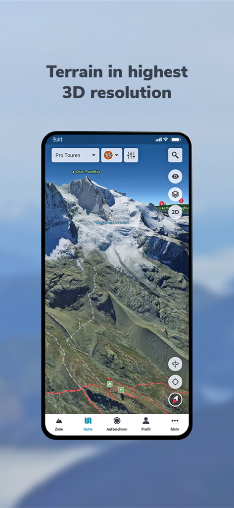
Mappa del terreno 3D ad alta risoluzione della montagna Gran Paradiso su uno smartphone
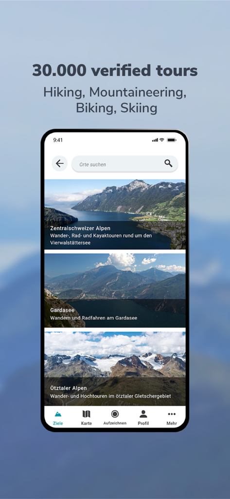
Schermata di uno smartphone che mostra l'app RealityMaps 3D con una selezione di tour verificati di escursionismo e alpinismo nelle Alpi
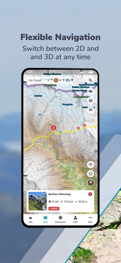
Interfaccia dell'app RealityMaps 3D che mostra una mappa topografica escursionistica 2D del Berliner Hohenweg
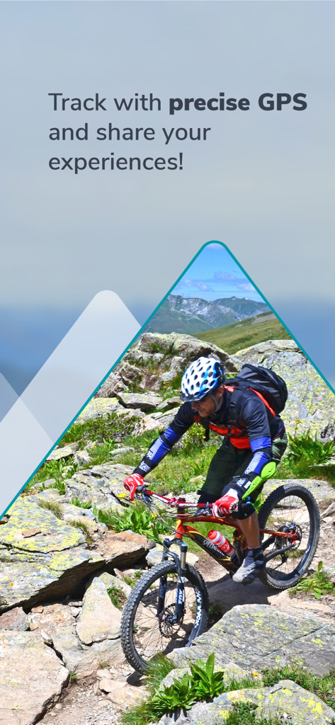
Un mountain biker che naviga su un sentiero di montagna roccioso con tracciamento GPS preciso
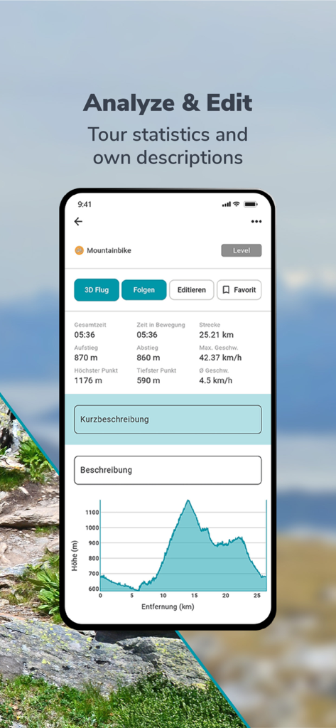
Interfaccia dell'app RealityMaps 3D che mostra statistiche del tour in mountain bike e grafico del profilo altimetrico.
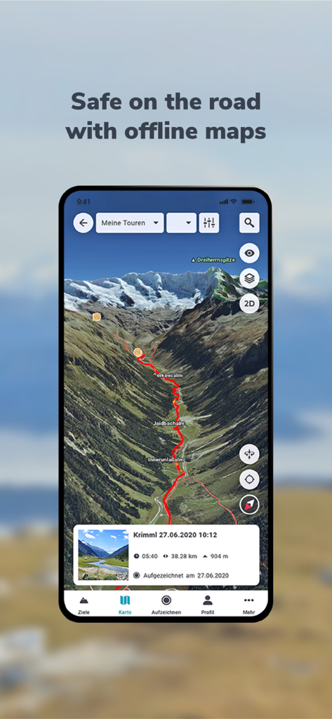
App RealityMaps 3D che visualizza un percorso escursionistico rosso su un paesaggio montano 3D realistico

Una mappa invernale 3D ad alta risoluzione che mostra un percorso sciistico su una vetta innevata
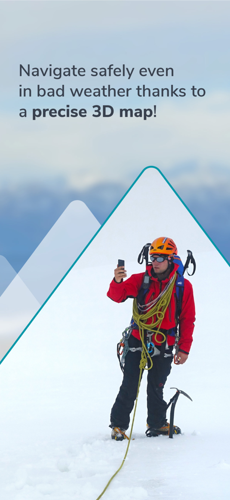
Alpinista che utilizza la navigazione 3D su una vetta innevata per la sicurezza
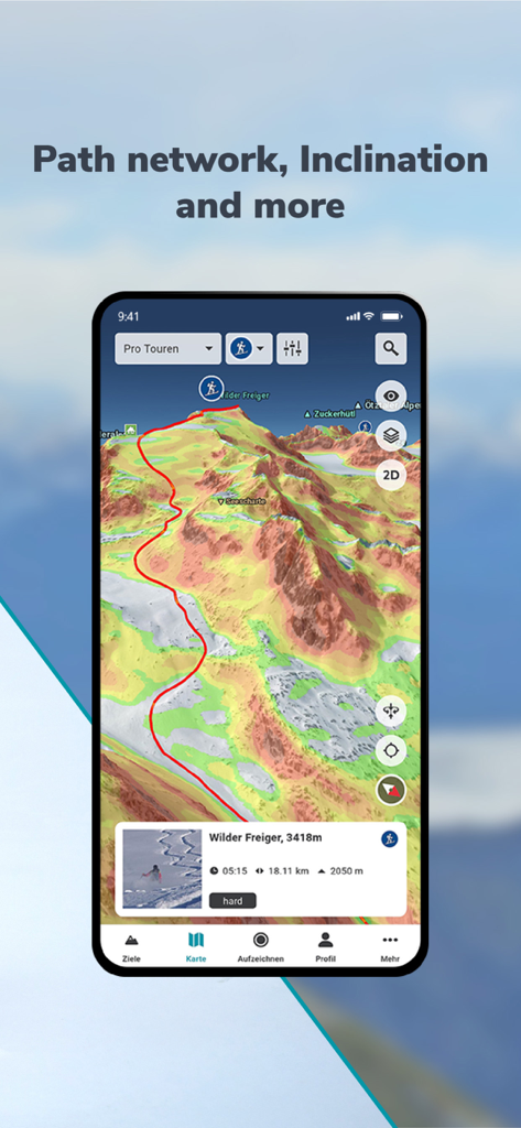
Interfaccia RealityMaps 3D che mostra un percorso di montagna con inclinazione della pendenza codificata a colori e dettagli del terreno
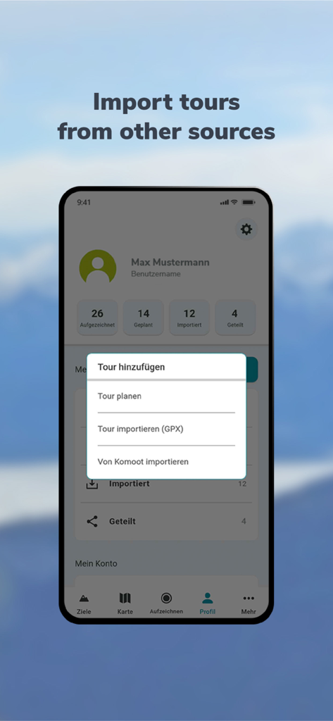
Un'interfaccia mobile per RealityMaps 3D che mostra un menu per importare tour di escursionismo e mountain bike da file GPX o Komoot.
Descrizione
Download
App Simili
App con funzionalità ed esperienza simili

Saki - Connect & Share
潇泳 庄

Gaggle Paragliding, Ultralight
Viszen Pty Ltd

AvTraffic
Tailwind Software

Paragliding Tracker: Wingman
iSolid SPRL

Skida: Alpine Adventures
Mountainsnow AS

Relief Maps : backcountry gps
Batiste Vonderweidt

Spot Assist Skydiving Tool
Andrey Kan

Flyskyhy
Rene Dekker

iGlide Advanced
Logic Design
Questa pagina non è una pagina ufficiale dell'app o del suo sviluppatore, ma una pubblicazione editoriale indipendente creata a scopo informativo e di commento. Salvo espressa indicazione contraria, né l'app né il suo sviluppatore sono affiliati, approvati, sponsorizzati, autorizzati o altrimenti ufficialmente collegati a MWM, Apple, Google Play, all'editore dell'app o allo sviluppatore dell'app, e nulla in questa pagina implica che l'app sia stata sviluppata utilizzando i servizi di MWM. Tutti i marchi, loghi, screenshot e altri contenuti rimangono di proprietà dei rispettivi proprietari.