Questa pagina non è una pagina ufficiale dell'app o del suo sviluppatore, ma una pubblicazione editoriale indipendente creata a scopo informativo e di commento. Salvo espressa indicazione contraria, né l'app né il suo sviluppatore sono affiliati, approvati, sponsorizzati, autorizzati o altrimenti ufficialmente collegati a MWM, Apple, Google Play, all'editore dell'app o allo sviluppatore dell'app, e nulla in questa pagina implica che l'app sia stata sviluppata utilizzando i servizi di MWM. Tutti i marchi, loghi, screenshot e altri contenuti rimangono di proprietà dei rispettivi proprietari.

RunwayMap - #1 Pilot Community
Perfeziona ogni atterraggio con anteprime in 3D dell'avvicinamento, meteo aeronautico in tempo reale e la guida definitiva ai migliori ristoranti aeroportuali.
Download
62K+Valutazione
Valutazioni totali
1K+Editore
Categoria
WeatherLingue
2Ultima versione
3.9.8Dimensione
76.7 MBData di lancio
28 giu 2017Controlla il tuo volo dalla pianificazione all'atterraggio
Unisciti alla community di piloti n. 1 per visualizzare gli avvicinamenti in 3D, ottenere informazioni meteo intuitive e scoprire la tua prossima destinazione per un 'hamburger da 100 dollari'.
Anteprime di avvicinamento in 3D
Elimina l'ansia da nuovo aeroporto volando virtualmente il tuo atterraggio in 3D. Imposta la distanza e il sentiero di discesa per perfezionare ogni avvicinamento prima ancora di decollare.
Meteo aeronautico visivo
Smetti di decodificare testi e inizia a guardare il cielo. Ottieni METAR visivi, venti in quota fino a FL150 e componenti del vento trasversale calcolate per la migliore scelta della pista.
Gli screenshot e la descrizione seguenti provengono direttamente dall'elenco ufficiale dello store dell'app e sono di proprietà dello sviluppatore.
App Store
Screenshot
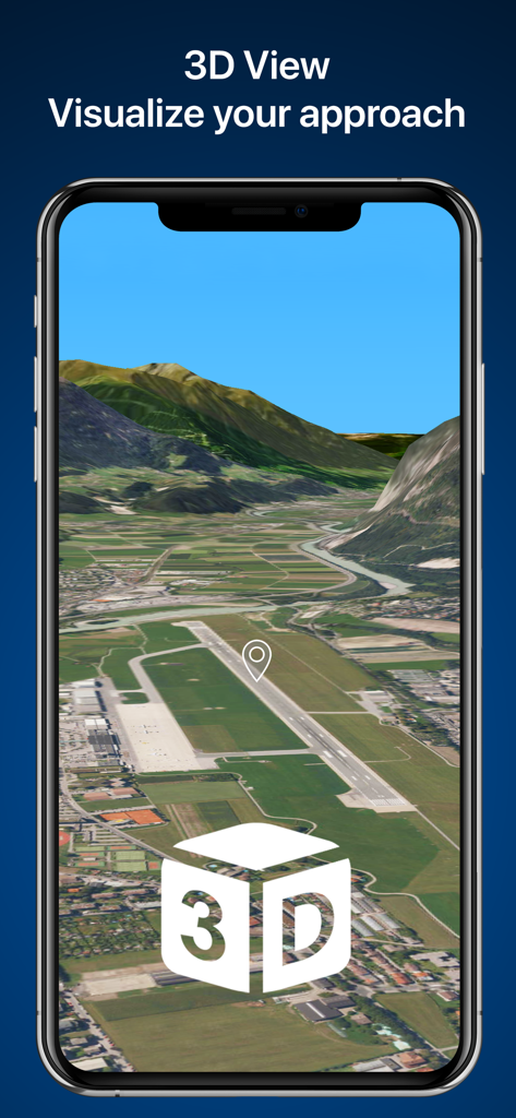
Visualizzazione 3D dell'avvicinamento di una pista aeroportuale sullo schermo di uno smartphone
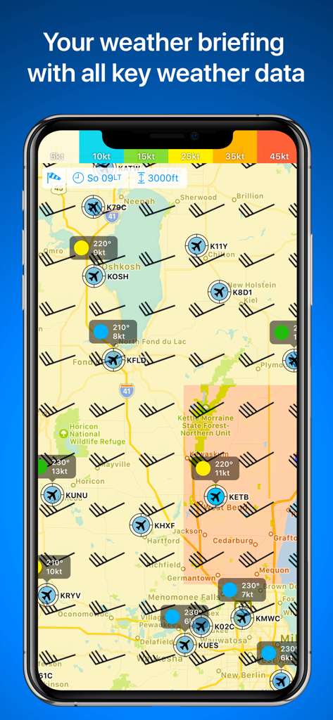
Mappa meteo aeronautica in RunwayMap che mostra i simboli del vento e le condizioni di volo dell'aeroporto
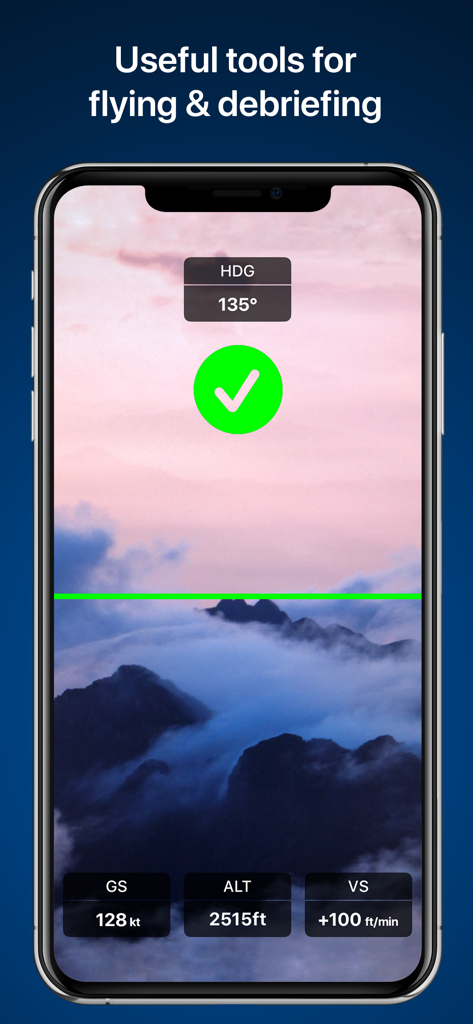
Schermo dello smartphone che mostra gli strumenti di volo di RunwayMap con sovrapposizioni di dati su altitudine e velocità
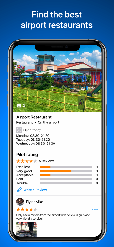
Interfaccia dell'app RunwayMap che mostra le valutazioni dei ristoranti aeroportuali e le recensioni dei piloti

Profilo utente e feed social nell'app RunwayMap che mostra un post di un pilota con un aereo leggero in un aeroporto.
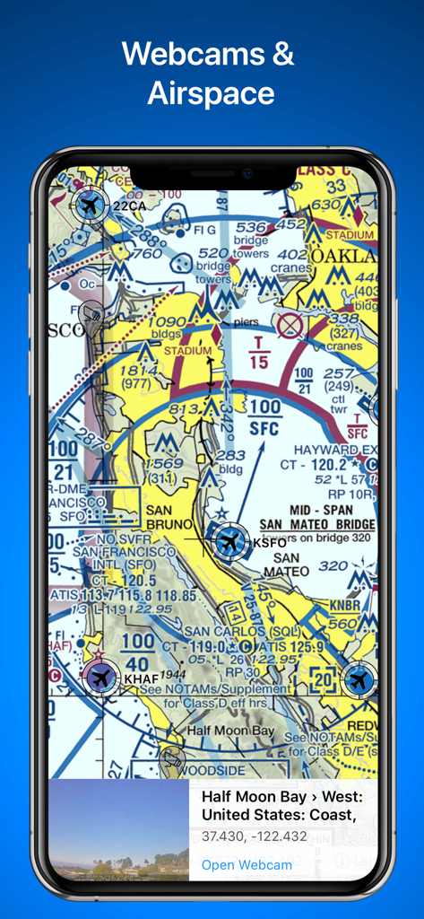
L'app RunwayMap visualizza una carta aeronautica sezionale con dettagli dello spazio aereo e un'anteprima della webcam in diretta per l'aeroporto di Half Moon Bay.
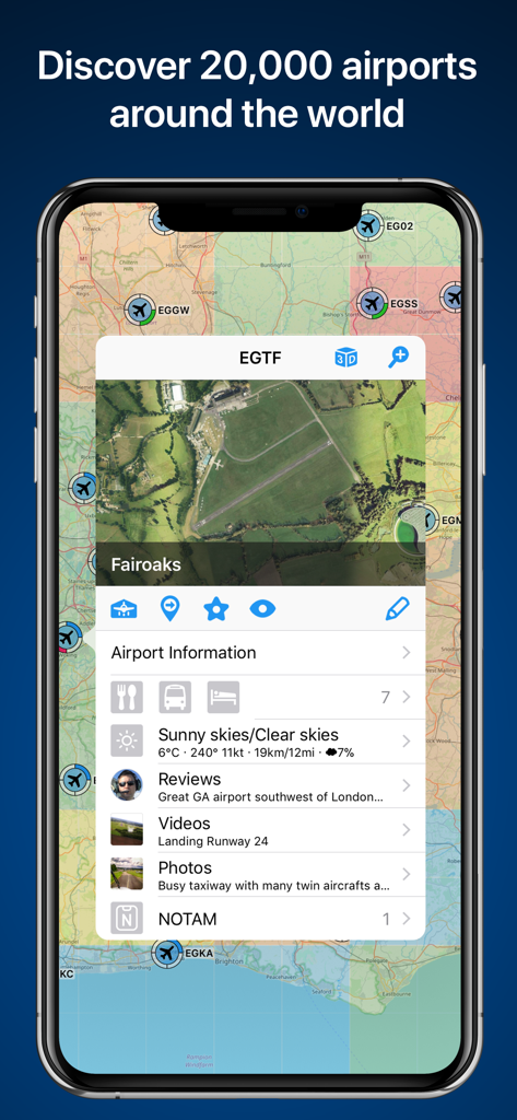
Schermata dell'app RunwayMap che mostra una mappa degli aeroporti con informazioni dettagliate per l'aeroporto di Fairoaks
Descrizione
Download
App Simili
App più classificate nella stessa categoria

墨迹天气-MojiWeather
Beijing MojiFengyun Technology Co.,Ltd.

The Weather Channel - Radar
The Weather Channel

Windy.com
Windyty, SE

天气预报-精准15日天气预报
Chongqing Caochen Technology Co., Ltd.

My Aurora Forecast & Alerts
JRustonApps B.V.

AccuWeather: Weather Forecast
AccuWeather International, Inc.

Weather & Radar - Storm radar
WetterOnline - Meteorologische Dienstleistungen GmbH

天气通
Weibo Internet Technology (China) Co.Ltd.

The Thermometer -Digital-
Vida Apps Incorporated
Questa pagina non è una pagina ufficiale dell'app o del suo sviluppatore, ma una pubblicazione editoriale indipendente creata a scopo informativo e di commento. Salvo espressa indicazione contraria, né l'app né il suo sviluppatore sono affiliati, approvati, sponsorizzati, autorizzati o altrimenti ufficialmente collegati a MWM, Apple, Google Play, all'editore dell'app o allo sviluppatore dell'app, e nulla in questa pagina implica che l'app sia stata sviluppata utilizzando i servizi di MWM. Tutti i marchi, loghi, screenshot e altri contenuti rimangono di proprietà dei rispettivi proprietari.