Questa pagina non è una pagina ufficiale dell'app o del suo sviluppatore, ma una pubblicazione editoriale indipendente creata a scopo informativo e di commento. Salvo espressa indicazione contraria, né l'app né il suo sviluppatore sono affiliati, approvati, sponsorizzati, autorizzati o altrimenti ufficialmente collegati a MWM, Apple, Google Play, all'editore dell'app o allo sviluppatore dell'app, e nulla in questa pagina implica che l'app sia stata sviluppata utilizzando i servizi di MWM. Tutti i marchi, loghi, screenshot e altri contenuti rimangono di proprietà dei rispettivi proprietari.

RWIS
Potenzia il tuo processo decisionale con condizioni stradali in tempo reale, avvisi di ghiaccio precoci e tracciamento dei servizi sul campo in tempo reale progettato per i professionisti delle infrastrutture.
Download
23K+Valutazione
Valutazioni totali
0Editore
Categoria
WeatherLingue
11Ultima versione
4.1.1Dimensione
34.0 MBData di lancio
25 lug 2014Comando Operativo in Tasca
Ottimizza la tua risposta alle condizioni meteorologiche invernali con condizioni stradali in tempo reale, tracciamento della flotta in tempo reale e dati dei sensori iperlocali creati per i professionisti delle infrastrutture.
Intelligenza Stradale Iperlocale
Monitora le temperature della superficie stradale, il livello dell'acqua e i rischi di ghiaccio con dati precisi dei sensori per trattare le strade solo quando necessario.
Coordinamento della Flotta in Tempo Reale
Traccia i veicoli attivi e i percorsi di intervento colorati su una mappa interattiva per garantire una copertura totale e trasparenza operativa.
Gli screenshot e la descrizione seguenti provengono direttamente dall'elenco ufficiale dello store dell'app e sono di proprietà dello sviluppatore.
App Store
Screenshot
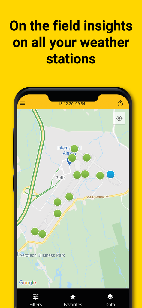
Interfaccia dell'app RWIS che mostra le posizioni delle stazioni meteorologiche su una mappa dell'aeroporto.
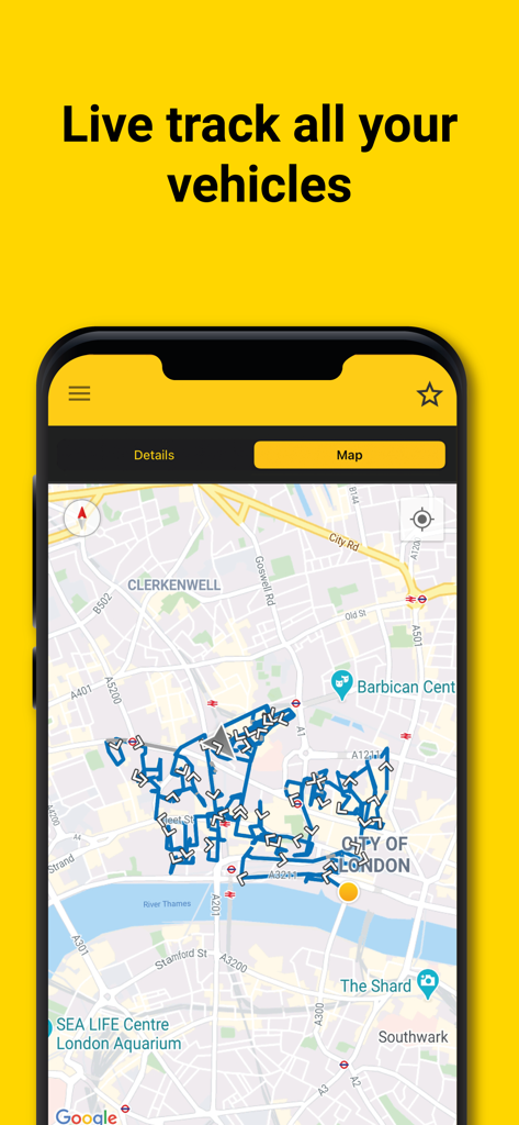
Interfaccia dell'app mobile RWIS che mostra il tracciamento del percorso dei veicoli in tempo reale su una mappa interattiva della città.
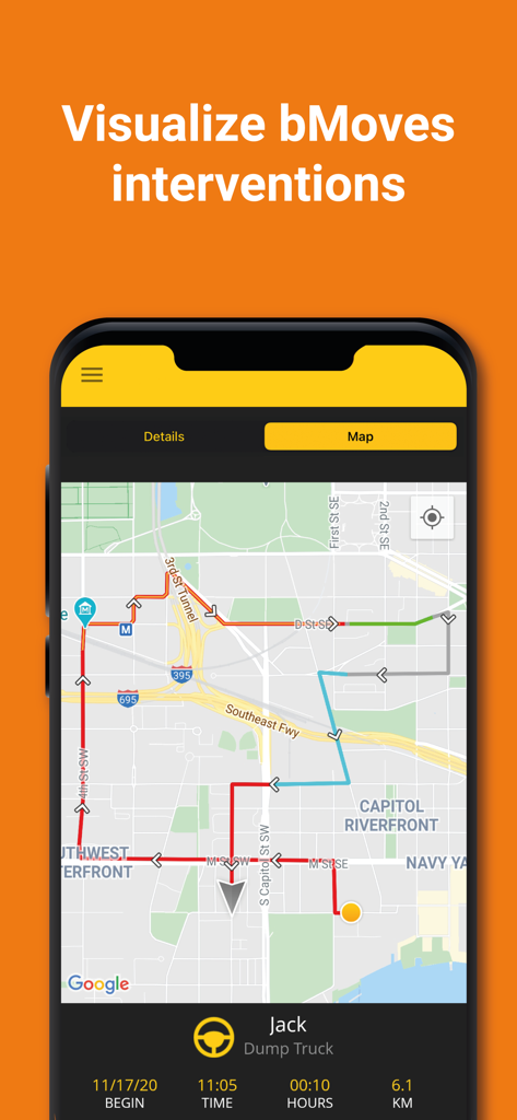
Vista mappa dell'app RWIS che mostra percorsi dei veicoli codificati a colori e tracciamento della flotta in tempo reale per gli interventi bMoves.
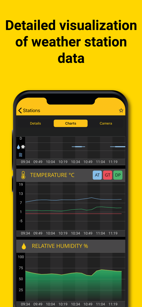
App RWIS che visualizza grafici di temperatura e umidità relativa in tempo reale per il monitoraggio delle stazioni meteorologiche stradali
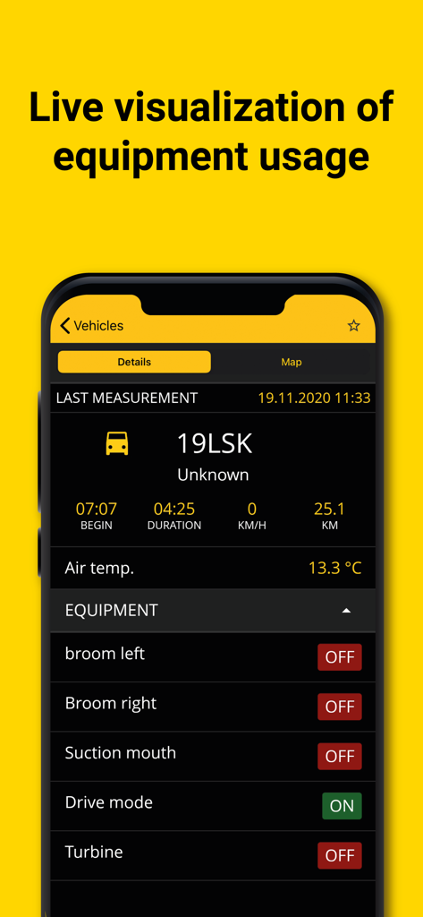
Dashboard dell'app RWIS che mostra lo stato delle apparecchiature in tempo reale e i dati dei veicoli per la manutenzione stradale
Descrizione
Download
App Simili
App più classificate nella stessa categoria

墨迹天气-MojiWeather
Beijing MojiFengyun Technology Co.,Ltd.

The Weather Channel - Radar
The Weather Channel

Windy.com
Windyty, SE

天气预报-精准15日天气预报
Chongqing Caochen Technology Co., Ltd.

My Aurora Forecast & Alerts
JRustonApps B.V.

AccuWeather: Weather Forecast
AccuWeather International, Inc.

Weather & Radar - Storm radar
WetterOnline - Meteorologische Dienstleistungen GmbH

天气通
Weibo Internet Technology (China) Co.Ltd.

The Thermometer -Digital-
Vida Apps Incorporated
Questa pagina non è una pagina ufficiale dell'app o del suo sviluppatore, ma una pubblicazione editoriale indipendente creata a scopo informativo e di commento. Salvo espressa indicazione contraria, né l'app né il suo sviluppatore sono affiliati, approvati, sponsorizzati, autorizzati o altrimenti ufficialmente collegati a MWM, Apple, Google Play, all'editore dell'app o allo sviluppatore dell'app, e nulla in questa pagina implica che l'app sia stata sviluppata utilizzando i servizi di MWM. Tutti i marchi, loghi, screenshot e altri contenuti rimangono di proprietà dei rispettivi proprietari.