Questa pagina non è una pagina ufficiale dell'app o del suo sviluppatore, ma una pubblicazione editoriale indipendente creata a scopo informativo e di commento. Salvo espressa indicazione contraria, né l'app né il suo sviluppatore sono affiliati, approvati, sponsorizzati, autorizzati o altrimenti ufficialmente collegati a MWM, Apple, Google Play, all'editore dell'app o allo sviluppatore dell'app, e nulla in questa pagina implica che l'app sia stata sviluppata utilizzando i servizi di MWM. Tutti i marchi, loghi, screenshot e altri contenuti rimangono di proprietà dei rispettivi proprietari.

The Photographer's Ephemeris
Lo strumento di pianificazione standard del settore per fotografi di paesaggio e outdoor. Visualizza Sole, Luna e Via Lattea con sovrapposizioni di mappe 3D, ricognizioni AR e analisi avanzate della linea di vista per catturare lo scatto perfetto, ogni volta.
Download
419K+Valutazione
Valutazioni totali
4K+Editore
Categoria
Photo & VideoLingue
4Ultima versione
4.15.1Dimensione
95.2 MBData di lancio
17 apr 2010Pianifica la Luce Perfetta
Il toolkit standard del settore per fotografi orientati alla precisione per padroneggiare la luce naturale e gli allineamenti celesti ovunque sulla Terra.
Pianificazione consapevole del terreno
Determina esattamente quando il sole o la luna sorgeranno da dietro la topografia locale per una precisione millimetrica nelle regioni montuose.
Visualizzazione AR sul campo
Visualizza i percorsi celesti in tempo reale utilizzando la realtà aumentata per bloccare la tua composizione ore prima del momento perfetto.
Gli screenshot e la descrizione seguenti provengono direttamente dall'elenco ufficiale dello store dell'app e sono di proprietà dello sviluppatore.
App Store
Screenshot
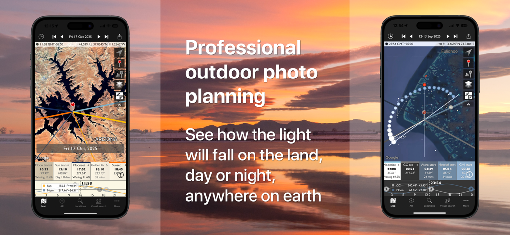
Interfaccia dell'app mobile The Photographers Ephemeris che mostra i percorsi del sole e della luna sulle mappe per la pianificazione fotografica outdoor
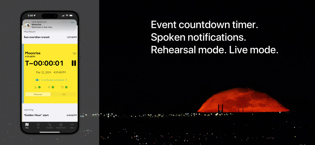
Interfaccia dell'app The Photographer's Ephemeris che mostra un timer per il conto alla rovescia dell'alba lunare e le impostazioni di notifica degli eventi.
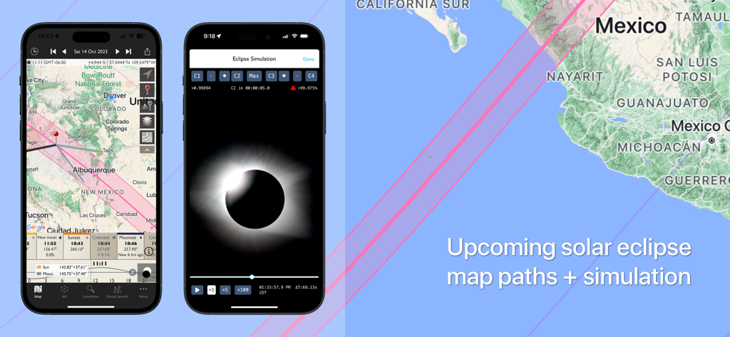
Percorsi della mappa dell'eclissi solare e simulazione visiva nell'app mobile The Photographer's Ephemeris.
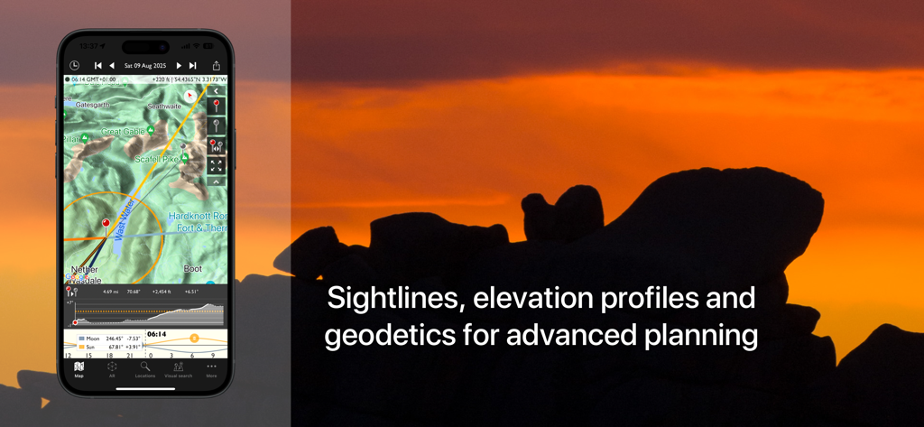
Interfaccia dell'app The Photographers Ephemeris che mostra linee di vista e profili di elevazione per la pianificazione fotografica durante il tramonto
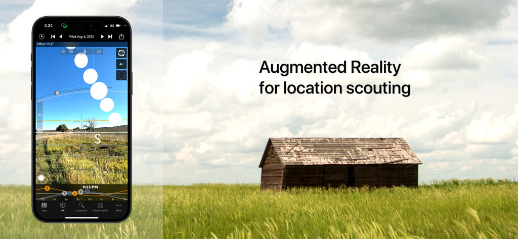
Smartphone che visualizza la funzione di realtà aumentata dell'app The Photographer's Ephemeris per la ricognizione della location su un campo con un capanno di legno.
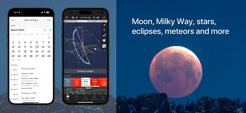
Screenshot dell'app The Photographer's Ephemeris che mostra un calendario di eventi celesti e funzionalità di mappatura delle eclissi lunari.
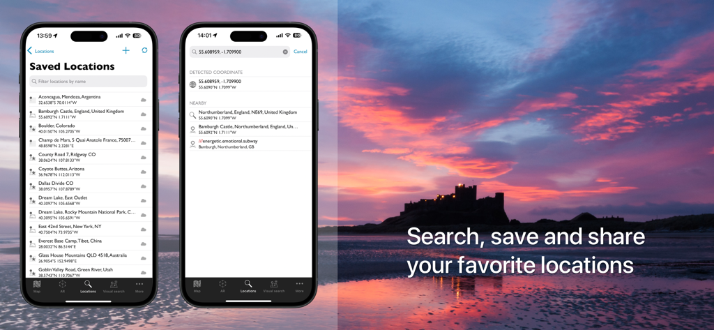
Schermate mobili dell'app The Photographer's Ephemeris che mostrano posizioni salvate e funzionalità di ricerca su un paesaggio al tramonto
Descrizione
Download
App Simili
App con funzionalità ed esperienza simili

Moon Phases and Lunar Calendar
Business City s.r.o.

My Moon Phase - Lunar Calendar
JRustonApps B.V.

The Moon: Calendar Moon Phases
Vitalii Gryniuk

Moonlitt: Moon Phase Tracker
Flipping Hues Srls

Sunrise Sunset Times
Fascinating Projects Pty Ltd

PhotoPills
PhotoPills S.L.

AuroraReach
HuskyCodes Oy

Sun Seeker - Sunlight Tracker
Ajnaware Pty Ltd

Sun Tracker AR
Zuzana Eskinasi
Questa pagina non è una pagina ufficiale dell'app o del suo sviluppatore, ma una pubblicazione editoriale indipendente creata a scopo informativo e di commento. Salvo espressa indicazione contraria, né l'app né il suo sviluppatore sono affiliati, approvati, sponsorizzati, autorizzati o altrimenti ufficialmente collegati a MWM, Apple, Google Play, all'editore dell'app o allo sviluppatore dell'app, e nulla in questa pagina implica che l'app sia stata sviluppata utilizzando i servizi di MWM. Tutti i marchi, loghi, screenshot e altri contenuti rimangono di proprietà dei rispettivi proprietari.