Questa pagina non è una pagina ufficiale dell'app o del suo sviluppatore, ma una pubblicazione editoriale indipendente creata a scopo informativo e di commento. Salvo espressa indicazione contraria, né l'app né il suo sviluppatore sono affiliati, approvati, sponsorizzati, autorizzati o altrimenti ufficialmente collegati a MWM, Apple, Google Play, all'editore dell'app o allo sviluppatore dell'app, e nulla in questa pagina implica che l'app sia stata sviluppata utilizzando i servizi di MWM. Tutti i marchi, loghi, screenshot e altri contenuti rimangono di proprietà dei rispettivi proprietari.

The Wildfire Tracker
Anticipa le fiamme con il tracciamento dei punti caldi live, previsioni sulla qualità dell'aria e allarmi di sicurezza istantanei. Ottieni i dati di cui hai bisogno da NASA e NWS per mantenere al sicuro la tua famiglia e la tua proprietà.
Download
40K+Valutazione
Valutazioni totali
200Editore
Categoria
WeatherLingue
1Ultima versione
2.1.1Dimensione
407.8 MBData di lancio
5 giu 2023Protezione Completa per la Tua Casa e la Tua Salute
Ottieni i dati di cui hai bisogno per rimanere al sicuro durante la stagione degli incendi con tracciamento satellitare in tempo reale, allarmi iper-locali e previsioni ambientali avanzate.
Mappatura dei Punti Caldi in Tempo Reale
Visualizza incendi attivi e perimetri degli incendi utilizzando dati ad alta precisione dalla NASA e dal National Interagency Fire Center.
Allarmi Iper-Locali Istantanei
Segna la tua proprietà o le posizioni dei familiari per ricevere notifiche push immediate ogni volta che viene rilevata una minaccia di incendio nelle vicinanze.
Gli screenshot e la descrizione seguenti provengono direttamente dall'elenco ufficiale dello store dell'app e sono di proprietà dello sviluppatore.
App Store
Screenshot
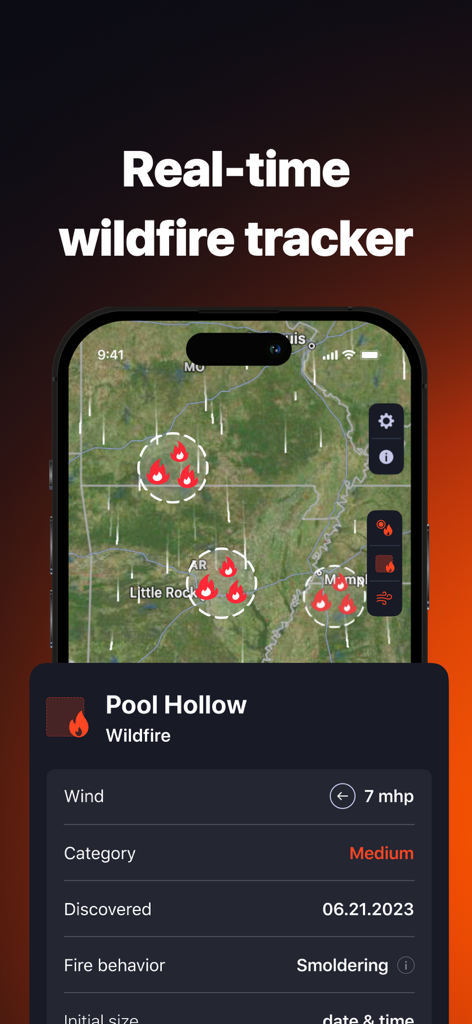
Interfaccia dell'app The Wildfire Tracker che mostra una mappa interattiva con punti caldi di incendi e dati dettagliati sugli incendi.
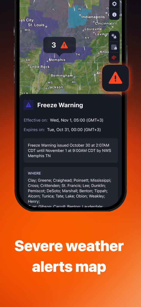
Interfaccia dell'app The Wildfire Tracker che mostra una mappa degli allarmi meteo gravi con una notifica di avviso di gelo per Memphis
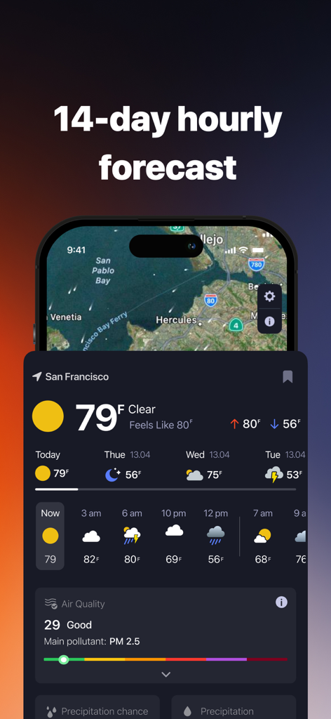
Interfaccia dell'app The Wildfire Tracker che mostra una previsione meteo oraria per 14 giorni e l'indice di qualità dell'aria per San Francisco
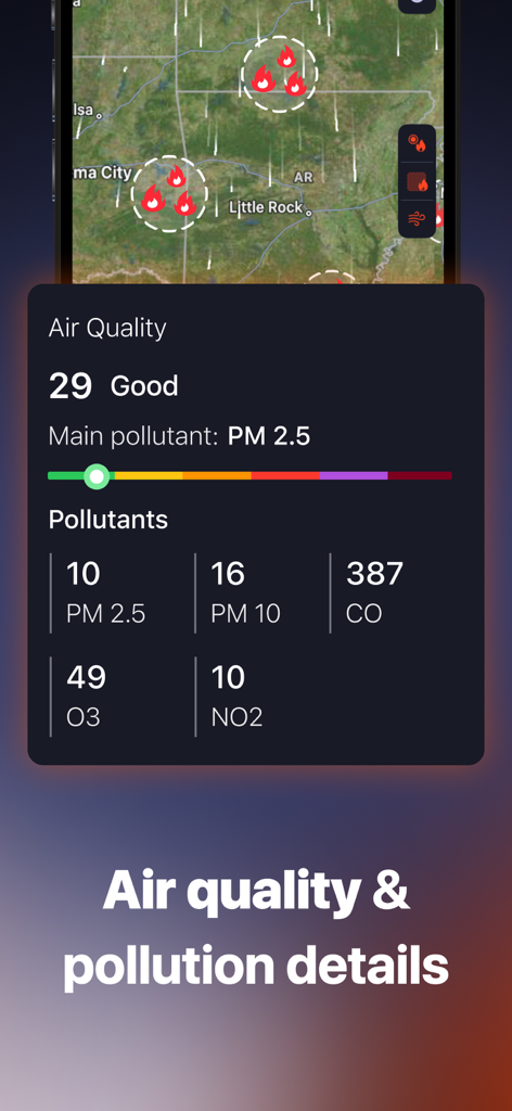
Dashboard sulla qualità dell'aria e sui livelli di inquinamento nell'app The Wildfire Tracker
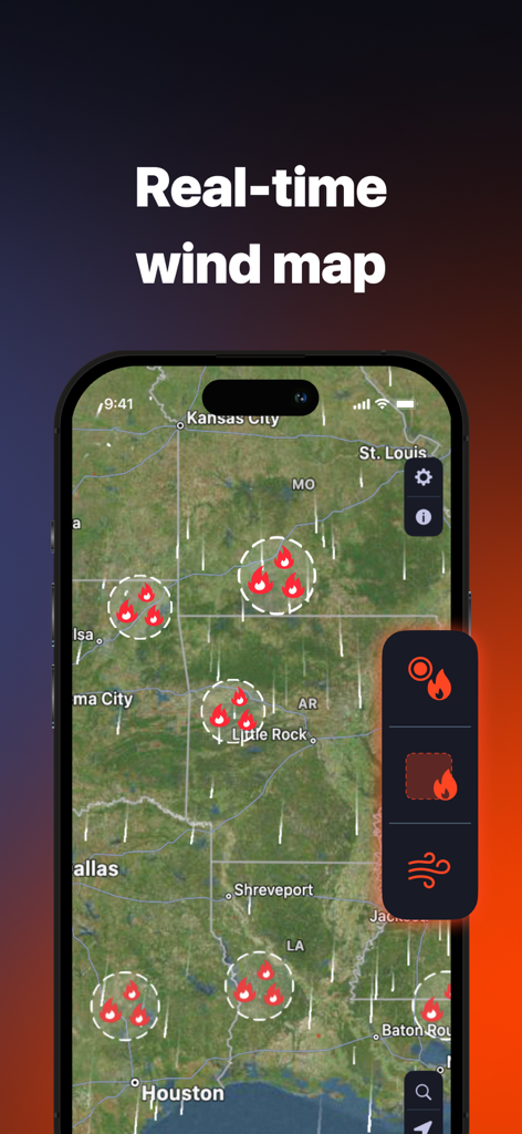
Una mappa satellitare che mostra punti caldi di incendi e schemi del vento in tempo reale in tutti gli Stati Uniti nell'app The Wildfire Tracker.
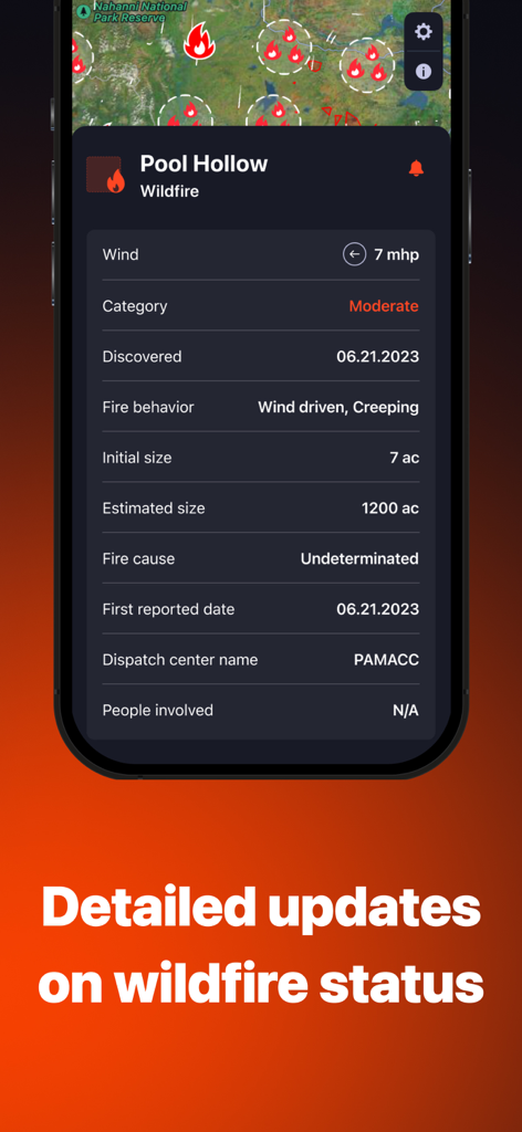
Uno schermo di un'applicazione mobile che mostra informazioni dettagliate sullo stato degli incendi, inclusa la velocità del vento, il comportamento del fuoco e le dimensioni stimate.
Descrizione
Download
App Simili
App con funzionalità ed esperienza simili

Watch Duty: Wildfire Maps
Sherwood Forestry Service, Inc.

My Hurricane Tracker & Alerts
JRustonApps B.V.

Air Quality & Pollen - AirCare
AirCare Data, Inc.

My Hurricane Tracker Pro
JRustonApps B.V.

เช็คน้ำ
Geo-Informatics and Space Technology Development Agency

SharkSmart
NSW Trade & Investment, Regional Infrastructure & Services

Dorsal Shark Reports
Bluebottle Digital Pty. Ltd.

global storms
Kelly Technology Inc.

My AQI Air Quality & Pollution
Jean Baptiste Stevenard
Questa pagina non è una pagina ufficiale dell'app o del suo sviluppatore, ma una pubblicazione editoriale indipendente creata a scopo informativo e di commento. Salvo espressa indicazione contraria, né l'app né il suo sviluppatore sono affiliati, approvati, sponsorizzati, autorizzati o altrimenti ufficialmente collegati a MWM, Apple, Google Play, all'editore dell'app o allo sviluppatore dell'app, e nulla in questa pagina implica che l'app sia stata sviluppata utilizzando i servizi di MWM. Tutti i marchi, loghi, screenshot e altri contenuti rimangono di proprietà dei rispettivi proprietari.