Esta página não é uma página oficial do aplicativo ou de seu desenvolvedor, mas uma publicação editorial independente criada para fins informativos e de comentário. Salvo indicação expressa em contrário, nem o aplicativo nem seu desenvolvedor são afiliados, endossados, patrocinados, autorizados ou oficialmente conectados à MWM, Apple, Google Play, ao editor do aplicativo ou ao desenvolvedor do aplicativo, e nada nesta página implica que o aplicativo foi desenvolvido utilizando os serviços da MWM. Todas as marcas comerciais, logotipos, capturas de tela e outros conteúdos permanecem propriedade de seus respectivos proprietários.

Air Navigation Pro
Domine os céus com cartas aeronáuticas de nível profissional, alertas de tráfego em tempo real e camadas meteorológicas avançadas. Projetado para pilotos focados em segurança que exigem consciência situacional total do decolar ao pouso.
Downloads
523K+Avaliação
Total de avaliações
200Editor
Categoria
NavigationIdiomas
10Última versão
8.4.150Tamanho
213.4 MBData de lançamento
6 de jan. de 2009Ferramentas de Voo de Precisão para o Piloto Moderno
Transforme seu iPad em um Electronic Flight Bag de nível profissional com consciência situacional em tempo real e dados aeronáuticos mundiais.
Visão Sintética 3D e TAWS
Voe com confiança em qualquer terreno usando visualizações 3D de alta resolução e Sistemas de Alerta de Consciência de Terreno para a segurança situacional definitiva.
Tráfego ao Vivo Integrado
Receba alertas visuais e sonoros em tempo real através da integração nativa SafeSky, garantindo que você esteja sempre ciente das aeronaves próximas.
As capturas de tela e a descrição a seguir são provenientes diretamente da listagem oficial da loja do aplicativo e são propriedade do desenvolvedor.
App Store
Capturas
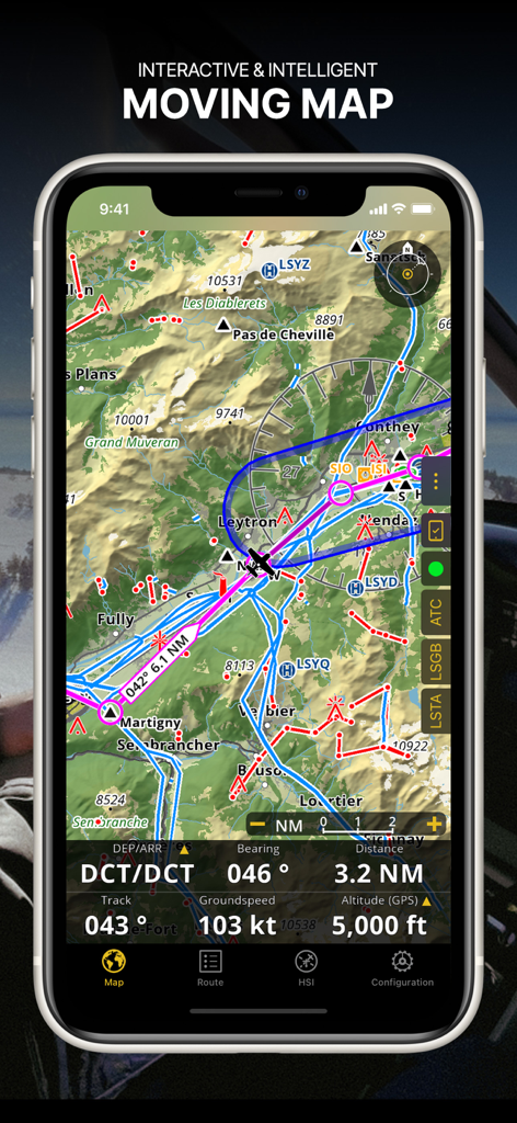
Captura de tela do aplicativo Air Navigation Pro mostrando um mapa em movimento interativo com cartas aeronáuticas e dados de voo em tempo real
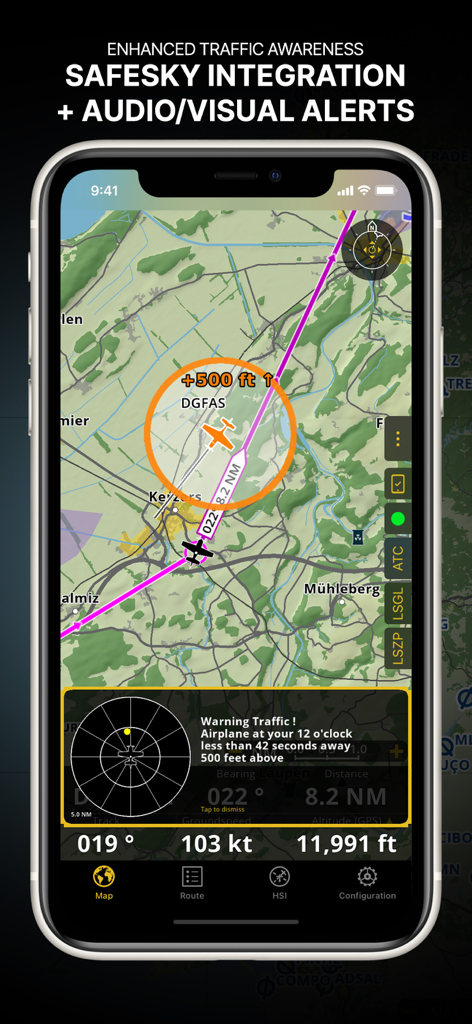
Interface do Air Navigation Pro mostrando consciência de tráfego aprimorada com integração Safesky e alertas visuais
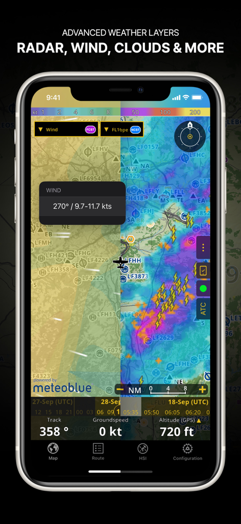
Captura de tela do aplicativo Air Navigation Pro mostrando camadas meteorológicas avançadas incluindo radar de vento e cobertura de nuvens em um mapa de navegação
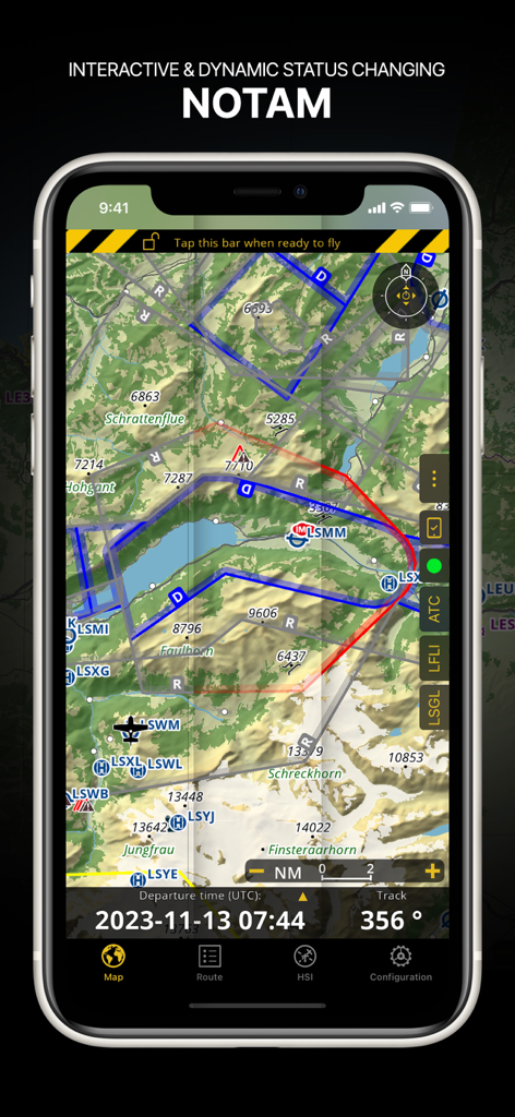
Interface do Air Navigation Pro exibindo informações NOTAM dinâmicas em um mapa aeronáutico topográfico
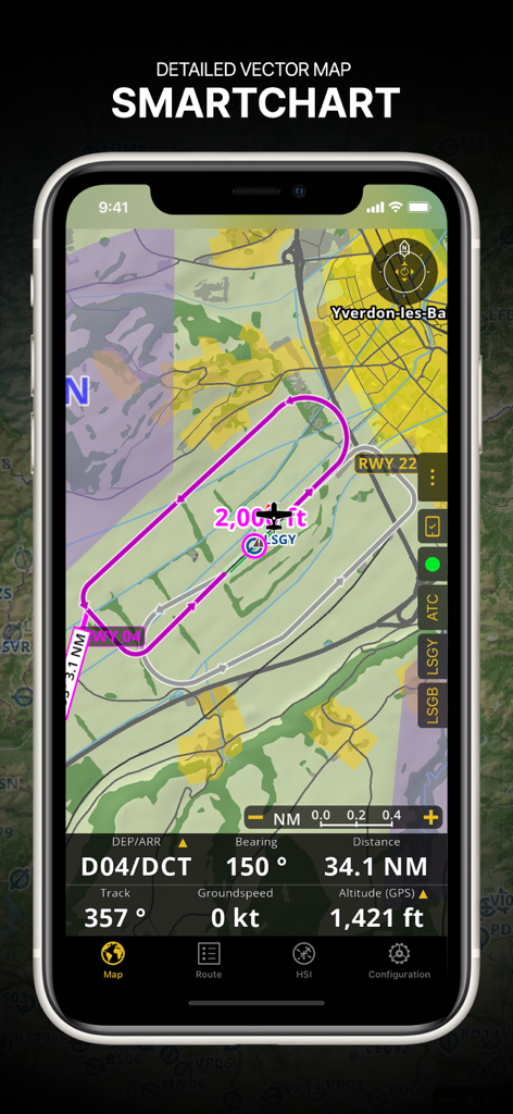
Interface do Air Navigation Pro mostrando um SmartChart vetorial detalhado com uma rota de voo e dados de navegação em tempo real.
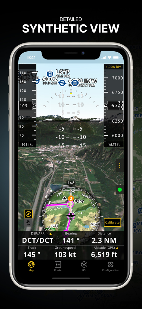
Aplicativo Air Navigation Pro exibindo o recurso de visão sintética detalhada com terreno 3D e instrumentos de voo integrados
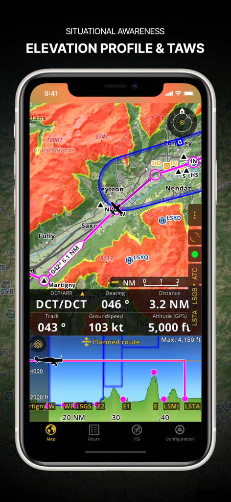
Captura de tela do Air Navigation Pro mostrando perfil de elevação e sistema de aviso de proximidade de terreno.
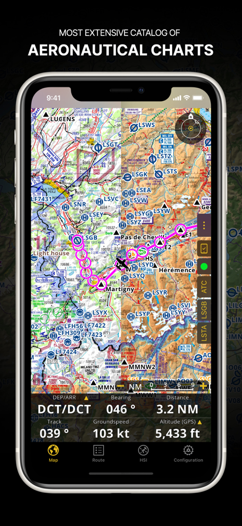
Aplicativo Air Navigation Pro exibindo uma carta aeronáutica detalhada com um caminho de voo e dados de navegação em uma tela de smartphone
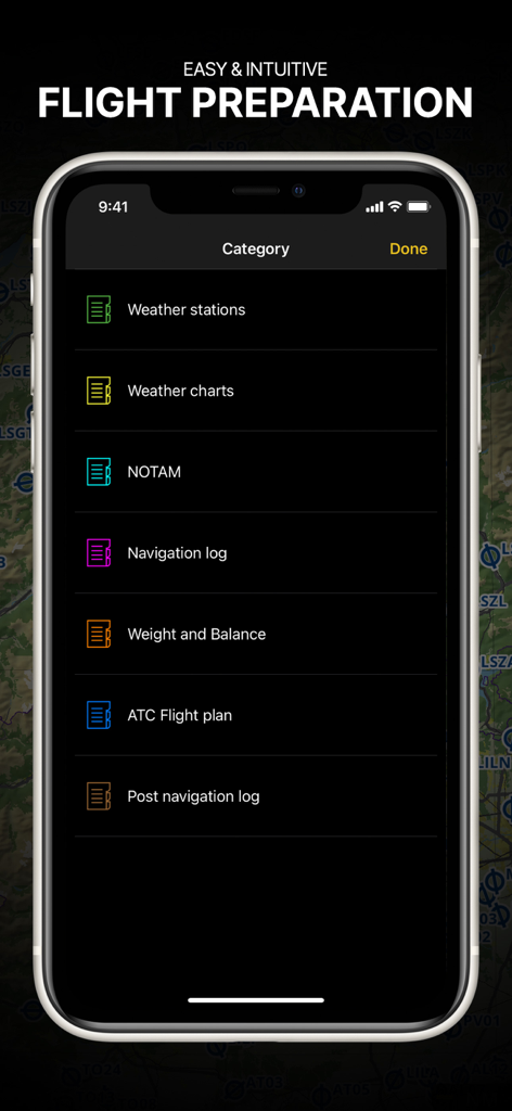
Aplicativo Air Navigation Pro mostrando o menu de preparação de voo com categorias de briefing para pilotos
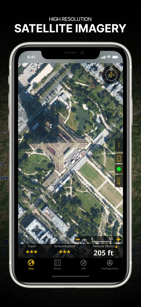
Captura de tela do aplicativo Air Navigation Pro exibindo imagens de satélite de alta resolução da Torre Eiffel com sobreposições de dados de voo
Descrição
Download
Apps Semelhantes
Apps com recursos e experiência semelhantes

Navigraph Charts
Navigraph KB

SkyDemon
Divelements Limited

Airports
Applicate Ltd

OzRunways EFB
OzRunways Pty. Ltd.

fDeck: flight instruments
Darren Yeates

Noisy Goose
Automata Solutions Ltd.

StationWeather - METAR and TAF
Oliver Puetz

Drone UAV Fly Forecast: AirMap
MONIQ TAP COMPANY LIMITED

Airmate
Myriel Aviation SA
Esta página não é uma página oficial do aplicativo ou de seu desenvolvedor, mas uma publicação editorial independente criada para fins informativos e de comentário. Salvo indicação expressa em contrário, nem o aplicativo nem seu desenvolvedor são afiliados, endossados, patrocinados, autorizados ou oficialmente conectados à MWM, Apple, Google Play, ao editor do aplicativo ou ao desenvolvedor do aplicativo, e nada nesta página implica que o aplicativo foi desenvolvido utilizando os serviços da MWM. Todas as marcas comerciais, logotipos, capturas de tela e outros conteúdos permanecem propriedade de seus respectivos proprietários.