Esta página não é uma página oficial do aplicativo ou de seu desenvolvedor, mas uma publicação editorial independente criada para fins informativos e de comentário. Salvo indicação expressa em contrário, nem o aplicativo nem seu desenvolvedor são afiliados, endossados, patrocinados, autorizados ou oficialmente conectados à MWM, Apple, Google Play, ao editor do aplicativo ou ao desenvolvedor do aplicativo, e nada nesta página implica que o aplicativo foi desenvolvido utilizando os serviços da MWM. Todas as marcas comerciais, logotipos, capturas de tela e outros conteúdos permanecem propriedade de seus respectivos proprietários.

Fires: Wildfire News and Atlas
Proteja sua casa e família com a ferramenta de nível profissional confiada por milhões de pessoas. Monitore chamas ativas com rastreamento de aeronaves em 3D ao vivo, alertas oficiais de evacuação e mapas offline de alta resolução.
Downloads
349K+Avaliação
Total de avaliações
100Editor
Categoria
NewsIdiomas
1Última versão
4.7.0Tamanho
54.6 MBData de lançamento
8 de set. de 2016Inteligência de Nível Profissional para sua Segurança
Acesse os mesmos dados em tempo real usados pelas equipes de resgate para proteger sua casa, família e aventuras ao ar livre com o rastreador de incêndios florestais mais confiável do mundo.
Rastreamento de Aeronaves em 3D ao Vivo
Monitore aviões-tanque e helicópteros de combate a incêndios em tempo real com rotas de voo em 3D para ver exatamente onde os esforços de supressão estão focados.
Atlas Offline Profissional
Navegue com segurança fora da rede com acesso a mais de 80 mapas de alta resolução de Florestas Nacionais e BLM que funcionam sem sinal de celular.
As capturas de tela e a descrição a seguir são provenientes diretamente da listagem oficial da loja do aplicativo e são propriedade do desenvolvedor.
App Store
Capturas
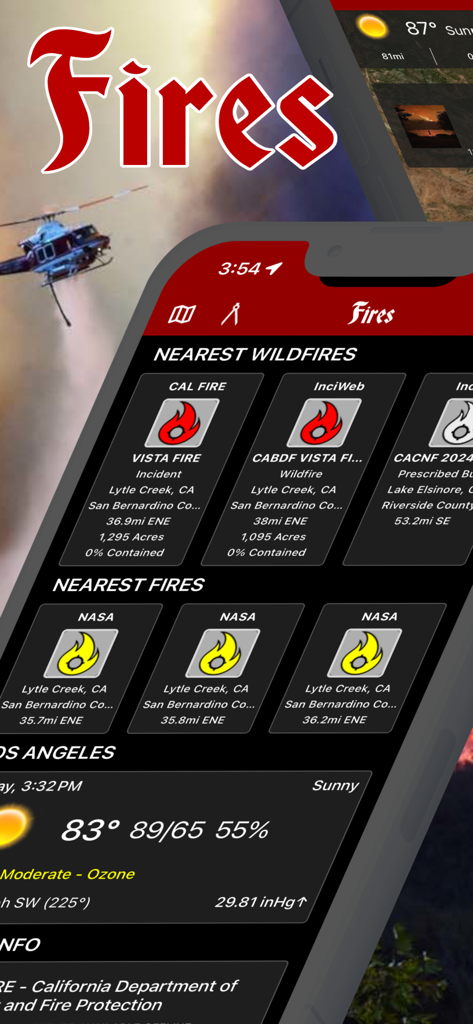
Interface do aplicativo Fires mostrando rastreamento de incêndios florestais em tempo real e dados meteorológicos locais
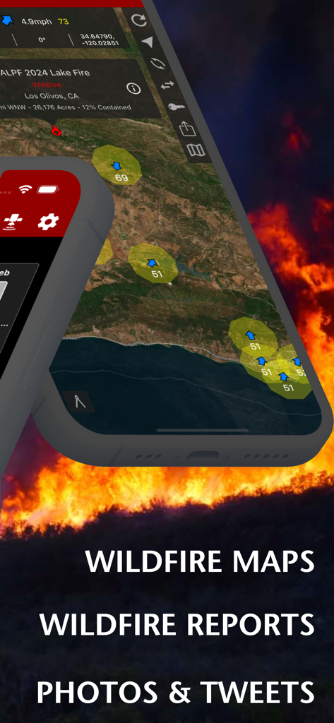
Interface do aplicativo Fires mostrando mapas de incêndios florestais e relatórios de incidentes sobre um fundo de chamas
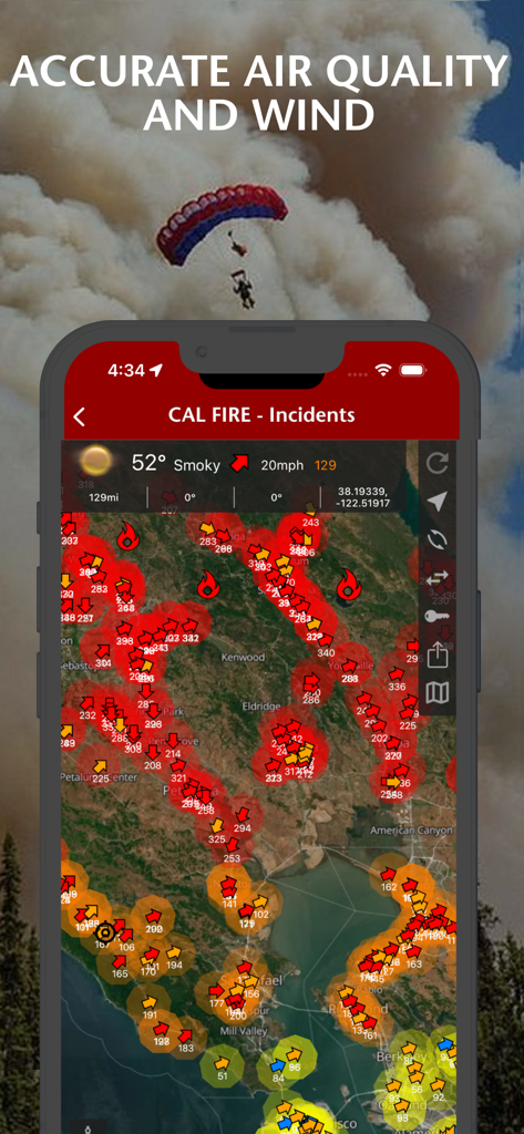
Aplicativo de notícias sobre incêndios florestais exibindo a qualidade do ar e as condições do vento em um mapa de incidentes interativo.
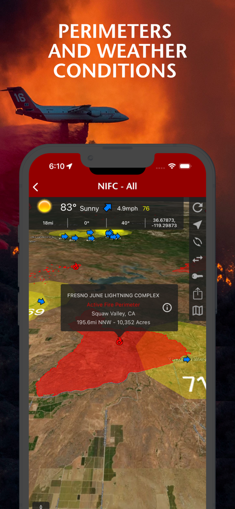
Uma tela de smartphone exibindo perímetros de incêndios florestais e condições meteorológicas em um mapa do aplicativo Fires

Interface de aplicativo móvel exibindo detalhes de incidentes de incêndios florestais, incluindo um perímetro no mapa e uma foto do Lake Fire de 2024
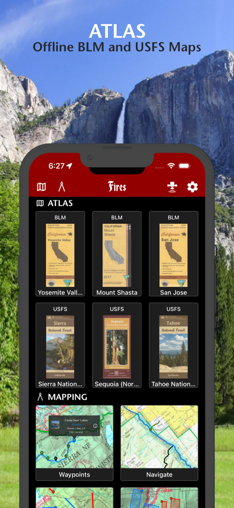
Interface do aplicativo Fires mostrando mapas offline do BLM e USFS para florestas nacionais e parques
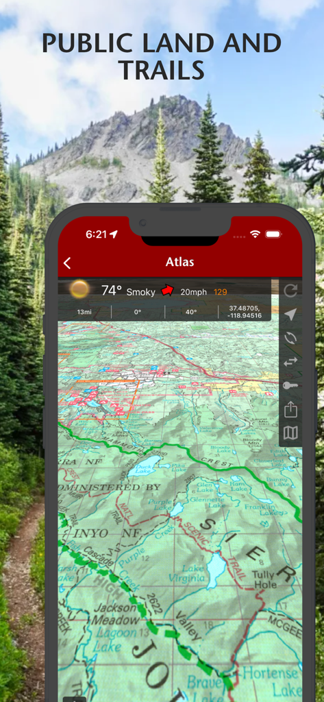
Visualização de mapa topográfico mostrando terras públicas e trilhas de caminhada com dados meteorológicos no aplicativo Fires.
Descrição
Download
Apps Semelhantes
Apps mais bem classificados na mesma categoria

X
X Corp.

REDDIT, INC.

Substack
Substack Inc.

NYTimes: US and Global News
The New York Times Company

Nextdoor: Neighborhood Network
Nextdoor.com, Inc.

CrimeRadar Dispatch Audio
Scoopz Inc.

NewsBreak: Local News & Alerts
Particle Media Inc.

Ground News
Snapwise Inc.

Google News
Google LLC
Esta página não é uma página oficial do aplicativo ou de seu desenvolvedor, mas uma publicação editorial independente criada para fins informativos e de comentário. Salvo indicação expressa em contrário, nem o aplicativo nem seu desenvolvedor são afiliados, endossados, patrocinados, autorizados ou oficialmente conectados à MWM, Apple, Google Play, ao editor do aplicativo ou ao desenvolvedor do aplicativo, e nada nesta página implica que o aplicativo foi desenvolvido utilizando os serviços da MWM. Todas as marcas comerciais, logotipos, capturas de tela e outros conteúdos permanecem propriedade de seus respectivos proprietários.