Esta página não é uma página oficial do aplicativo ou de seu desenvolvedor, mas uma publicação editorial independente criada para fins informativos e de comentário. Salvo indicação expressa em contrário, nem o aplicativo nem seu desenvolvedor são afiliados, endossados, patrocinados, autorizados ou oficialmente conectados à MWM, Apple, Google Play, ao editor do aplicativo ou ao desenvolvedor do aplicativo, e nada nesta página implica que o aplicativo foi desenvolvido utilizando os serviços da MWM. Todas as marcas comerciais, logotipos, capturas de tela e outros conteúdos permanecem propriedade de seus respectivos proprietários.

Fulcrum GIS field data capture
Otimize inspeções, rastreamento de ativos e pesquisas com aplicativos móveis potencializados por IA. Capture dados geoespaciais precisos em qualquer lugar — mesmo offline — e sincronize perfeitamente com o Esri ArcGIS.
Downloads
41K+Avaliação
Total de avaliações
100Editor
Categoria
BusinessIdiomas
30Última versão
2601.2.0Tamanho
162.7 MBData de lançamento
7 de out. de 2011Dados de Campo de Precisão, Simplificados
Capacite sua equipe com uma solução móvel robusta para inspeções digitais, rastreamento de ativos em tempo real e mapeamento GIS de nível profissional.
Captura Confiável de Dados Offline
Nunca deixe uma zona sem sinal interromper seu progresso. Capture dados com marcação GPS em locais remotos e sincronize automaticamente assim que retornar à cobertura.
Entrada de Voz por IA Mãos-Livres
Resolva o problema das 'mãos sujas' com o Audio FastFill. Dite notas e observações do local instantaneamente, mantendo o foco no trabalho.
As capturas de tela e a descrição a seguir são provenientes diretamente da listagem oficial da loja do aplicativo e são propriedade do desenvolvedor.
App Store
Capturas
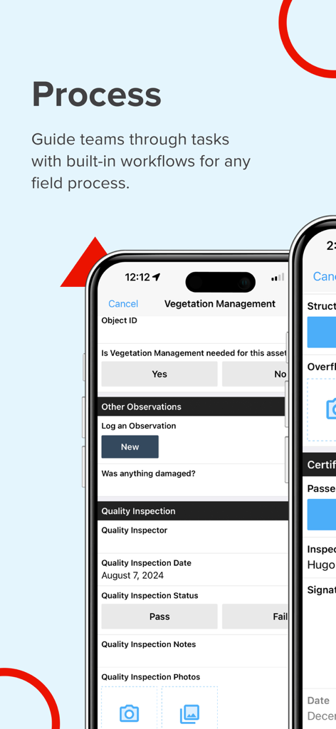
Interface do aplicativo móvel Fulcrum para gerenciar fluxos de trabalho de campo e inspeções de vegetação
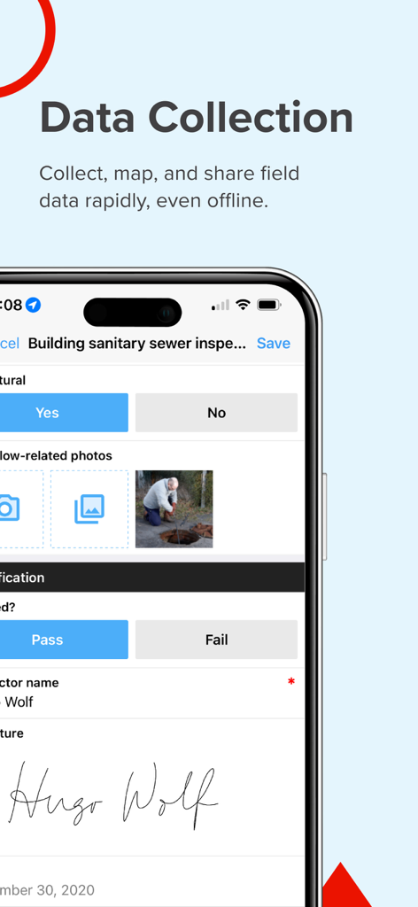
Uma interface móvel do aplicativo Fulcrum mostrando um formulário de inspeção de esgoto sanitário com foto de um trabalhador de campo e assinatura digital.
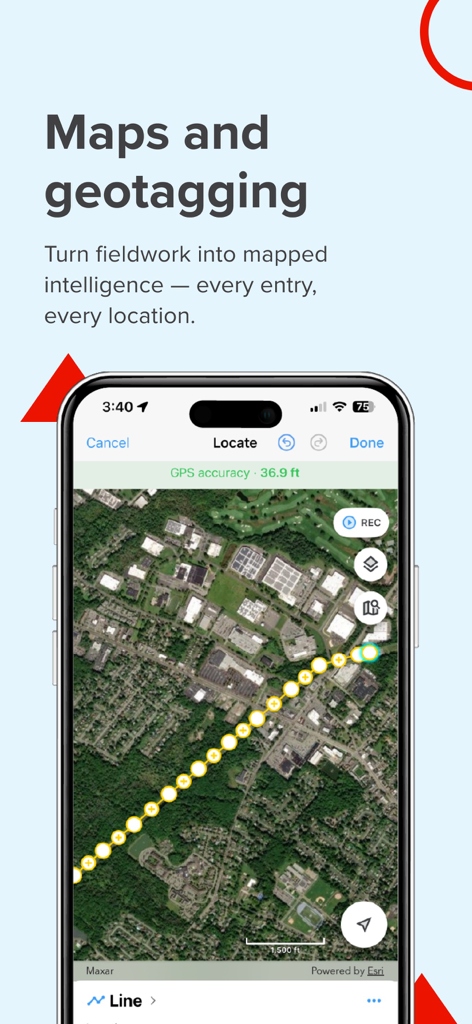
Tela do aplicativo Fulcrum demonstrando mapeamento GIS e coleta de dados de campo geotagged em uma visualização de satélite.
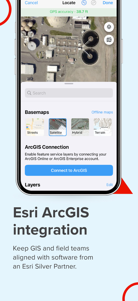
Aplicativo móvel Fulcrum mostrando integração com Esri ArcGIS e opções de mapeamento por satélite para profissionais de campo
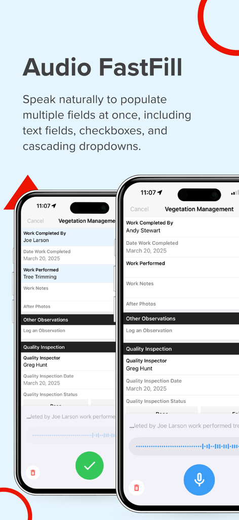
Captura de tela do aplicativo Fulcrum exibindo Audio FastFill para entrada de dados por voz potencializada por IA em formulários de inspeção de campo.
Descrição
Download
Apps Semelhantes
Apps mais bem classificados na mesma categoria

Microsoft Teams
Microsoft Corporation

Zoom Workplace
Zoom Communications, Inc.

WhatsApp Business
WhatsApp Inc.

Indeed Job Search
Indeed Inc.

LinkedIn: Network & Job Finder
LinkedIn Corporation

Adobe Acrobat Reader: Sign PDF
Adobe Inc.

WeCom-Work Communication&Tools
Tencent Technology (Shenzhen) Company Limited

BOSS直聘-招聘求职找工作神器
Beijing China Product Bo Farce Network Technology Co., Ltd.

DingDing - Redefine Work in AI
DingTalk Technology Co., Ltd.
Esta página não é uma página oficial do aplicativo ou de seu desenvolvedor, mas uma publicação editorial independente criada para fins informativos e de comentário. Salvo indicação expressa em contrário, nem o aplicativo nem seu desenvolvedor são afiliados, endossados, patrocinados, autorizados ou oficialmente conectados à MWM, Apple, Google Play, ao editor do aplicativo ou ao desenvolvedor do aplicativo, e nada nesta página implica que o aplicativo foi desenvolvido utilizando os serviços da MWM. Todas as marcas comerciais, logotipos, capturas de tela e outros conteúdos permanecem propriedade de seus respectivos proprietários.