Esta página não é uma página oficial do aplicativo ou de seu desenvolvedor, mas uma publicação editorial independente criada para fins informativos e de comentário. Salvo indicação expressa em contrário, nem o aplicativo nem seu desenvolvedor são afiliados, endossados, patrocinados, autorizados ou oficialmente conectados à MWM, Apple, Google Play, ao editor do aplicativo ou ao desenvolvedor do aplicativo, e nada nesta página implica que o aplicativo foi desenvolvido utilizando os serviços da MWM. Todas as marcas comerciais, logotipos, capturas de tela e outros conteúdos permanecem propriedade de seus respectivos proprietários.

i-Boating:HD Gps Marine Charts
Navegue com confiança utilizando cartas NOAA de alta definição, batimetria de 1 pé para pesca de precisão e rotas guiadas por voz em tempo real — tudo no dispositivo que já possui.
Downloads
15K+Avaliação
Total de avaliações
200Editor
Categoria
SportsIdiomas
8Última versão
154.0.0Tamanho
48.6 MBData de lançamento
20 de mar. de 2017Navegue com Confiança Profissional
Transforme o seu dispositivo móvel num chartplotter de nível profissional. Desde batimetria de alta definição para pescadores a rotas guiadas por voz para cruzeiros, obtenha a precisão necessária para dominar as águas.
Cartas Náuticas Vetoriais HD
Aceda a dados detalhados da NOAA e USACE com contornos de profundidade de 1 pé, perfeitos para identificar os melhores pontos de pesca e navegar em águas rasas com total segurança.
GPS Marítimo Guiado por Voz
A primeira aplicação marítima com comandos de voz. Receba alertas em tempo real para marcadores de rota e avisos de desvio de curso sem nunca tirar os olhos do horizonte.
As capturas de tela e a descrição a seguir são provenientes diretamente da listagem oficial da loja do aplicativo e são propriedade do desenvolvedor.
App Store
Capturas
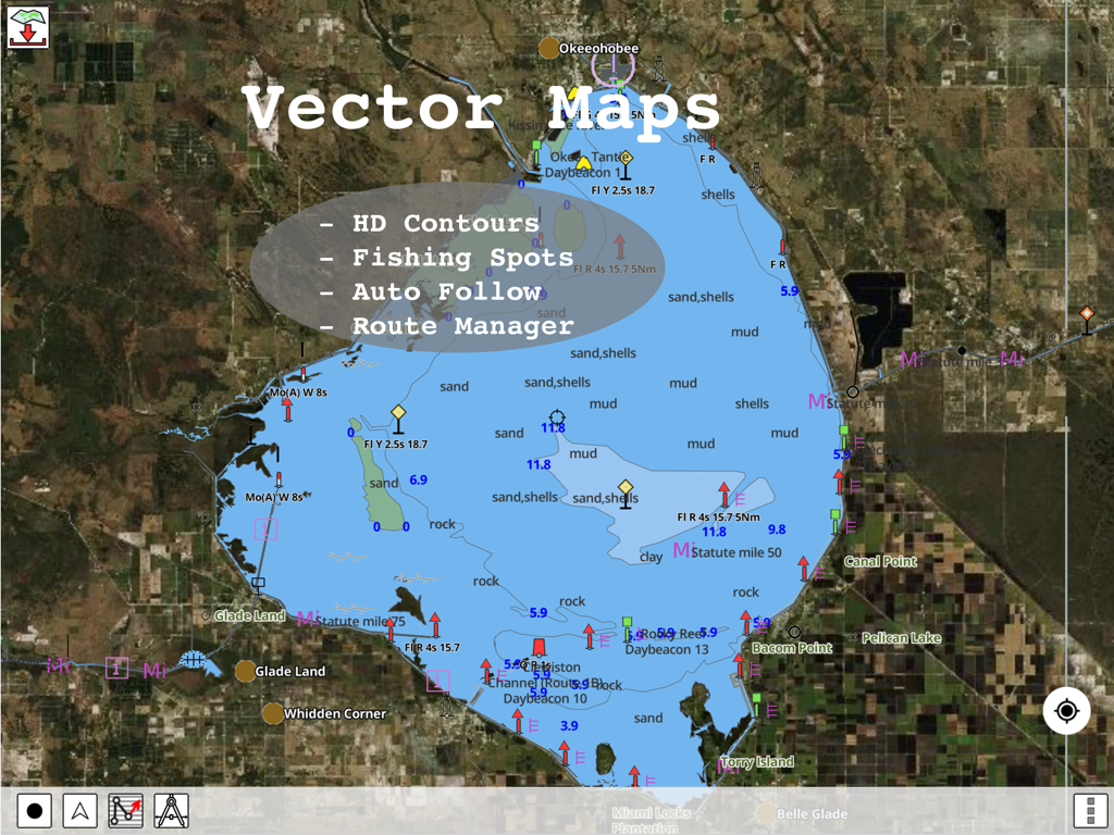
Cartas marítimas vetoriais HD com contornos de profundidade e pontos de pesca na aplicação i-Boating
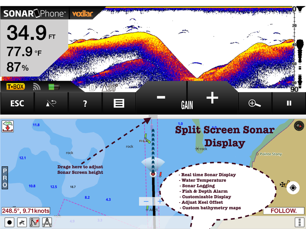
Vista de ecrã dividido da aplicação i-Boating que apresenta dados de sonar em tempo real e cartas de navegação náutica num iPad.
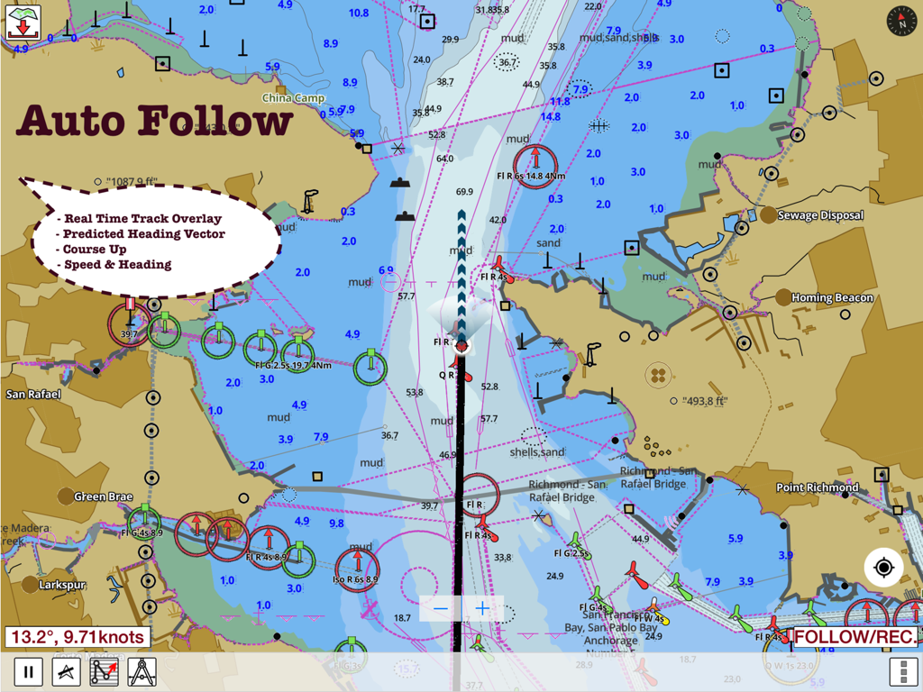
Ecrã da aplicação i-Boating que mostra uma carta marítima com seguimento automático e dados de navegação em tempo real
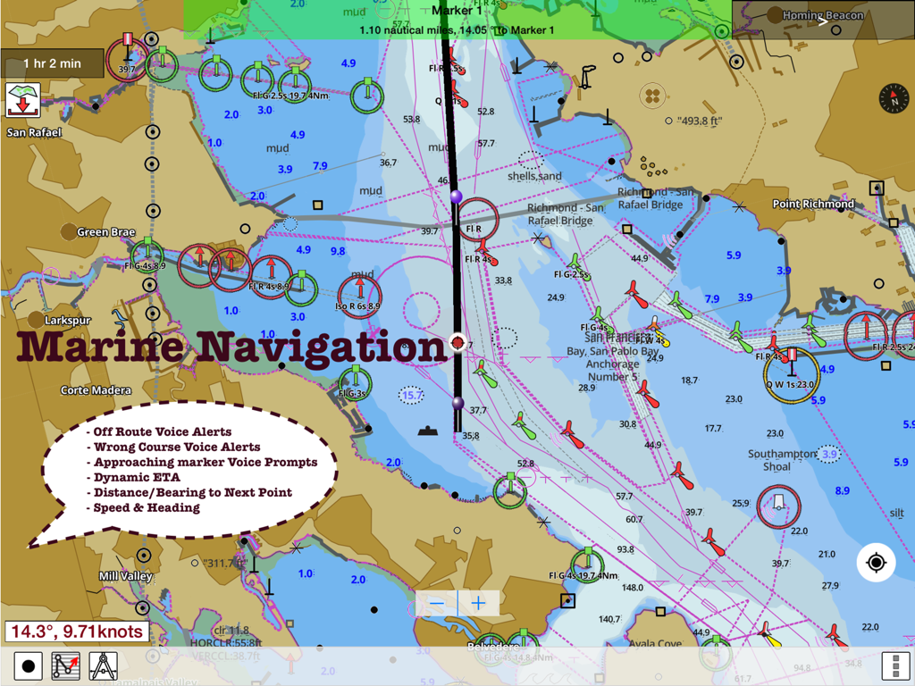
Mapa náutico detalhado na aplicação i-Boating com assistência de rota e alertas de voz de navegação marítima.
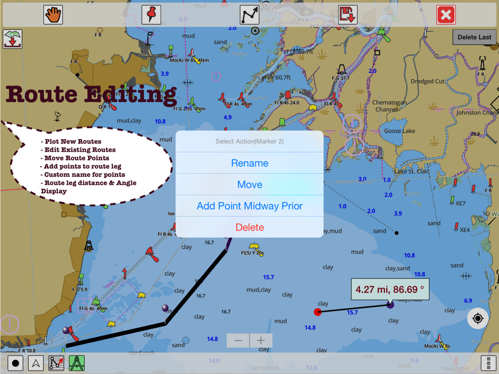
Interface da aplicação i-Boating que mostra funcionalidades de edição de rotas e medições de distância num gráfico GPS marítimo
Descrição
Download
Apps Semelhantes
Apps com recursos e experiência semelhantes

PredictWind — Marine Forecasts
PredictWind Limited

Navily
The Navigation Family

Argo - Boating Navigation
Argo Navigation, LLC

SEAiq Pilot
Sakhalin, LLC

Maptrails
Pasi Salenius

KartenWerft NavGo 2.0
KartenWerft GmbH

MarineTraffic - Ship Tracking
MARINETRAFFIC APPLICATIONS LTD

Wavve Boating: Marine Boat GPS
Wavve Boating Inc

Savvy Navvy Boating Navigation
SAVVY NAVVY LTD
Esta página não é uma página oficial do aplicativo ou de seu desenvolvedor, mas uma publicação editorial independente criada para fins informativos e de comentário. Salvo indicação expressa em contrário, nem o aplicativo nem seu desenvolvedor são afiliados, endossados, patrocinados, autorizados ou oficialmente conectados à MWM, Apple, Google Play, ao editor do aplicativo ou ao desenvolvedor do aplicativo, e nada nesta página implica que o aplicativo foi desenvolvido utilizando os serviços da MWM. Todas as marcas comerciais, logotipos, capturas de tela e outros conteúdos permanecem propriedade de seus respectivos proprietários.