Esta página não é uma página oficial do aplicativo ou de seu desenvolvedor, mas uma publicação editorial independente criada para fins informativos e de comentário. Salvo indicação expressa em contrário, nem o aplicativo nem seu desenvolvedor são afiliados, endossados, patrocinados, autorizados ou oficialmente conectados à MWM, Apple, Google Play, ao editor do aplicativo ou ao desenvolvedor do aplicativo, e nada nesta página implica que o aplicativo foi desenvolvido utilizando os serviços da MWM. Todas as marcas comerciais, logotipos, capturas de tela e outros conteúdos permanecem propriedade de seus respectivos proprietários.

Maps 3D PRO - Hike & Bike
Junte-se a mais de 1,7 milhão de aventureiros que usam mapas de terreno offline de nível NASA e rastreamento GPS profissional para conquistar cada pico e trilha.
Downloads
378K+Avaliação
Total de avaliações
100Editor
Categoria
NavigationIdiomas
6Última versão
6.8Tamanho
25.2 MBData de lançamento
25 de mar. de 2011Domine Cada Terreno em 3D Deslumbrante
Pare de navegar com mapas planos. Tenha uma visão aérea de sua próxima aventura com elevação 3D profissional e rastreamento GPS offline projetados para o explorador sério.
Visualização 3D de Precisão
Visualize vales, colinas e picos usando varreduras de terreno da NASA. Conheça a elevação exata e a dificuldade de sua rota antes mesmo de começar.
Confiabilidade Totalmente Offline
Baixe dados de mapas mundiais antes de sair. Navegue com segurança nos locais mais remotos com funcionalidade GPS completa e zero sinal de celular.
As capturas de tela e a descrição a seguir são provenientes diretamente da listagem oficial da loja do aplicativo e são propriedade do desenvolvedor.
App Store
Capturas
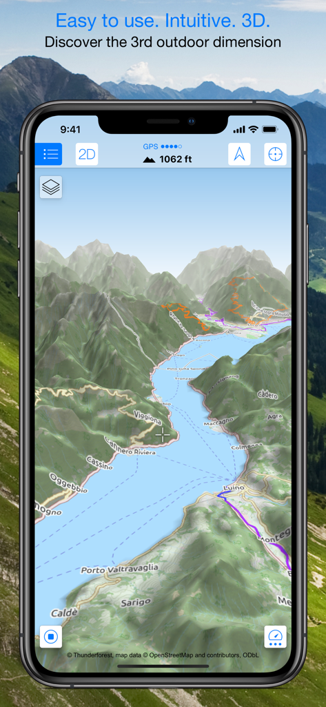
Smartphone exibindo um mapa topográfico 3D com montanhas e trilhas de caminhada.
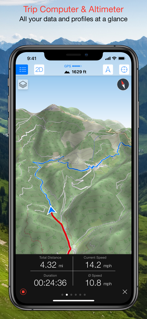
Interface do Maps 3D PRO mostrando um mapa topográfico 3D com dados do computador de bordo, incluindo velocidade, distância e altitude.
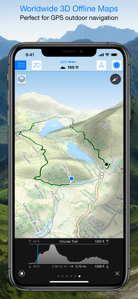
Interface do aplicativo Maps 3D PRO exibindo um mapa topográfico 3D com uma trilha de caminhada e perfil de elevação.
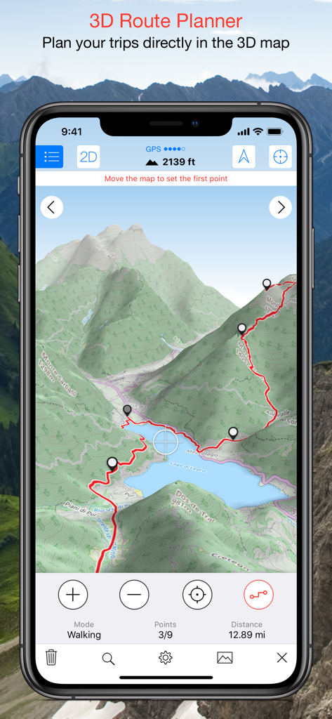
Captura de tela do aplicativo Maps 3D PRO mostrando uma rota de caminhada planejada em um mapa de terreno 3D.
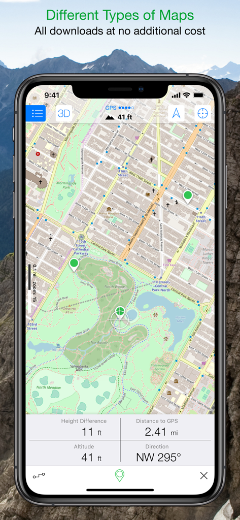
Interface do aplicativo Maps 3D PRO exibindo um mapa detalhado do parque com dados de rastreamento de altitude e distância em tempo real.
Descrição
Download
Apps Semelhantes
Apps com recursos e experiência semelhantes

AllTrails: Hike, Bike & Run
AllTrails, Inc.

Pedometer++
Cross Forward Consulting, LLC

Organic Maps: Offline Map
Organic Maps OU

Gaia GPS: Mobile Trail Maps
Trailbehind, INC.

Offline hiking maps: Mapy.com
Seznam.cz a.s.

Hiking Map Poland
Mapa Turystyczna sp. z o.o.

MapOut
Valnova GmbH

FarOut: Offline GPS Trail Maps
Atlas Guides DE, Inc.

Norgeskart
Norgeskart AS
Esta página não é uma página oficial do aplicativo ou de seu desenvolvedor, mas uma publicação editorial independente criada para fins informativos e de comentário. Salvo indicação expressa em contrário, nem o aplicativo nem seu desenvolvedor são afiliados, endossados, patrocinados, autorizados ou oficialmente conectados à MWM, Apple, Google Play, ao editor do aplicativo ou ao desenvolvedor do aplicativo, e nada nesta página implica que o aplicativo foi desenvolvido utilizando os serviços da MWM. Todas as marcas comerciais, logotipos, capturas de tela e outros conteúdos permanecem propriedade de seus respectivos proprietários.