Esta página não é uma página oficial do aplicativo ou de seu desenvolvedor, mas uma publicação editorial independente criada para fins informativos e de comentário. Salvo indicação expressa em contrário, nem o aplicativo nem seu desenvolvedor são afiliados, endossados, patrocinados, autorizados ou oficialmente conectados à MWM, Apple, Google Play, ao editor do aplicativo ou ao desenvolvedor do aplicativo, e nada nesta página implica que o aplicativo foi desenvolvido utilizando os serviços da MWM. Todas as marcas comerciais, logotipos, capturas de tela e outros conteúdos permanecem propriedade de seus respectivos proprietários.

RWIS
Capacite sua tomada de decisão com condições de superfície de estrada em tempo real, alertas antecipados de gelo e rastreamento de serviços de campo ao vivo, projetados para profissionais de infraestrutura.
Downloads
23K+Avaliação
Total de avaliações
0Editor
Categoria
WeatherIdiomas
11Última versão
4.1.1Tamanho
34.0 MBData de lançamento
25 de jul. de 2014Comando Operacional no Seu Bolso
Otimize sua resposta a condições climáticas de inverno com condições de estrada em tempo real, rastreamento de frota ao vivo e dados de sensores hiperlocais criados para profissionais de infraestrutura.
Inteligência Hiperlocal de Estrada
Monitore temperaturas da superfície da estrada, profundidade da água e riscos de gelo com dados de sensores de precisão para tratar as estradas apenas quando necessário.
Coordenação de Frota em Tempo Real
Rastreie veículos ativos e rotas de intervenção codificadas por cores em um mapa interativo para garantir cobertura total e transparência operacional.
As capturas de tela e a descrição a seguir são provenientes diretamente da listagem oficial da loja do aplicativo e são propriedade do desenvolvedor.
App Store
Capturas
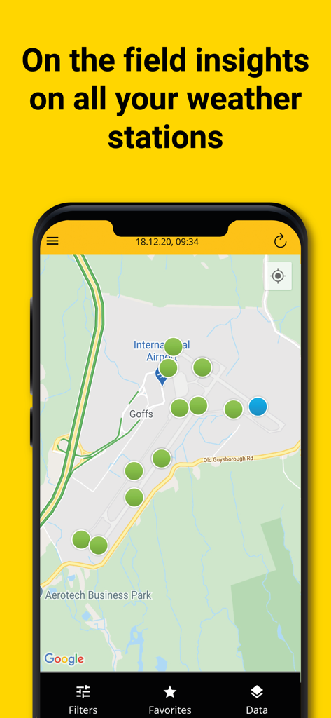
Interface do aplicativo RWIS mostrando locais de estações meteorológicas em um mapa de aeroporto.

Interface do aplicativo móvel RWIS mostrando rastreamento de rota de veículo em tempo real em um mapa interativo da cidade.
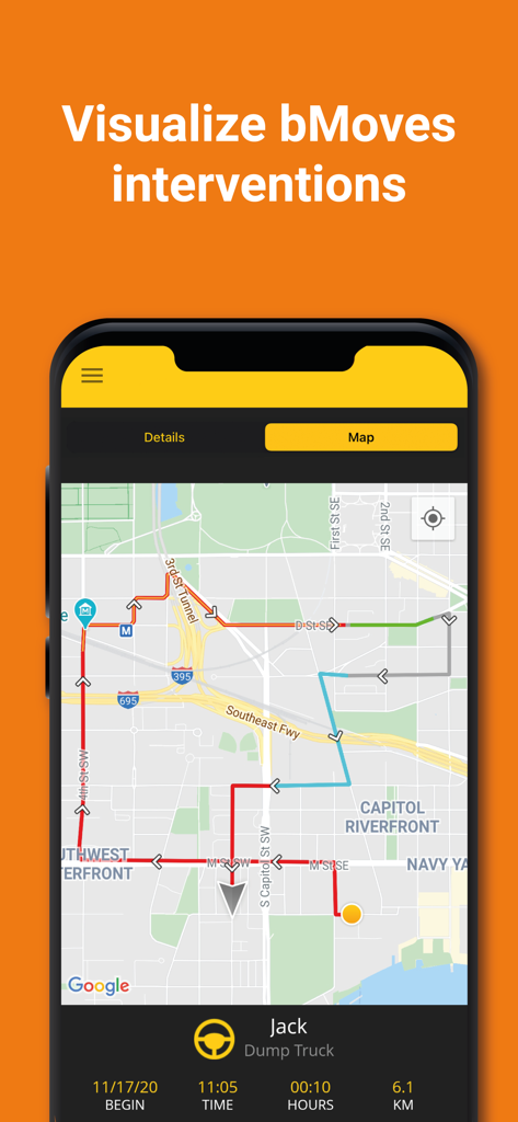
Visualização de mapa do aplicativo RWIS mostrando rotas de veículos codificadas por cores e rastreamento de frota em tempo real para intervenções do bMoves.
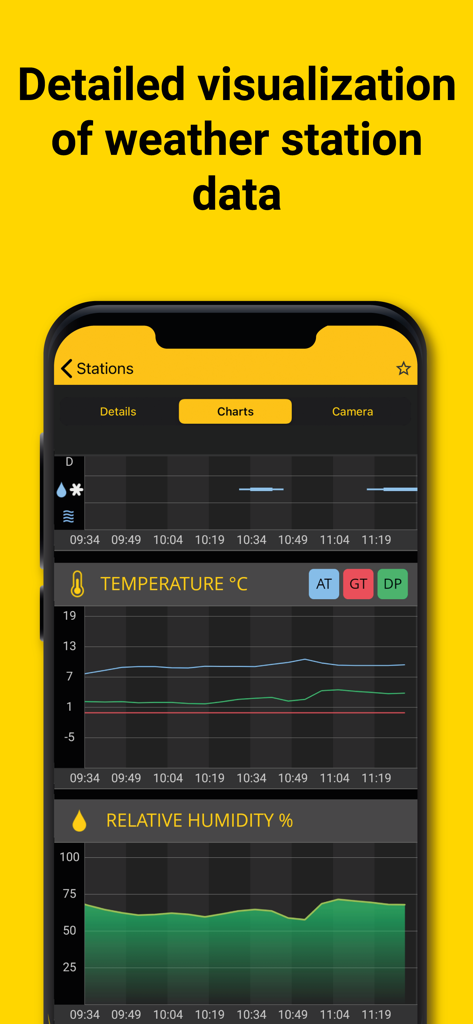
Aplicativo RWIS exibindo gráficos de temperatura e umidade relativa em tempo real para monitoramento de estações meteorológicas rodoviárias.
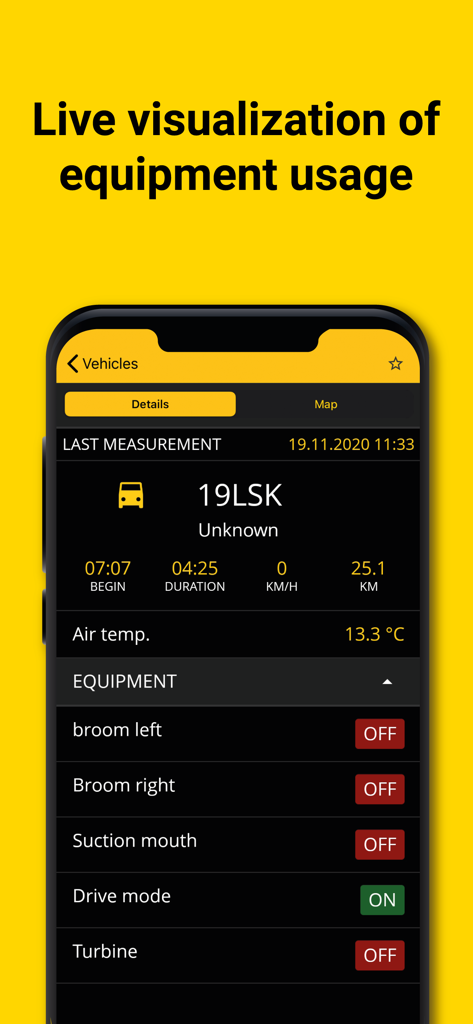
Painel do aplicativo RWIS mostrando status de equipamento ao vivo e dados de veículos para manutenção rodoviária
Descrição
Download
Apps Semelhantes
Apps mais bem classificados na mesma categoria

墨迹天气-MojiWeather
Beijing MojiFengyun Technology Co.,Ltd.

The Weather Channel - Radar
The Weather Channel

Windy.com
Windyty, SE

天气预报-精准15日天气预报
Chongqing Caochen Technology Co., Ltd.

My Aurora Forecast & Alerts
JRustonApps B.V.

AccuWeather: Weather Forecast
AccuWeather International, Inc.

Weather & Radar - Storm radar
WetterOnline - Meteorologische Dienstleistungen GmbH

天气通
Weibo Internet Technology (China) Co.Ltd.

The Thermometer -Digital-
Vida Apps Incorporated
Esta página não é uma página oficial do aplicativo ou de seu desenvolvedor, mas uma publicação editorial independente criada para fins informativos e de comentário. Salvo indicação expressa em contrário, nem o aplicativo nem seu desenvolvedor são afiliados, endossados, patrocinados, autorizados ou oficialmente conectados à MWM, Apple, Google Play, ao editor do aplicativo ou ao desenvolvedor do aplicativo, e nada nesta página implica que o aplicativo foi desenvolvido utilizando os serviços da MWM. Todas as marcas comerciais, logotipos, capturas de tela e outros conteúdos permanecem propriedade de seus respectivos proprietários.