Esta página não é uma página oficial do aplicativo ou de seu desenvolvedor, mas uma publicação editorial independente criada para fins informativos e de comentário. Salvo indicação expressa em contrário, nem o aplicativo nem seu desenvolvedor são afiliados, endossados, patrocinados, autorizados ou oficialmente conectados à MWM, Apple, Google Play, ao editor do aplicativo ou ao desenvolvedor do aplicativo, e nada nesta página implica que o aplicativo foi desenvolvido utilizando os serviços da MWM. Todas as marcas comerciais, logotipos, capturas de tela e outros conteúdos permanecem propriedade de seus respectivos proprietários.

Tactical NAV
Construído em combate por um veterano para as exigências robustas do campo. Obtenha precisão de 1 mm, coordenadas MGRS e mapeamento offline completo para operar com confiança em qualquer ambiente.
Downloads
229K+Avaliação
Total de avaliações
600Editor
Categoria
NavigationIdiomas
1Última versão
5.0.10Tamanho
49.3 MBData de lançamento
14 de fev. de 2011Construído para a Missão, Comprovado em Combate
Capacitando militares e socorristas com uma plataforma de navegação robusta e de alta precisão, projetada para operar nos ambientes mais hostis do mundo.
Precisão de Campo de Batalha
Alcance precisão de 1 mm com os sistemas de coordenadas MGRS, UTM e BNG, igualando o desempenho do hardware oficial do DoD, como o AN/PSN-13 DAGR.
Capacidade Offline Total
Opere com zero emissão celular. Baixe mapas e planeje missões em ambientes completamente desconectados ou contestados com suporte completo de desenho tático.
As capturas de tela e a descrição a seguir são provenientes diretamente da listagem oficial da loja do aplicativo e são propriedade do desenvolvedor.
App Store
Capturas
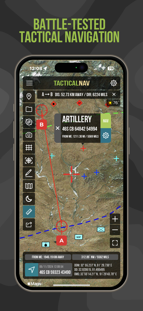
Interface do aplicativo Tactical NAV mostrando mapa de satélite com coordenadas MGRS e ponto de artilharia
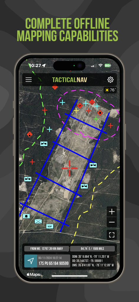
Interface do aplicativo Tactical NAV mostrando mapeamento offline de satélite com coordenadas de grade militar e sobreposições táticas
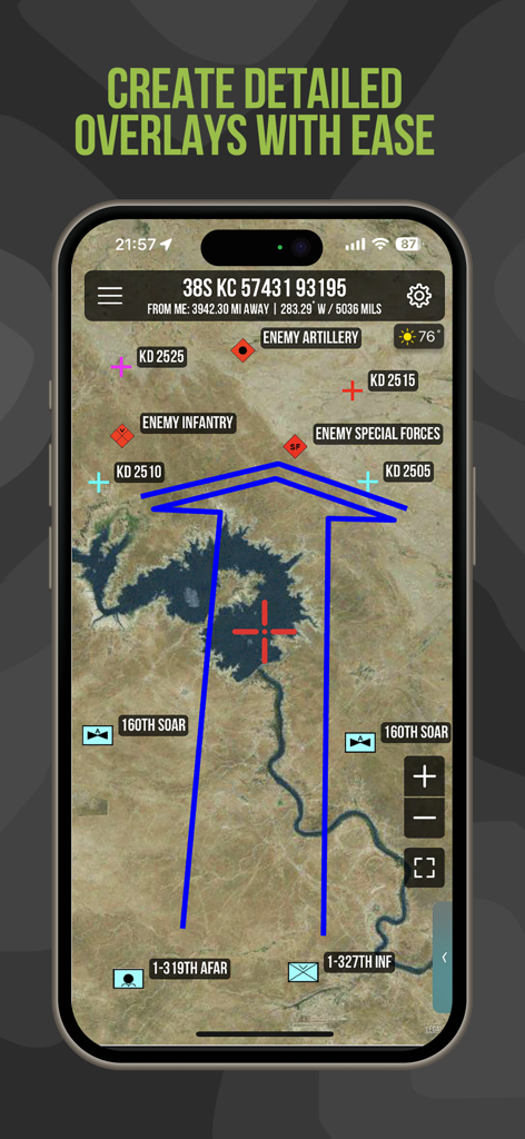
Aplicativo Tactical NAV mostrando sobreposições detalhadas militares e posições de unidades em um mapa de satélite
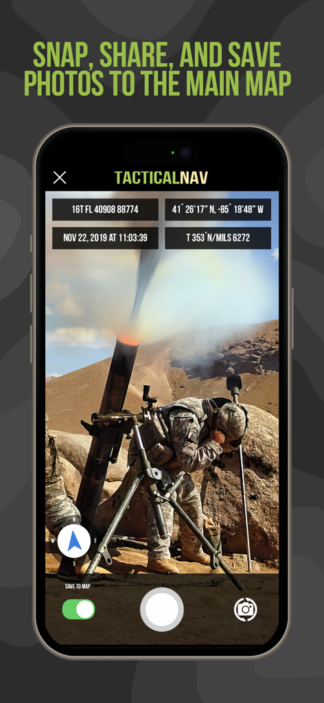
Interface do aplicativo Tactical NAV mostrando uma foto de operações militares com coordenadas MGRS e sobreposições de dados de localização
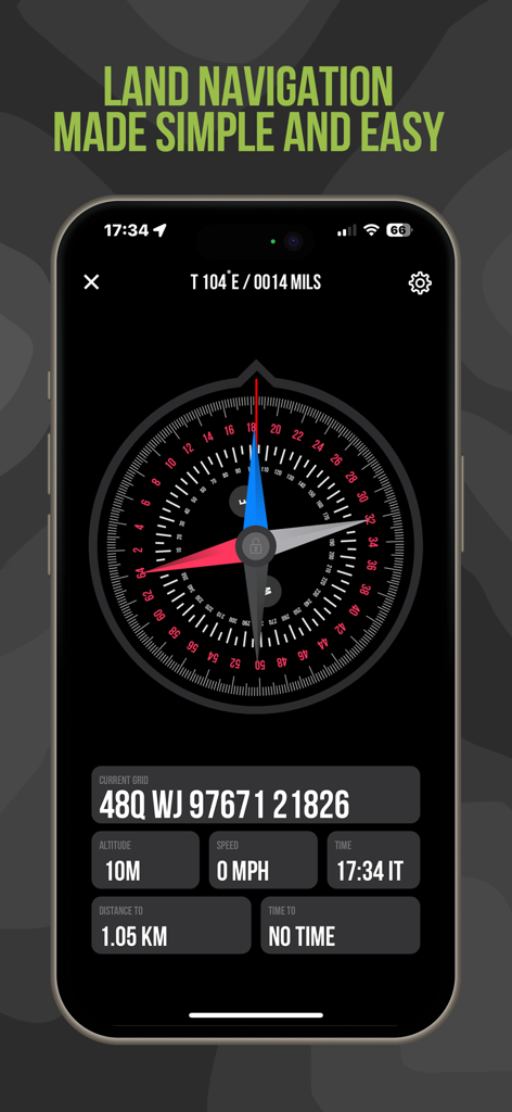
Tela de navegação terrestre do Tactical NAV com coordenadas MGRS e bússola digital
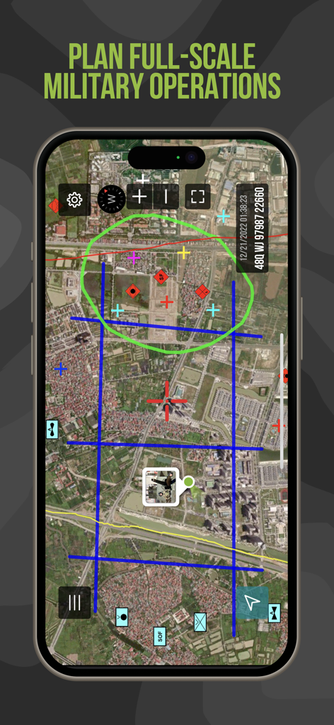
Interface do aplicativo Tactical NAV apresentando ferramentas de planejamento de missão e sobreposições de mapas táticos
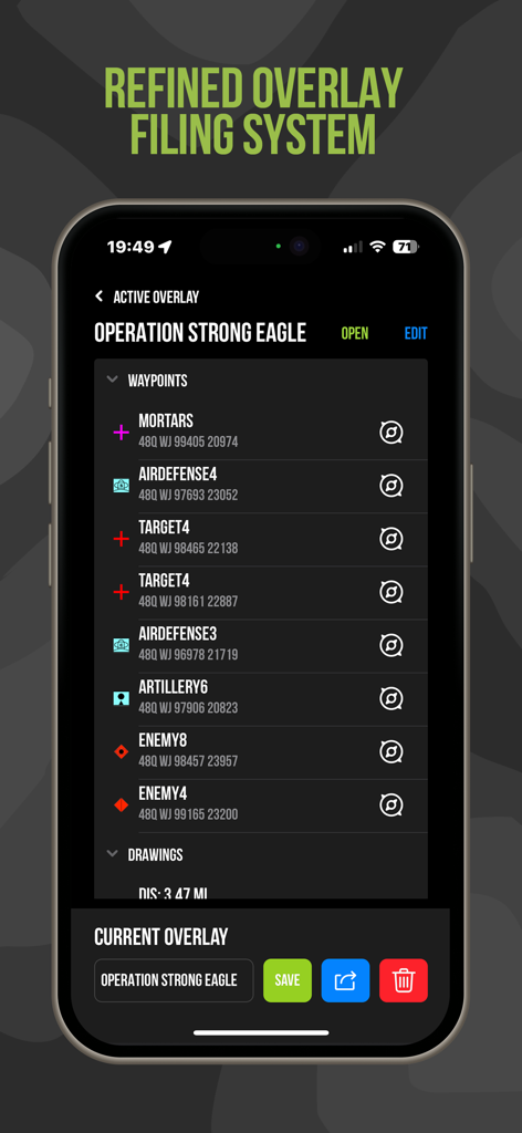
Interface do aplicativo Tactical NAV mostrando gerenciamento de pontos de passagem e coordenadas MGRS para planejamento de missão
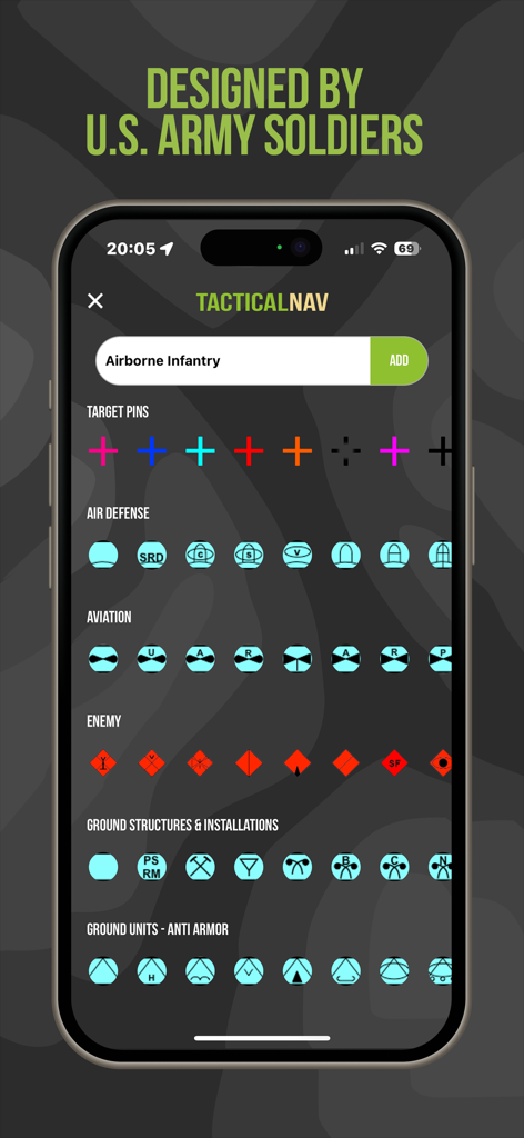
Tela do aplicativo Tactical NAV exibindo vários símbolos e ícones militares para planejamento de missão tática

Tela do aplicativo Tactical NAV dedicada aos heróis caídos do Exército dos EUA e instituições de caridade para veteranos

Página Sobre do aplicativo Tactical NAV mostrando uma mensagem pessoal de seu criador veterano
Descrição
Download
Apps Semelhantes
Apps com recursos e experiência semelhantes

MilGPS
Cascode Labs Pty Ltd

SEAiq Pilot VPP
Sakhalin, LLC

Cartograph Maps 3
Harald Meyer

新知卫星地图-路线规划,高清地图导航
Chongqing Xinzhi Space Technology Co., Ltd.

Coordinates – GPS Converter
Mapnitude Company Limited

Mgrs & Utm Map
Vahid Cataltas

DeepStateMap
Heorhii Karpenko

Map Plus
Miocool Inc.

Compass 55. Map & GPS kit.
Kalimex-Consulting s.r.o.
Esta página não é uma página oficial do aplicativo ou de seu desenvolvedor, mas uma publicação editorial independente criada para fins informativos e de comentário. Salvo indicação expressa em contrário, nem o aplicativo nem seu desenvolvedor são afiliados, endossados, patrocinados, autorizados ou oficialmente conectados à MWM, Apple, Google Play, ao editor do aplicativo ou ao desenvolvedor do aplicativo, e nada nesta página implica que o aplicativo foi desenvolvido utilizando os serviços da MWM. Todas as marcas comerciais, logotipos, capturas de tela e outros conteúdos permanecem propriedade de seus respectivos proprietários.