Esta página não é uma página oficial do aplicativo ou de seu desenvolvedor, mas uma publicação editorial independente criada para fins informativos e de comentário. Salvo indicação expressa em contrário, nem o aplicativo nem seu desenvolvedor são afiliados, endossados, patrocinados, autorizados ou oficialmente conectados à MWM, Apple, Google Play, ao editor do aplicativo ou ao desenvolvedor do aplicativo, e nada nesta página implica que o aplicativo foi desenvolvido utilizando os serviços da MWM. Todas as marcas comerciais, logotipos, capturas de tela e outros conteúdos permanecem propriedade de seus respectivos proprietários.

WingX®
Aumente sua consciência situacional com a premiada Visão Sintética, clima ADS-B em tempo real e planejamento de voo avançado. A escolha confiável para Aviação Geral, oferecendo desempenho premium e assinaturas gratuitas exclusivas para pilotos VFR e militares.
Downloads
116K+Avaliação
Total de avaliações
1K+Editor
Categoria
NavigationIdiomas
1Última versão
9.2.6.206Tamanho
80.4 MBData de lançamento
30 de jun. de 2010Navegação de Precisão para o Piloto Profissional
Experimente um Electronic Flight Bag rico em recursos, projetado para aumentar a segurança e a eficiência, desde o planejamento pré-voo até a aproximação final.
Consciência Situacional de Nova Geração
Voe com confiança usando Visão Sintética, alertas de terreno GPWS e tráfego ADS-B em tempo real e sobreposições meteorológicas em um mapa em movimento de alto desempenho.
Valor Focado em Militares e VFR
Acesse ferramentas de aviação líderes do setor com níveis de assinatura gratuitos dedicados para pessoal militar ativo ou aposentado e pilotos apenas VFR.
As capturas de tela e a descrição a seguir são provenientes diretamente da listagem oficial da loja do aplicativo e são propriedade do desenvolvedor.
App Store
Capturas
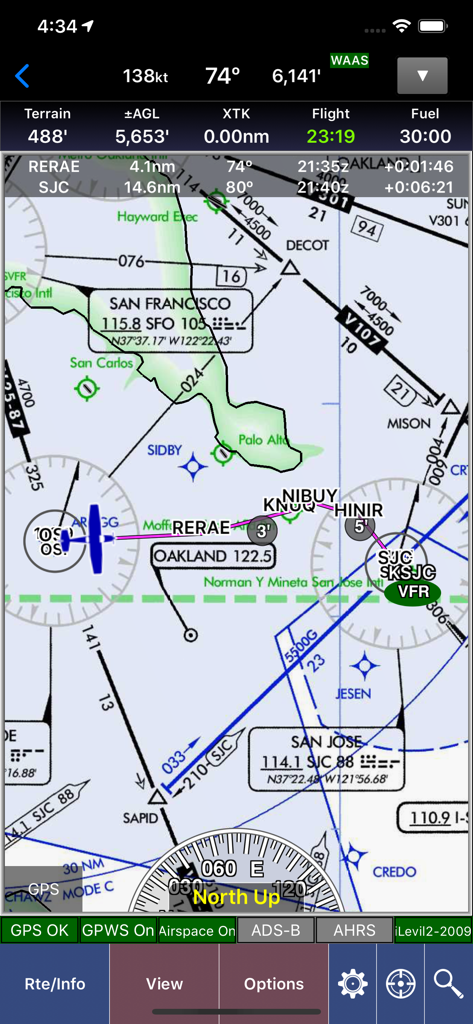
Mapa de navegação de aviação WingX mostrando dados de voo e cartas seccionais sobre a área de São Francisco.
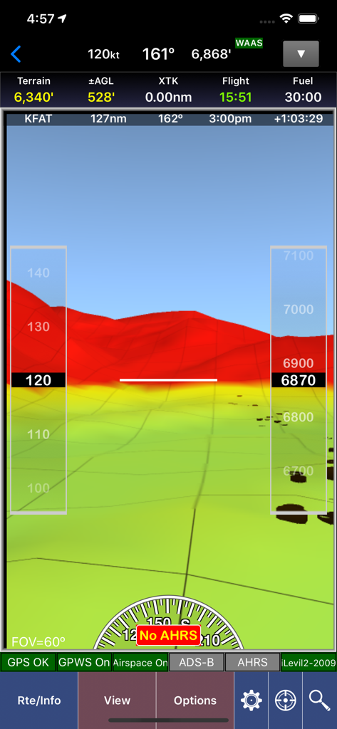
Captura de tela do aplicativo WingX mostrando visão sintética com mapeamento de terreno 3D e sobreposições de instrumentos de voo
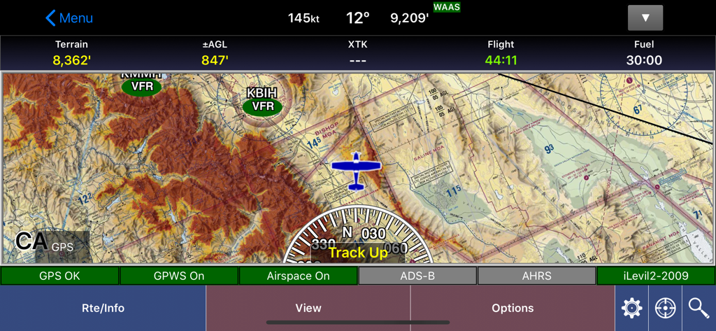
Interface de mapa em movimento de navegação de aviação do aplicativo WingX mostrando detalhes de terreno e dados de voo
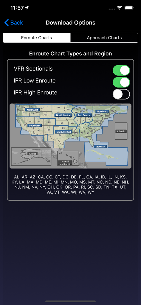
Tela de Opções de Download do aplicativo WingX para selecionar cartas de rota e regiões dos EUA
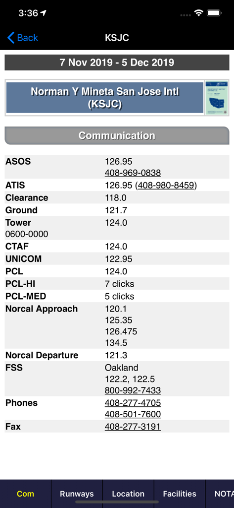
Frequências de comunicação de aviação para o Aeroporto Internacional de San Jose no aplicativo WingX
Descrição
Download
Apps Semelhantes
Apps com recursos e experiência semelhantes

Navigraph Charts
Navigraph KB

SkyDemon
Divelements Limited

Airports
Applicate Ltd

OzRunways EFB
OzRunways Pty. Ltd.

fDeck: flight instruments
Darren Yeates

Noisy Goose
Automata Solutions Ltd.

StationWeather - METAR and TAF
Oliver Puetz

Drone UAV Fly Forecast: AirMap
MONIQ TAP COMPANY LIMITED

Airmate
Myriel Aviation SA
Esta página não é uma página oficial do aplicativo ou de seu desenvolvedor, mas uma publicação editorial independente criada para fins informativos e de comentário. Salvo indicação expressa em contrário, nem o aplicativo nem seu desenvolvedor são afiliados, endossados, patrocinados, autorizados ou oficialmente conectados à MWM, Apple, Google Play, ao editor do aplicativo ou ao desenvolvedor do aplicativo, e nada nesta página implica que o aplicativo foi desenvolvido utilizando os serviços da MWM. Todas as marcas comerciais, logotipos, capturas de tela e outros conteúdos permanecem propriedade de seus respectivos proprietários.