Esta página no es una página oficial de la aplicación ni de su desarrollador, sino una publicación editorial independiente creada con fines informativos y de comentario. Salvo que se indique expresamente lo contrario, ni la aplicación ni su desarrollador están afiliados, respaldados, patrocinados, autorizados ni conectados oficialmente con MWM, Apple, Google Play, el editor de la aplicación ni su desarrollador, y nada en esta página implica que la aplicación haya sido desarrollada utilizando los servicios de MWM. Todas las marcas comerciales, logotipos, capturas de pantalla y demás contenidos son propiedad de sus respectivos propietarios.

GoGoEarth - Custom map source
Desbloquea fuentes satelitales premium de la NASA, Maxar y Nearmap. Desde modelos 3D de ciudades hasta altitud en tiempo real, experimenta mapeo de grado profesional y exploración virtual al alcance de tu mano.
Descargas
427K+Valoración
Total valoraciones
8K+Editor
Categoría
NavigationIdiomas
2Última versión
3.2.3Tamaño
155.6 MBFecha de lanzamiento
11 may 2022Explora la Tierra en Asombroso Detalle
Desde imágenes satelitales de alta resolución hasta modelos arquitectónicos 3D, GoGoEarth proporciona las herramientas de grado profesional que necesitas para descubrir el mundo desde la palma de tu mano.
Vistas Satelitales Ultra-HD
Experimenta el mundo con imágenes cristalinas impulsadas por la NASA y Maxar, proporcionando niveles de detalle que van mucho más allá de los mapas estándar.
Turismo Global Virtual
Viaja por más de 200 regiones con vistas panorámicas de calle HD y explora modelos 3D realistas de los sitios más famosos del mundo.
Las siguientes capturas de pantalla y la descripción provienen directamente del listado oficial de la tienda de la aplicación y son propiedad del desarrollador.
App Store
Capturas
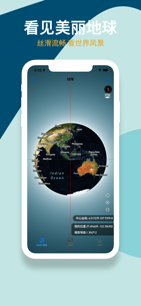
Interfaz de la aplicación GoGoEarth mostrando un globo satelital 3D con etiquetas geográficas y coordenadas
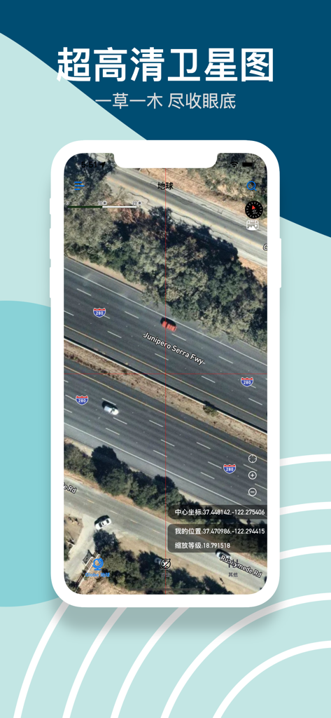
Imágenes satelitales de alta definición de una autopista con coches y coordenadas precisas en la aplicación GoGoEarth
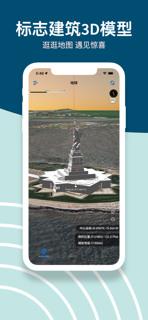
Captura de pantalla de la aplicación GoGoEarth mostrando un modelo 3D detallado de la Estatua de la Libertad en un mapa satelital
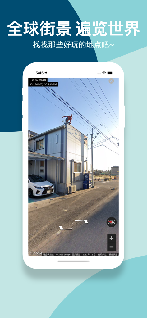
Captura de pantalla de la aplicación GoGoEarth mostrando una vista panorámica de calle de alta definición de un vecindario en Japón
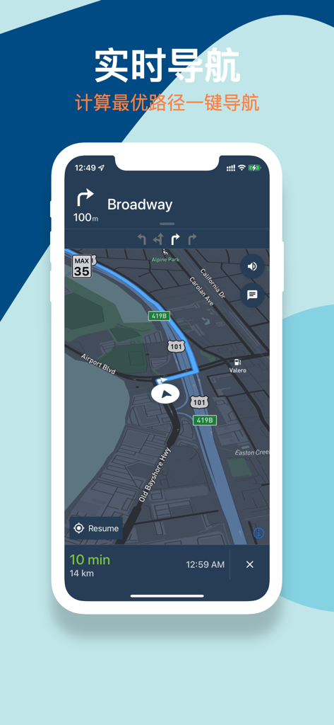
Aplicación móvil GoGoEarth mostrando la interfaz de navegación en tiempo real con una ruta en un mapa satelital oscuro.
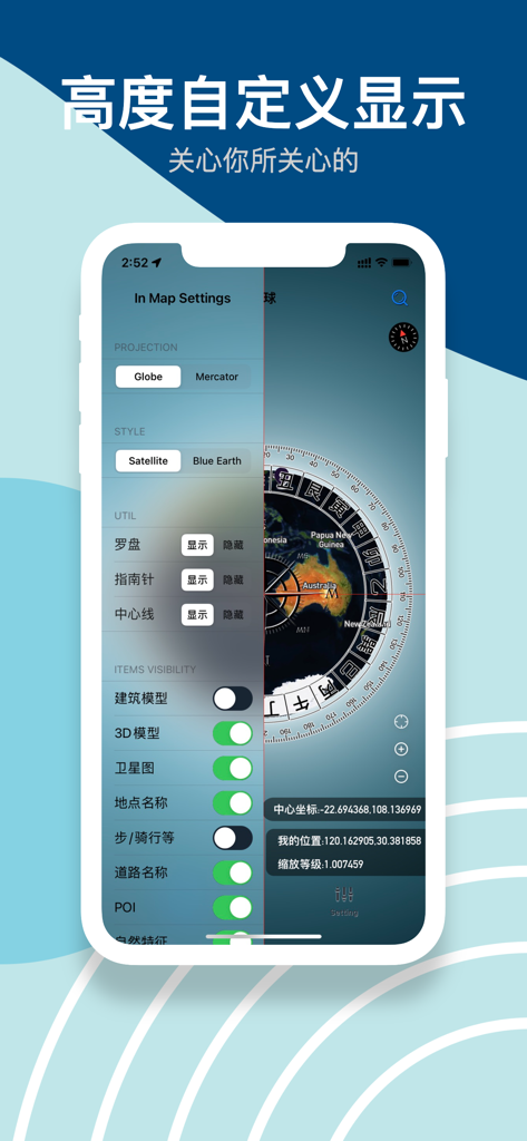
Interfaz de la aplicación GoGoEarth mostrando configuraciones de mapa para estilos de proyección y visibilidad de modelos 3D
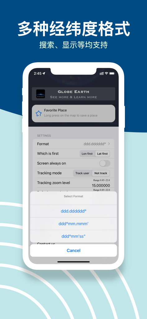
Interfaz de la aplicación GoGoEarth mostrando múltiples opciones de formato de coordenadas de latitud y longitud en el menú de configuración.
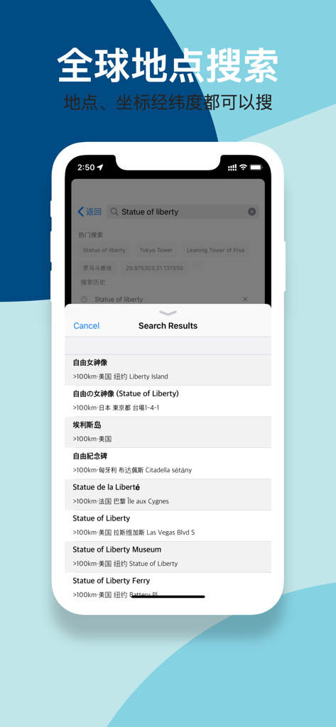
Interfaz de la aplicación GoGoEarth mostrando resultados de búsqueda global para la Estatua de la Libertad con soporte de latitud y longitud.
Descripción
Download
Apps Similares
Apps con características y experiencia similares

Earth Maps
FOXPOI PTE. LTD.

Satellite Map - Live Earth
慧敏 赵

Satellite Map - Earth View
ANKAGIS YAZILIM ANONIM SIRKETI

World Street 3D Panoramic Map
Beijing Zhiyue Information Technology Co., Ltd

3D Earth Map Street View
Naik Ur Rehman

Globe 3D Earth: World Map Live
Shams Alam

Street View - street view maps
国辉 满

卫星地图-高清地球探索世界
方元 朱

高清3D街景地图-地图软件手机全景版
Suzhou Caichuang Network Technology Co., Ltd.
Esta página no es una página oficial de la aplicación ni de su desarrollador, sino una publicación editorial independiente creada con fines informativos y de comentario. Salvo que se indique expresamente lo contrario, ni la aplicación ni su desarrollador están afiliados, respaldados, patrocinados, autorizados ni conectados oficialmente con MWM, Apple, Google Play, el editor de la aplicación ni su desarrollador, y nada en esta página implica que la aplicación haya sido desarrollada utilizando los servicios de MWM. Todas las marcas comerciales, logotipos, capturas de pantalla y demás contenidos son propiedad de sus respectivos propietarios.