Esta página no es una página oficial de la aplicación ni de su desarrollador, sino una publicación editorial independiente creada con fines informativos y de comentario. Salvo que se indique expresamente lo contrario, ni la aplicación ni su desarrollador están afiliados, respaldados, patrocinados, autorizados ni conectados oficialmente con MWM, Apple, Google Play, el editor de la aplicación ni su desarrollador, y nada en esta página implica que la aplicación haya sido desarrollada utilizando los servicios de MWM. Todas las marcas comerciales, logotipos, capturas de pantalla y demás contenidos son propiedad de sus respectivos propietarios.

RadarScope
Experimenta datos NEXRAD Nivel II sin procesar y productos de radar nativos con latencia cero. Rastrea tornados, huracanes y tormentas severas utilizando las mismas herramientas de alta resolución en las que confían meteorólogos y socorristas.
Descargas
408K+Valoración
Total valoraciones
5K+Editor
Categoría
WeatherIdiomas
4Última versión
5.5.2Tamaño
288.4 MBFecha de lanzamiento
12 feb 2019Visualización de Radar de Nivel Profesional
Accede a datos de radar sin procesar y de alta resolución y a herramientas avanzadas de seguimiento de tormentas diseñadas para profesionales y entusiastas que exigen precisión sobre estética.
Datos Brutos NEXRAD Nivel II
Visualiza los datos del radar en su formato radial original sin suavizado, lo que te permite identificar cúmples de velocidad y bolas de escombros con latencia cero.
Alertas de Tiempo Severo en Tiempo Real
Monitoriza las advertencias generadas por el NWS para tornados, inundaciones repentinas y tormentas eléctricas severas con trayectorias de tormentas integradas y atributos de granizo.
Las siguientes capturas de pantalla y la descripción provienen directamente del listado oficial de la tienda de la aplicación y son propiedad del desarrollador.
App Store
Capturas
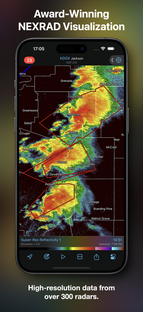
Aplicación RadarScope mostrando datos de radar NEXRAD de alta resolución en un dispositivo móvil.
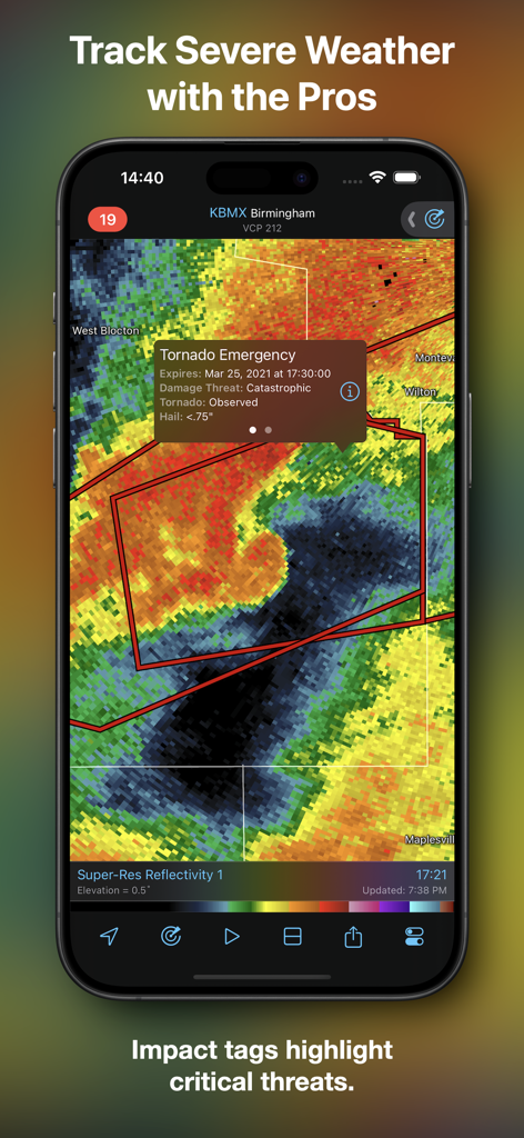
Aplicación RadarScope mostrando una etiqueta de impacto de emergencia por tornado en un mapa de radar meteorológico.
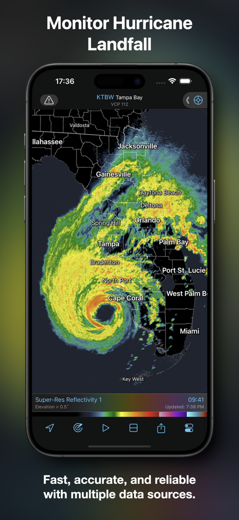
Interfaz de la aplicación RadarScope mostrando un bucle de radar de huracanes de alta resolución sobre Florida.
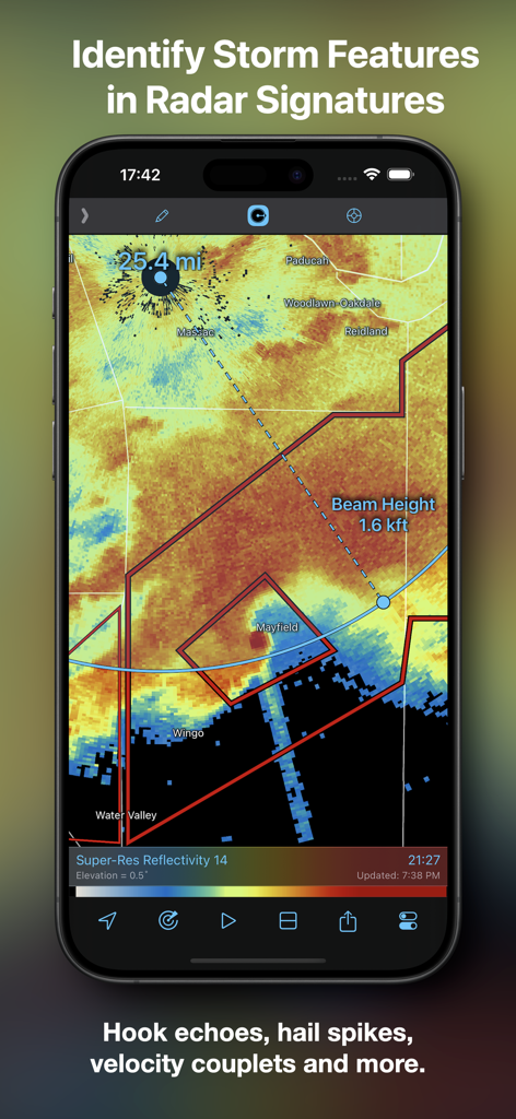
Captura de pantalla de la aplicación RadarScope mostrando un mapa de radar con marcadores de distancia y altura del haz para identificar características de la tormenta.
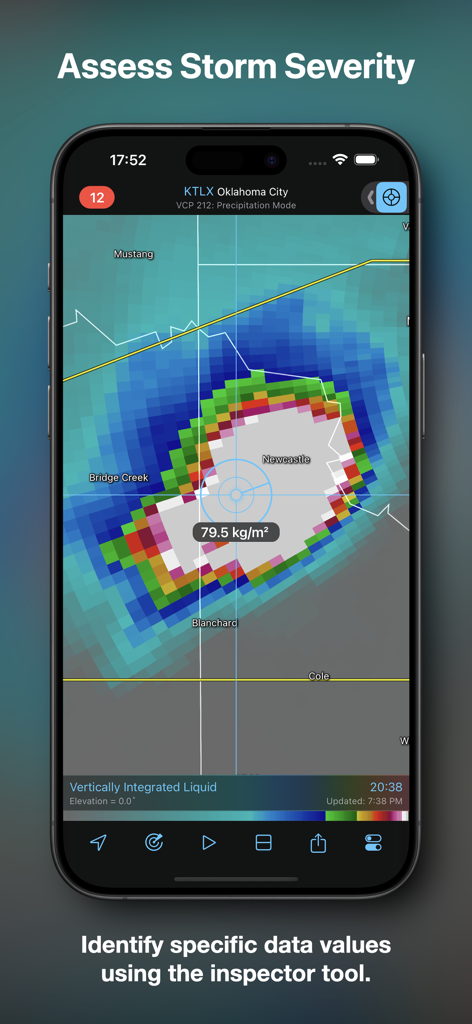
Interfaz de la aplicación RadarScope mostrando la evaluación de la gravedad de la tormenta utilizando la herramienta inspectora.
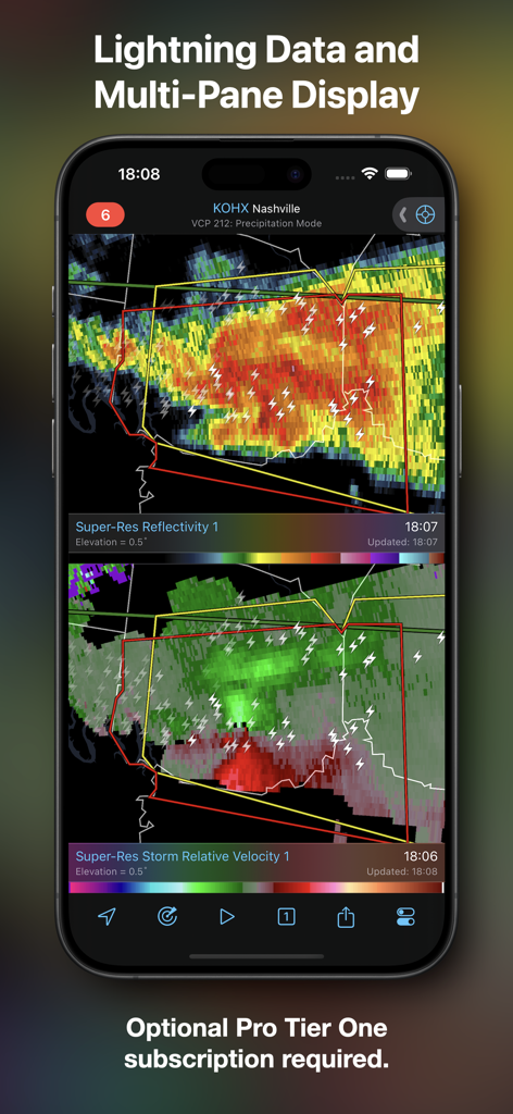
Captura de pantalla de la aplicación RadarScope mostrando una vista de pantalla dividida con reflectividad súper resolutiva y velocidad relativa de la tormenta, incluyendo datos de rayos.
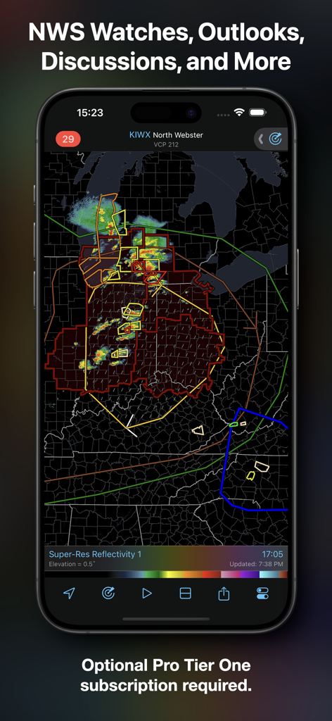
Interfaz de la aplicación RadarScope mostrando avisos y perspectivas del Servicio Meteorológico Nacional en un mapa de radar de alta resolución.
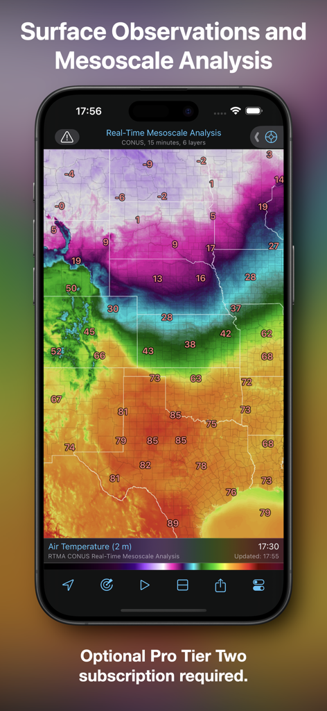
Aplicación RadarScope mostrando análisis mesoescala en tiempo real y observaciones de temperatura superficial.
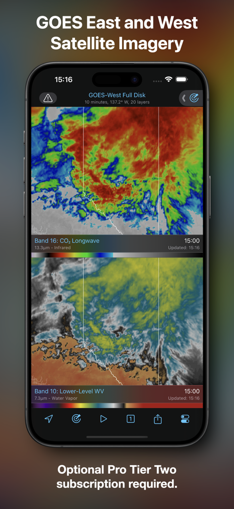
Aplicación móvil RadarScope mostrando imágenes de satélite GOES Este y Oeste con capas infrarrojas y de vapor de agua.
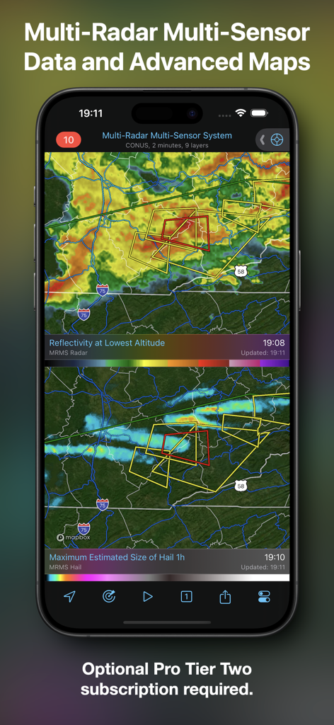
Interfaz de la aplicación RadarScope mostrando mapas meteorológicos avanzados con reflectividad y datos de tamaño de granizo.
Descripción
Download
Apps Similares
Apps con características y experiencia similares

墨迹天气-MojiWeather
Beijing MojiFengyun Technology Co.,Ltd.

Windy.com
Windyty, SE

天气通
Weibo Internet Technology (China) Co.Ltd.

Zoom Earth - Weather Forecast
Neave Interactive Limited

实时天气-40日精准天气实时预报
犇 牛

MyRadar Accurate Weather Radar
Aviation Data Systems, Inc

Ventusky: Weather & Live Radar
Ventusky s.r.o.

FOX Weather: Daily Forecasts
Fox News Network, LLC

2345天气王-天气和空气质量查询小组件
Shanghai 2345 Network Technology Co., Ltd.
Esta página no es una página oficial de la aplicación ni de su desarrollador, sino una publicación editorial independiente creada con fines informativos y de comentario. Salvo que se indique expresamente lo contrario, ni la aplicación ni su desarrollador están afiliados, respaldados, patrocinados, autorizados ni conectados oficialmente con MWM, Apple, Google Play, el editor de la aplicación ni su desarrollador, y nada en esta página implica que la aplicación haya sido desarrollada utilizando los servicios de MWM. Todas las marcas comerciales, logotipos, capturas de pantalla y demás contenidos son propiedad de sus respectivos propietarios.