Cette page n'est pas une page officielle de l'application ou de son développeur, mais une publication éditoriale indépendante créée à des fins d'information et de commentaire. Sauf indication expresse contraire, ni l'application ni son développeur ne sont affiliés, approuvés, sponsorisés, autorisés ou autrement officiellement liés à MWM, Apple, Google Play, à l'éditeur de l'application ou au développeur de l'application, et rien sur cette page n'implique que l'application a été développée en utilisant les services de MWM. Toutes les marques, logos, captures d'écran et autres contenus restent la propriété de leurs propriétaires respectifs.

GoGoEarth - Custom map source
Débloquez des sources satellites premium de la NASA, Maxar et Nearmap. Des modèles de villes en 3D à l'altitude en temps réel, découvrez la cartographie professionnelle et l'exploration virtuelle du bout des doigts.
Téléchargements
427K+Note
Nombre d'avis
8K+Éditeur
Catégorie
NavigationLangues
2Dernière version
3.2.3Taille
155.6 MBDate de sortie
11 mai 2022Explorez la Terre avec des détails époustouflants
Des images satellites haute résolution aux modèles architecturaux 3D, GoGoEarth fournit les outils professionnels dont vous avez besoin pour découvrir le monde dans la paume de votre main.
Vues satellites Ultra-HD
Découvrez le monde avec des images cristallines alimentées par la NASA et Maxar, offrant des niveaux de détail qui vont bien au-delà des cartes standard.
Tourisme virtuel mondial
Voyagez dans plus de 200 régions avec des vues panoramiques HD de la rue et explorez des modèles 3D réalistes des sites les plus célèbres du monde.
Les captures d'écran et la description suivantes proviennent directement de la fiche officielle de l'application sur le store et sont la propriété du développeur.
App Store
Captures
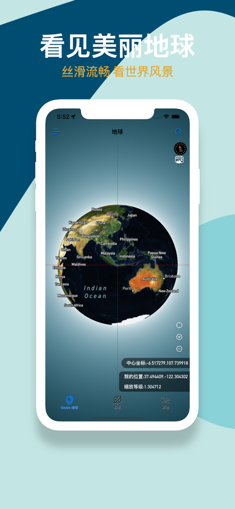
Interface de l'application GoGoEarth affichant un globe satellite 3D avec des étiquettes géographiques et des coordonnées
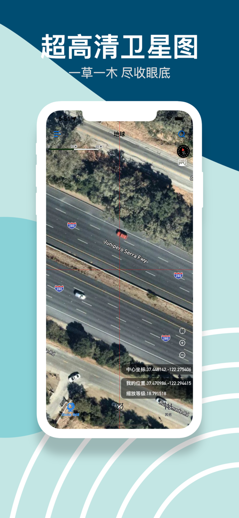
Images satellites haute définition d'une autoroute avec des voitures et des coordonnées précises dans l'application GoGoEarth
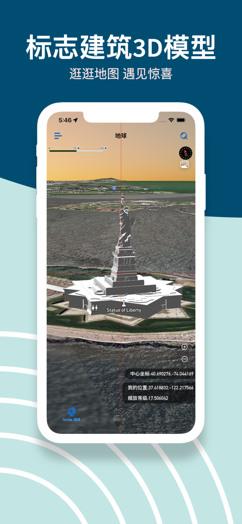
Capture d'écran de l'application GoGoEarth montrant un modèle 3D détaillé de la Statue de la Liberté sur une carte satellite
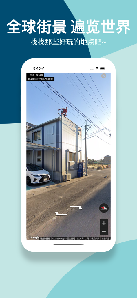
Capture d'écran de l'application GoGoEarth affichant une vue panoramique HD d'un quartier au Japon
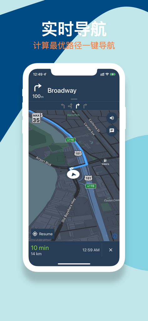
Application mobile GoGoEarth affichant une interface de navigation en temps réel avec un itinéraire sur une carte satellite sombre.
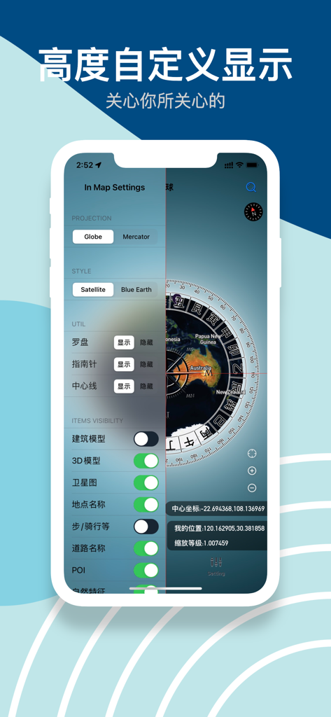
Interface de l'application GoGoEarth montrant les paramètres de la carte pour les styles de projection et la visibilité des modèles 3D
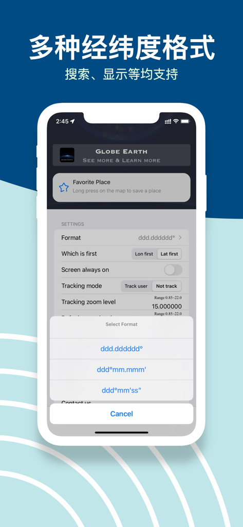
Interface de l'application GoGoEarth montrant plusieurs options de format de coordonnées latitude et longitude dans le menu des paramètres.
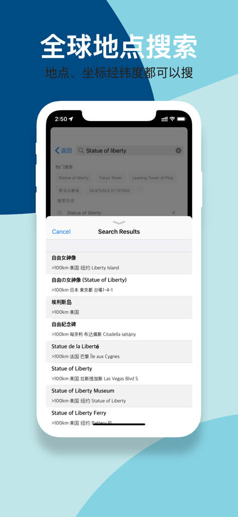
Interface de l'application GoGoEarth affichant les résultats de recherche mondiaux pour la Statue de la Liberté avec prise en charge de la latitude et de la longitude.
Description
Download
Apps Similaires
Apps avec des fonctionnalités et une expérience similaires

Earth Maps
FOXPOI PTE. LTD.

Satellite Map - Live Earth
慧敏 赵

Satellite Map - Earth View
ANKAGIS YAZILIM ANONIM SIRKETI

World Street 3D Panoramic Map
Beijing Zhiyue Information Technology Co., Ltd

3D Earth Map Street View
Naik Ur Rehman

Globe 3D Earth: World Map Live
Shams Alam

Street View - street view maps
国辉 满

卫星地图-高清地球探索世界
方元 朱

高清3D街景地图-地图软件手机全景版
Suzhou Caichuang Network Technology Co., Ltd.
Cette page n'est pas une page officielle de l'application ou de son développeur, mais une publication éditoriale indépendante créée à des fins d'information et de commentaire. Sauf indication expresse contraire, ni l'application ni son développeur ne sont affiliés, approuvés, sponsorisés, autorisés ou autrement officiellement liés à MWM, Apple, Google Play, à l'éditeur de l'application ou au développeur de l'application, et rien sur cette page n'implique que l'application a été développée en utilisant les services de MWM. Toutes les marques, logos, captures d'écran et autres contenus restent la propriété de leurs propriétaires respectifs.