Questa pagina non è una pagina ufficiale dell'app o del suo sviluppatore, ma una pubblicazione editoriale indipendente creata a scopo informativo e di commento. Salvo espressa indicazione contraria, né l'app né il suo sviluppatore sono affiliati, approvati, sponsorizzati, autorizzati o altrimenti ufficialmente collegati a MWM, Apple, Google Play, all'editore dell'app o allo sviluppatore dell'app, e nulla in questa pagina implica che l'app sia stata sviluppata utilizzando i servizi di MWM. Tutti i marchi, loghi, screenshot e altri contenuti rimangono di proprietà dei rispettivi proprietari.

Maps 3D PRO - Hike & Bike
Unisciti a oltre 1,7 milioni di avventurieri che utilizzano mappe del terreno offline di livello NASA e tracciamento GPS professionale per conquistare ogni cima e sentiero.
Download
378K+Valutazione
Valutazioni totali
100Editore
Categoria
NavigationLingue
6Ultima versione
6.8Dimensione
25.2 MBData di lancio
25 mar 2011Padroneggia Ogni Terreno in Uno Sbalorditivo 3D
Smetti di navigare con mappe piatte. Ottieni una vista aerea della tua prossima avventura con elevazione 3D di livello professionale e tracciamento GPS offline progettato per l'esploratore serio.
Visualizzazione 3D di Precisione
Visualizza valli, colline e cime utilizzando scansioni del terreno NASA. Conosci l'esatta elevazione e difficoltà del tuo percorso prima ancora di iniziare.
Affidabilità Completamente Offline
Scarica i dati delle mappe mondiali prima di partire. Naviga in sicurezza nelle zone più remote con funzionalità GPS complete e zero segnale cellulare.
Gli screenshot e la descrizione seguenti provengono direttamente dall'elenco ufficiale dello store dell'app e sono di proprietà dello sviluppatore.
App Store
Screenshot
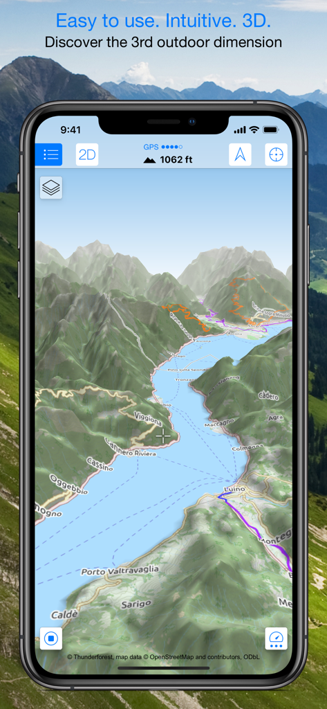
Smartphone che visualizza una mappa topografica 3D con montagne e sentieri escursionistici.
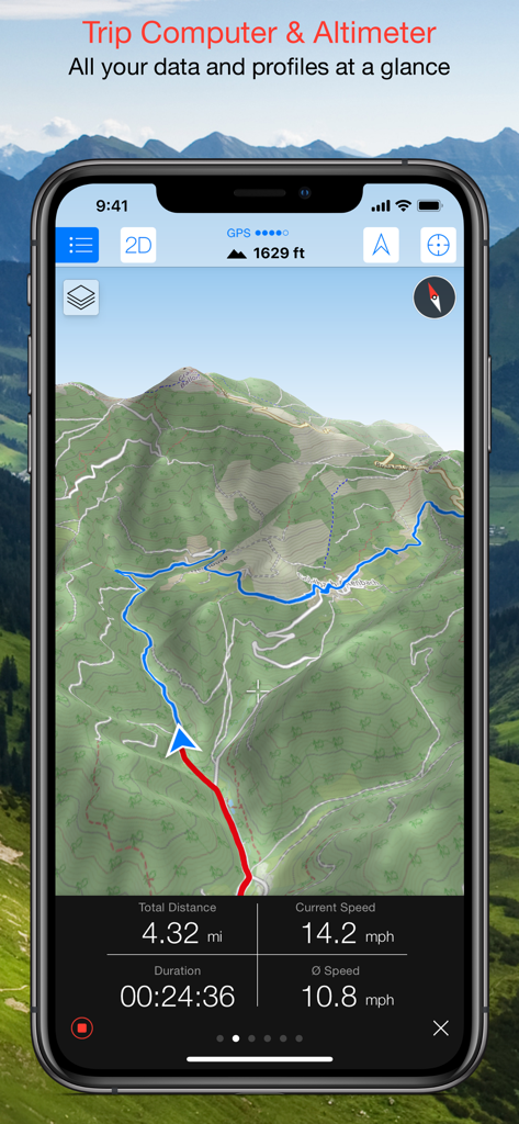
Interfaccia di Maps 3D PRO che mostra una mappa topografica 3D con dati del computer di bordo tra cui velocità, distanza e altitudine.
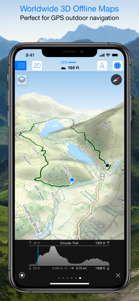
Interfaccia dell'app Maps 3D PRO che visualizza una mappa topografica 3D con un sentiero escursionistico e un profilo altimetrico.
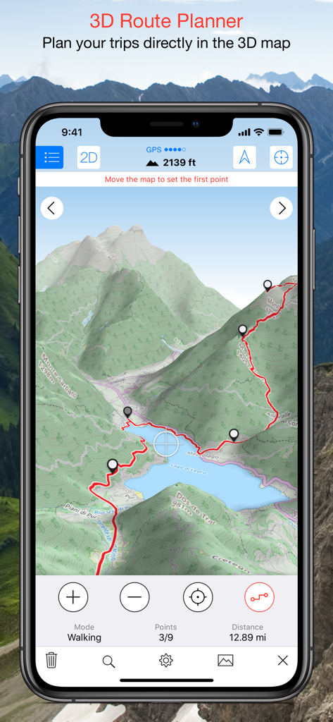
Screenshot dell'app Maps 3D PRO che mostra un percorso escursionistico pianificato su una mappa del terreno 3D.
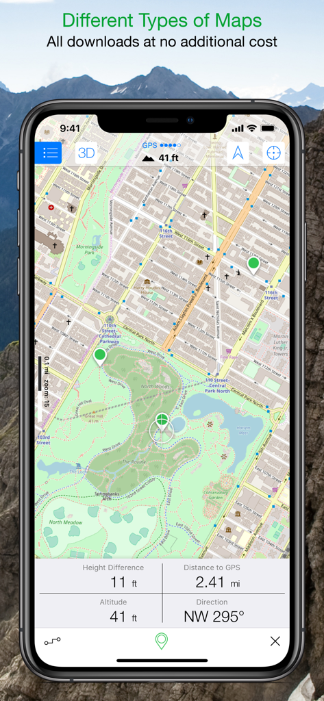
Interfaccia dell'app Maps 3D PRO che visualizza una mappa dettagliata di un parco con dati di tracciamento in tempo reale di altitudine e distanza.
Descrizione
Download
App Simili
App con funzionalità ed esperienza simili

AllTrails: Hike, Bike & Run
AllTrails, Inc.

Pedometer++
Cross Forward Consulting, LLC

Organic Maps: Offline Map
Organic Maps OU

Gaia GPS: Mobile Trail Maps
Trailbehind, INC.

Offline hiking maps: Mapy.com
Seznam.cz a.s.

Hiking Map Poland
Mapa Turystyczna sp. z o.o.

MapOut
Valnova GmbH

FarOut: Offline GPS Trail Maps
Atlas Guides DE, Inc.

Norgeskart
Norgeskart AS
Questa pagina non è una pagina ufficiale dell'app o del suo sviluppatore, ma una pubblicazione editoriale indipendente creata a scopo informativo e di commento. Salvo espressa indicazione contraria, né l'app né il suo sviluppatore sono affiliati, approvati, sponsorizzati, autorizzati o altrimenti ufficialmente collegati a MWM, Apple, Google Play, all'editore dell'app o allo sviluppatore dell'app, e nulla in questa pagina implica che l'app sia stata sviluppata utilizzando i servizi di MWM. Tutti i marchi, loghi, screenshot e altri contenuti rimangono di proprietà dei rispettivi proprietari.