Questa pagina non è una pagina ufficiale dell'app o del suo sviluppatore, ma una pubblicazione editoriale indipendente creata a scopo informativo e di commento. Salvo espressa indicazione contraria, né l'app né il suo sviluppatore sono affiliati, approvati, sponsorizzati, autorizzati o altrimenti ufficialmente collegati a MWM, Apple, Google Play, all'editore dell'app o allo sviluppatore dell'app, e nulla in questa pagina implica che l'app sia stata sviluppata utilizzando i servizi di MWM. Tutti i marchi, loghi, screenshot e altri contenuti rimangono di proprietà dei rispettivi proprietari.

RadarScope
Sperimenta dati radar grezzi NEXRAD di Livello II e prodotti radar nativi con latenza zero. Traccia tornado, uragani e tempeste severe utilizzando gli stessi strumenti ad alta risoluzione di cui si fidano meteorologi e soccorritori.
Download
408K+Valutazione
Valutazioni totali
5K+Editore
Categoria
WeatherLingue
4Ultima versione
5.5.2Dimensione
288.4 MBData di lancio
12 feb 2019Visualizzazione Radar di Livello Professionale
Accedi a dati radar grezzi ad alta risoluzione e strumenti avanzati di tracciamento delle tempeste progettati per professionisti e appassionati che richiedono accuratezza rispetto all'estetica.
Dati grezzi NEXRAD di Livello II
Visualizza i dati radar nel loro formato radiale originale senza alcuna interpolazione, permettendoti di identificare coppie di velocità e detriti con latenza zero.
Allarmi Meteo Severi in Tempo Reale
Monitora gli avvisi generati dal NWS per tornado, alluvioni improvvise e temporali severi con tracce di tempesta integrate e attributi di grandine.
Gli screenshot e la descrizione seguenti provengono direttamente dall'elenco ufficiale dello store dell'app e sono di proprietà dello sviluppatore.
App Store
Screenshot
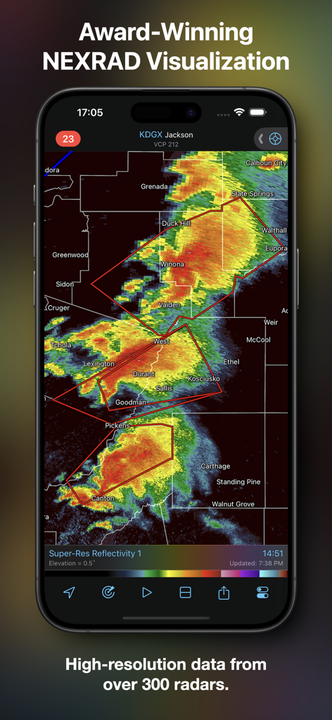
App RadarScope che mostra dati radar NEXRAD ad alta risoluzione su un dispositivo mobile.
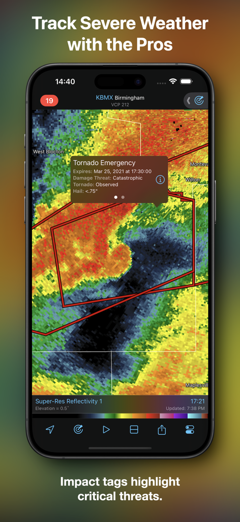
App RadarScope che mostra un'etichetta di allerta tornado sul campo su una mappa radar meteorologica.
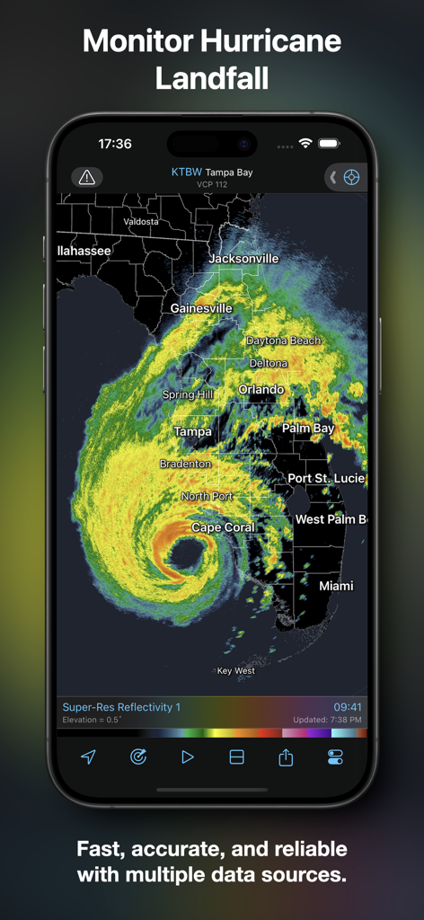
Interfaccia dell'app RadarScope che mostra un loop radar di uragani ad alta risoluzione sulla Florida.
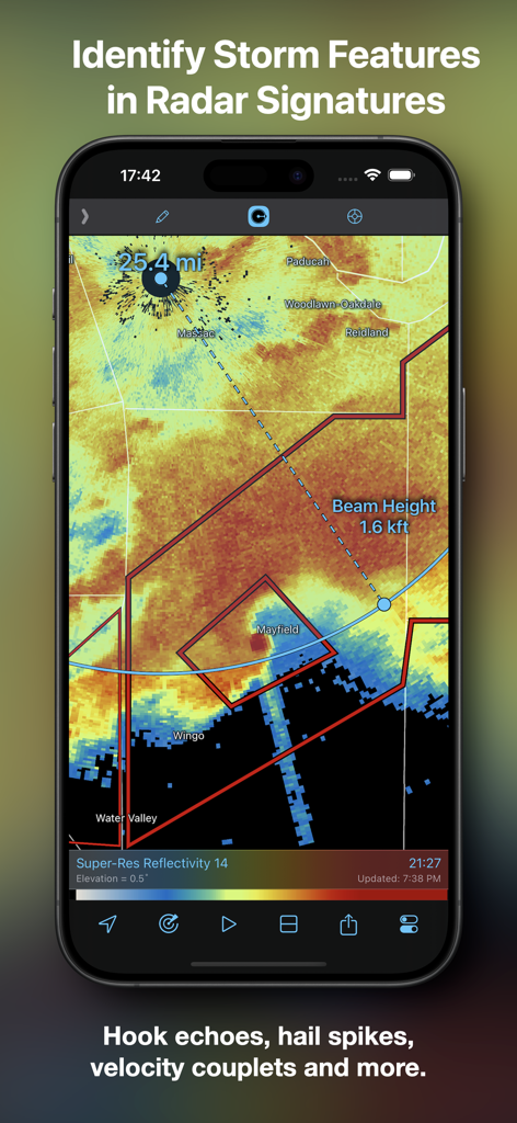
Screenshot dell'app RadarScope che mostra una mappa radar con indicatori di distanza e altezza del fascio per identificare le caratteristiche della tempesta.
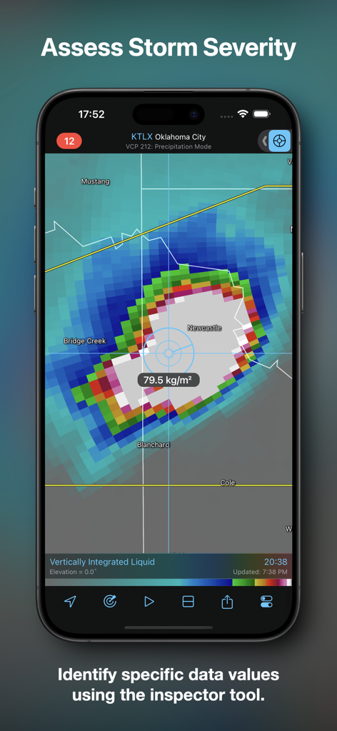
Interfaccia dell'app RadarScope che mostra la valutazione della gravità della tempesta utilizzando lo strumento di ispezione.
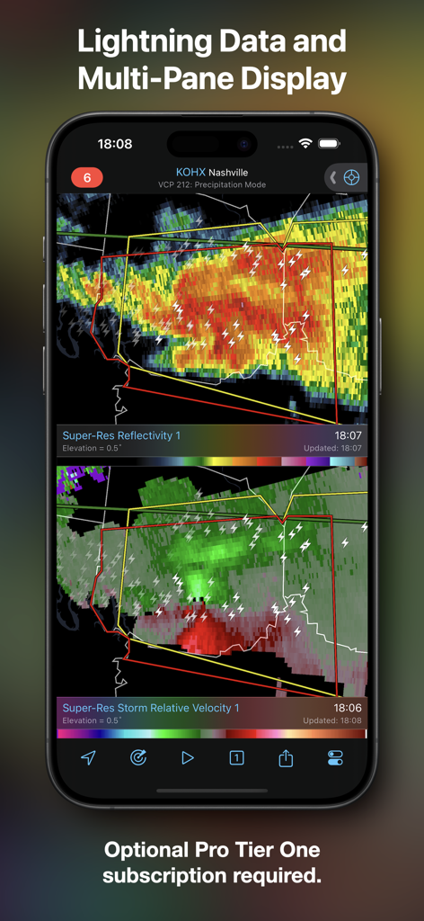
Screenshot dell'app RadarScope che mostra una visualizzazione a schermo diviso con riflettività super-risoluzione e velocità relativa alla tempesta, inclusi i dati sui fulmini.
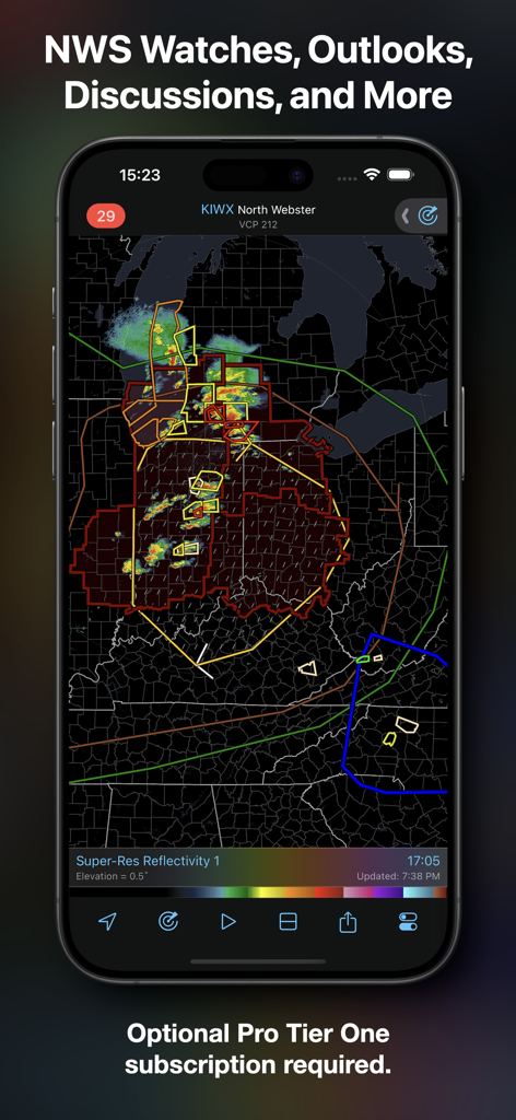
Interfaccia dell'app RadarScope che mostra gli avvisi e le previsioni del National Weather Service su una mappa radar ad alta risoluzione.
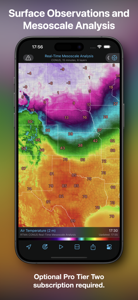
App RadarScope che mostra analisi mesoscalari in tempo reale e osservazioni della temperatura superficiale.
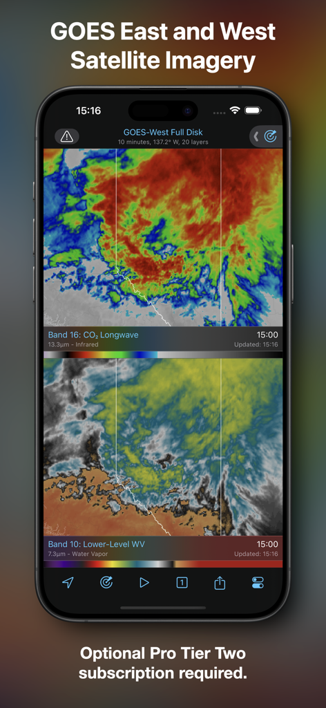
App mobile RadarScope che mostra immagini satellitari GOES Est e Ovest con strati infrarossi e di vapore acqueo.
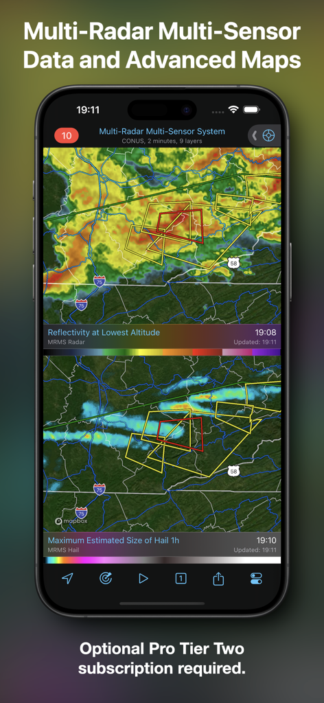
Interfaccia dell'app RadarScope che mostra mappe meteorologiche avanzate con dati di riflettività e dimensione della grandine.
Descrizione
Download
App Simili
App con funzionalità ed esperienza simili

墨迹天气-MojiWeather
Beijing MojiFengyun Technology Co.,Ltd.

Windy.com
Windyty, SE

天气通
Weibo Internet Technology (China) Co.Ltd.

Zoom Earth - Weather Forecast
Neave Interactive Limited

实时天气-40日精准天气实时预报
犇 牛

MyRadar Accurate Weather Radar
Aviation Data Systems, Inc

Ventusky: Weather & Live Radar
Ventusky s.r.o.

FOX Weather: Daily Forecasts
Fox News Network, LLC

2345天气王-天气和空气质量查询小组件
Shanghai 2345 Network Technology Co., Ltd.
Questa pagina non è una pagina ufficiale dell'app o del suo sviluppatore, ma una pubblicazione editoriale indipendente creata a scopo informativo e di commento. Salvo espressa indicazione contraria, né l'app né il suo sviluppatore sono affiliati, approvati, sponsorizzati, autorizzati o altrimenti ufficialmente collegati a MWM, Apple, Google Play, all'editore dell'app o allo sviluppatore dell'app, e nulla in questa pagina implica che l'app sia stata sviluppata utilizzando i servizi di MWM. Tutti i marchi, loghi, screenshot e altri contenuti rimangono di proprietà dei rispettivi proprietari.