Questa pagina non è una pagina ufficiale dell'app o del suo sviluppatore, ma una pubblicazione editoriale indipendente creata a scopo informativo e di commento. Salvo espressa indicazione contraria, né l'app né il suo sviluppatore sono affiliati, approvati, sponsorizzati, autorizzati o altrimenti ufficialmente collegati a MWM, Apple, Google Play, all'editore dell'app o allo sviluppatore dell'app, e nulla in questa pagina implica che l'app sia stata sviluppata utilizzando i servizi di MWM. Tutti i marchi, loghi, screenshot e altri contenuti rimangono di proprietà dei rispettivi proprietari.

ShipAtlas - Ship Tracker
Traccia oltre 125.000 navi in tempo reale con AIS satellitare di livello professionale, stima precisa degli orari di arrivo e informazioni sul traffico portuale mondiale.
Download
21K+Valutazione
Valutazioni totali
1K+Editore
Categoria
ProductivityLingue
1Ultima versione
8.0.1Dimensione
84.4 MBData di lancio
9 ago 2020Intelligence Marittima Professionale a Portata di Mano
Dal tracciamento AIS in tempo reale alla pianificazione avanzata delle rotte, ShipAtlas fornisce gli insight basati sui dati di cui hai bisogno per monitorare l'attività marittima e portuale globale con totale sicurezza.
Tracciamento Live Potenziato da Satellite
Monitora oltre 125.000 navi in tutto il mondo con dati AIS satellitari e terrestri ad alta risoluzione, assicurandoti di non perdere mai di vista una nave, anche in mare aperto.
Rotte Marittime Intelligenti e Orari di Arrivo
Pianifica viaggi precisi e calcola orari di arrivo accurati da qualsiasi posizione AIS a qualsiasi porto del mondo, personalizzati per velocità specifiche della nave e condizioni marittime in tempo reale.
Gli screenshot e la descrizione seguenti provengono direttamente dall'elenco ufficiale dello store dell'app e sono di proprietà dello sviluppatore.
App Store
Screenshot
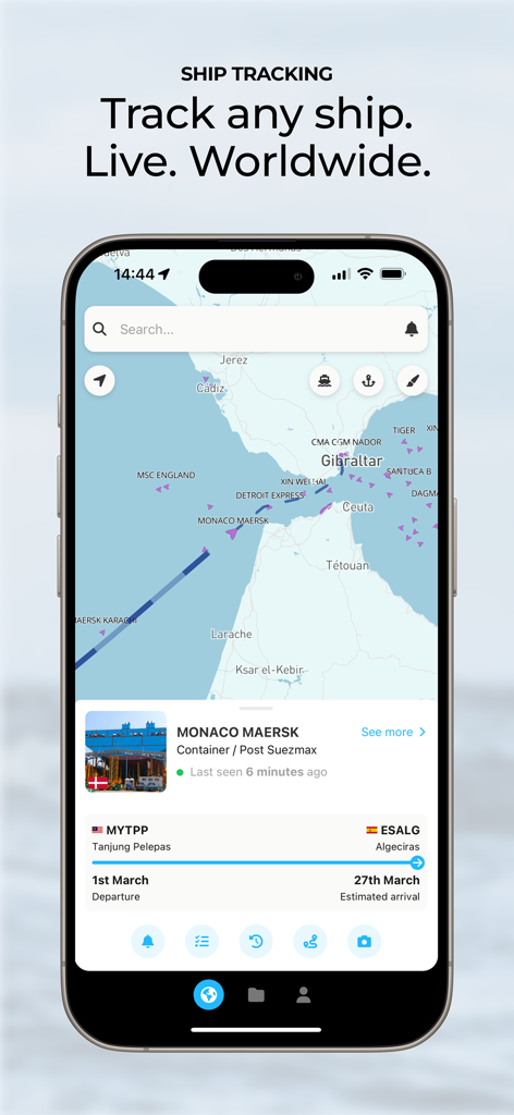
Interfaccia dell'app mobile ShipAtlas che mostra il tracciamento AIS in tempo reale delle navi e i dettagli delle navi su una mappa marittima
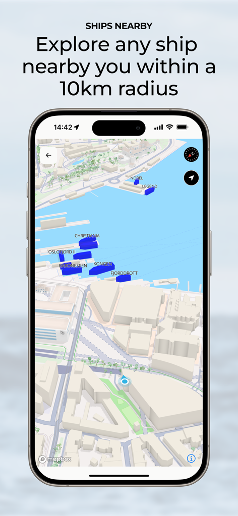
Interfaccia dell'app ShipAtlas che mostra una mappa delle navi nelle vicinanze entro un raggio di 10 km
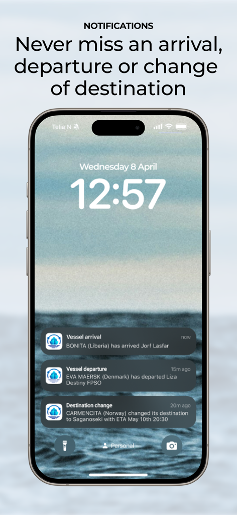
Schermata di blocco dell'iPhone che mostra le notifiche di ShipAtlas per arrivi, partenze e cambi di destinazione delle navi
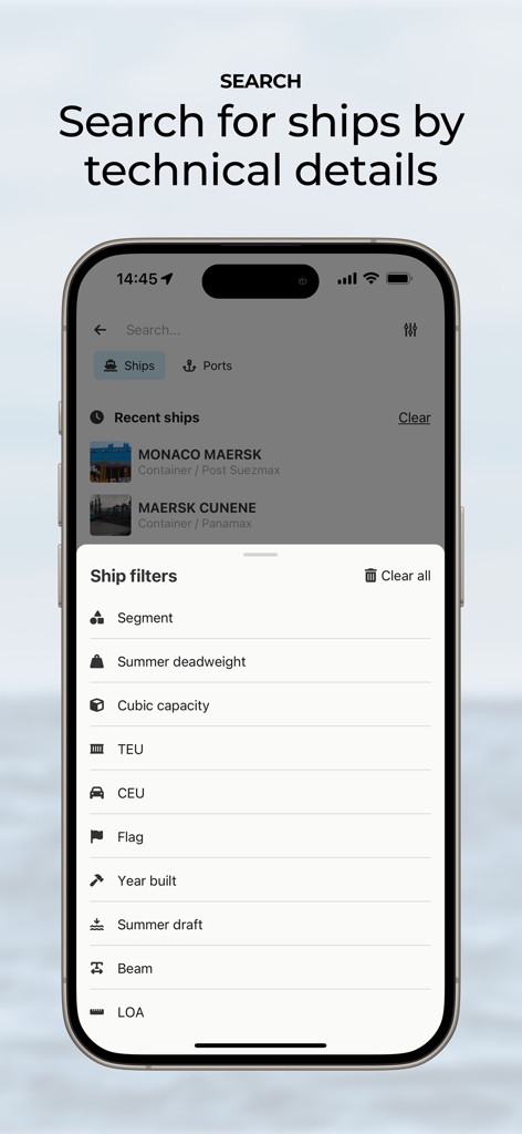
Schermata dell'app ShipAtlas che mostra filtri di ricerca tecnici per navi come portata lorda e TEU.
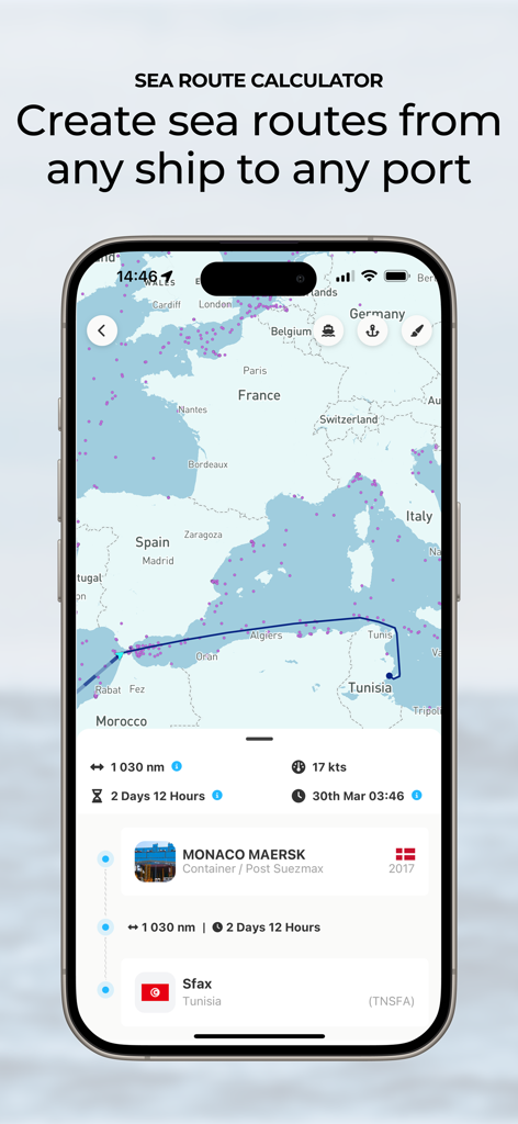
Calcolatore di rotte marittime nell'app ShipAtlas che mostra un viaggio navale dal Mediterraneo a un porto con orario di arrivo stimato e distanza.
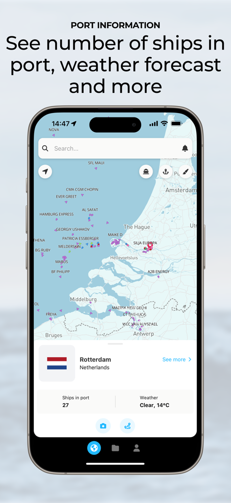
Interfaccia dell'app ShipAtlas che mostra informazioni portuali in tempo reale per Rotterdam con numero di navi e previsioni meteo su una mappa
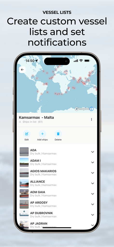
Interfaccia dell'app ShipAtlas che mostra elenchi di navi personalizzati e notifiche di tracciamento marittimo
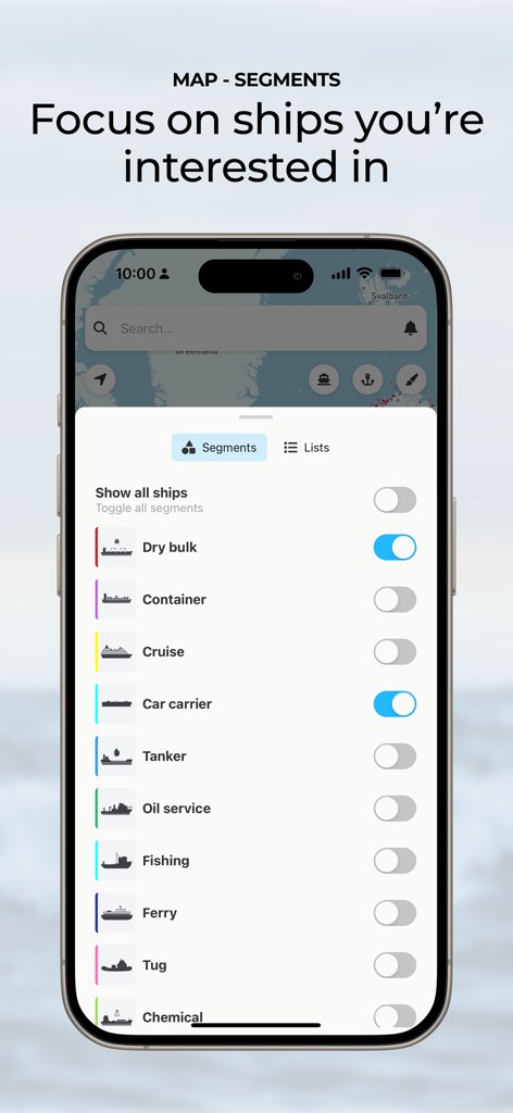
Interfaccia ShipAtlas che mostra filtri di segmenti navali per il tracciamento personalizzato delle navi
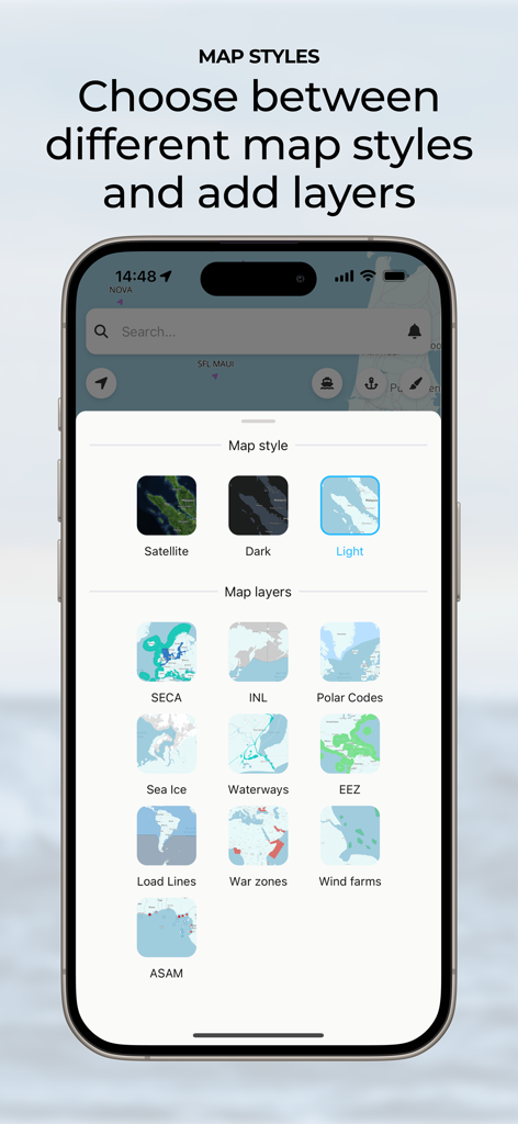
Interfaccia dell'app ShipAtlas per la scelta di stili di mappa e livelli di dati marittimi
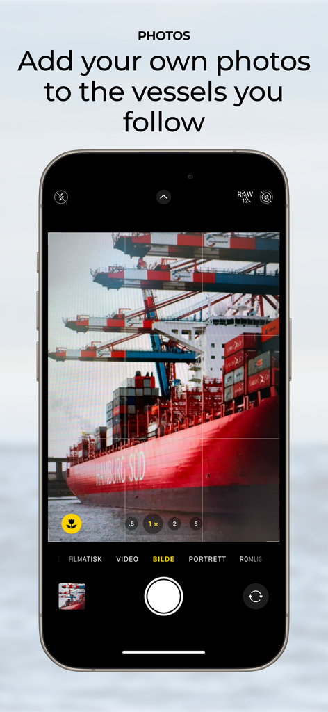
Schermata di uno smartphone che dimostra la funzione per catturare e aggiungere foto personali di navi tracciate nell'app ShipAtlas.
Descrizione
Download
App Simili
App più classificate nella stessa categoria

ChatGPT
OpenAI OpCo, LLC

Google Gemini
Google LLC

Grok
X.AI Corporation

Gmail - Email by Google
Google LLC

千问 - 阿里最强大模型官方AI助手
Shanghai Zhixin Puhui Technology Co., Ltd.

Google Drive
Google LLC

Microsoft Authenticator
Microsoft Corporation

Google Sheets
Google LLC

Google Docs
Google LLC
Questa pagina non è una pagina ufficiale dell'app o del suo sviluppatore, ma una pubblicazione editoriale indipendente creata a scopo informativo e di commento. Salvo espressa indicazione contraria, né l'app né il suo sviluppatore sono affiliati, approvati, sponsorizzati, autorizzati o altrimenti ufficialmente collegati a MWM, Apple, Google Play, all'editore dell'app o allo sviluppatore dell'app, e nulla in questa pagina implica che l'app sia stata sviluppata utilizzando i servizi di MWM. Tutti i marchi, loghi, screenshot e altri contenuti rimangono di proprietà dei rispettivi proprietari.