Diese Seite ist keine offizielle Seite der App oder ihres Entwicklers, sondern eine unabhängige redaktionelle Veröffentlichung, die zu Informations- und Kommentarzwecken erstellt wurde. Sofern nicht ausdrücklich anders angegeben, sind weder die App noch ihr Entwickler mit MWM, Apple, Google Play, dem App-Herausgeber oder dem Entwickler der App verbunden, von ihnen unterstützt, gesponsert, autorisiert oder anderweitig offiziell verbunden, und nichts auf dieser Seite impliziert, dass die App unter Verwendung der Dienste von MWM entwickelt wurde. Alle Marken, Logos, Screenshots und andere Inhalte bleiben Eigentum ihrer jeweiligen Inhaber.

3D Mappa - GIS & Topo Analysis
Verwandeln Sie Ihr iPhone oder iPad in eine leistungsstarke Geodaten-Workstation. Visualisieren Sie Höhenlinien, Neigungen und Strömungsmuster in Echtzeit und exportieren Sie Präzisionsdaten direkt auf dem Gelände in AutoCAD und GIS-Software.
Downloads
7K+Bewertung
Bewertungen gesamt
0Herausgeber
Kategorie
NavigationSprachen
1Neueste Version
1.5.0Größe
232.3 MBErstveröffentlichung
11. Apr. 2024Feldtaugliche GIS-Analyse
Warten Sie nicht länger auf das Büro. Analysieren Sie Topografie, simulieren Sie Strömungsmuster und exportieren Sie professionelle Daten direkt von Ihrem iPhone oder iPad.
Leistung wie am Schreibtisch vor Ort
Führen Sie komplexe Hang-, Ausrichtungs- und Strömungsanalysen direkt dort durch, wo Sie stehen, reduzieren Sie kostspielige Nachprüfungen und erhöhen Sie die Effizienz im Feld.
Nahtlose CAD-Integration
Exportieren Sie Ihre Ergebnisse in branchenüblichen DXF-, SHP- und CSV-Formaten, um Felddaten direkt in Ihr AutoCAD- oder ArcGIS-Projekt zu übertragen.
Die folgenden Screenshots und die Beschreibung stammen direkt aus dem offiziellen Store-Eintrag der App und sind Eigentum des Entwicklers.
App Store
Screenshots
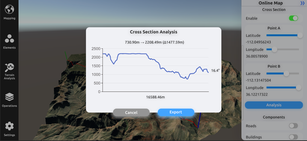
Oberfläche von 3D Mappa, die ein Querschnittsanalyse-Diagramm mit Höhenprofil über einem 3D-Geländemodell zeigt
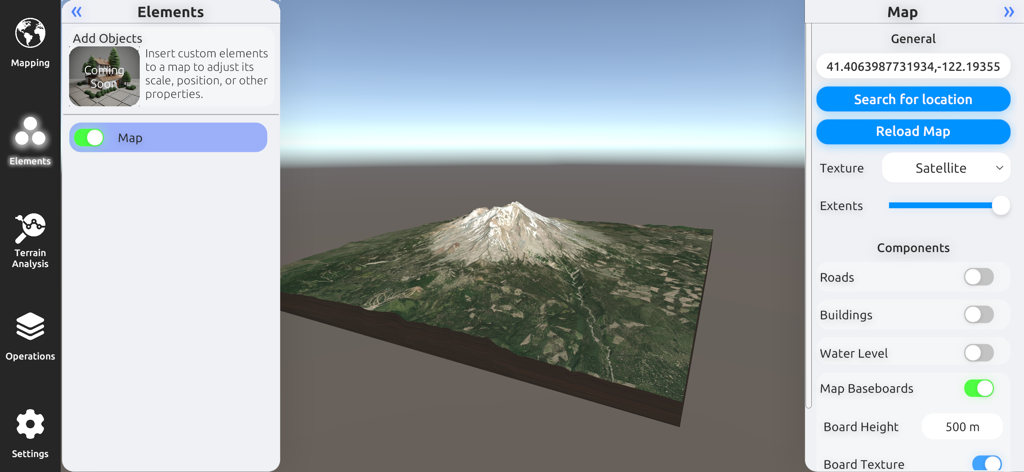
Ein 3D-Geländemodell eines Berges mit Satellitenbildern und Karteneinstellungen in der 3D Mappa GIS-App.
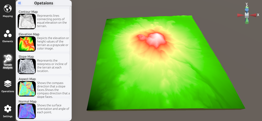
3D-Höhenmodell und Seitenleiste für Geländeanalyse in der 3D Mappa-App
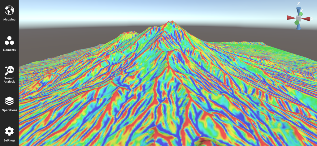
3D-Geländevisualisierung, die eine mehrfarbige Neigungskarte auf einer Berglandschaft in der 3D Mappa-App zeigt
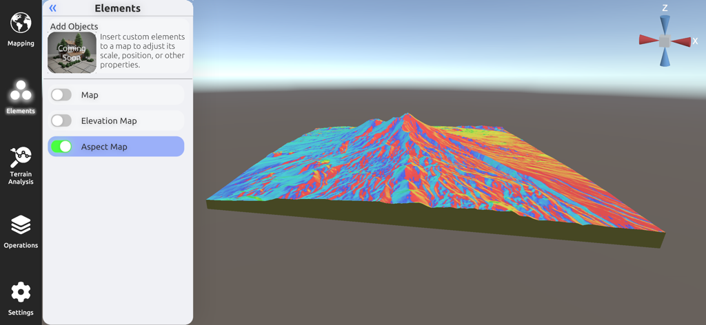
3D Mappa mobile Oberfläche, die eine detaillierte farbige 3D-Ausrichtungskarte für die Geländeanalyse anzeigt.
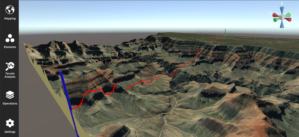
Eine professionelle 3D-Geländeanalyse- und Kartenschnittstelle, die eine raue Canyonlandschaft mit einem roten Pfad zeigt
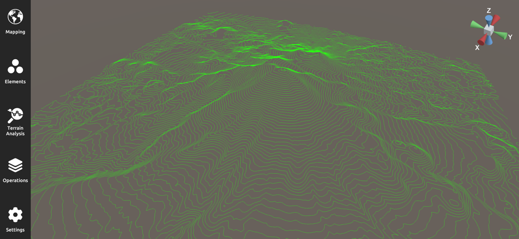
Eine 3D-topografische Karte mit grünen Höhenlinien für die GIS-Geländeanalyse
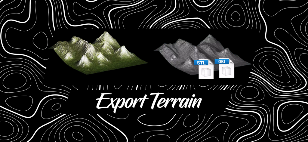
Exportieren von 3D-Geländemodellen in STL- und OBJ-Formaten mit 3D Mappa.
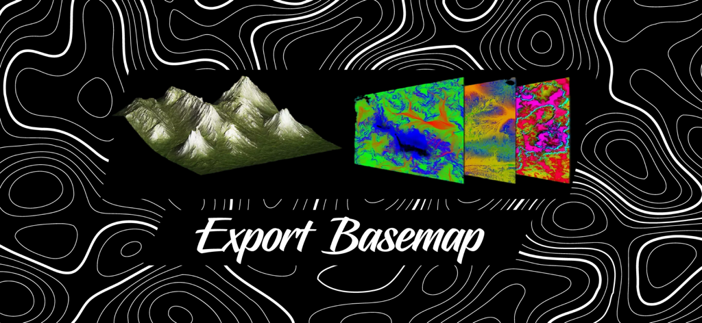
Ein 3D-Geländemodell und farbige topografische Basiskarten-Ebenen mit dem Text Export Basemap
Beschreibung
Download
Ähnliche Apps
Top-gerankte Apps in derselben Kategorie

Google Maps
Google LLC

Waze Navigation & Live Traffic
waze

AMap Global
AutoNavi Information Technology Co. Ltd.

百度地图-路线规划,出行必备
Beijing Baidu Netcom Science & Technology Co.,Ltd

Moovit: Bus & Transit Tracker
Moovit App Global LTD

Transit • Subway & Bus Times
9280-0366 Quebec inc.

ParkMobile: Park. Pay. Go.
Parkmobile USA, Inc

腾讯地图-路线规划,导航地铁打车出行
Shenzhen Tencent Computer Systems Company Limited

Île-de-France Mobilités
Ile de France Mobilites
Diese Seite ist keine offizielle Seite der App oder ihres Entwicklers, sondern eine unabhängige redaktionelle Veröffentlichung, die zu Informations- und Kommentarzwecken erstellt wurde. Sofern nicht ausdrücklich anders angegeben, sind weder die App noch ihr Entwickler mit MWM, Apple, Google Play, dem App-Herausgeber oder dem Entwickler der App verbunden, von ihnen unterstützt, gesponsert, autorisiert oder anderweitig offiziell verbunden, und nichts auf dieser Seite impliziert, dass die App unter Verwendung der Dienste von MWM entwickelt wurde. Alle Marken, Logos, Screenshots und andere Inhalte bleiben Eigentum ihrer jeweiligen Inhaber.