Diese Seite ist keine offizielle Seite der App oder ihres Entwicklers, sondern eine unabhängige redaktionelle Veröffentlichung, die zu Informations- und Kommentarzwecken erstellt wurde. Sofern nicht ausdrücklich anders angegeben, sind weder die App noch ihr Entwickler mit MWM, Apple, Google Play, dem App-Herausgeber oder dem Entwickler der App verbunden, von ihnen unterstützt, gesponsert, autorisiert oder anderweitig offiziell verbunden, und nichts auf dieser Seite impliziert, dass die App unter Verwendung der Dienste von MWM entwickelt wurde. Alle Marken, Logos, Screenshots und andere Inhalte bleiben Eigentum ihrer jeweiligen Inhaber.

Agro Measure Map Pro
Verwandeln Sie Ihr iPad oder iPhone in ein professionelles GIS-Werkzeug. Berechnen Sie Feldflächen, erstellen Sie Saatgutsrastersysteme und legen Sie Pufferzonen mit laserähnlicher Genauigkeit an, um Ihre Betriebe zu optimieren und den ROI zu maximieren.
Downloads
28K+Bewertung
Bewertungen gesamt
0Herausgeber
Kategorie
UtilitiesSprachen
10Neueste Version
8.10.5Größe
239.1 MBErstveröffentlichung
29. Jan. 2015Präzisions-Mapping für professionelles Landmanagement
Optimieren Sie Ihre Feldarbeiten mit laserähnlichen Messungen und fortschrittlichen Planungswerkzeugen für Landwirte, Ingenieure und Stadtplaner.
Professionelle Genauigkeit
Berechnen Sie Flächen und Umfänge mit Kompensation der Erdkrümmung und gewährleisten Sie so eine punktgenaue Präzision für Saatgut-, Dünger- und Zäunbudgets.
Intelligente Raster- & Pufferzonenplanung
Optimieren Sie Ihren Ertrag mit automatisierten Saatgutsrastergeneratoren und erstellen Sie präzise Sprühpufferzonen zur Reduzierung von Chemikalienabfällen und -kosten.
Die folgenden Screenshots und die Beschreibung stammen direkt aus dem offiziellen Store-Eintrag der App und sind Eigentum des Entwicklers.
App Store
Screenshots
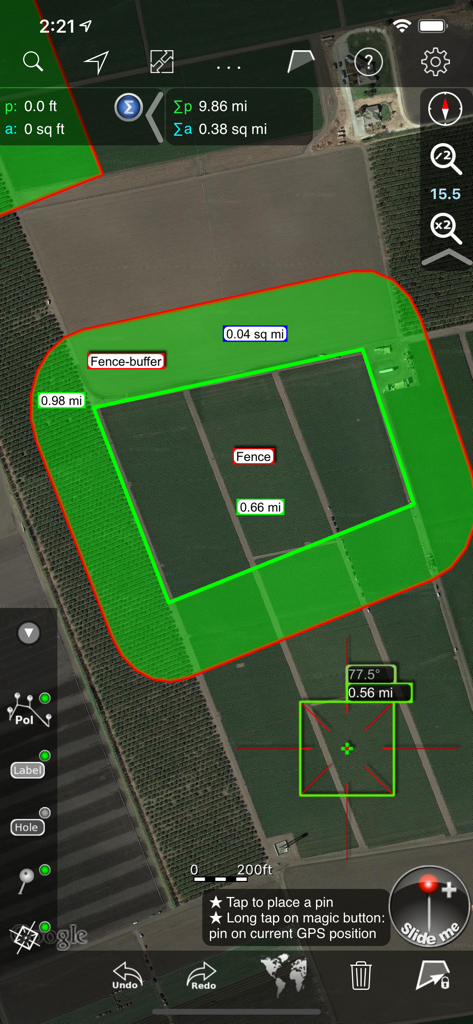
Agro Measure Map Pro-Oberfläche, die Satellitenbilder von Agrarland mit einer berechneten Zaunpufferzone und Feldmessungen anzeigt.
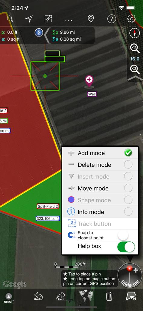
Agro Measure Map Pro-Oberfläche mit Werkzeugen zur Feldvermessung und Auswahl des Bearbeitungsmodus auf einer Satellitenkarte.
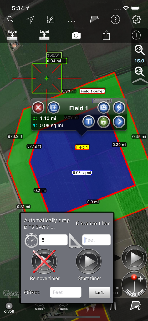
Agro Measure Map Pro-Oberfläche mit Feldvermessungs- und automatischen GPS-Tracking-Optionen.
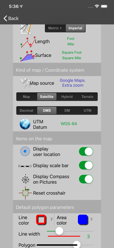
Einstellungsbildschirm von Agro Measure Map Pro, der die Konfiguration für Einheiten, Kartenquellen, Koordinatensysteme und Anzeigeeinstellungen zeigt.
Beschreibung
Download
Ähnliche Apps
Top-gerankte Apps in derselben Kategorie

Google LLC

Google Chrome
Google LLC

中国移动(手机营业厅)
China Mobile Online Services Co., Ltd.

Google Authenticator
Google LLC

CNH do Brasil
Servicos e Informacoes do Brasil

Cleanup: Phone Storage Cleaner
DEEP FLOW SOFTWARE SERVICES - FZCO

gov.br
Servicos e Informacoes do Brasil

中国电信-全国统一官方服务平台
CHINA TELECOM Corporation Ltd.

Microsoft Edge: AI Browser
Microsoft Corporation
Diese Seite ist keine offizielle Seite der App oder ihres Entwicklers, sondern eine unabhängige redaktionelle Veröffentlichung, die zu Informations- und Kommentarzwecken erstellt wurde. Sofern nicht ausdrücklich anders angegeben, sind weder die App noch ihr Entwickler mit MWM, Apple, Google Play, dem App-Herausgeber oder dem Entwickler der App verbunden, von ihnen unterstützt, gesponsert, autorisiert oder anderweitig offiziell verbunden, und nichts auf dieser Seite impliziert, dass die App unter Verwendung der Dienste von MWM entwickelt wurde. Alle Marken, Logos, Screenshots und andere Inhalte bleiben Eigentum ihrer jeweiligen Inhaber.