Diese Seite ist keine offizielle Seite der App oder ihres Entwicklers, sondern eine unabhängige redaktionelle Veröffentlichung, die zu Informations- und Kommentarzwecken erstellt wurde. Sofern nicht ausdrücklich anders angegeben, sind weder die App noch ihr Entwickler mit MWM, Apple, Google Play, dem App-Herausgeber oder dem Entwickler der App verbunden, von ihnen unterstützt, gesponsert, autorisiert oder anderweitig offiziell verbunden, und nichts auf dieser Seite impliziert, dass die App unter Verwendung der Dienste von MWM entwickelt wurde. Alle Marken, Logos, Screenshots und andere Inhalte bleiben Eigentum ihrer jeweiligen Inhaber.

BusBahnBim
Von den Straßen Wiens bis zu den Gipfeln der Alpen – meistere deine Reise mit multimodaler Echtzeit-Navigation für Züge, Straßenbahnen, Busse, Fahrräder und mehr.
Downloads
239K+Bewertung
Bewertungen gesamt
1K+Herausgeber
Kategorie
TravelSprachen
11Neueste Version
11.2.4Größe
81.4 MBErstveröffentlichung
18. Apr. 2012Alles, was du brauchst, um Österreich zu navigieren
Höre auf zu raten und fange an zu erkunden mit Österreichs genauestem multimodalen Nahverkehrsplaner, der dich wie ein Einheimischer von Punkt A nach Punkt B bringt.
Nahtlose multimodale Routenplanung
Kombiniere Züge, Straßenbahnen, Busse und Fahrräder zu einer einzigen Reiseroute für den schnellsten Weg durch jede Stadt oder jedes alpine Dorf.
Live-Genauigkeit, der du vertrauen kannst
Vermeide Reise-Stress mit Echtzeit-Updates zu Verspätungen und Baustellen, angetrieben durch offizielle österreichische Verkehrsdaten.
Die folgenden Screenshots und die Beschreibung stammen direkt aus dem offiziellen Store-Eintrag der App und sind Eigentum des Entwicklers.
App Store
Screenshots
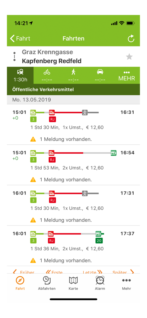
Screenshot der BusBahnBim-App, der Reiseziele und Fahrpläne des öffentlichen Nahverkehrs in Österreich zeigt
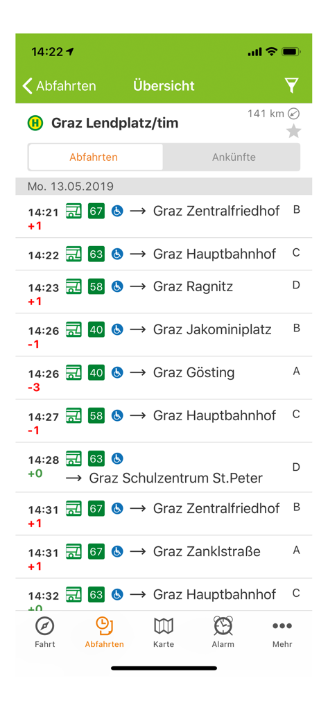
Liste der Abfahrten von Bussen in Echtzeit für Graz Lendplatz in der BusBahnBim-App
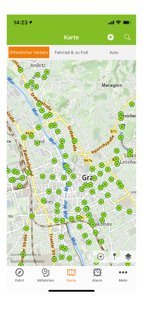
Kartenansicht der BusBahnBim-App, die Haltestellen des öffentlichen Nahverkehrs in Graz, Österreich, anzeigt
Beschreibung
Download
Ähnliche Apps
Top-gerankte Apps in derselben Kategorie

Uber - Request a ride
Uber Technologies, Inc.

Airbnb
Airbnb, Inc.

铁路12306
ACADEMY OF RAILWAY SCIENCES CO., ltd.

Booking.com: Hotels & Travel
Booking.com B.V.

Grab: Taxi Ride, Food Delivery
GRABTAXI HOLDINGS PTE. LTD.

Trip.com: Book Flights, Hotels
Trip.com Travel Singapore Pte. Ltd.

DiDi China: Ride Hailing
Didi Chuxing (Beijing) Network Platform Technology Co., Ltd

去哪儿旅行-订酒店机票火车票
Beijing Qunar Information Technology Company Limit

Bolt: Request a Ride
BOLT TECHNOLOGY OU
Diese Seite ist keine offizielle Seite der App oder ihres Entwicklers, sondern eine unabhängige redaktionelle Veröffentlichung, die zu Informations- und Kommentarzwecken erstellt wurde. Sofern nicht ausdrücklich anders angegeben, sind weder die App noch ihr Entwickler mit MWM, Apple, Google Play, dem App-Herausgeber oder dem Entwickler der App verbunden, von ihnen unterstützt, gesponsert, autorisiert oder anderweitig offiziell verbunden, und nichts auf dieser Seite impliziert, dass die App unter Verwendung der Dienste von MWM entwickelt wurde. Alle Marken, Logos, Screenshots und andere Inhalte bleiben Eigentum ihrer jeweiligen Inhaber.