Diese Seite ist keine offizielle Seite der App oder ihres Entwicklers, sondern eine unabhängige redaktionelle Veröffentlichung, die zu Informations- und Kommentarzwecken erstellt wurde. Sofern nicht ausdrücklich anders angegeben, sind weder die App noch ihr Entwickler mit MWM, Apple, Google Play, dem App-Herausgeber oder dem Entwickler der App verbunden, von ihnen unterstützt, gesponsert, autorisiert oder anderweitig offiziell verbunden, und nichts auf dieser Seite impliziert, dass die App unter Verwendung der Dienste von MWM entwickelt wurde. Alle Marken, Logos, Screenshots und andere Inhalte bleiben Eigentum ihrer jeweiligen Inhaber.

FarOut: Offline GPS Trail Maps
Navigieren Sie über 50.000 Meilen erstklassiger Wanderwege mit offiziellen, von Experten geprüften Daten, die zu 100 % offline funktionieren. Entwickelt für Fernwanderer, Bikepacker und Entdecker, die Zuverlässigkeit im rauesten Gelände verlangen.
Downloads
515K+Bewertung
Bewertungen gesamt
25K+Herausgeber
Kategorie
NavigationSprachen
4Neueste Version
15.0.3Größe
182.1 MBErstveröffentlichung
8. März 2013Entwickelt für die Reise des Fernwanderers
Mehr als nur eine Karte – Ihr unverzichtbarer digitaler Reiseführer für Fernwanderungen, Radtouren und Paddeltouren auf über 50.000 Meilen Wildnis.
100 % Offline-Navigation
Lassen Sie das Netz hinter sich. Greifen Sie auf detaillierte topografische Karten und GPS-Tracking zu, die im Flugmodus perfekt funktionieren und Batterie und Signalunabhängigkeit bewahren.
Geprüfte kritische Wegpunkte
Hören Sie auf zu raten. Greifen Sie auf zuverlässige Daten zu Wasserquellen, Wegsperrungen und Nachschubpunkten zu, die von offiziellen Wanderpartnern und geprüften Community-Experten bereitgestellt werden.
Die folgenden Screenshots und die Beschreibung stammen direkt aus dem offiziellen Store-Eintrag der App und sind Eigentum des Entwicklers.
App Store
Screenshots
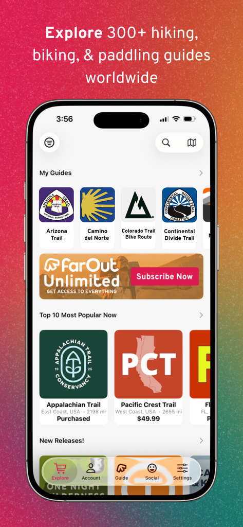
FarOut Mobile App-Oberfläche, die eine Bibliothek von Wander- und Radwanderführern wie den Appalachian Trail und den Pacific Crest Trail zeigt
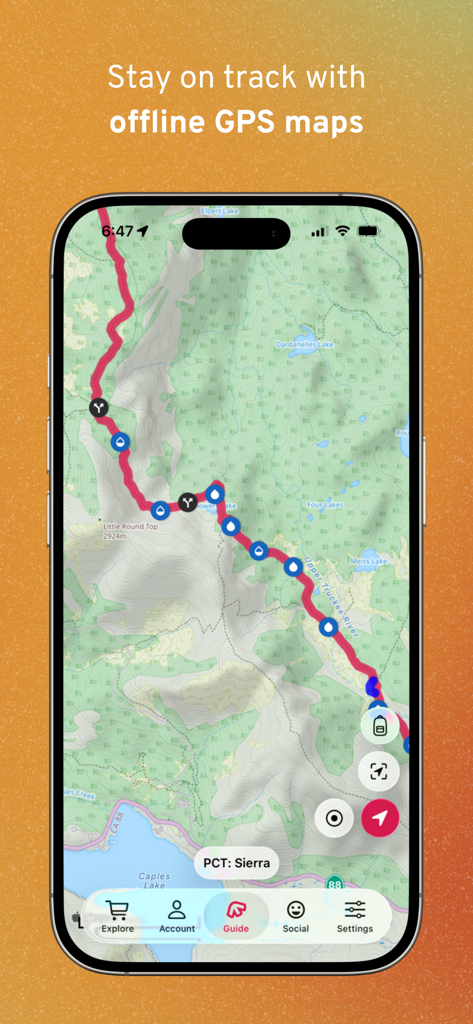
FarOut App zeigt eine Offline-Topografiekarte des PCT Sierra mit Wegpunkten für Wasser und Weggabelungen
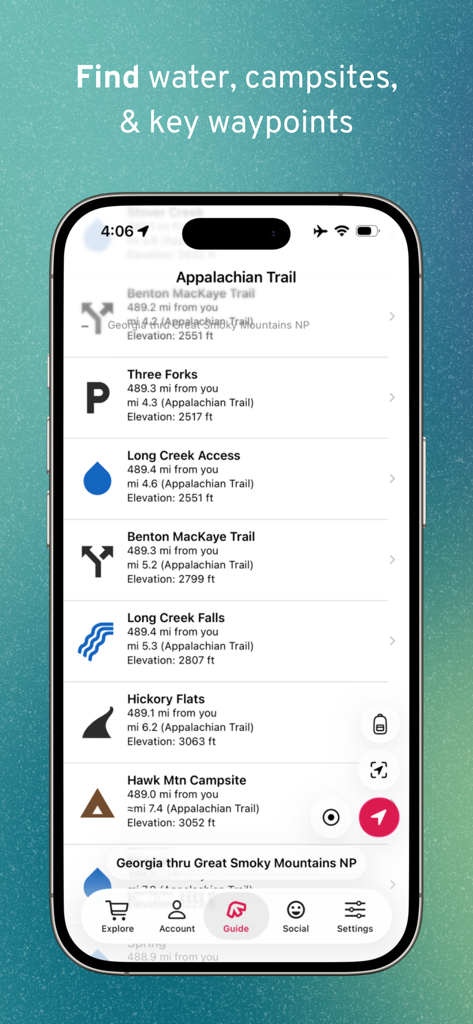
Mobilbildschirm mit Wegpunkten für Wasserquellen und Campingplätze auf dem Appalachian Trail in der FarOut App
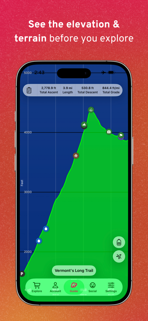
FarOut App zeigt ein Höhenprofil und eine Geländesicht für den Long Trail von Vermont
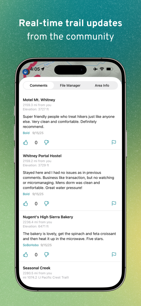
Oberfläche der FarOut App mit Echtzeit-Community-Kommentaren und Updates für Wegpunkte wie Herbergen und Bäckereien
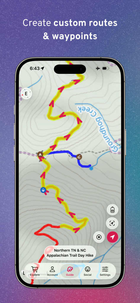
FarOut App-Bildschirm mit benutzerdefinierten Wanderrouten und Wegpunkten auf einer topografischen Wanderkarte
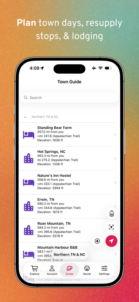
Smartphone-Anzeige des FarOut Town Guide zur Planung von Nachschubstopps und Unterkünften.
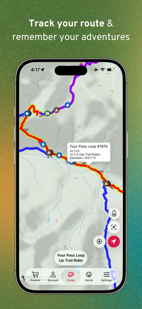
FarOut App zeigt eine topografische GPS-Wanderkarte mit Höhenangaben und Wegpunkten für Fernwanderungen

Ein Wander-Check-in-Post auf einer topografischen Wanderkarte in der FarOut Mobile App
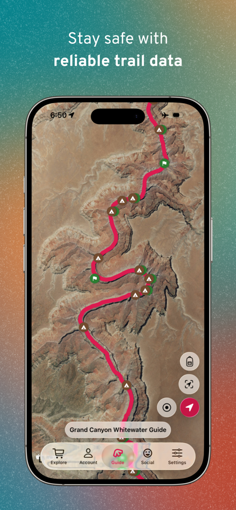
Satellitenkarte des Grand Canyon Whitewater Guide in der FarOut Wandernavigations-App.
Beschreibung
Download
Ähnliche Apps
Apps mit ähnlichen Funktionen und Nutzererfahrung

AllTrails: Hike, Bike & Run
AllTrails, Inc.

Pedometer++
Cross Forward Consulting, LLC

Organic Maps: Offline Map
Organic Maps OU

Gaia GPS: Mobile Trail Maps
Trailbehind, INC.

Offline hiking maps: Mapy.com
Seznam.cz a.s.

Hiking Map Poland
Mapa Turystyczna sp. z o.o.

MapOut
Valnova GmbH

Norgeskart
Norgeskart AS

GPX viewer - map
Lucas den Otter
Diese Seite ist keine offizielle Seite der App oder ihres Entwicklers, sondern eine unabhängige redaktionelle Veröffentlichung, die zu Informations- und Kommentarzwecken erstellt wurde. Sofern nicht ausdrücklich anders angegeben, sind weder die App noch ihr Entwickler mit MWM, Apple, Google Play, dem App-Herausgeber oder dem Entwickler der App verbunden, von ihnen unterstützt, gesponsert, autorisiert oder anderweitig offiziell verbunden, und nichts auf dieser Seite impliziert, dass die App unter Verwendung der Dienste von MWM entwickelt wurde. Alle Marken, Logos, Screenshots und andere Inhalte bleiben Eigentum ihrer jeweiligen Inhaber.