Diese Seite ist keine offizielle Seite der App oder ihres Entwicklers, sondern eine unabhängige redaktionelle Veröffentlichung, die zu Informations- und Kommentarzwecken erstellt wurde. Sofern nicht ausdrücklich anders angegeben, sind weder die App noch ihr Entwickler mit MWM, Apple, Google Play, dem App-Herausgeber oder dem Entwickler der App verbunden, von ihnen unterstützt, gesponsert, autorisiert oder anderweitig offiziell verbunden, und nichts auf dieser Seite impliziert, dass die App unter Verwendung der Dienste von MWM entwickelt wurde. Alle Marken, Logos, Screenshots und andere Inhalte bleiben Eigentum ihrer jeweiligen Inhaber.

FltPlan Go
Synchronisieren Sie nahtlos Ihre Flugpläne, NavLogs und georeferenzierten Karten direkt von FltPlan.com. Erleben Sie eine umfassende Suite von Karten, Wetter-Overlays und Avionik-Integrationen, die für den sicherheitsbewussten Piloten entwickelt wurde.
Downloads
154K+Bewertung
Bewertungen gesamt
500Herausgeber
Kategorie
NavigationSprachen
2Neueste Version
5.0.32Größe
180.0 MBErstveröffentlichung
28. Sept. 2013Professionelle Cockpit-Intelligenz für ernsthafte Piloten
Synchronisieren Sie nahtlos Ihre Flugpläne von FltPlan.com auf Ihr iPad. Greifen Sie auf wesentliche Offline-Karten, Echtzeitwetter und integrierten Avionik-Support zu, um sicherzustellen, dass jede Mission präzise ausgeführt wird.
Nahtlose Synchronisierung & Offline-Zugriff
Erstellen Sie Pläne auf FltPlan.com und synchronisieren Sie sie sofort. Laden Sie NavLogs und Karten für die zuverlässige, 100%ige Offline-Nutzung während des Fluges herunter.
Totale Situationswahrnehmung
Überlagern Sie georeferenzierte Anflugkarten, METARs und ADS-B-Verkehr auf interaktiven beweglichen Karten, um dem Wetter und Ihrer Route immer einen Schritt voraus zu sein.
Die folgenden Screenshots und die Beschreibung stammen direkt aus dem offiziellen Store-Eintrag der App und sind Eigentum des Entwicklers.
App Store
Screenshots
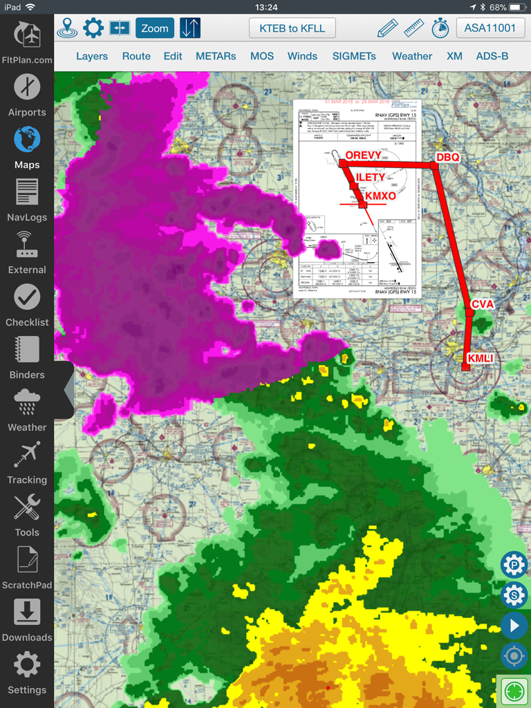
FltPlan Go iPad App-Oberfläche mit einer beweglichen Karte, die Flugrouten-Wetterradar-Overlays und eine Anflugkarte anzeigt
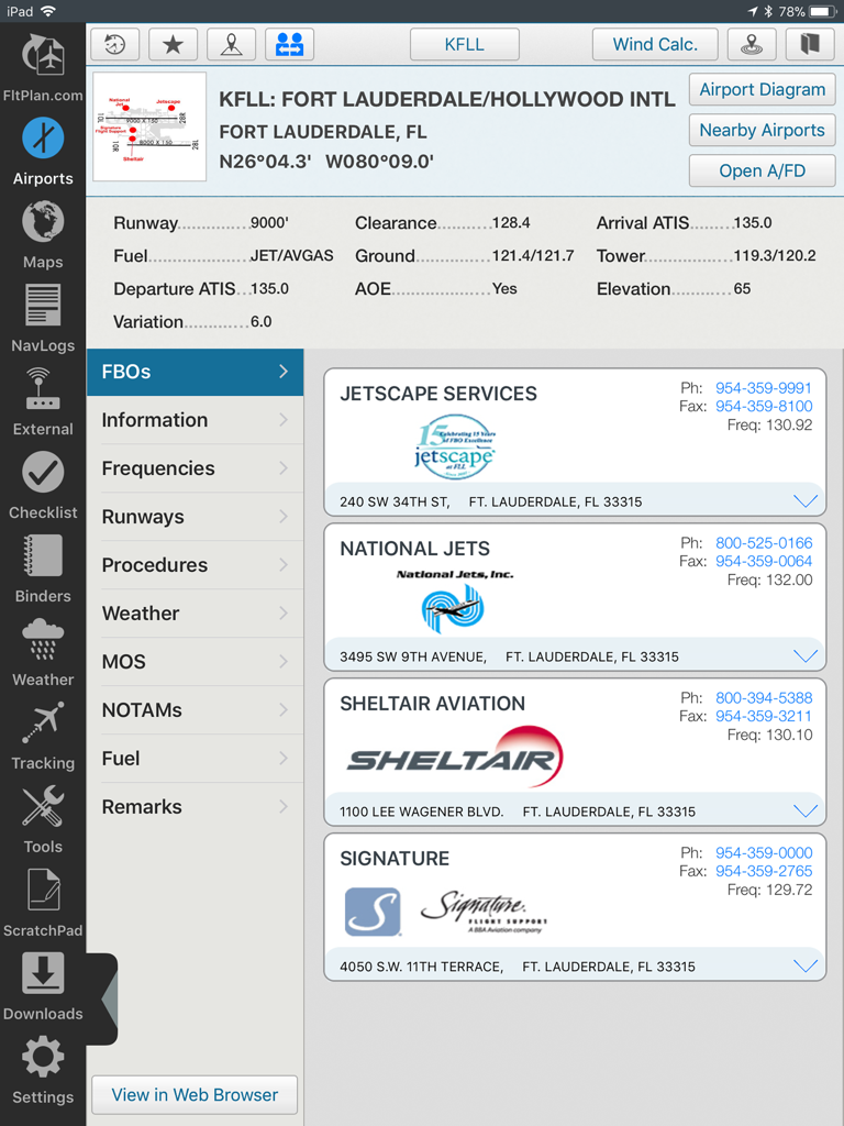
FltPlan Go iPad-Oberfläche mit Flughafeninformationen und FBO-Diensten für KFLL Fort Lauderdale
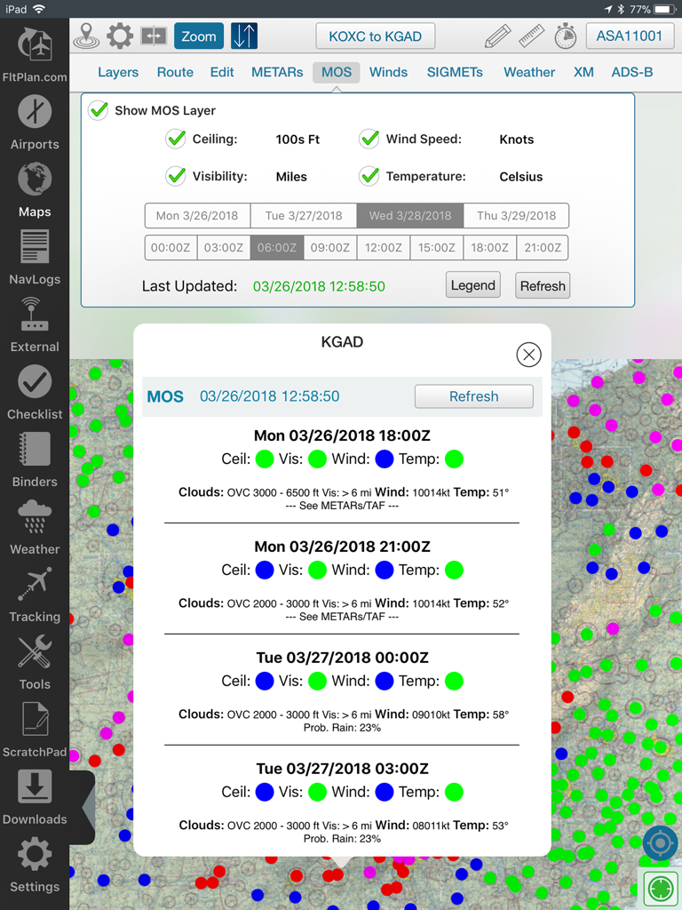
FltPlan Go iPad-Anwendung, die MOS-Wettervorhersagedaten auf einer Flugkarte anzeigt
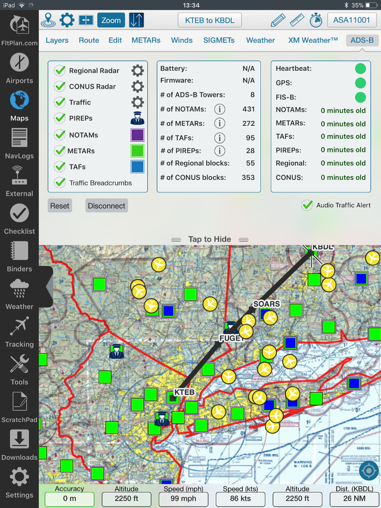
FltPlan Go iPad-Oberfläche mit einer beweglichen Karte, die Flugbahn, Wetter-Overlays und ADS-B-Statusdaten anzeigt.
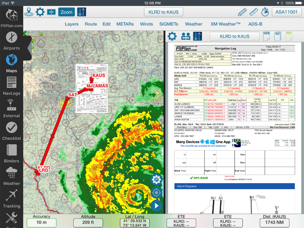
Geteilter Bildschirm von FltPlan Go auf dem iPad, der eine bewegliche Karte mit Wetterradar und ein Navigationsprotokoll anzeigt
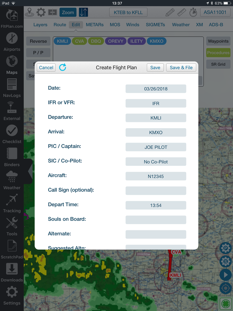
Ein Pilot füllt ein Flugplanformular in der FltPlan Go App über einer Navigationskarte mit Wetter-Overlays aus.
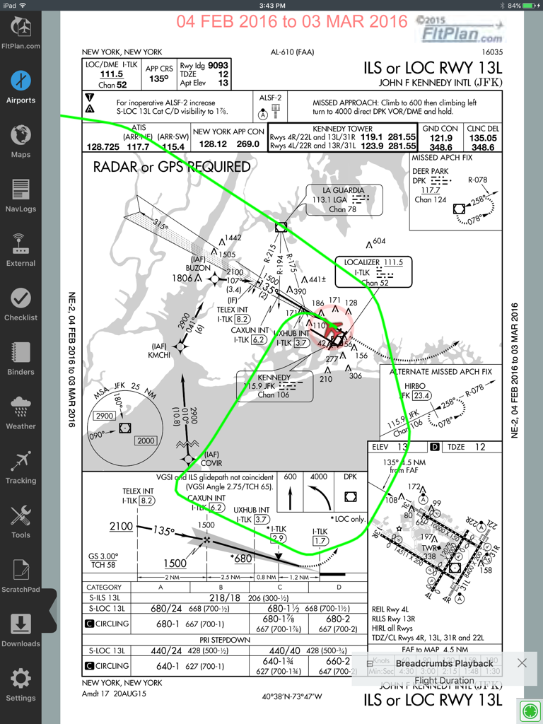
FltPlan Go iPad App zeigt eine JFK-Zielflugplatz-ILS-Anflugkarte mit einer grünen Breadcrumb-Flugpfad-Überlagerung an
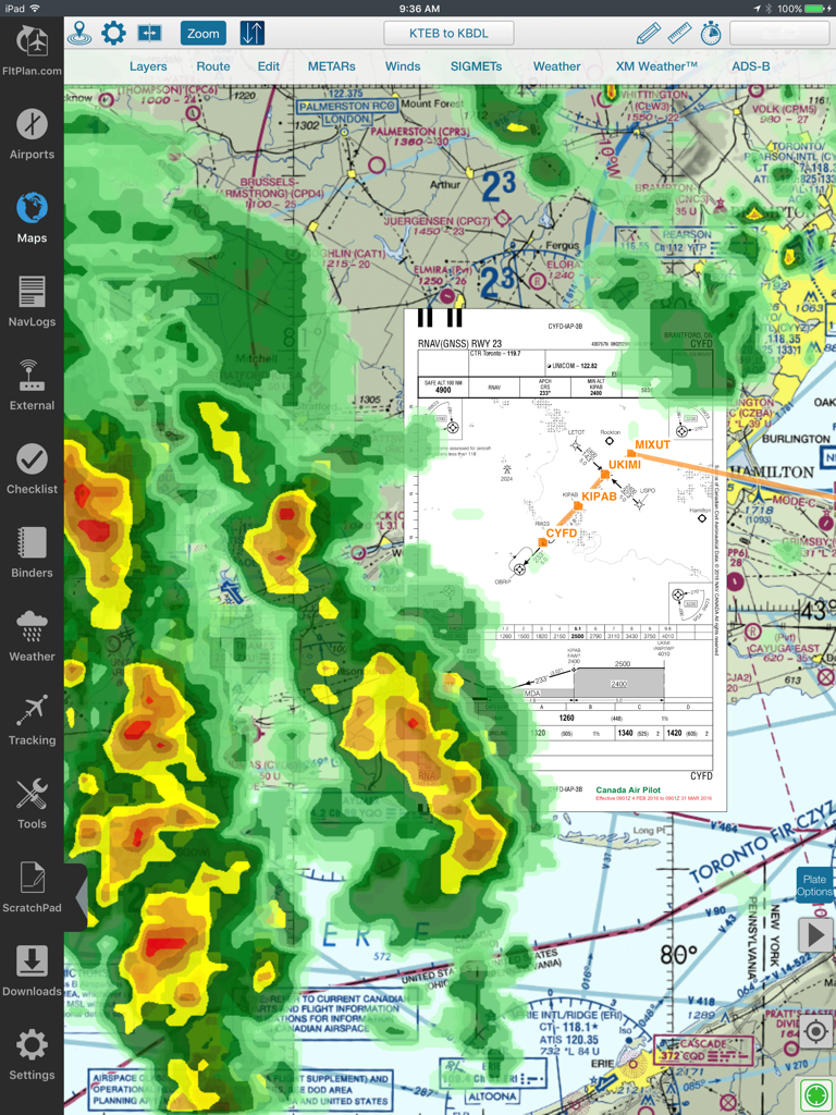
Luftfahrt-Bewegungskarte in FltPlan Go mit Wetterradar und Anflugkarten-Überlagerung
Beschreibung
Download
Ähnliche Apps
Top-gerankte Apps in derselben Kategorie

Google Maps
Google LLC

Waze Navigation & Live Traffic
waze

AMap Global
AutoNavi Information Technology Co. Ltd.

百度地图-路线规划,出行必备
Beijing Baidu Netcom Science & Technology Co.,Ltd

Moovit: Bus & Transit Tracker
Moovit App Global LTD

Transit • Subway & Bus Times
9280-0366 Quebec inc.

ParkMobile: Park. Pay. Go.
Parkmobile USA, Inc

腾讯地图-路线规划,导航地铁打车出行
Shenzhen Tencent Computer Systems Company Limited

Île-de-France Mobilités
Ile de France Mobilites
Diese Seite ist keine offizielle Seite der App oder ihres Entwicklers, sondern eine unabhängige redaktionelle Veröffentlichung, die zu Informations- und Kommentarzwecken erstellt wurde. Sofern nicht ausdrücklich anders angegeben, sind weder die App noch ihr Entwickler mit MWM, Apple, Google Play, dem App-Herausgeber oder dem Entwickler der App verbunden, von ihnen unterstützt, gesponsert, autorisiert oder anderweitig offiziell verbunden, und nichts auf dieser Seite impliziert, dass die App unter Verwendung der Dienste von MWM entwickelt wurde. Alle Marken, Logos, Screenshots und andere Inhalte bleiben Eigentum ihrer jeweiligen Inhaber.