Diese Seite ist keine offizielle Seite der App oder ihres Entwicklers, sondern eine unabhängige redaktionelle Veröffentlichung, die zu Informations- und Kommentarzwecken erstellt wurde. Sofern nicht ausdrücklich anders angegeben, sind weder die App noch ihr Entwickler mit MWM, Apple, Google Play, dem App-Herausgeber oder dem Entwickler der App verbunden, von ihnen unterstützt, gesponsert, autorisiert oder anderweitig offiziell verbunden, und nichts auf dieser Seite impliziert, dass die App unter Verwendung der Dienste von MWM entwickelt wurde. Alle Marken, Logos, Screenshots und andere Inhalte bleiben Eigentum ihrer jeweiligen Inhaber.

FlyQ+ EFB
Maximieren Sie Ihr Situationsbewusstsein mit 4D-Vorhersagewetter, 3D-synthetischer Sicht und branchenführendem GPS-Spoofing-Schutz. Entwickelt für Piloten, die ein leistungsstarkes und dennoch intuitives Cockpit-Erlebnis mit größeren Schriftarten und weniger Taps verlangen.
Downloads
116K+Bewertung
Bewertungen gesamt
1K+Herausgeber
Kategorie
NavigationSprachen
1Neueste Version
7.1.1Größe
494.2 MBErstveröffentlichung
24. Okt. 2014Fliegen Sie sicherer mit absoluter Klarheit
Das EFB, das speziell für die Cockpit-Umgebung entwickelt wurde, mit hochlesbaren Schnittstellen und fortschrittlichen Sicherheitstools, die die Arbeitsbelastung minimieren und das Situationsbewusstsein maximieren.
Hochsichtbare Benutzeroberfläche
Entwickelt für die Silver Wings-Demografie mit größeren Schriftarten und einem optimierten Layout, das die Bildschirmberührungen bei turbulenten Flugbedingungen minimiert.
3D synthetische Sicht & AR
Erleben Sie 'Röntgenblick' durch Wolken oder bei Nacht mit Augmented Reality und 3D-Geländeanzeigen, die die Art und Weise, wie Sie die Welt um sich herum sehen, verändern.
Die folgenden Screenshots und die Beschreibung stammen direkt aus dem offiziellen Store-Eintrag der App und sind Eigentum des Entwicklers.
App Store
Screenshots
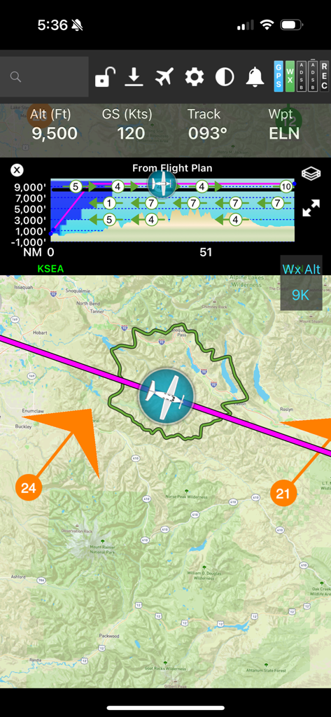
FlyQ plus EFB Flugnavigationsbildschirm, der eine bewegte Karte mit einem Gleitring und einem vertikalen Profil zeigt
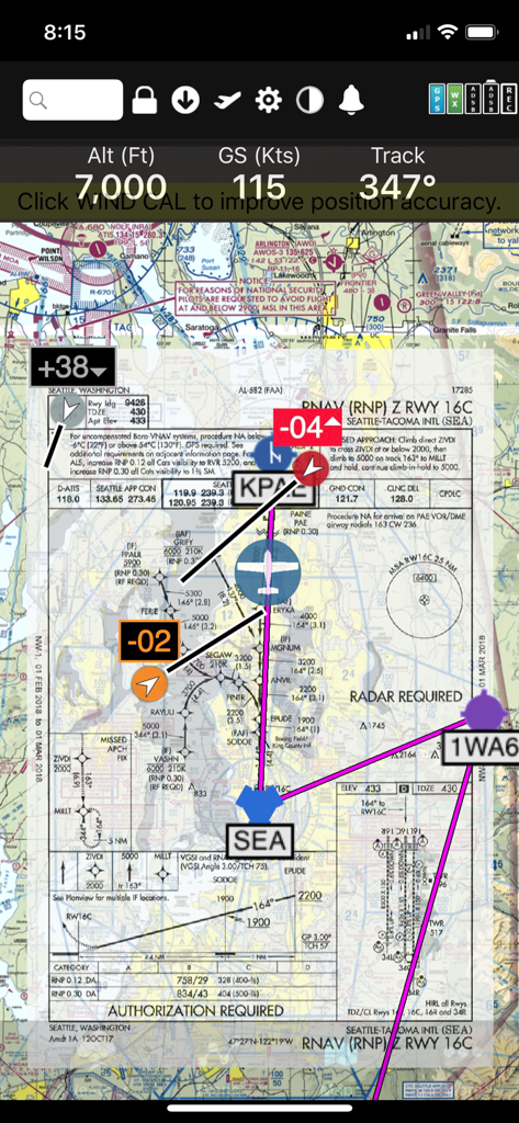
FlyQ+ EFB App-Oberfläche, die eine RNAV-Anflugplatte über einer digitalen Sektorkarte mit Flugtelemetrie zeigt
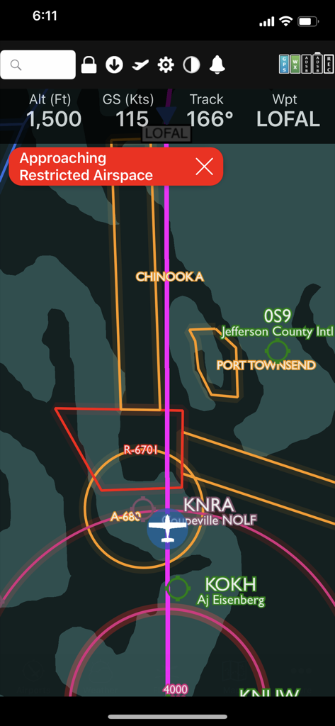
FlyQ plus App-Oberfläche, die eine Warnung vor eingeschränktem Luftraum auf einer digitalen Flugkarte zeigt.
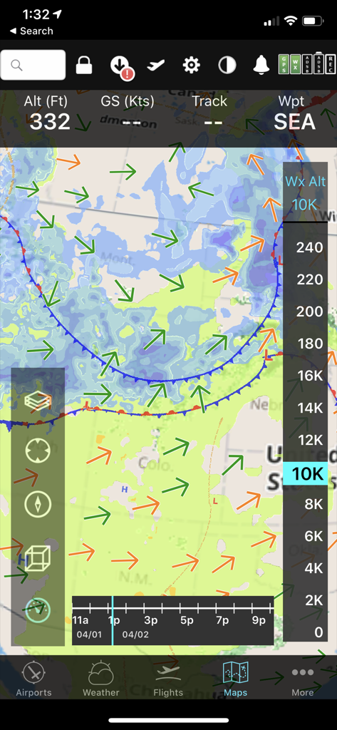
FlyQ+ EFB mobile Benutzeroberfläche, die eine prädiktive Wetterkarte mit Windvektoren und Höhenschieberegler für die Flugplanung anzeigt.
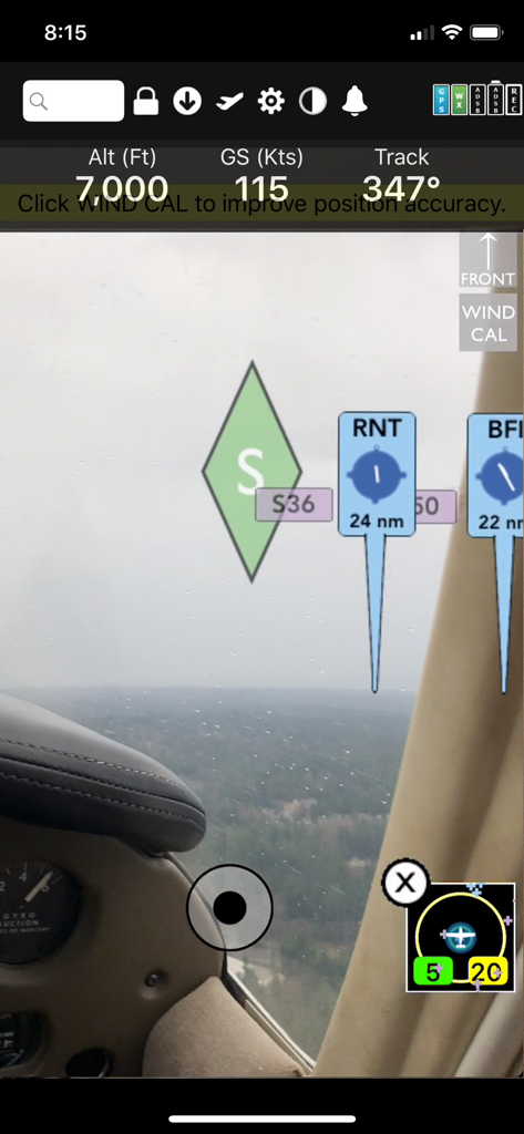
FlyQ Plus EFB Augmented Reality Navigationsdisplay, das Flughöhe, Bodengeschwindigkeit und Flughafenkennzeichnungen über einer Echtzeit-Cockpitansicht zeigt
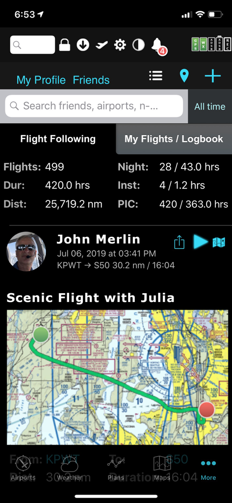
FlyQ plus EFB App, die Flugstatistiken des Piloten und eine szenische Flugkarte anzeigt
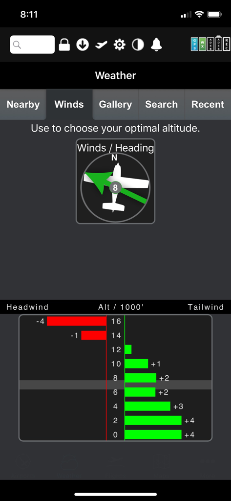
FlyQ Plus EFB grafischer Windoptimierer, der Rücken- und Gegenwinddaten nach Höhe anzeigt
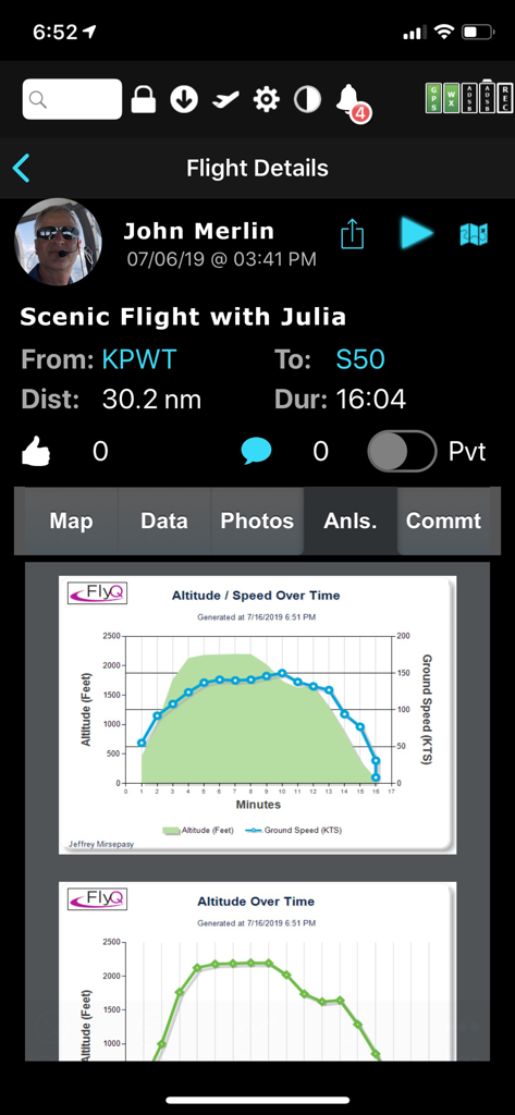
FlyQ EFB Flugdetailbildschirm, der Grafiken zur Nachfluganalyse für Höhe und Bodengeschwindigkeit anzeigt
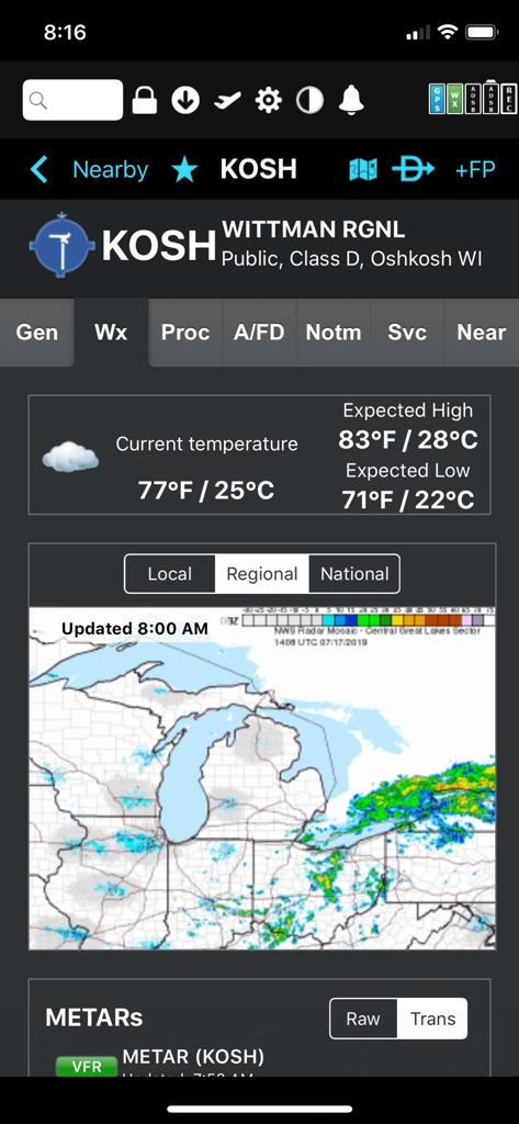
Wetteranzeige für Wittman Regional Airport mit Temperatur und regionalem Radar in der FlyQ plus EFB App
Beschreibung
Download
Ähnliche Apps
Apps mit ähnlichen Funktionen und Nutzererfahrung

Navigraph Charts
Navigraph KB

SkyDemon
Divelements Limited

Airports
Applicate Ltd

OzRunways EFB
OzRunways Pty. Ltd.

fDeck: flight instruments
Darren Yeates

Noisy Goose
Automata Solutions Ltd.

StationWeather - METAR and TAF
Oliver Puetz

Drone UAV Fly Forecast: AirMap
MONIQ TAP COMPANY LIMITED

Airmate
Myriel Aviation SA
Diese Seite ist keine offizielle Seite der App oder ihres Entwicklers, sondern eine unabhängige redaktionelle Veröffentlichung, die zu Informations- und Kommentarzwecken erstellt wurde. Sofern nicht ausdrücklich anders angegeben, sind weder die App noch ihr Entwickler mit MWM, Apple, Google Play, dem App-Herausgeber oder dem Entwickler der App verbunden, von ihnen unterstützt, gesponsert, autorisiert oder anderweitig offiziell verbunden, und nichts auf dieser Seite impliziert, dass die App unter Verwendung der Dienste von MWM entwickelt wurde. Alle Marken, Logos, Screenshots und andere Inhalte bleiben Eigentum ihrer jeweiligen Inhaber.