Diese Seite ist keine offizielle Seite der App oder ihres Entwicklers, sondern eine unabhängige redaktionelle Veröffentlichung, die zu Informations- und Kommentarzwecken erstellt wurde. Sofern nicht ausdrücklich anders angegeben, sind weder die App noch ihr Entwickler mit MWM, Apple, Google Play, dem App-Herausgeber oder dem Entwickler der App verbunden, von ihnen unterstützt, gesponsert, autorisiert oder anderweitig offiziell verbunden, und nichts auf dieser Seite impliziert, dass die App unter Verwendung der Dienste von MWM entwickelt wurde. Alle Marken, Logos, Screenshots und andere Inhalte bleiben Eigentum ihrer jeweiligen Inhaber.

GoGoEarth - Custom map source
Schalten Sie Premium-Satellitenquellen von NASA, Maxar und Nearmap frei. Von 3D-Stadtmodellen bis zur Echtzeit-Höhe – erleben Sie professionelle Kartierung und virtuelle Erkundung auf Knopfdruck.
Downloads
427K+Bewertung
Bewertungen gesamt
8K+Herausgeber
Kategorie
NavigationSprachen
2Neueste Version
3.2.3Größe
155.6 MBErstveröffentlichung
11. Mai 2022Erkunden Sie die Erde in atemberaubenden Details
Von hochauflösenden Satellitenbildern bis hin zu 3D-Architekturmodellen bietet GoGoEarth die professionellen Werkzeuge, die Sie benötigen, um die Welt aus der Handfläche zu entdecken.
Ultra-HD-Satellitenansichten
Erleben Sie die Welt mit kristallklaren Bildern von NASA und Maxar, die weit über Standardkarten hinausgehende Detailstufen bieten.
Virtueller globaler Tourismus
Reisen Sie durch über 200 Regionen mit HD-Panoramastraßenansichten und erkunden Sie realistische 3D-Modelle der berühmtesten Sehenswürdigkeiten der Welt.
Die folgenden Screenshots und die Beschreibung stammen direkt aus dem offiziellen Store-Eintrag der App und sind Eigentum des Entwicklers.
App Store
Screenshots
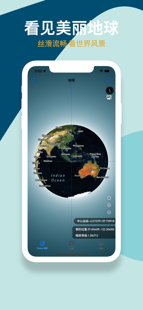
GoGoEarth App-Oberfläche, die einen 3D-Satellitenglobus mit geografischen Bezeichnungen und Koordinaten anzeigt
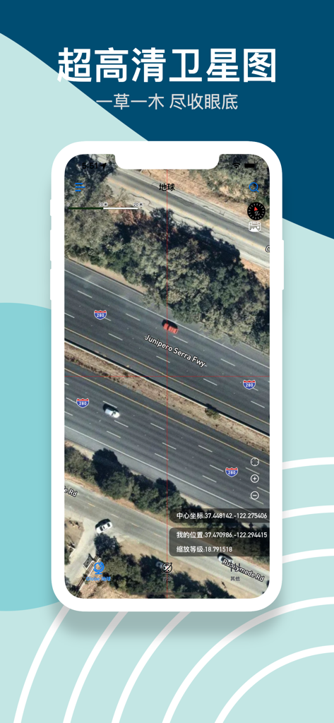
Hochauflösende Satellitenbilder einer Autobahn mit Autos und präzisen Koordinaten in der GoGoEarth-App
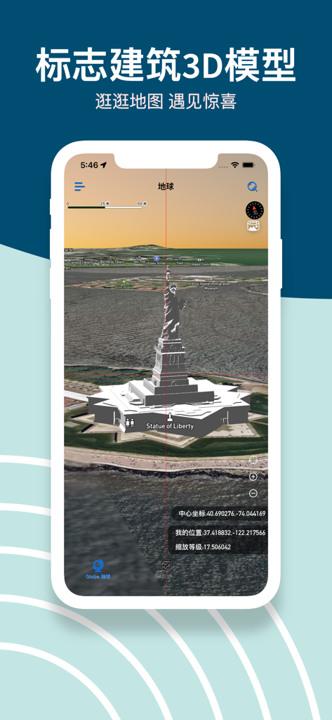
GoGoEarth App-Screenshot, der ein detailliertes 3D-Modell der Freiheitsstatue auf einer Satellitenkarte zeigt
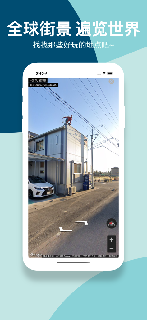
GoGoEarth App-Screenshot, der eine hochauflösende Panorama-Straßenansicht eines Viertels in Japan anzeigt
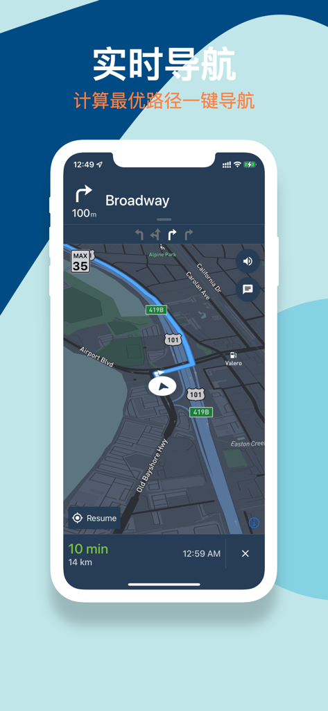
GoGoEarth mobile App zeigt eine Echtzeit-Navigationsschnittstelle mit einer Route auf einer dunklen Satellitenkarte.
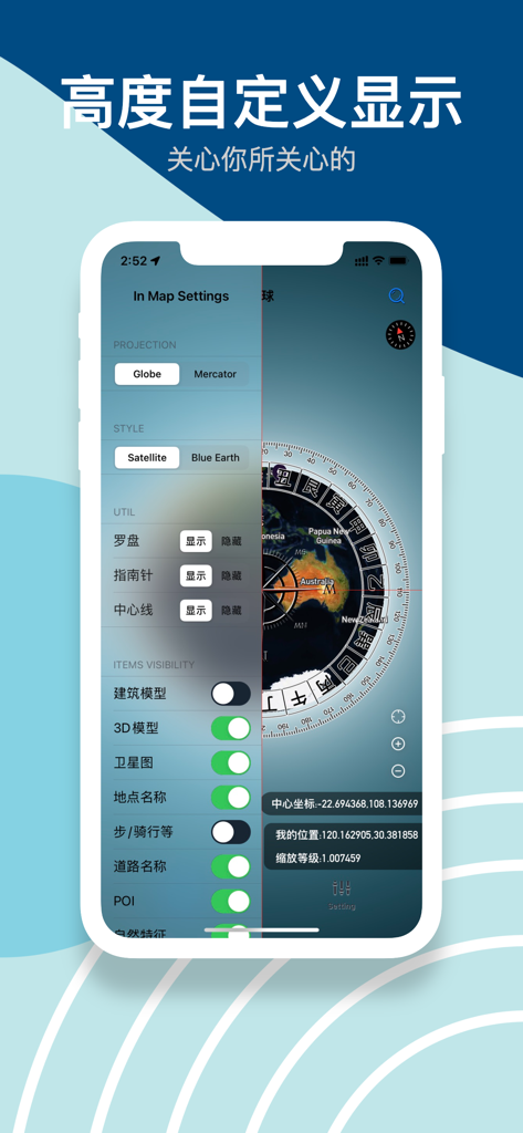
GoGoEarth App-Oberfläche, die Karteneinstellungen für Projektionsstile und die Sichtbarkeit von 3D-Modellen anzeigt
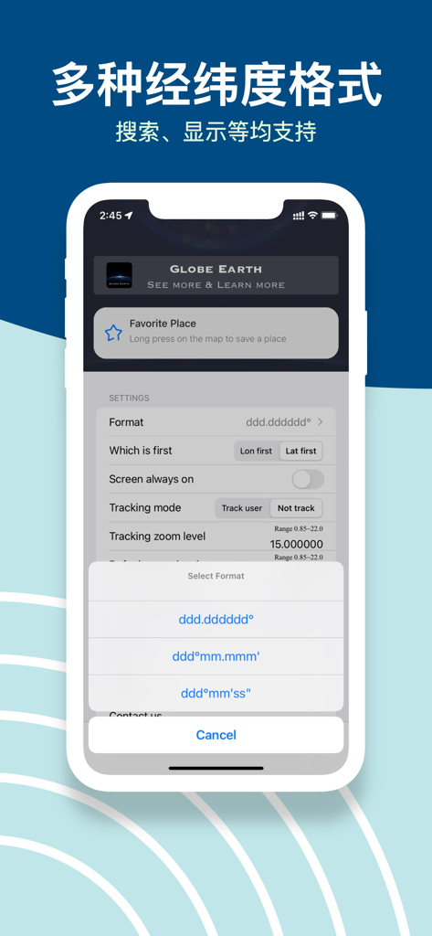
GoGoEarth App-Oberfläche, die mehrere Optionen für Breiten- und Längengradkoordinatenformate in den Einstellungen anzeigt.
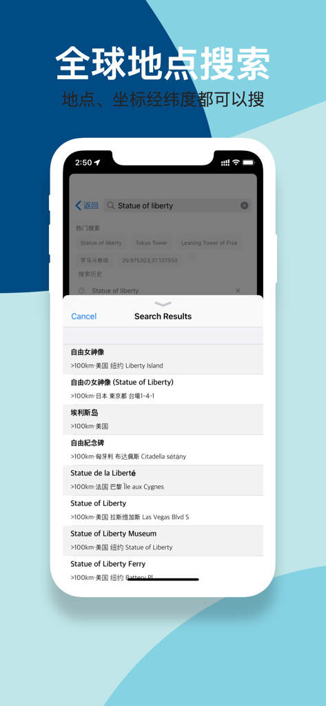
GoGoEarth App-Oberfläche, die globale Suchergebnisse für die Freiheitsstatue mit Breiten- und Längengradunterstützung anzeigt.
Beschreibung
Download
Ähnliche Apps
Apps mit ähnlichen Funktionen und Nutzererfahrung

Earth Maps
FOXPOI PTE. LTD.

Satellite Map - Live Earth
慧敏 赵

Satellite Map - Earth View
ANKAGIS YAZILIM ANONIM SIRKETI

World Street 3D Panoramic Map
Beijing Zhiyue Information Technology Co., Ltd

3D Earth Map Street View
Naik Ur Rehman

Globe 3D Earth: World Map Live
Shams Alam

Street View - street view maps
国辉 满

卫星地图-高清地球探索世界
方元 朱

高清3D街景地图-地图软件手机全景版
Suzhou Caichuang Network Technology Co., Ltd.
Diese Seite ist keine offizielle Seite der App oder ihres Entwicklers, sondern eine unabhängige redaktionelle Veröffentlichung, die zu Informations- und Kommentarzwecken erstellt wurde. Sofern nicht ausdrücklich anders angegeben, sind weder die App noch ihr Entwickler mit MWM, Apple, Google Play, dem App-Herausgeber oder dem Entwickler der App verbunden, von ihnen unterstützt, gesponsert, autorisiert oder anderweitig offiziell verbunden, und nichts auf dieser Seite impliziert, dass die App unter Verwendung der Dienste von MWM entwickelt wurde. Alle Marken, Logos, Screenshots und andere Inhalte bleiben Eigentum ihrer jeweiligen Inhaber.