Diese Seite ist keine offizielle Seite der App oder ihres Entwicklers, sondern eine unabhängige redaktionelle Veröffentlichung, die zu Informations- und Kommentarzwecken erstellt wurde. Sofern nicht ausdrücklich anders angegeben, sind weder die App noch ihr Entwickler mit MWM, Apple, Google Play, dem App-Herausgeber oder dem Entwickler der App verbunden, von ihnen unterstützt, gesponsert, autorisiert oder anderweitig offiziell verbunden, und nichts auf dieser Seite impliziert, dass die App unter Verwendung der Dienste von MWM entwickelt wurde. Alle Marken, Logos, Screenshots und andere Inhalte bleiben Eigentum ihrer jeweiligen Inhaber.

GPS Map Camera Geotag Location
Betten Sie automatisch GPS-Koordinaten, Zeitstempel und technische Daten wie Höhe und Magnetfelder in jedes Foto ein. Das ultimative Werkzeug für Immobilien, Feldberichte und professionelle Reisedokumentationen.
Downloads
44K+Bewertung
Bewertungen gesamt
1K+Herausgeber
Kategorie
NavigationSprachen
1Neueste Version
2.0Größe
70.2 MBErstveröffentlichung
15. Aug. 2023Erfassen Sie jedes Detail mit Präzision
Automatisieren Sie Ihre Dokumentation mit professionellen Stempeln, die GPS-Koordinaten, Echtzeit-Wetter- und Umgebungsdaten enthalten.
Professionelle Standortverifizierung
Fügen Sie sofort verifizierte GPS-Koordinaten und Adressen hinzu, um unbestreitbare Arbeitsnachweise für Immobilien und Feldberichte zu liefern.
All-in-One-Datenstempel
Überlagern Sie Höhe, Kompassrichtung, Magnetfelder und lokale Wetterbedingungen direkt auf Ihre Aufnahmen.
Die folgenden Screenshots und die Beschreibung stammen direkt aus dem offiziellen Store-Eintrag der App und sind Eigentum des Entwicklers.
App Store
Screenshots
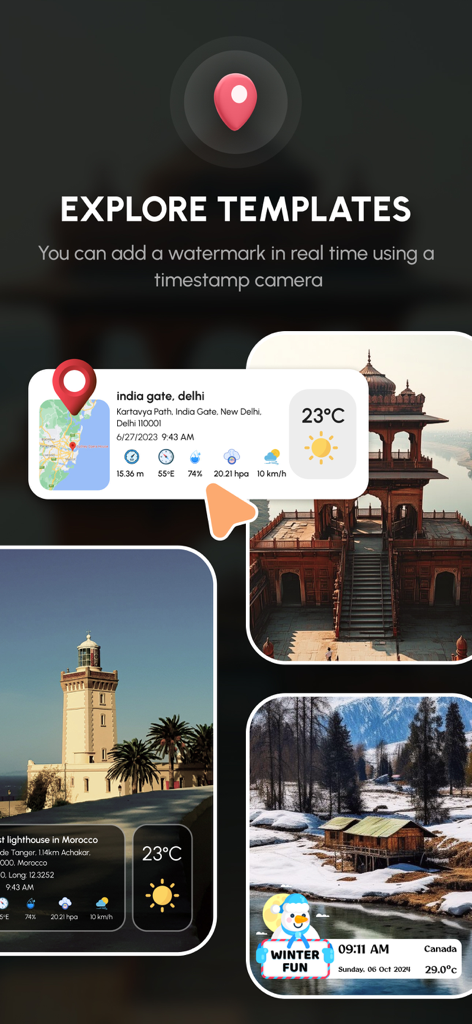
GPS-Kamera-App mit Fotovorlagen mit Überlagerung von Standort- und Wetterdaten
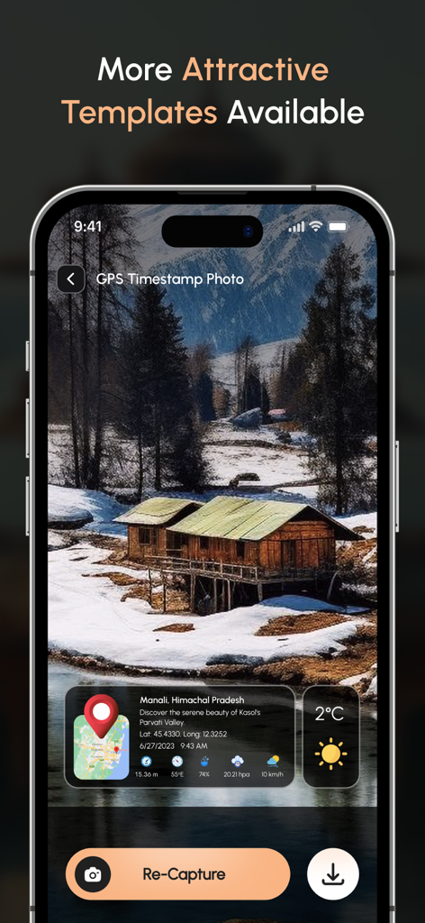
GPS-Kamerasoftware, die ein Geotag-Foto mit Standortkoordinaten und Wetterinformationen anzeigt
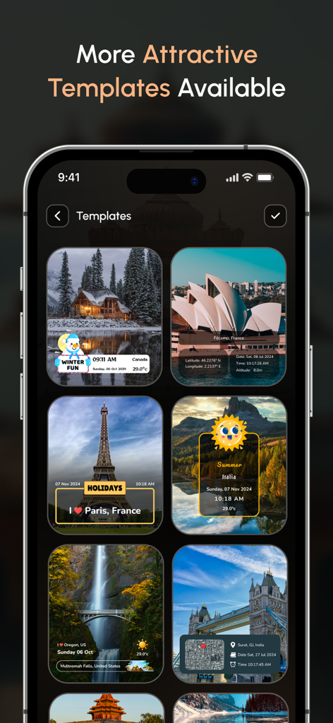
Oberfläche der mobilen App, die mehrere Geotag-Fotovorlagen mit Standort-, Datums- und Wetterstempeln anzeigt.
Oberfläche der GPS Map Camera App, die Live-Datum, -Uhrzeit und Standortstempelfunktionen für die professionelle Fotodokumentation anzeigt
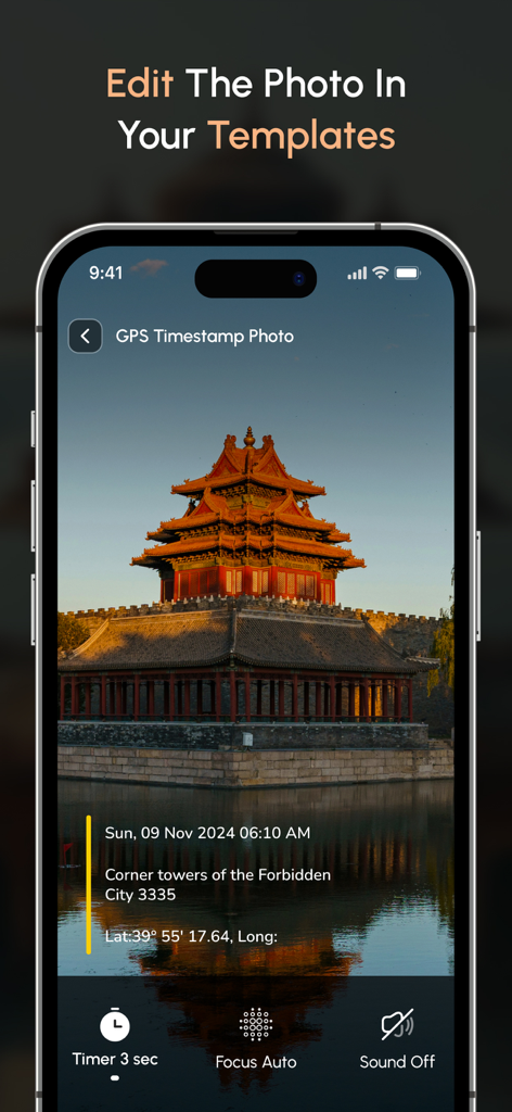
Smartphone-Bildschirm mit einem Geotag-Foto mit Datums- und Standortdetails
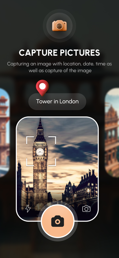
Oberfläche der GPS Map Camera App, die ein Foto von Big Ben mit einem Geotag-Standort-Pin aufnimmt
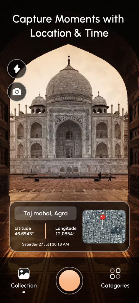
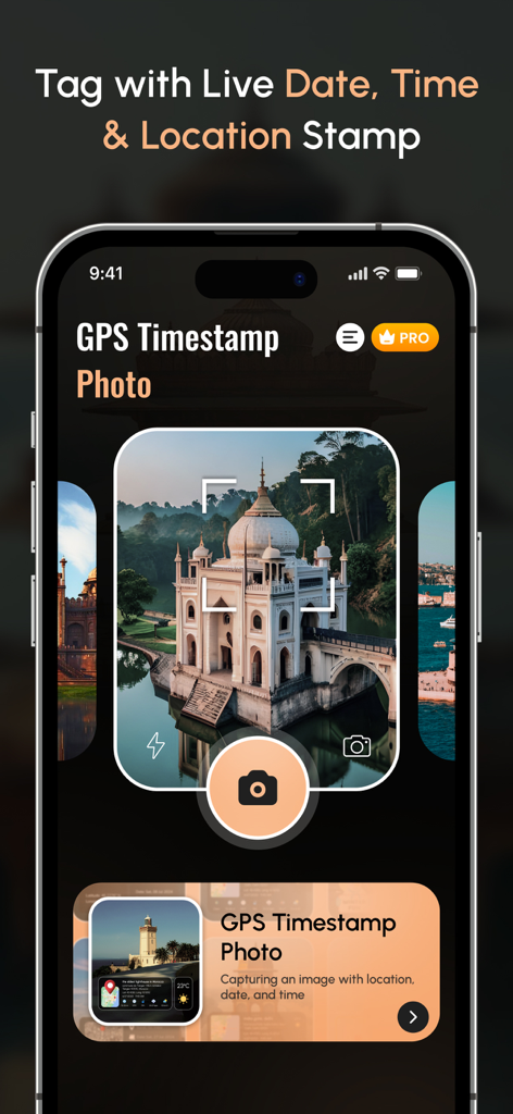
Oberfläche der mobilen App, die ein Geotag-Foto des Taj Mahal mit Längen- und Breitengrad sowie Kartenüberlagerung zeigt
Beschreibung
Download
Ähnliche Apps
Top-gerankte Apps in derselben Kategorie

Google Maps
Google LLC

Waze Navigation & Live Traffic
waze

AMap Global
AutoNavi Information Technology Co. Ltd.

百度地图-路线规划,出行必备
Beijing Baidu Netcom Science & Technology Co.,Ltd

Moovit: Bus & Transit Tracker
Moovit App Global LTD

Transit • Subway & Bus Times
9280-0366 Quebec inc.

ParkMobile: Park. Pay. Go.
Parkmobile USA, Inc

腾讯地图-路线规划,导航地铁打车出行
Shenzhen Tencent Computer Systems Company Limited

Île-de-France Mobilités
Ile de France Mobilites
Diese Seite ist keine offizielle Seite der App oder ihres Entwicklers, sondern eine unabhängige redaktionelle Veröffentlichung, die zu Informations- und Kommentarzwecken erstellt wurde. Sofern nicht ausdrücklich anders angegeben, sind weder die App noch ihr Entwickler mit MWM, Apple, Google Play, dem App-Herausgeber oder dem Entwickler der App verbunden, von ihnen unterstützt, gesponsert, autorisiert oder anderweitig offiziell verbunden, und nichts auf dieser Seite impliziert, dass die App unter Verwendung der Dienste von MWM entwickelt wurde. Alle Marken, Logos, Screenshots und andere Inhalte bleiben Eigentum ihrer jeweiligen Inhaber.