Diese Seite ist keine offizielle Seite der App oder ihres Entwicklers, sondern eine unabhängige redaktionelle Veröffentlichung, die zu Informations- und Kommentarzwecken erstellt wurde. Sofern nicht ausdrücklich anders angegeben, sind weder die App noch ihr Entwickler mit MWM, Apple, Google Play, dem App-Herausgeber oder dem Entwickler der App verbunden, von ihnen unterstützt, gesponsert, autorisiert oder anderweitig offiziell verbunden, und nichts auf dieser Seite impliziert, dass die App unter Verwendung der Dienste von MWM entwickelt wurde. Alle Marken, Logos, Screenshots und andere Inhalte bleiben Eigentum ihrer jeweiligen Inhaber.

iHikeGPS : Classic Topo Maps
Verwandeln Sie Ihr Gerät in einen Hochleistungs-GPS-Empfänger mit detaillierten USGS- und USFS-Kartenblättern. Kein Abonnement, keine Werbung und kein Mobilfunksignal erforderlich – nur professionelle Navigation für den ernsthaften Entdecker.
Downloads
158K+Bewertung
Bewertungen gesamt
200Herausgeber
Kategorie
NavigationSprachen
1Neueste Version
9.6.6Größe
12.1 MBErstveröffentlichung
12. Feb. 2010Gebaut für den ernsthaften Wildnis-Entdecker
Navigieren Sie mit professionellen USGS-Topografiekarten, fortschrittlicher Track-Aufzeichnung und einem datenschutzfreundlichen Erlebnis – alles zu einem Festpreis ohne Abonnements.
Klassische Raster-Topo-Kartenblätter
Greifen Sie auf hochauflösende Karten des USGS und des US Forest Service zu, die versteckte Quellen, alte Straßen und Geländedetails zeigen, die bei modernen Vektorkarten oft fehlen.
Keine Abonnements, jemals
Ein niedriger Preis gibt Ihnen lebenslangen Zugriff. Wir respektieren Ihre Privatsphäre ohne Anmeldungen, ohne Werbung und ohne wiederkehrende Gebühren, damit Ihre Werkzeuge im Feld funktionieren.
Die folgenden Screenshots und die Beschreibung stammen direkt aus dem offiziellen Store-Eintrag der App und sind Eigentum des Entwicklers.
App Store
Screenshots
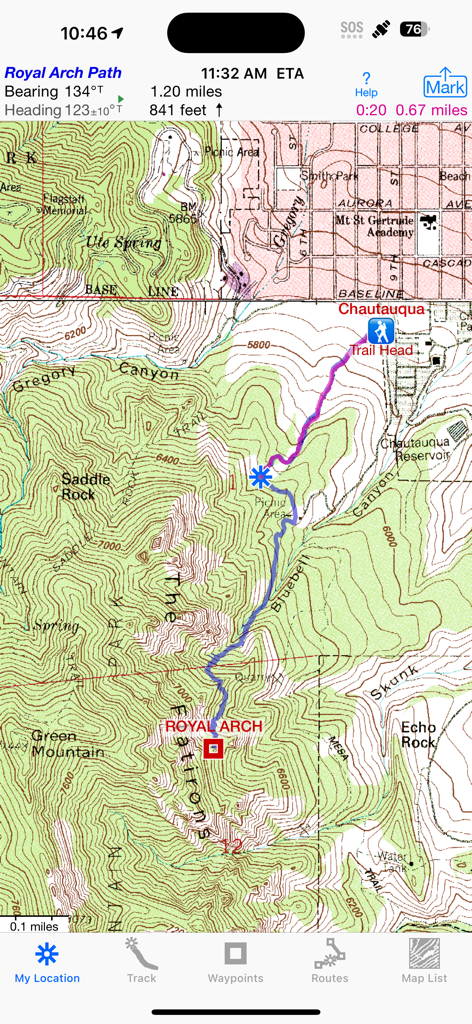
iHikeGPS App-Bildschirm mit einer klassischen USGS-Topografiemap mit einem aufgezeichneten Wanderweg und Navigationsdaten
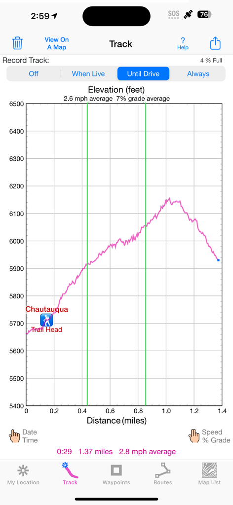
Höhenprofil-Diagramm eines Wanderwegs, das die Höhe in Fuß und die Entfernung in Meilen zeigt
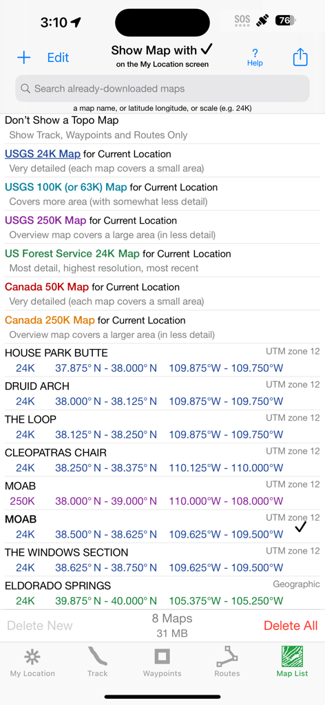
Kartenlistenscreen in iHikeGPS, der USGS- und Kanada-Topo-Kartenoptionen und technische Koordinaten für heruntergeladene Karten anzeigt.
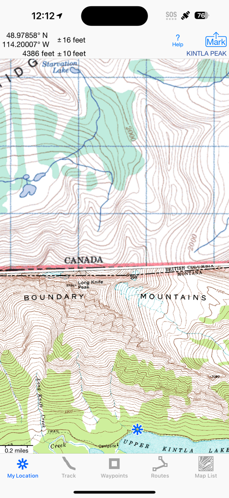
iHikeGPS App-Oberfläche mit einer detaillierten klassischen topografischen Karte der US-Kanada-Grenze mit Höhen- und GPS-Koordinaten
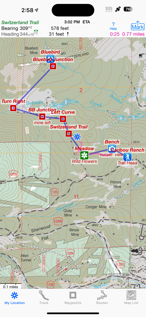
iHikeGPS App-Oberfläche mit einer klassischen topografischen Karte mit einer Wanderroute und Wegpunkten.
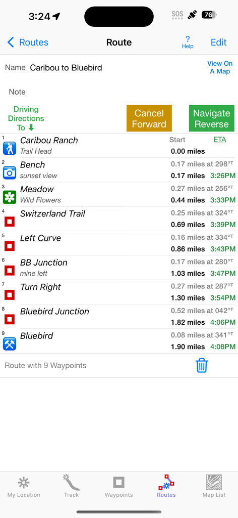
iHikeGPS Routenbildschirm mit einer Liste von Wegpunkten mit Entfernungen und geschätzten Ankunftszeiten
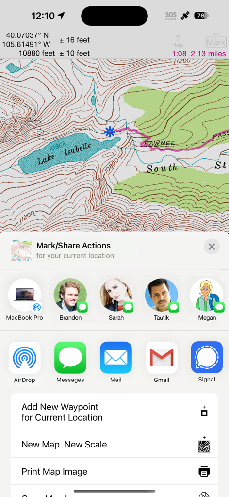
iHikeGPS App-Oberfläche mit einer detaillierten Topo-Karte des Lake Isabelle mit Freigabe- und Wegpunktoptionen.

Detailliertes Höhenprofil einer Wanderroute, das Entfernung und Höhengewinn für den Blue Lake Trail in iHikeGPS zeigt
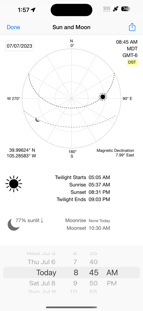
iHikeGPS App-Bildschirm mit Anzeige von Sonnen- und Mondpositionen, Sonnenauf- und -untergangszeiten, Koordinaten und magnetischer Deklination.
Beschreibung
Download
Ähnliche Apps
Top-gerankte Apps in derselben Kategorie

Google Maps
Google LLC

Waze Navigation & Live Traffic
waze

AMap Global
AutoNavi Information Technology Co. Ltd.

百度地图-路线规划,出行必备
Beijing Baidu Netcom Science & Technology Co.,Ltd

Moovit: Bus & Transit Tracker
Moovit App Global LTD

Transit • Subway & Bus Times
9280-0366 Quebec inc.

ParkMobile: Park. Pay. Go.
Parkmobile USA, Inc

腾讯地图-路线规划,导航地铁打车出行
Shenzhen Tencent Computer Systems Company Limited

Île-de-France Mobilités
Ile de France Mobilites
Diese Seite ist keine offizielle Seite der App oder ihres Entwicklers, sondern eine unabhängige redaktionelle Veröffentlichung, die zu Informations- und Kommentarzwecken erstellt wurde. Sofern nicht ausdrücklich anders angegeben, sind weder die App noch ihr Entwickler mit MWM, Apple, Google Play, dem App-Herausgeber oder dem Entwickler der App verbunden, von ihnen unterstützt, gesponsert, autorisiert oder anderweitig offiziell verbunden, und nichts auf dieser Seite impliziert, dass die App unter Verwendung der Dienste von MWM entwickelt wurde. Alle Marken, Logos, Screenshots und andere Inhalte bleiben Eigentum ihrer jeweiligen Inhaber.