Diese Seite ist keine offizielle Seite der App oder ihres Entwicklers, sondern eine unabhängige redaktionelle Veröffentlichung, die zu Informations- und Kommentarzwecken erstellt wurde. Sofern nicht ausdrücklich anders angegeben, sind weder die App noch ihr Entwickler mit MWM, Apple, Google Play, dem App-Herausgeber oder dem Entwickler der App verbunden, von ihnen unterstützt, gesponsert, autorisiert oder anderweitig offiziell verbunden, und nichts auf dieser Seite impliziert, dass die App unter Verwendung der Dienste von MWM entwickelt wurde. Alle Marken, Logos, Screenshots und andere Inhalte bleiben Eigentum ihrer jeweiligen Inhaber.

iHikeGPS NZ : LINZ Topo Maps
Das ultimative Werkzeug für ernsthafte Wanderer und Reisende. Erleben Sie hochleistungsfähige GPS-Navigation mit 100%iger Offline-Zuverlässigkeit. Ein Preis, keine Abonnements, keine Werbung – nur reine Sicherheit im Hinterland.
Downloads
153K+Bewertung
Bewertungen gesamt
100Herausgeber
Kategorie
NavigationSprachen
1Neueste Version
9.6.6Größe
10.6 MBErstveröffentlichung
22. Dez. 2011Entwickelt für den ernsthaften Entdecker
Erhalten Sie professionelle Navigation mit offiziellen LINZ Topo-Karten und fortschrittlichen GPS-Funktionen, die für Neuseelands abgelegenstes Hinterland entwickelt wurden – alles ohne Abonnements oder Tracking.
Offizielle Offline-Topo-Karten
Greifen Sie überall auf hochauflösende LINZ 50K-Karten zu. Navigieren Sie nahtlos in tiefen Tälern und abgelegenen Gebieten ohne Mobilfunksignal und ohne teure Roaming-Gebühren.
Präzise Routeninformationen
Bleiben Sie sicher mit Echtzeit-Ankunftszeiten, Höhenprofilen und Abweichungsalarmen. Verfolgen Sie Ihren Fortschritt mit Hochleistungs-GPS-Werkzeugen, die Ihr iPhone zu einem lebensrettenden Gerät machen.
Die folgenden Screenshots und die Beschreibung stammen direkt aus dem offiziellen Store-Eintrag der App und sind Eigentum des Entwicklers.
App Store
Screenshots
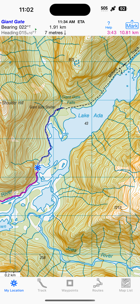
Topografische Kartenanzeige des Milford Track in der Nähe des Lake Ada in der iHikeGPS NZ App
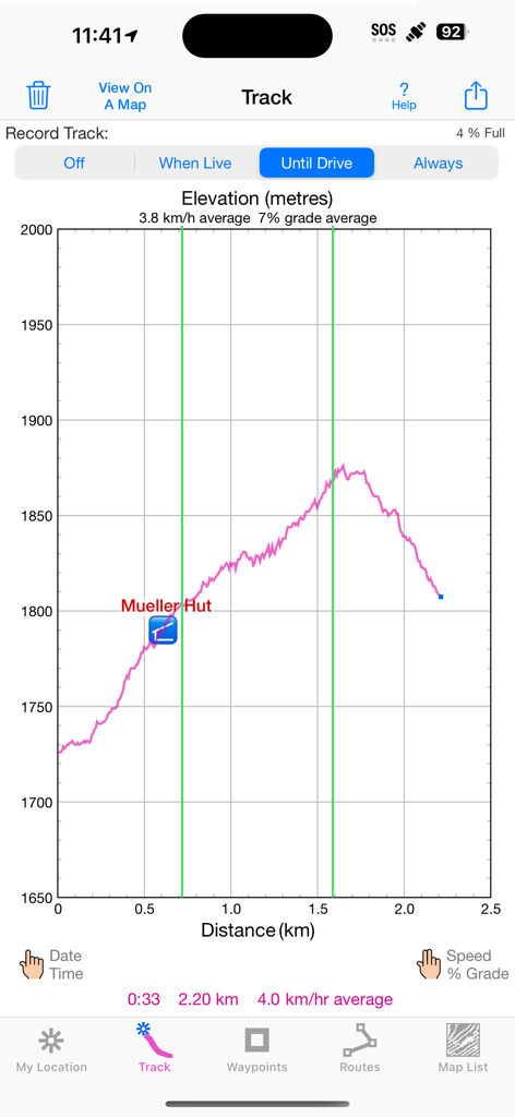
Höhenprofil-Graph, der Distanz und Höhe für eine Wanderung zur Mueller Hut in der iHikeGPS NZ App zeigt.
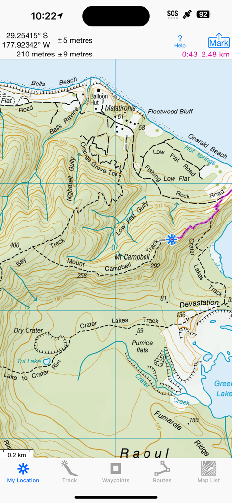
Eine detaillierte LINZ-Topografische-Kartenoberfläche in der iHikeGPS NZ App, die Wanderwege und GPS-Koordinaten anzeigt.
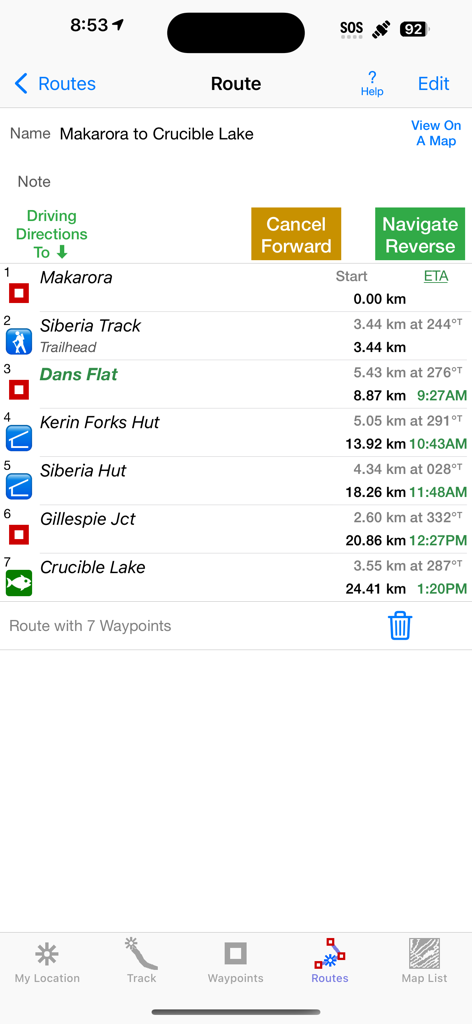
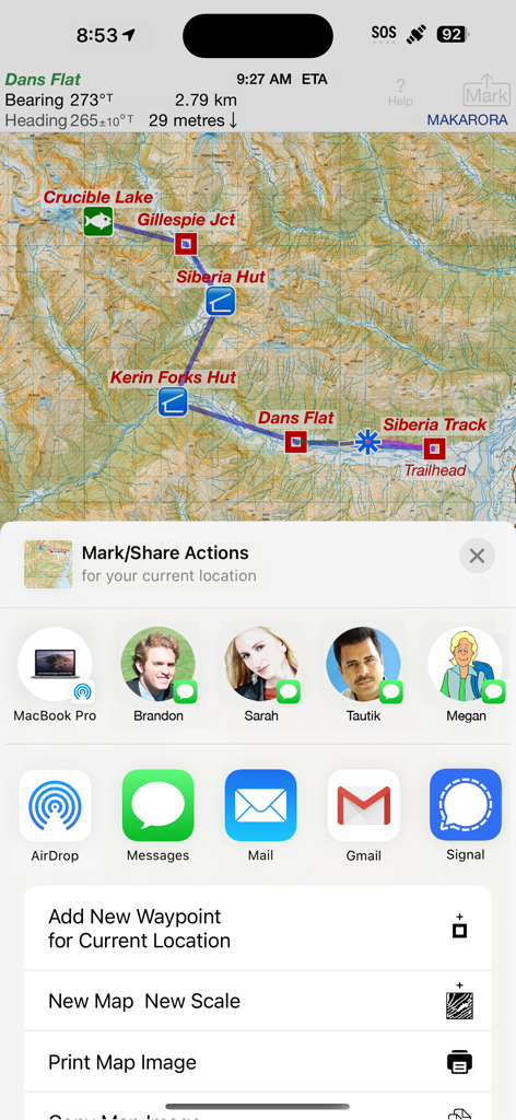
iHikeGPS NZ App Routenbildschirm mit Wegpunkten und geschätzten Ankunftszeiten für eine Wanderung von Makarora nach Crucible Lake
Topografische Karte von Neuseeland in iHikeGPS NZ mit geöffnetem Menü für Teilen und Markieren.
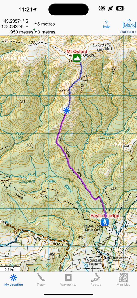
Eine detaillierte neuseeländische topografische Karte, die eine Wanderroute in der Nähe des Mt Oxford zeigt
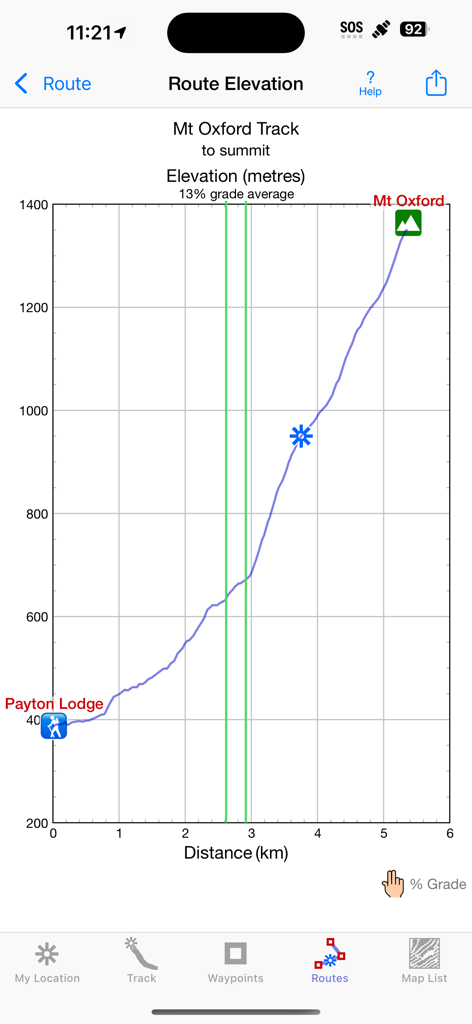
Höhenprofil-Graph für den Mt Oxford Track in der iHikeGPS NZ App
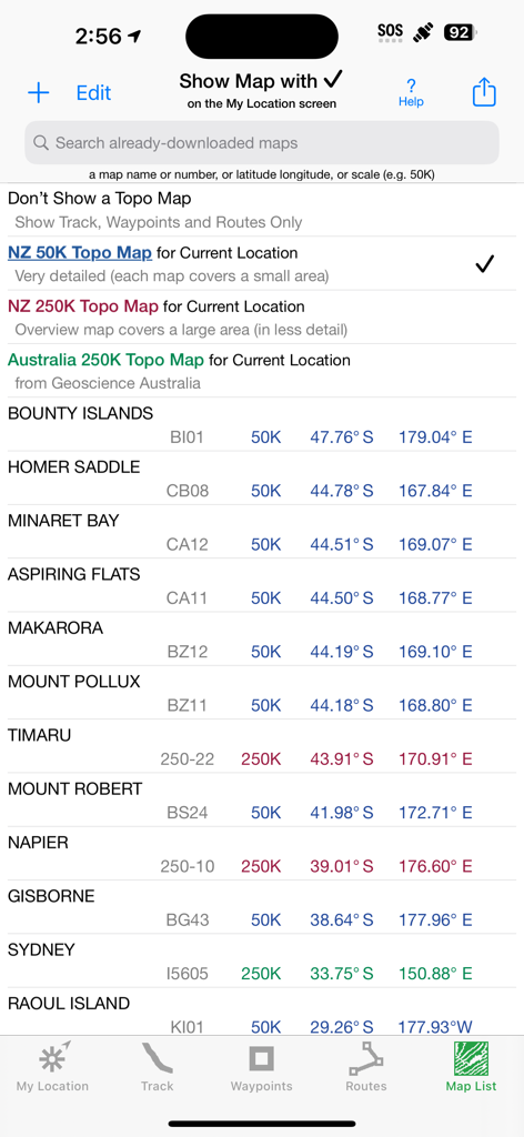
Bildschirm mit einer Liste offizieller neuseeländischer und australischer topografischer Karten mit ihren Maßstäben und Koordinaten in der iHikeGPS NZ App.
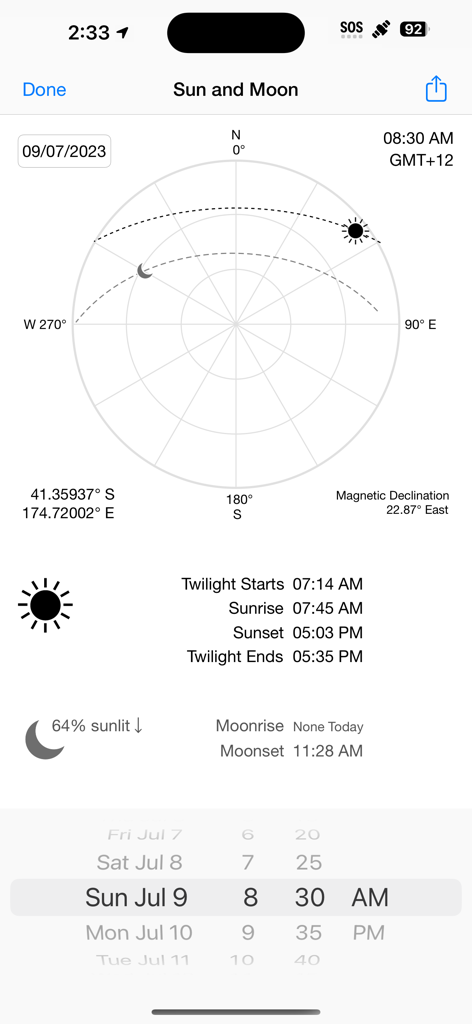
Ein Screenshot der iHikeGPS NZ App, der Sonnen- und Mondpositionen, Auf- und Untergangszeiten sowie die magnetische Deklination anzeigt.
Beschreibung
Download
Ähnliche Apps
Top-gerankte Apps in derselben Kategorie

Google Maps
Google LLC

Waze Navigation & Live Traffic
waze

AMap Global
AutoNavi Information Technology Co. Ltd.

百度地图-路线规划,出行必备
Beijing Baidu Netcom Science & Technology Co.,Ltd

Moovit: Bus & Transit Tracker
Moovit App Global LTD

Transit • Subway & Bus Times
9280-0366 Quebec inc.

ParkMobile: Park. Pay. Go.
Parkmobile USA, Inc

腾讯地图-路线规划,导航地铁打车出行
Shenzhen Tencent Computer Systems Company Limited

Île-de-France Mobilités
Ile de France Mobilites
Diese Seite ist keine offizielle Seite der App oder ihres Entwicklers, sondern eine unabhängige redaktionelle Veröffentlichung, die zu Informations- und Kommentarzwecken erstellt wurde. Sofern nicht ausdrücklich anders angegeben, sind weder die App noch ihr Entwickler mit MWM, Apple, Google Play, dem App-Herausgeber oder dem Entwickler der App verbunden, von ihnen unterstützt, gesponsert, autorisiert oder anderweitig offiziell verbunden, und nichts auf dieser Seite impliziert, dass die App unter Verwendung der Dienste von MWM entwickelt wurde. Alle Marken, Logos, Screenshots und andere Inhalte bleiben Eigentum ihrer jeweiligen Inhaber.