Diese Seite ist keine offizielle Seite der App oder ihres Entwicklers, sondern eine unabhängige redaktionelle Veröffentlichung, die zu Informations- und Kommentarzwecken erstellt wurde. Sofern nicht ausdrücklich anders angegeben, sind weder die App noch ihr Entwickler mit MWM, Apple, Google Play, dem App-Herausgeber oder dem Entwickler der App verbunden, von ihnen unterstützt, gesponsert, autorisiert oder anderweitig offiziell verbunden, und nichts auf dieser Seite impliziert, dass die App unter Verwendung der Dienste von MWM entwickelt wurde. Alle Marken, Logos, Screenshots und andere Inhalte bleiben Eigentum ihrer jeweiligen Inhaber.

Memory-Map for All
Beherrschen Sie die Wildnis und die Wellen mit professionellen USGS-Topografiekarten und NOAA-Seekarten. Entwickelt für ernsthafte Entdecker, ist dies Ihr Präzisionswerkzeug für die Planung am Desktop und die Offline-Navigation an den entlegensten Orten der Welt.
Downloads
55K+Bewertung
Bewertungen gesamt
400Herausgeber
Kategorie
NavigationSprachen
-Neueste Version
2.0.5Größe
42.3 MBErstveröffentlichung
26. Mai 2022Professionelle Navigation für Ihre anspruchsvollsten Expeditionen
Entwickelt für technische Entdecker und Seefahrer, die absolute Zuverlässigkeit abseits des Netzes benötigen. Wechseln Sie nahtlos von detaillierter Routenplanung zu Hause zur risikoreichen Navigation im Feld.
Völlige Offline-Unabhängigkeit
Navigieren Sie mit Zuversicht in völligen 'Funklöchern'. Laden Sie hochauflösende USGS-Topografiekarten und NOAA-Seekarten vorab herunter, um die volle GPS-Funktionalität ohne Mobilfunksignal zu gewährleisten.
Nahtlose plattformübergreifende Planung
Perfektionieren Sie Ihre Routen auf Ihrem PC oder Mac mit der Desktop-App und synchronisieren Sie dann automatisch alle Wegpunkte und Tracks über die Cloud mit Ihren Mobilgeräten.
Die folgenden Screenshots und die Beschreibung stammen direkt aus dem offiziellen Store-Eintrag der App und sind Eigentum des Entwicklers.
App Store
Screenshots
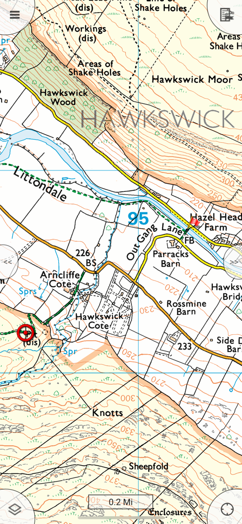
Eine detaillierte topografische Kartenansicht in der Memory-Map-App, die Geländekonturlinien, Gebäude und geografische Beschriftungen für die Navigation im ländlichen Raum zeigt.
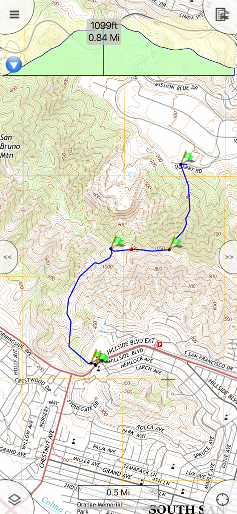
Eine topografische Karte in der Memory-Map für Alle-App, die eine blaue Wanderroute mit grünen Wegpunkten und einem detaillierten Höhenprofilgraphen zeigt.
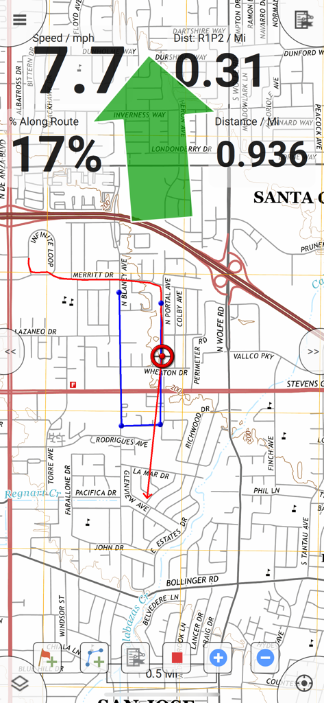
GPS-Navigationsbildschirm mit Kartenverfolgung und Informationen zu Geschwindigkeit und Entfernung
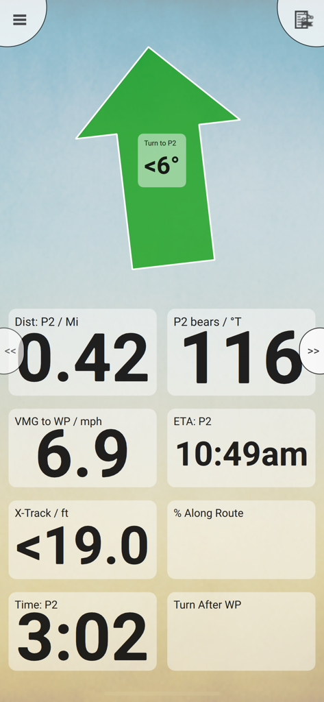
Memory Map Navigations-Dashboard mit einem großen Steuerpfeil und Datenfeldern für Kurs und voraussichtliche Ankunftszeit
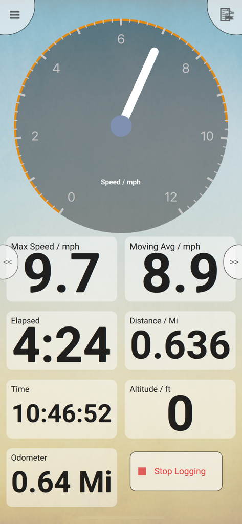
Mobiles GPS-Navigations-Dashboard mit Tacho- und Trip-Statistiken
Beschreibung
Download
Ähnliche Apps
Top-gerankte Apps in derselben Kategorie

Google Maps
Google LLC

Waze Navigation & Live Traffic
waze

AMap Global
AutoNavi Information Technology Co. Ltd.

百度地图-路线规划,出行必备
Beijing Baidu Netcom Science & Technology Co.,Ltd

Moovit: Bus & Transit Tracker
Moovit App Global LTD

Transit • Subway & Bus Times
9280-0366 Quebec inc.

ParkMobile: Park. Pay. Go.
Parkmobile USA, Inc

腾讯地图-路线规划,导航地铁打车出行
Shenzhen Tencent Computer Systems Company Limited

Île-de-France Mobilités
Ile de France Mobilites
Diese Seite ist keine offizielle Seite der App oder ihres Entwicklers, sondern eine unabhängige redaktionelle Veröffentlichung, die zu Informations- und Kommentarzwecken erstellt wurde. Sofern nicht ausdrücklich anders angegeben, sind weder die App noch ihr Entwickler mit MWM, Apple, Google Play, dem App-Herausgeber oder dem Entwickler der App verbunden, von ihnen unterstützt, gesponsert, autorisiert oder anderweitig offiziell verbunden, und nichts auf dieser Seite impliziert, dass die App unter Verwendung der Dienste von MWM entwickelt wurde. Alle Marken, Logos, Screenshots und andere Inhalte bleiben Eigentum ihrer jeweiligen Inhaber.