Diese Seite ist keine offizielle Seite der App oder ihres Entwicklers, sondern eine unabhängige redaktionelle Veröffentlichung, die zu Informations- und Kommentarzwecken erstellt wurde. Sofern nicht ausdrücklich anders angegeben, sind weder die App noch ihr Entwickler mit MWM, Apple, Google Play, dem App-Herausgeber oder dem Entwickler der App verbunden, von ihnen unterstützt, gesponsert, autorisiert oder anderweitig offiziell verbunden, und nichts auf dieser Seite impliziert, dass die App unter Verwendung der Dienste von MWM entwickelt wurde. Alle Marken, Logos, Screenshots und andere Inhalte bleiben Eigentum ihrer jeweiligen Inhaber.

My Altitude and Elevation GPS
Verfolgen Sie Höhe und Koordinaten mit professioneller Genauigkeit mithilfe von UTM, MGRS und Apple Watch-Integration. Perfekt für Wanderer, Profis und Entdecker, die zuverlässige Daten benötigen, wo der Mobilfunkempfang versagt.
Downloads
267K+Bewertung
Bewertungen gesamt
2K+Herausgeber
Kategorie
NavigationSprachen
14Neueste Version
6.50Größe
72.8 MBErstveröffentlichung
15. Feb. 2018Präzisionsnavigation für den modernen Entdecker
Von professioneller Landvermessung bis hin zu Wanderungen im Hinterland – meistern Sie jedes Gelände mit hochgenauen Höhendaten und spezialisierten GPS-Tools, die für die raue Natur entwickelt wurden.
Hyperpräzise Höhenverfolgung
Überwachen Sie Ihre Höhe mit höchster Präzision unter Verwendung professioneller Koordinatenformate wie UTM und MGRS, um stets Ihre genaue Position auf jeder topografischen Karte zu kennen.
Intelligente Geotagg-Dokumentation
Machen Sie Fotos mit eingebetteten Standortdaten, um perfekte Campingplätze zu erkunden oder professionelle Feldstandorte zu dokumentieren, mit voller Unterstützung für GPX- und KML-Datenexporte.
Die folgenden Screenshots und die Beschreibung stammen direkt aus dem offiziellen Store-Eintrag der App und sind Eigentum des Entwicklers.
App Store
Screenshots
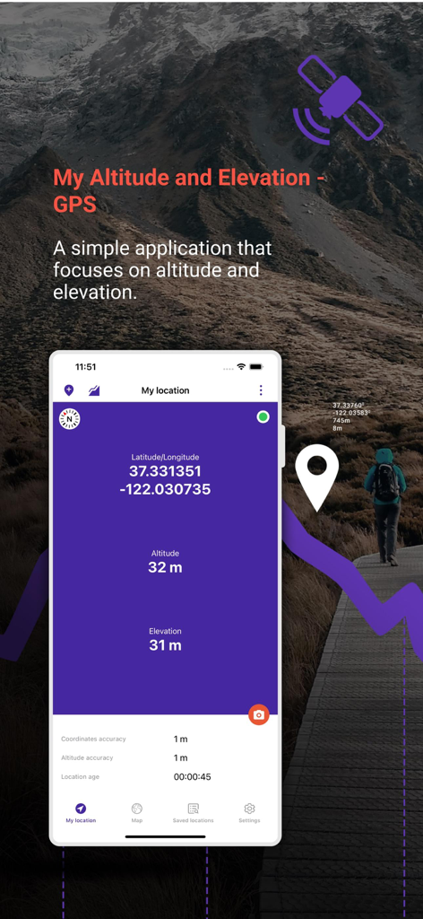
Benutzeroberfläche der My Altitude and Elevation GPS App, die Breiten- und Längengrade sowie Höhendaten über einer Berglandschaft anzeigt
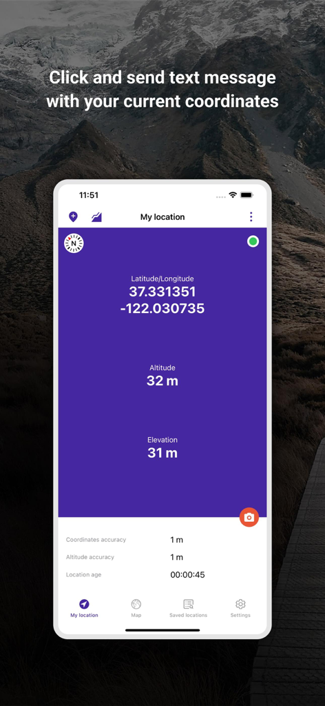
Benutzeroberfläche der My Altitude and Elevation GPS App, die Breiten-, Längengrade und Höhenkoordinaten anzeigt
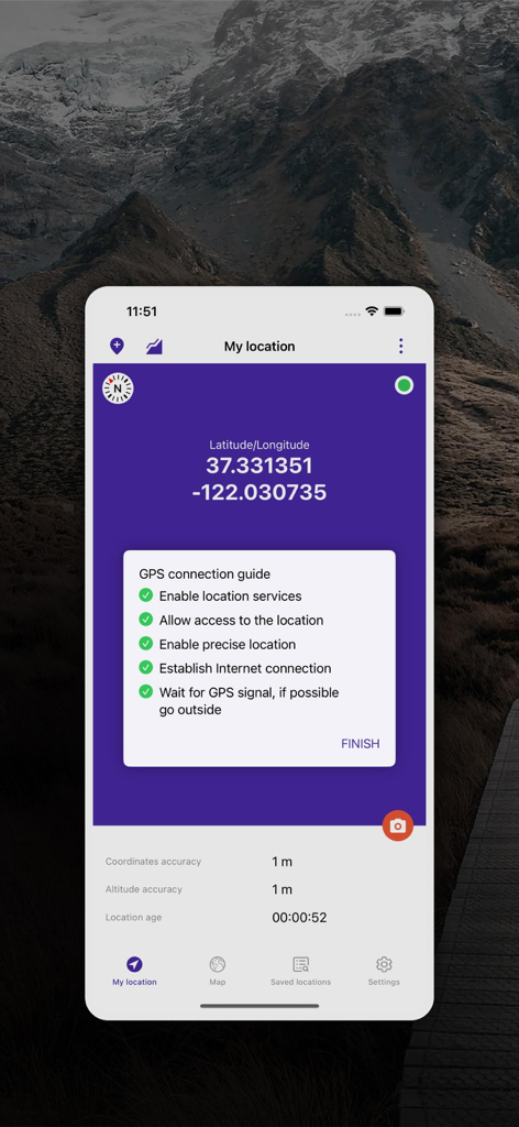
Bildschirm der My Altitude and Elevation GPS App, der Breiten- und Längengrade mit Standortgenauigkeitsdaten anzeigt
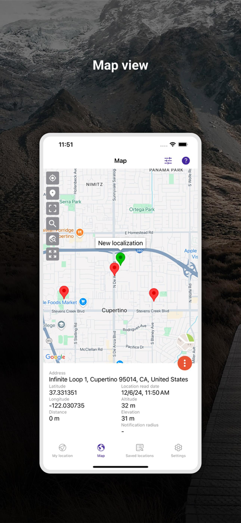
Kartenansicht der My Altitude and Elevation GPS App, die Markierungen und detaillierte Standortkoordinaten anzeigt
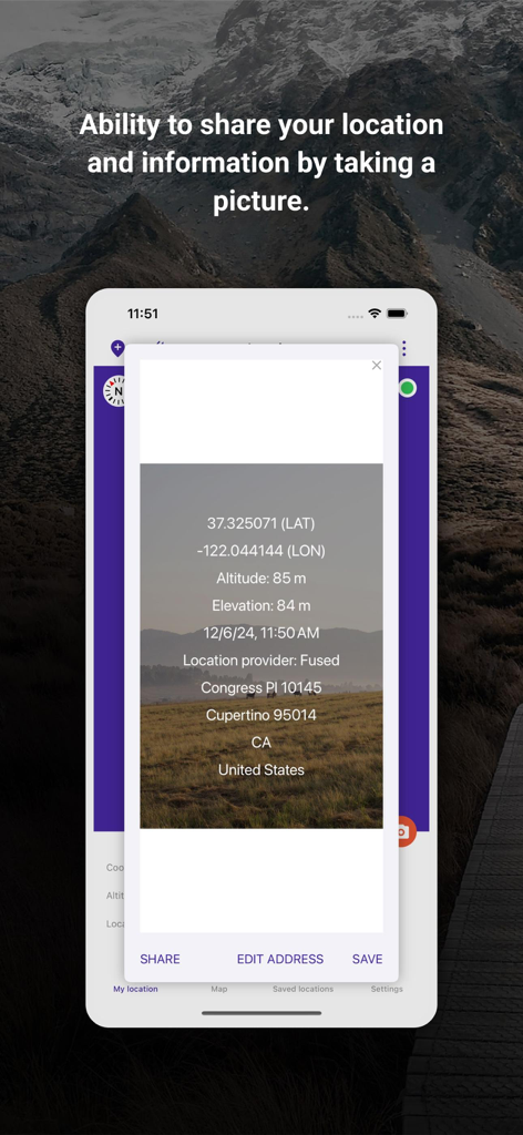
Screenshot der My Altitude App, der ein Foto mit überlagerten GPS-Koordinaten und Höhendaten zum Teilen zeigt.
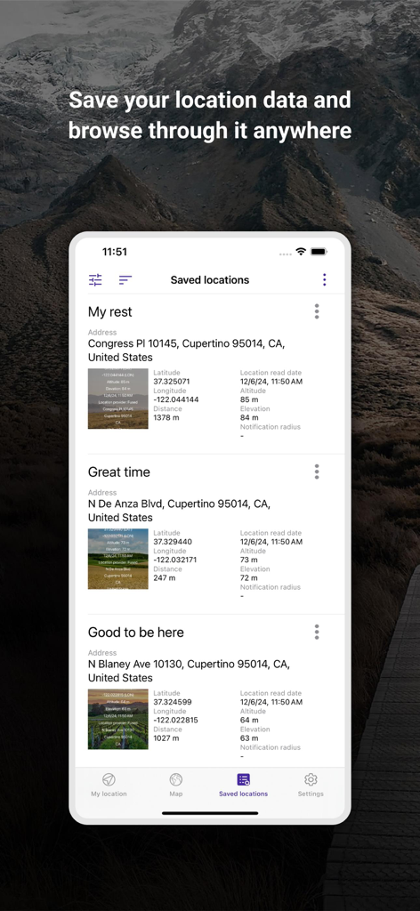
Liste der gespeicherten Orte in der My Altitude and Elevation GPS App, die Koordinaten und Höhendaten anzeigt
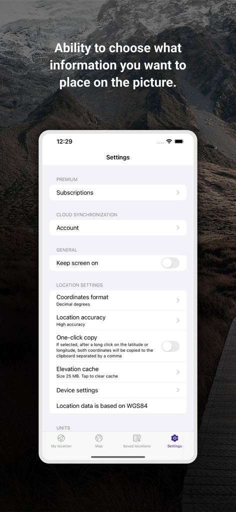
Einstellungsbildschirm der My Altitude and Elevation GPS App, der Koordinatenformate und Optionen für die Standortgenauigkeit anzeigt
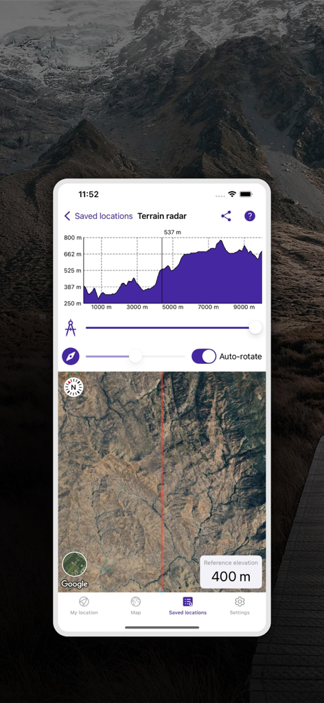
Geländeradar-Funktion, die ein Höhenprofil-Diagramm und eine Satellitenkartenansicht zeigt
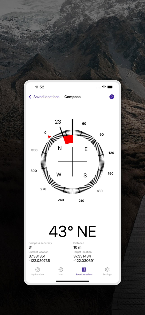
Digitale Kompass-Benutzeroberfläche, die Peilung und GPS-Koordinaten zur Navigation anzeigt.
Beschreibung
Download
Ähnliche Apps
Top-gerankte Apps in derselben Kategorie

Google Maps
Google LLC

Waze Navigation & Live Traffic
waze

AMap Global
AutoNavi Information Technology Co. Ltd.

百度地图-路线规划,出行必备
Beijing Baidu Netcom Science & Technology Co.,Ltd

Moovit: Bus & Transit Tracker
Moovit App Global LTD

Transit • Subway & Bus Times
9280-0366 Quebec inc.

ParkMobile: Park. Pay. Go.
Parkmobile USA, Inc

腾讯地图-路线规划,导航地铁打车出行
Shenzhen Tencent Computer Systems Company Limited

Île-de-France Mobilités
Ile de France Mobilites
Diese Seite ist keine offizielle Seite der App oder ihres Entwicklers, sondern eine unabhängige redaktionelle Veröffentlichung, die zu Informations- und Kommentarzwecken erstellt wurde. Sofern nicht ausdrücklich anders angegeben, sind weder die App noch ihr Entwickler mit MWM, Apple, Google Play, dem App-Herausgeber oder dem Entwickler der App verbunden, von ihnen unterstützt, gesponsert, autorisiert oder anderweitig offiziell verbunden, und nichts auf dieser Seite impliziert, dass die App unter Verwendung der Dienste von MWM entwickelt wurde. Alle Marken, Logos, Screenshots und andere Inhalte bleiben Eigentum ihrer jeweiligen Inhaber.