Diese Seite ist keine offizielle Seite der App oder ihres Entwicklers, sondern eine unabhängige redaktionelle Veröffentlichung, die zu Informations- und Kommentarzwecken erstellt wurde. Sofern nicht ausdrücklich anders angegeben, sind weder die App noch ihr Entwickler mit MWM, Apple, Google Play, dem App-Herausgeber oder dem Entwickler der App verbunden, von ihnen unterstützt, gesponsert, autorisiert oder anderweitig offiziell verbunden, und nichts auf dieser Seite impliziert, dass die App unter Verwendung der Dienste von MWM entwickelt wurde. Alle Marken, Logos, Screenshots und andere Inhalte bleiben Eigentum ihrer jeweiligen Inhaber.

Northumberland Maps Offline
Der unverzichtbare Begleiter für Trekkingtouren entlang Hadrianswall und im Nationalpark. Navigieren Sie durch die Wildnis mit professionellen Karten des Ordnance Survey – ohne Mobilfunksignal oder Roaming-Daten.
Downloads
8K+Bewertung
Bewertungen gesamt
0Herausgeber
Kategorie
NavigationSprachen
1Neueste Version
2.1.1Größe
612.2 MBErstveröffentlichung
9. Mai 2015Navigieren wie ein lokaler Experte
Professionelle Karten des Ordnance Survey, zugeschnitten auf den zielorientierten Entdecker. Entdecken Sie Hadrianswall und die nordumbrischen Moore mit der detailliertesten Offline-Kartografie der Welt.
Kein Signal? Kein Problem.
Eliminieren Sie internationale Roaming-Gebühren und bleiben Sie sicher in abgelegenen 'Funklöchern'. Unsere hochauflösenden Karten werden vollständig auf Ihrem Gerät gespeichert, für totale Offline-Unabhängigkeit.
Genauigkeit des Ordnance Survey
Erleben Sie den Goldstandard der Kartografie im Vereinigten Königreich. Sehen Sie detaillierte Höhenlinien, spezifische Fußwege und historische Sehenswürdigkeiten im professionellen Maßstab 1:25.000 Explorer.
Die folgenden Screenshots und die Beschreibung stammen direkt aus dem offiziellen Store-Eintrag der App und sind Eigentum des Entwicklers.
App Store
Screenshots
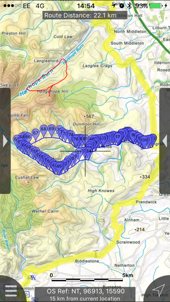
Detaillierte topografische Wanderkarte mit einer verfolgten Route und Wegpunkten in Northumberland
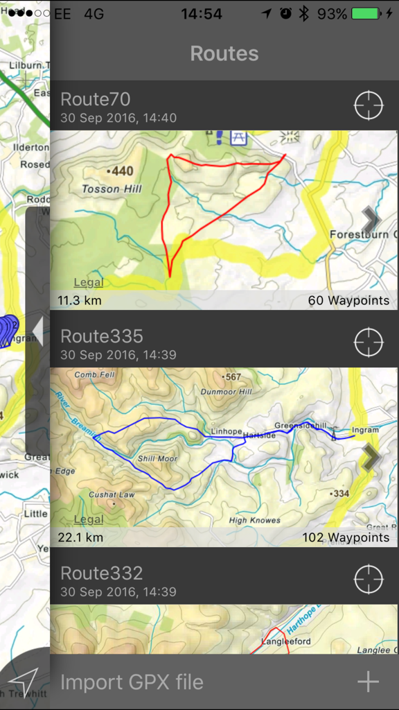
Eine Liste gespeicherter Wanderrouten in der Northumberland Maps Offline App, die Distanzen und topografische Karten zeigt
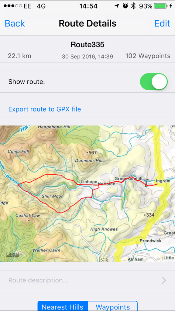
Detaillierte Wanderroute auf einer topografischen Karte innerhalb der Northumberland Maps App
Offline-Schnittstelle zur Suche nach Hügeln in Northumberland
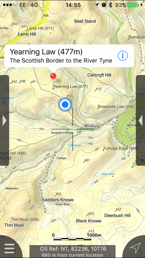
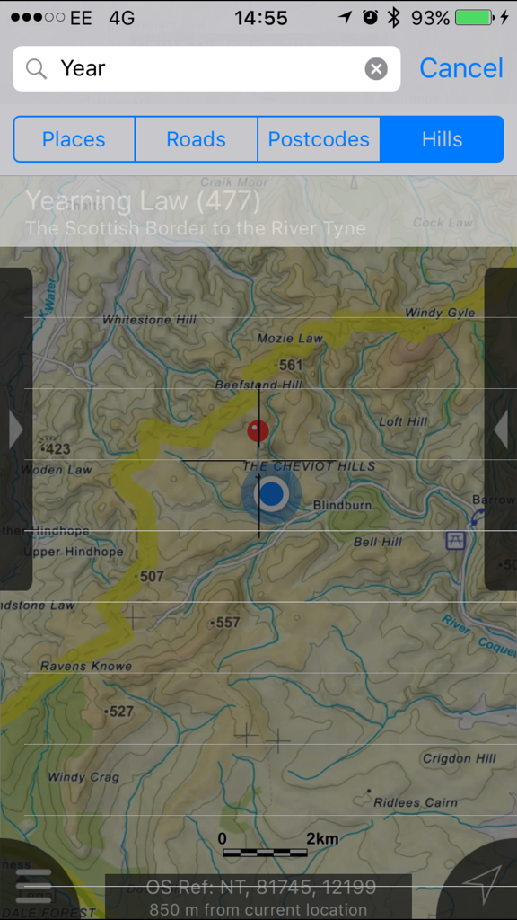
Topografische Karte von Northumberland, die Yearning Law mit Höhenlinien und Wanderwegen zeigt
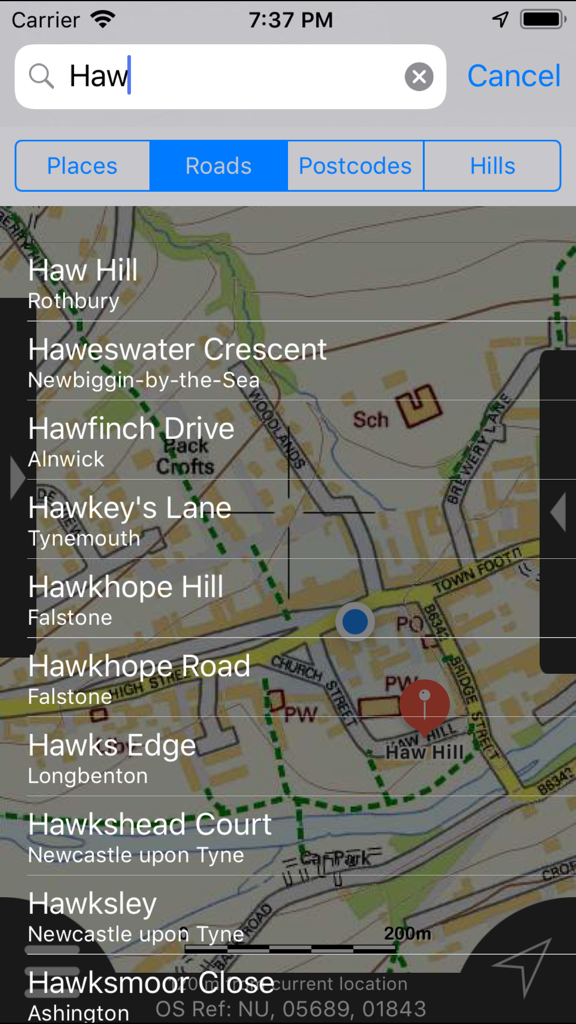
Offline-Suchergebnisse für Straßen und Hügel in der Northumberland Maps App
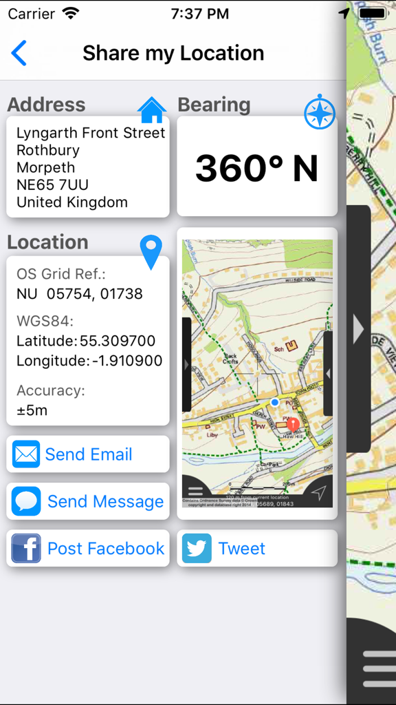
Schnittstelle zum Teilen meines Standorts, die Adresse, GPS-Koordinaten und Kartenansicht zeigt.
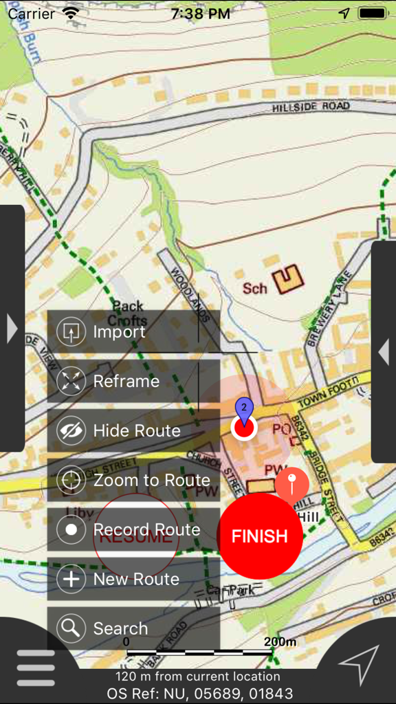
Northumberland Maps Offline App-Oberfläche mit detaillierter Karte und Menü zur Routenverwaltung
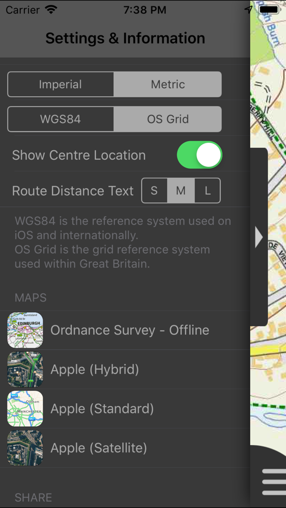
Einstellungen und Informationsbildschirm der Northumberland Maps Offline App mit Anzeige von Einheiten und Koordinatensystemen.
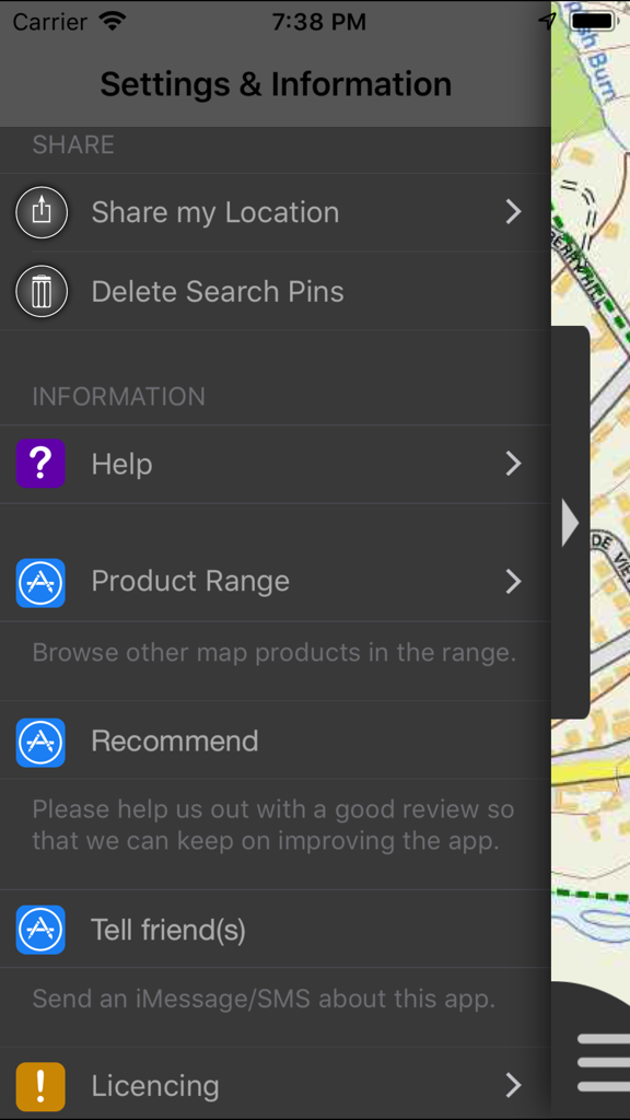
Bildschirm für Einstellungen und Informationsmenü der Northumberland Maps Offline App mit verschiedenen Navigations- und Freigabeoptionen.
Beschreibung
Download
Ähnliche Apps
Top-gerankte Apps in derselben Kategorie

Google Maps
Google LLC

Waze Navigation & Live Traffic
waze

AMap Global
AutoNavi Information Technology Co. Ltd.

百度地图-路线规划,出行必备
Beijing Baidu Netcom Science & Technology Co.,Ltd

Moovit: Bus & Transit Tracker
Moovit App Global LTD

Transit • Subway & Bus Times
9280-0366 Quebec inc.

ParkMobile: Park. Pay. Go.
Parkmobile USA, Inc

腾讯地图-路线规划,导航地铁打车出行
Shenzhen Tencent Computer Systems Company Limited

Île-de-France Mobilités
Ile de France Mobilites
Diese Seite ist keine offizielle Seite der App oder ihres Entwicklers, sondern eine unabhängige redaktionelle Veröffentlichung, die zu Informations- und Kommentarzwecken erstellt wurde. Sofern nicht ausdrücklich anders angegeben, sind weder die App noch ihr Entwickler mit MWM, Apple, Google Play, dem App-Herausgeber oder dem Entwickler der App verbunden, von ihnen unterstützt, gesponsert, autorisiert oder anderweitig offiziell verbunden, und nichts auf dieser Seite impliziert, dass die App unter Verwendung der Dienste von MWM entwickelt wurde. Alle Marken, Logos, Screenshots und andere Inhalte bleiben Eigentum ihrer jeweiligen Inhaber.