Diese Seite ist keine offizielle Seite der App oder ihres Entwicklers, sondern eine unabhängige redaktionelle Veröffentlichung, die zu Informations- und Kommentarzwecken erstellt wurde. Sofern nicht ausdrücklich anders angegeben, sind weder die App noch ihr Entwickler mit MWM, Apple, Google Play, dem App-Herausgeber oder dem Entwickler der App verbunden, von ihnen unterstützt, gesponsert, autorisiert oder anderweitig offiziell verbunden, und nichts auf dieser Seite impliziert, dass die App unter Verwendung der Dienste von MWM entwickelt wurde. Alle Marken, Logos, Screenshots und andere Inhalte bleiben Eigentum ihrer jeweiligen Inhaber.

OpenMaps - Topographic maps
Beherrschen Sie jedes Gelände mit präzisen OpenStreetMap-Daten, Live-Karten-Rendering und speziellen topografischen Ebenen, entwickelt für Wanderer, Mountainbiker und Backcountry-Enthusiasten, die Zuverlässigkeit abseits der Zivilisation verlangen.
Downloads
227K+Bewertung
Bewertungen gesamt
0Herausgeber
Kategorie
NavigationSprachen
1Neueste Version
6.16Größe
16.2 MBErstveröffentlichung
22. Sept. 2015Präzisionskartierung für echte Entdecker
Nutzen Sie die Leistung von OpenStreetMap und speziellen topografischen Ebenen, um auch in anspruchsvollstem Gelände souverän und mit technischer Genauigkeit zu navigieren.
Live-Integration von OSM-Daten
Bleiben Sie auf dem Laufenden mit Echtzeitdaten aus der Community, die neueste Wegänderungen und versteckte Routen erfassen, die herkömmliche GPS-Apps übersehen.
Technische Gelände-Einblicke
Meistern Sie jeden Auf- und Abstieg mit detaillierten Höhenlinien und 6 speziellen Kartenstilen, die auf Bergsteiger und Mountainbiker zugeschnitten sind.
Die folgenden Screenshots und die Beschreibung stammen direkt aus dem offiziellen Store-Eintrag der App und sind Eigentum des Entwicklers.
App Store
Screenshots
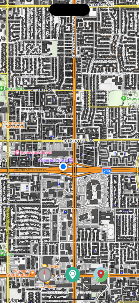
Detaillierte städtische Straßenkartenansicht mit lokalen Sehenswürdigkeiten und Straßen
Ein Screenshot der OpenMaps-App, der eine detaillierte Stadtkarte mit einem blauen Punkt für den aktuellen Standort zeigt.
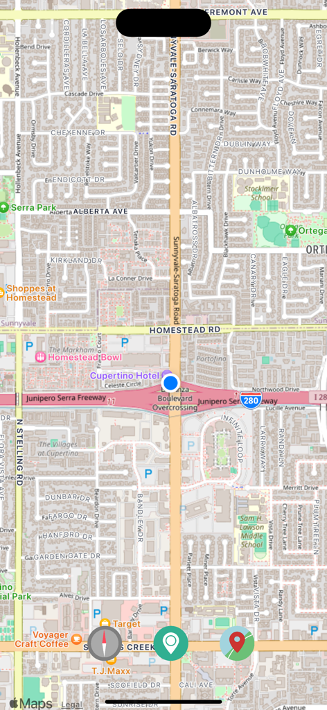
Bildschirm der OpenMaps-App mit einer detaillierten Stadtkarte inklusive Straßennamen und Points of Interest
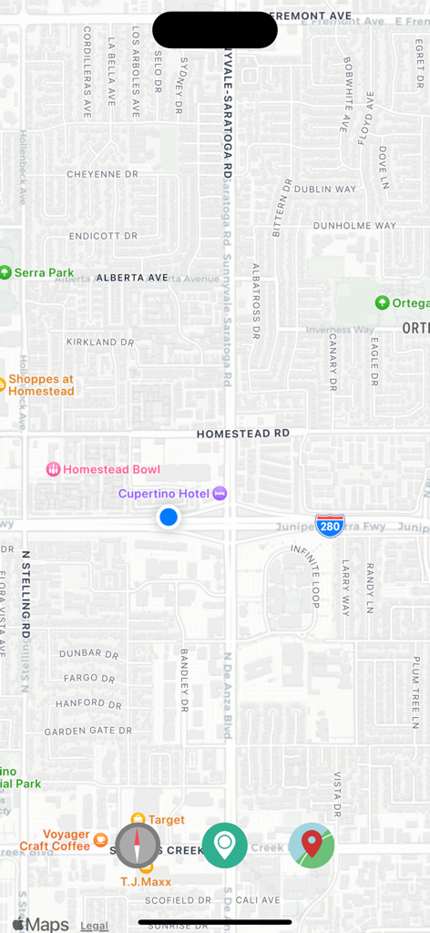
Screenshot der OpenMaps-App mit einer Straßenkartenansicht, Navigationsschaltflächen und einer Markierung für den aktuellen Standort.
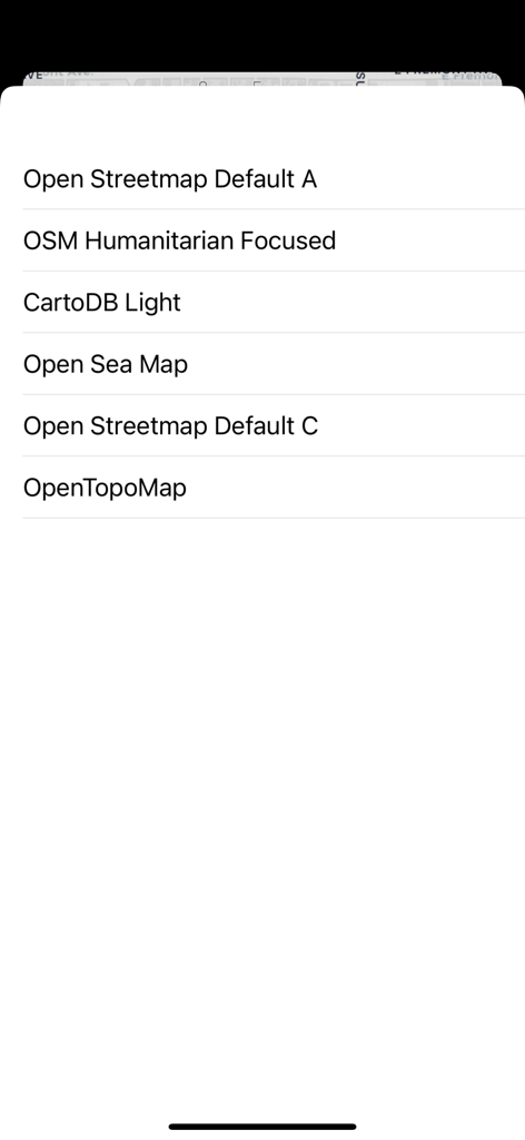
Menü in der OpenMaps-App mit einer Auswahl von sechs quelloffenen topografischen und Seekartenebenen
Beschreibung
Download
Ähnliche Apps
Top-gerankte Apps in derselben Kategorie

Google Maps
Google LLC

Waze Navigation & Live Traffic
waze

AMap Global
AutoNavi Information Technology Co. Ltd.

百度地图-路线规划,出行必备
Beijing Baidu Netcom Science & Technology Co.,Ltd

Moovit: Bus & Transit Tracker
Moovit App Global LTD

Transit • Subway & Bus Times
9280-0366 Quebec inc.

ParkMobile: Park. Pay. Go.
Parkmobile USA, Inc

腾讯地图-路线规划,导航地铁打车出行
Shenzhen Tencent Computer Systems Company Limited

Île-de-France Mobilités
Ile de France Mobilites
Diese Seite ist keine offizielle Seite der App oder ihres Entwicklers, sondern eine unabhängige redaktionelle Veröffentlichung, die zu Informations- und Kommentarzwecken erstellt wurde. Sofern nicht ausdrücklich anders angegeben, sind weder die App noch ihr Entwickler mit MWM, Apple, Google Play, dem App-Herausgeber oder dem Entwickler der App verbunden, von ihnen unterstützt, gesponsert, autorisiert oder anderweitig offiziell verbunden, und nichts auf dieser Seite impliziert, dass die App unter Verwendung der Dienste von MWM entwickelt wurde. Alle Marken, Logos, Screenshots und andere Inhalte bleiben Eigentum ihrer jeweiligen Inhaber.