Diese Seite ist keine offizielle Seite der App oder ihres Entwicklers, sondern eine unabhängige redaktionelle Veröffentlichung, die zu Informations- und Kommentarzwecken erstellt wurde. Sofern nicht ausdrücklich anders angegeben, sind weder die App noch ihr Entwickler mit MWM, Apple, Google Play, dem App-Herausgeber oder dem Entwickler der App verbunden, von ihnen unterstützt, gesponsert, autorisiert oder anderweitig offiziell verbunden, und nichts auf dieser Seite impliziert, dass die App unter Verwendung der Dienste von MWM entwickelt wurde. Alle Marken, Logos, Screenshots und andere Inhalte bleiben Eigentum ihrer jeweiligen Inhaber.

RunwayMap - #1 Pilot Community
Meistern Sie jede Landung mit 3D-Anflugvorschauen, Echtzeit-Luftfahrtwetter und dem ultimativen Guide zu den besten Flughafenrestaurants.
Downloads
62K+Bewertung
Bewertungen gesamt
1K+Herausgeber
Kategorie
WeatherSprachen
2Neueste Version
3.9.8Größe
76.7 MBErstveröffentlichung
28. Juni 2017Meistern Sie Ihren Flug von der Planung bis zum Aufsetzen
Treten Sie der Nr. 1 Piloten-Community bei, um 3D-Anflüge zu visualisieren, intuitive Wettereinblicke zu erhalten und Ihr nächstes Ziel für einen 100-Dollar-Hamburger zu entdecken.
3D-Anflugvorschauen
Beseitigen Sie die Angst vor neuen Flughäfen, indem Sie Ihre Landung virtuell in 3D fliegen. Legen Sie Ihre Entfernung und Ihren Gleitpfad fest, um jeden Anflug zu meistern, bevor Sie abheben.
Visuelles Luftfahrtwetter
Hören Sie auf, Text zu dekodieren, und fangen Sie an, den Himmel zu sehen. Erhalten Sie visuelle METARs, Höhenwinde bis FL150 und berechnete Seitenwindkomponenten für die beste Landebahnauswahl.
Die folgenden Screenshots und die Beschreibung stammen direkt aus dem offiziellen Store-Eintrag der App und sind Eigentum des Entwicklers.
App Store
Screenshots
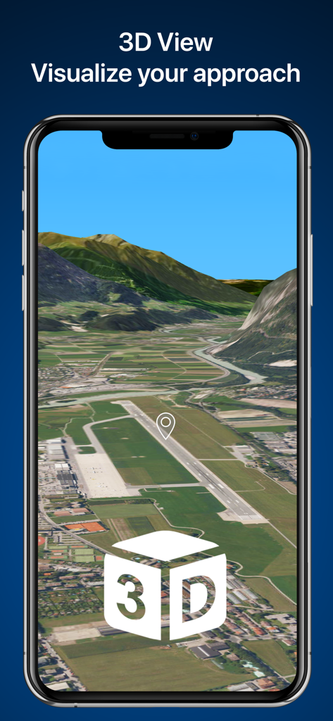
3D-Anflugvisualisierung einer Landebahn auf einem Smartphone-Bildschirm
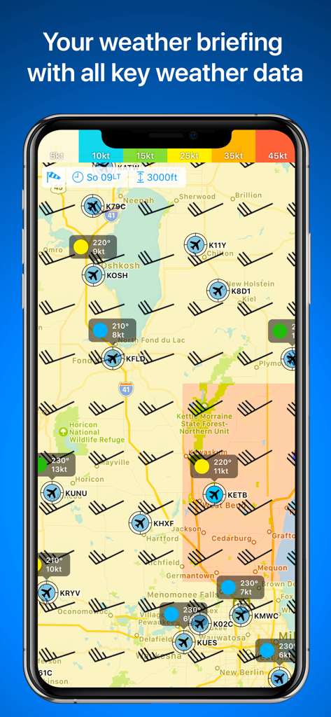
Luftfahrtwetterkarte in RunwayMap mit Windpfeilen und Flugbedingungen am Flughafen
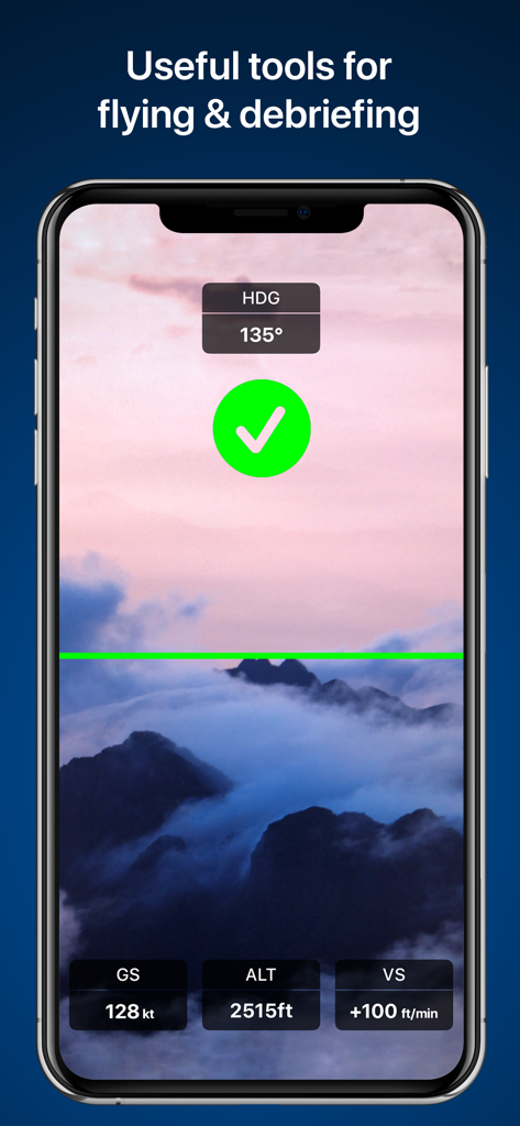
Smartphone-Bildschirm mit RunwayMap-Flug-Tools mit Einblendungen von Höhen- und Geschwindigkeitsdaten
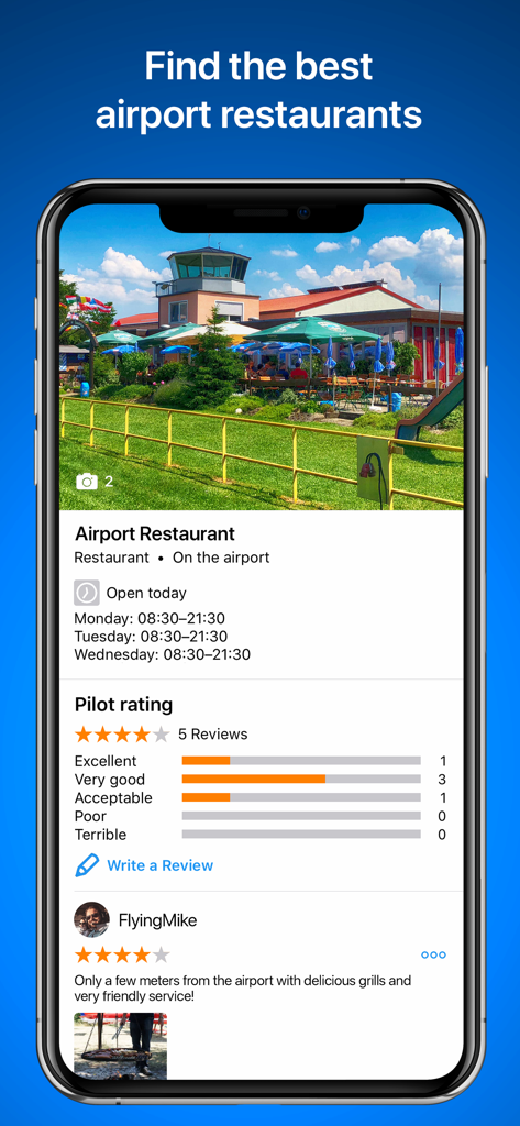
App-Oberfläche von RunwayMap mit Bewertungen von Flughafenrestaurants und Pilotenbewertungen

Benutzerprofil und Social-Feed in der RunwayMap-App mit einem Piloten-Post mit einem Leichtflugzeug an einem Flughafen.
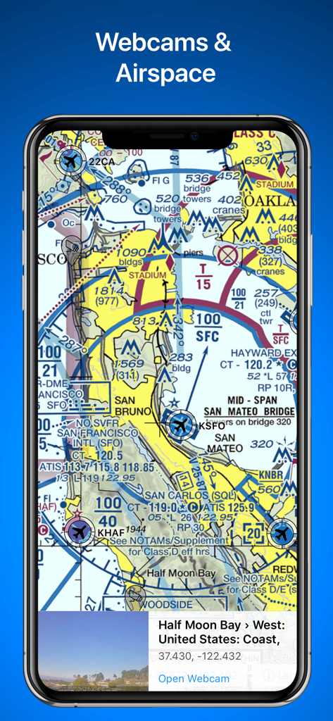
Die RunwayMap-App zeigt eine Luftfahrtkarte mit Luftraumdetails und einer Live-Vorschau der Flughafen-Webcam für Half Moon Bay.
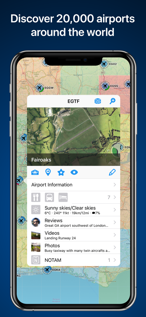
Bildschirm der RunwayMap-App mit einer Karte von Flughäfen und detaillierten Informationen für den Flughafen Fairoaks
Beschreibung
Download
Ähnliche Apps
Top-gerankte Apps in derselben Kategorie

墨迹天气-MojiWeather
Beijing MojiFengyun Technology Co.,Ltd.

The Weather Channel - Radar
The Weather Channel

Windy.com
Windyty, SE

天气预报-精准15日天气预报
Chongqing Caochen Technology Co., Ltd.

My Aurora Forecast & Alerts
JRustonApps B.V.

AccuWeather: Weather Forecast
AccuWeather International, Inc.

Weather & Radar - Storm radar
WetterOnline - Meteorologische Dienstleistungen GmbH

天气通
Weibo Internet Technology (China) Co.Ltd.

The Thermometer -Digital-
Vida Apps Incorporated
Diese Seite ist keine offizielle Seite der App oder ihres Entwicklers, sondern eine unabhängige redaktionelle Veröffentlichung, die zu Informations- und Kommentarzwecken erstellt wurde. Sofern nicht ausdrücklich anders angegeben, sind weder die App noch ihr Entwickler mit MWM, Apple, Google Play, dem App-Herausgeber oder dem Entwickler der App verbunden, von ihnen unterstützt, gesponsert, autorisiert oder anderweitig offiziell verbunden, und nichts auf dieser Seite impliziert, dass die App unter Verwendung der Dienste von MWM entwickelt wurde. Alle Marken, Logos, Screenshots und andere Inhalte bleiben Eigentum ihrer jeweiligen Inhaber.