Diese Seite ist keine offizielle Seite der App oder ihres Entwicklers, sondern eine unabhängige redaktionelle Veröffentlichung, die zu Informations- und Kommentarzwecken erstellt wurde. Sofern nicht ausdrücklich anders angegeben, sind weder die App noch ihr Entwickler mit MWM, Apple, Google Play, dem App-Herausgeber oder dem Entwickler der App verbunden, von ihnen unterstützt, gesponsert, autorisiert oder anderweitig offiziell verbunden, und nichts auf dieser Seite impliziert, dass die App unter Verwendung der Dienste von MWM entwickelt wurde. Alle Marken, Logos, Screenshots und andere Inhalte bleiben Eigentum ihrer jeweiligen Inhaber.

RWIS
Treffen Sie fundiertere Entscheidungen mit Echtzeit-Straßenoberflächenbedingungen, Eisfrühwarnungen und Live-Außendienstverfolgung, entwickelt für Infrastrukturprofis.
Downloads
23K+Bewertung
Bewertungen gesamt
0Herausgeber
Kategorie
WeatherSprachen
11Neueste Version
4.1.1Größe
34.0 MBErstveröffentlichung
25. Juli 2014Einsatzleitung in Ihrer Tasche
Optimieren Sie Ihre Reaktion auf Winterwetter mit Echtzeit-Straßenbedingungen, Live-Flottenverfolgung und hyperlokalen Sensordaten für Infrastrukturprofis.
Hyperlokale Straßeninformationen
Überwachen Sie Straßenoberflächentemperaturen, Wassertiefe und Eisrisiken mit präzisen Sensordaten, um Straßen nur bei Bedarf zu behandeln.
Echtzeit-Flottenkoordination
Verfolgen Sie aktive Fahrzeuge und farbkodierte Interventionen auf einer interaktiven Karte, um eine vollständige Abdeckung und operative Transparenz zu gewährleisten.
Die folgenden Screenshots und die Beschreibung stammen direkt aus dem offiziellen Store-Eintrag der App und sind Eigentum des Entwicklers.
App Store
Screenshots
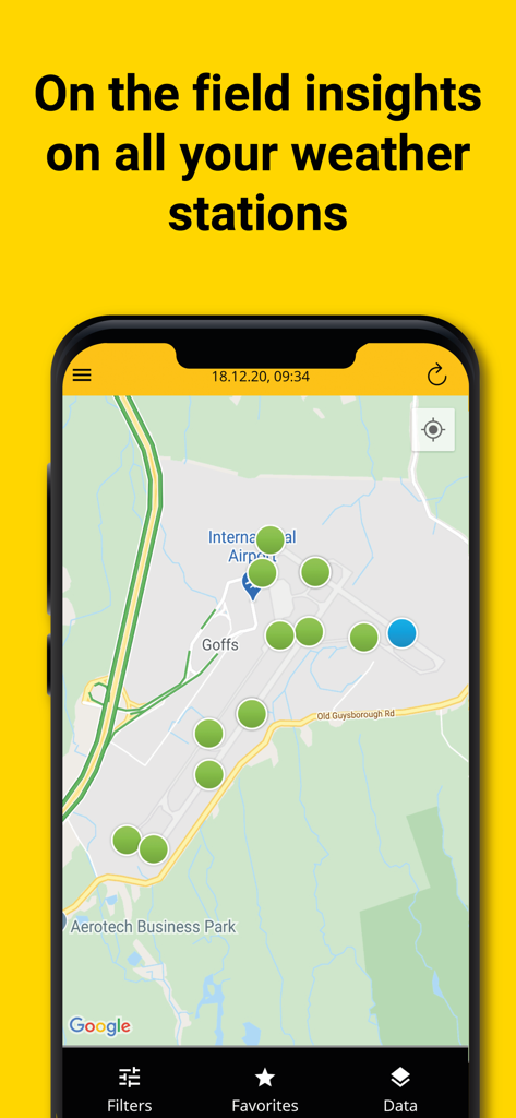
RWIS App-Oberfläche mit Wetterstationsstandorten auf einer Flughafenkarte.
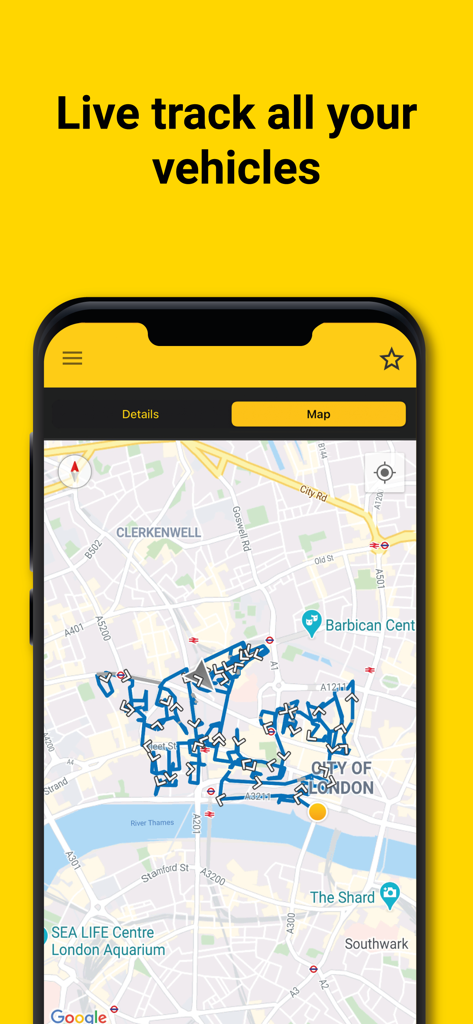
RWIS Mobile App-Oberfläche mit Echtzeit-Fahrroutenverfolgung auf einer interaktiven Stadtkarte.
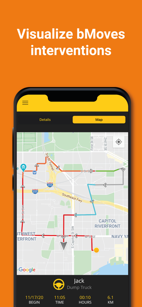
RWIS App Kartenansicht mit farbkodierten Fahrzeugrouten und Echtzeit-Flottenverfolgung für bMoves-Interventionen.
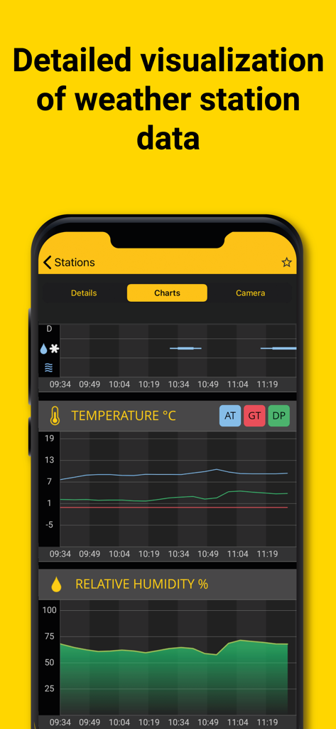
RWIS App zeigt Echtzeit-Temperatur- und relative Luftfeuchtigkeitsdiagramme für die Überwachung von Straßenwetterstationen.
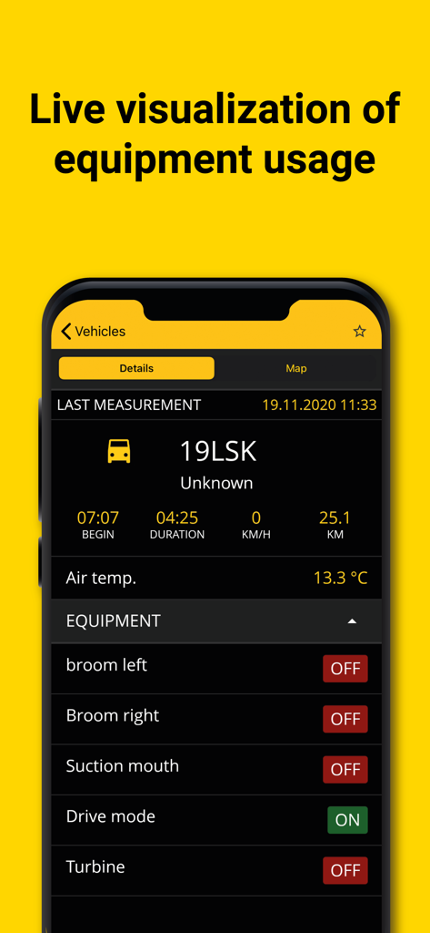
RWIS App Dashboard zeigt Live-Gerätestatus und Fahrzeugdaten für die Straßenwartung
Beschreibung
Download
Ähnliche Apps
Top-gerankte Apps in derselben Kategorie

墨迹天气-MojiWeather
Beijing MojiFengyun Technology Co.,Ltd.

The Weather Channel - Radar
The Weather Channel

Windy.com
Windyty, SE

天气预报-精准15日天气预报
Chongqing Caochen Technology Co., Ltd.

My Aurora Forecast & Alerts
JRustonApps B.V.

AccuWeather: Weather Forecast
AccuWeather International, Inc.

Weather & Radar - Storm radar
WetterOnline - Meteorologische Dienstleistungen GmbH

天气通
Weibo Internet Technology (China) Co.Ltd.

The Thermometer -Digital-
Vida Apps Incorporated
Diese Seite ist keine offizielle Seite der App oder ihres Entwicklers, sondern eine unabhängige redaktionelle Veröffentlichung, die zu Informations- und Kommentarzwecken erstellt wurde. Sofern nicht ausdrücklich anders angegeben, sind weder die App noch ihr Entwickler mit MWM, Apple, Google Play, dem App-Herausgeber oder dem Entwickler der App verbunden, von ihnen unterstützt, gesponsert, autorisiert oder anderweitig offiziell verbunden, und nichts auf dieser Seite impliziert, dass die App unter Verwendung der Dienste von MWM entwickelt wurde. Alle Marken, Logos, Screenshots und andere Inhalte bleiben Eigentum ihrer jeweiligen Inhaber.