Diese Seite ist keine offizielle Seite der App oder ihres Entwicklers, sondern eine unabhängige redaktionelle Veröffentlichung, die zu Informations- und Kommentarzwecken erstellt wurde. Sofern nicht ausdrücklich anders angegeben, sind weder die App noch ihr Entwickler mit MWM, Apple, Google Play, dem App-Herausgeber oder dem Entwickler der App verbunden, von ihnen unterstützt, gesponsert, autorisiert oder anderweitig offiziell verbunden, und nichts auf dieser Seite impliziert, dass die App unter Verwendung der Dienste von MWM entwickelt wurde. Alle Marken, Logos, Screenshots und andere Inhalte bleiben Eigentum ihrer jeweiligen Inhaber.

TrueNorth: Compass, Altimeter
Navigieren Sie mit absolutem Vertrauen dank dreifacher Höhengenauigkeit, Echtzeit-Barometerüberwachung und hochpräzisen Kompasswerkzeugen. Entwickelt für Profis und Outdoor-Enthusiasten, die Offline-Zuverlässigkeit und totale Privatsphäre in den anspruchsvollsten Umgebungen der Welt benötigen.
Downloads
600Bewertung
Bewertungen gesamt
0Herausgeber
Kategorie
NavigationSprachen
1Neueste Version
1.0.4Größe
17.9 MBErstveröffentlichung
30. Mai 2025Professionelle Navigation für das Hinterland
Verwandeln Sie Ihr iPhone in ein zuverlässiges Feldinstrument, das für Spitzenleistungen entwickelt wurde, wenn Sie vollständig offline sind.
Dreifache Höhenpräzision
Kombinieren Sie GPS, Barometersensoren und Höhenmodelle für die genauesten Höhenmessungen in jedem Gelände.
Gebaut für Offline-Zuverlässigkeit
Kein Mobilfunknetz? Kein Problem. Greifen Sie auf Ihren professionellen Kompass und Ihre GPS-Koordinaten zu, ohne eine Internetverbindung zu benötigen.
Die folgenden Screenshots und die Beschreibung stammen direkt aus dem offiziellen Store-Eintrag der App und sind Eigentum des Entwicklers.
App Store
Screenshots
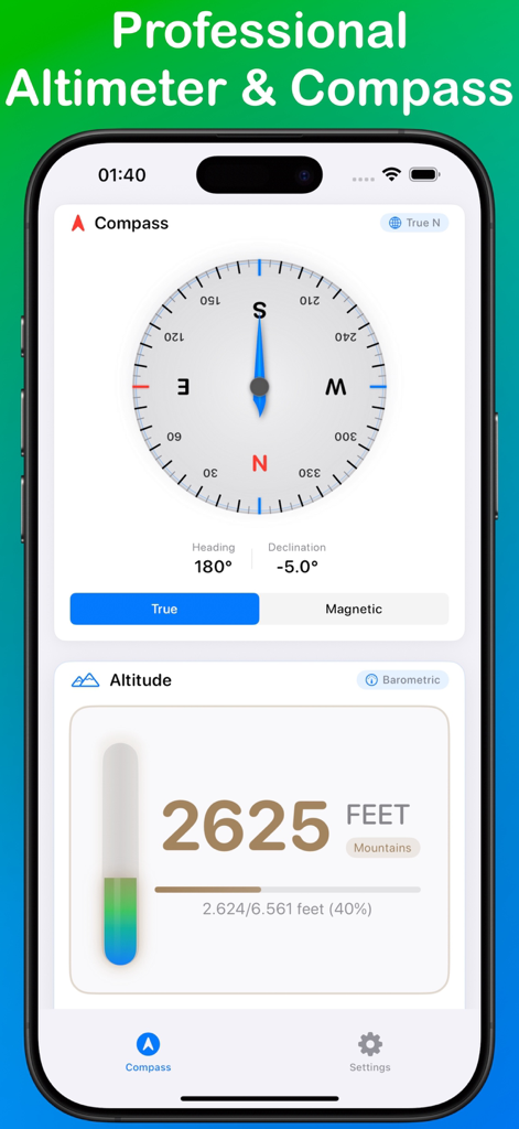
TrueNorth App-Oberfläche mit einer professionellen Kompassrose und einer Peilung von 180 Grad sowie einem digitalen Höhenmesser, der 2625 Fuß anzeigt
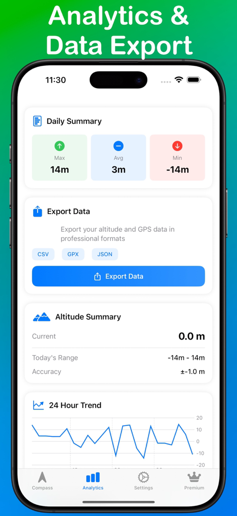
TrueNorth App Analyse-Dashboard mit Höhenübersicht und Datenexportoptionen
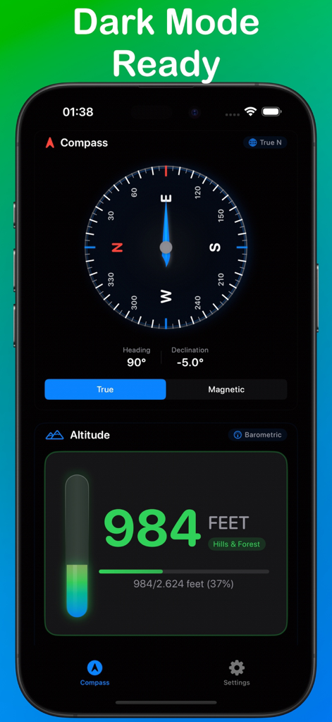
TrueNorth App-Oberfläche im Dunkelmodus mit professionellem Kompass und digitalem Höhenmesser.
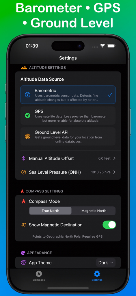
TrueNorth App-Einstellungsbildschirm mit Optionen für die Höhenquelle und Kompass-Navigationsmodi
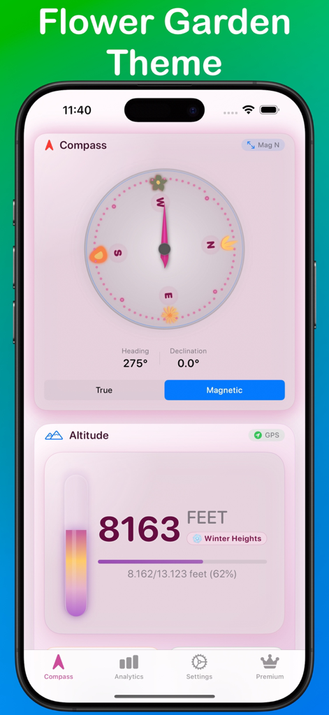
TrueNorth Navigations-App mit Kompass und Höhenmesser im pinken Blumengarten-Design
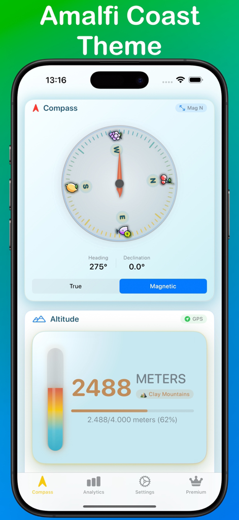
TrueNorth App-Oberfläche mit Amalfi-Küsten-Design, Kompass und Höhenanzeigen.
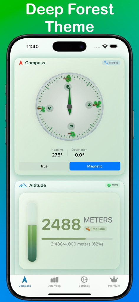
TrueNorth Navigations-App mit Magnetkompass und Höhenmesser im tiefgrünen Wald-Design.
Beschreibung
Download
Ähnliche Apps
Top-gerankte Apps in derselben Kategorie

Google Maps
Google LLC

Waze Navigation & Live Traffic
waze

AMap Global
AutoNavi Information Technology Co. Ltd.

百度地图-路线规划,出行必备
Beijing Baidu Netcom Science & Technology Co.,Ltd

Moovit: Bus & Transit Tracker
Moovit App Global LTD

Transit • Subway & Bus Times
9280-0366 Quebec inc.

ParkMobile: Park. Pay. Go.
Parkmobile USA, Inc

腾讯地图-路线规划,导航地铁打车出行
Shenzhen Tencent Computer Systems Company Limited

Île-de-France Mobilités
Ile de France Mobilites
Diese Seite ist keine offizielle Seite der App oder ihres Entwicklers, sondern eine unabhängige redaktionelle Veröffentlichung, die zu Informations- und Kommentarzwecken erstellt wurde. Sofern nicht ausdrücklich anders angegeben, sind weder die App noch ihr Entwickler mit MWM, Apple, Google Play, dem App-Herausgeber oder dem Entwickler der App verbunden, von ihnen unterstützt, gesponsert, autorisiert oder anderweitig offiziell verbunden, und nichts auf dieser Seite impliziert, dass die App unter Verwendung der Dienste von MWM entwickelt wurde. Alle Marken, Logos, Screenshots und andere Inhalte bleiben Eigentum ihrer jeweiligen Inhaber.