Diese Seite ist keine offizielle Seite der App oder ihres Entwicklers, sondern eine unabhängige redaktionelle Veröffentlichung, die zu Informations- und Kommentarzwecken erstellt wurde. Sofern nicht ausdrücklich anders angegeben, sind weder die App noch ihr Entwickler mit MWM, Apple, Google Play, dem App-Herausgeber oder dem Entwickler der App verbunden, von ihnen unterstützt, gesponsert, autorisiert oder anderweitig offiziell verbunden, und nichts auf dieser Seite impliziert, dass die App unter Verwendung der Dienste von MWM entwickelt wurde. Alle Marken, Logos, Screenshots und andere Inhalte bleiben Eigentum ihrer jeweiligen Inhaber.

Wavve Boating: Marine Boat GPS
Hören Sie auf, mit komplexen Kartenplottern zu kämpfen. Erhalten Sie benutzerdefinierte Seekarten, die auf den Tiefgang Ihres Bootes zugeschnitten sind, Echtzeit-Wetter und Live-Freundesverfolgung in einer benutzerfreundlichen App.
Downloads
866K+Bewertung
Bewertungen gesamt
5K+Herausgeber
Kategorie
NavigationSprachen
1Neueste Version
5.5.9Größe
181.6 MBErstveröffentlichung
12. Aug. 2017Bootfahren leicht gemacht für jeden Kapitän
Lassen Sie die komplexen Karten hinter sich. Wavve kombiniert intuitive Navigation, Echtzeit-Sicherheitsdaten und soziale Verbindung, um jeden Tag auf dem Wasser stressfrei zu gestalten.
Personalisierte Sicherheitskarten
Stellen Sie den Tiefgang Ihres Bootes ein und lassen Sie sich von Wavve zeigen, wo es sicher ist. Bleiben Sie einfach im Blauen und vermeiden Sie das Rote, um kostspielige Propellerschäden zu verhindern.
Echtzeit-Marinewetter
Planen Sie mit 7-Tage-Vorhersagen und Gezeitenprognosen. Kennen Sie Wellenhöhen und Windgeschwindigkeiten, bevor Sie überhaupt den Steg verlassen.
Häufig gestellte Fragen
Alles, was Sie über wissen müssen Wavve Boating: Marine Boat GPS
Was ist Wavve Boating: Marine Boat GPS?
Wavve Boating: Marine Boat GPS ist eine Navigations-App für Bootsfahrer. Sie bietet detaillierte Seekarten, Gezeiten-Vorhersagen und Wettervorhersagen in einem einfach zu bedienenden Werkzeug für die Schifffahrt.
Wie viel kostet ein Abonnement für Wavve Boating: Marine Boat GPS?
Ein Abonnement für Wavve Boating: Marine Boat GPS kostet 11,99 $/Monat für die monatliche Option oder 59,99 $/Jahr für die jährliche Option. Eine kostenlose 14-tägige Testversion ist verfügbar.
Gibt es eine kostenlose Testversion für Wavve Boating: Marine Boat GPS?
Ja, Wavve Boating: Marine Boat GPS bietet eine kostenlose 14-tägige Testphase. Benutzer können die App kostenlos herunterladen, um ihre Funktionen zu nutzen, bevor sie ein Abonnement abschließen.
Welche geografischen Regionen decken die Seekarten von Wavve Boating: Marine Boat GPS ab?
Wavve Boating: Marine Boat GPS bietet Seekarten für die USA, Kanada, Australien und das Vereinigte Königreich. Benutzer können eine Karte der vollständigen Abdeckung auf der Website von Wavve Boating einsehen.
Ermöglicht Wavve Boating: Marine Boat GPS die Anpassung von Seekarten?
Ja, Wavve Boating: Marine Boat GPS ermöglicht die Anpassung von Seekarten. Benutzer können den Tiefgang ihres Bootes einstellen, und die App zeichnet die Karten neu, um sie an ihr spezifisches Boot anzupassen.
Bietet Wavve Boating: Marine Boat GPS Gezeiten-Vorhersagen?
Ja, Wavve Boating: Marine Boat GPS bietet Gezeiten-Vorhersagen. Es verfolgt Wasserhöhenänderungen und zeigt die vorhergesagten Wasserhöhen bis zu 18 Stunden im Voraus für nordamerikanische Regionen an.
Enthält Wavve Boating: Marine Boat GPS Wettervorhersagen?
Ja, Wavve Boating: Marine Boat GPS enthält umfassende Wettervorhersagen. Es bietet eine Sieben-Tage-Vorhersage für Nordamerika, die Temperatur, Windgeschwindigkeit und Wellenhöhe anzeigt.
Können Benutzer ihren Standort mit Freunden in Wavve Boating: Marine Boat GPS teilen?
Ja, Benutzer können ihren Standort mit Freunden in Wavve Boating: Marine Boat GPS über die Funktion "Fleets of Friends" teilen. Benutzer können ihren Standort auch ausblenden.
Hilft Wavve Boating: Marine Boat GPS Bootsfahrern, Gefahren zu vermeiden?
Ja, Wavve Boating: Marine Boat GPS hilft Bootsfahrern, Gefahren zu vermeiden. Es präsentiert klare visuelle Informationen, einschließlich farbcodierter Bereiche, um potenzielle Gefahren auf dem Wasser hervorzuheben.
Kann ich Wavve Boating: Marine Boat GPS offline verwenden?
Ja, Wavve Boating: Marine Boat GPS kann offline verwendet werden. Benutzer können Kartendaten herunterladen, um die Navigation ohne aktive Internetverbindung fortzusetzen.
Können Benutzer interessante Punkte in Wavve Boating: Marine Boat GPS markieren und teilen?
Ja, Benutzer können interessante Punkte in Wavve Boating: Marine Boat GPS markieren. Sie können freigegebene oder private Pins zur Karte hinzufügen, wobei für freigegebene Punkte eine Community-Abstimmung verfügbar ist.
Welche anderen Marine-GPS-Apps kann Wavve Boating: Marine Boat GPS ersetzen?
Wavve Boating: Marine Boat GPS ist eine Alternative zu herkömmlichen Kartenplottern und Anwendungen wie Navionics, Embark und Garmin Active Captain und integriert Seekarten.
Verfügt Wavve Boating: Marine Boat GPS über eine Auto-Routing-Funktion?
Ja, Wavve Boating: Marine Boat GPS verfügt über eine Auto-Routing-Funktion. Diese Funktion ist Teil seines umfassenden Werkzeugkastens für eine effiziente Marine-Navigation.
Die folgenden Screenshots und die Beschreibung stammen direkt aus dem offiziellen Store-Eintrag der App und sind Eigentum des Entwicklers.
App Store
Screenshots
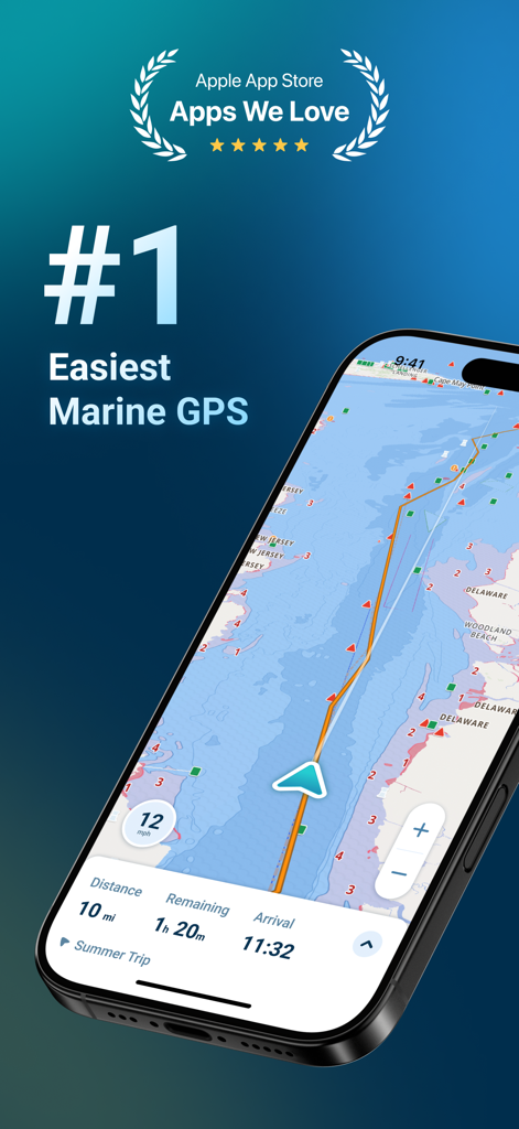
Ein Smartphone, das die Wavve Boating Marine-GPS-Navigationsschnittstelle mit Seekarten und Reisedetails anzeigt.
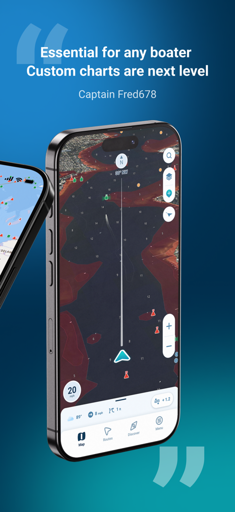
Smartphone-Bildschirm, der Wavve Boating Seekarten und eine positive Benutzerbewertung anzeigt
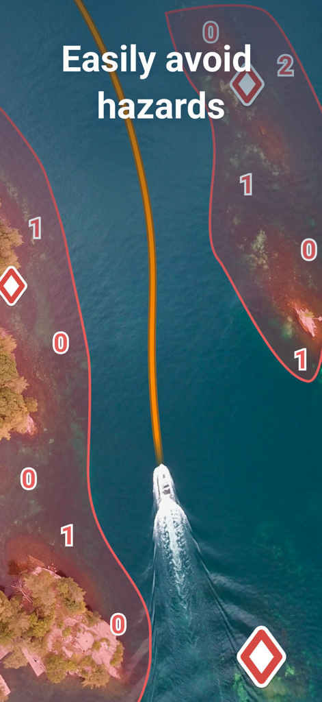
Ein Boot navigiert auf der Wavve Boating Marine-GPS-App durch einen sicheren blauen Pfad zwischen roten Gefahrenzonen.
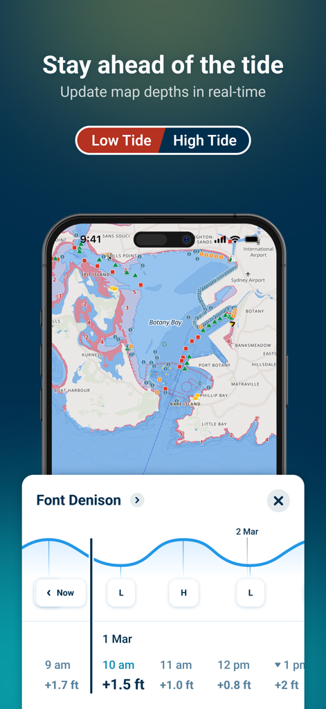
Wavve Boating App zeigt Echtzeit-Gezeitenprognosen und Tiefenaktualisierungen auf einer Marine-GPS-Karte an.
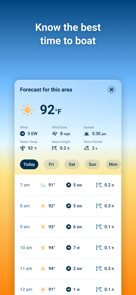
Eine mobile Benutzeroberfläche der Wavve Boating App, die Marine-Wettervorhersagen einschließlich Windgeschwindigkeit und Wellenhöhe anzeigt.
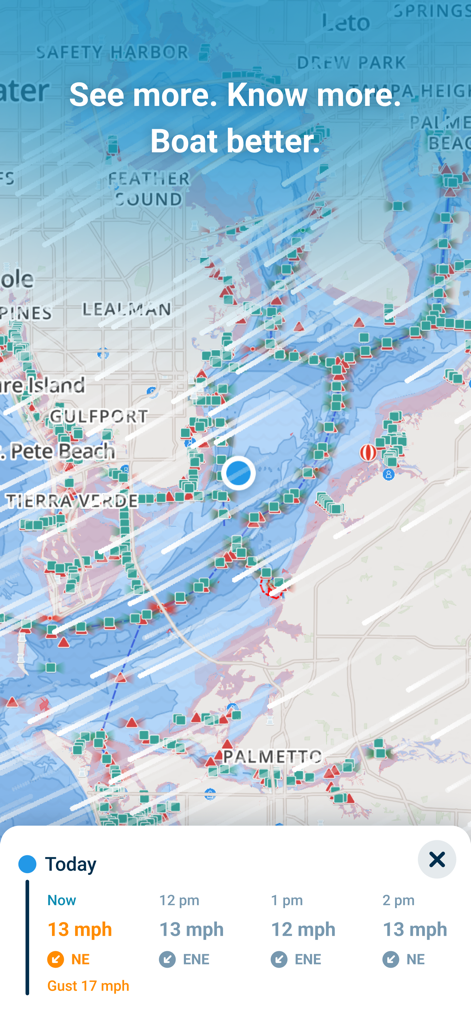
Wavve Boating App-Benutzeroberfläche zeigt eine Marine-Navigationskarte mit einem Echtzeit-Windgeschwindigkeits- und Wettervorhersagefeld.
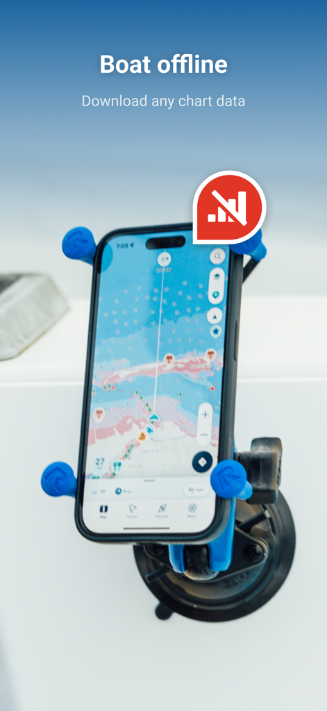
iPhone auf einem Boot montiert, das die Wavve Boating App mit Offline-Seekarten anzeigt
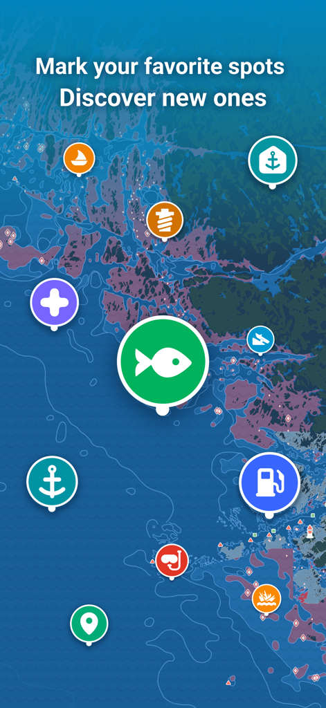
Seekarte mit bunten Symbolen für Angeln, Treibstoff und Ankerplätze
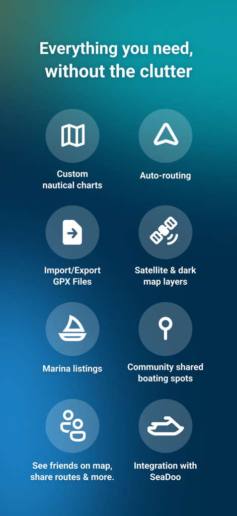
Liste der Wavve Boating App-Funktionen, einschließlich benutzerdefinierter Seekarten, automatischer Routenplanung und sozialer Navigationswerkzeuge
Beschreibung
Download
Ähnliche Apps
Apps mit ähnlichen Funktionen und Nutzererfahrung

PredictWind — Marine Forecasts
PredictWind Limited

Navily
The Navigation Family

Argo - Boating Navigation
Argo Navigation, LLC

SEAiq Pilot
Sakhalin, LLC

Maptrails
Pasi Salenius

KartenWerft NavGo 2.0
KartenWerft GmbH

MarineTraffic - Ship Tracking
MARINETRAFFIC APPLICATIONS LTD

Savvy Navvy Boating Navigation
SAVVY NAVVY LTD

Aqua Map Boating
GEC s.r.l.
Diese Seite ist keine offizielle Seite der App oder ihres Entwicklers, sondern eine unabhängige redaktionelle Veröffentlichung, die zu Informations- und Kommentarzwecken erstellt wurde. Sofern nicht ausdrücklich anders angegeben, sind weder die App noch ihr Entwickler mit MWM, Apple, Google Play, dem App-Herausgeber oder dem Entwickler der App verbunden, von ihnen unterstützt, gesponsert, autorisiert oder anderweitig offiziell verbunden, und nichts auf dieser Seite impliziert, dass die App unter Verwendung der Dienste von MWM entwickelt wurde. Alle Marken, Logos, Screenshots und andere Inhalte bleiben Eigentum ihrer jeweiligen Inhaber.