Diese Seite ist keine offizielle Seite der App oder ihres Entwicklers, sondern eine unabhängige redaktionelle Veröffentlichung, die zu Informations- und Kommentarzwecken erstellt wurde. Sofern nicht ausdrücklich anders angegeben, sind weder die App noch ihr Entwickler mit MWM, Apple, Google Play, dem App-Herausgeber oder dem Entwickler der App verbunden, von ihnen unterstützt, gesponsert, autorisiert oder anderweitig offiziell verbunden, und nichts auf dieser Seite impliziert, dass die App unter Verwendung der Dienste von MWM entwickelt wurde. Alle Marken, Logos, Screenshots und andere Inhalte bleiben Eigentum ihrer jeweiligen Inhaber.

Wellsite Navigator
Hören Sie auf, sich dort zu verirren, wo der Asphalt endet. Navigieren Sie auf proprietären Pachtstraßen, suchen Sie nach API- oder Pachtnamen und arbeiten Sie vollständig offline mit dem zuverlässigsten Kartentool der Branche.
Downloads
172K+Bewertung
Bewertungen gesamt
600Herausgeber
Kategorie
NavigationSprachen
1Neueste Version
3.34.3Größe
124.2 MBErstveröffentlichung
22. Jan. 2013Gebaut für das Ölfeld
Das vertrauenswürdige Navigationswerkzeug für über 150.000 Ölfeldprofis. Erreichen Sie Ihr Ziel effizient mit proprietären Straßendaten und branchenspezifischen Suchwerkzeugen, die für das Feld entwickelt wurden.
Proprietäre Karten von Pachtstraßen
Navigieren Sie auf Zehntausenden von Kilometern privater Feld- und Schotterstraßen, die Standard-GPS-Apps übersehen, und stellen Sie sicher, dass Sie jedes Mal die richtige Bohrinsel erreichen.
Zuverlässige Offline-Navigation
Arbeiten Sie selbstbewusst in abgelegenen 'Funklöchern'. Laden Sie Ihre Karten herunter und nutzen Sie die vollständige Turn-by-Turn-Navigation im Flugzeugmodus, ohne Mobilfunkempfang zu benötigen.
Die folgenden Screenshots und die Beschreibung stammen direkt aus dem offiziellen Store-Eintrag der App und sind Eigentum des Entwicklers.
App Store
Screenshots
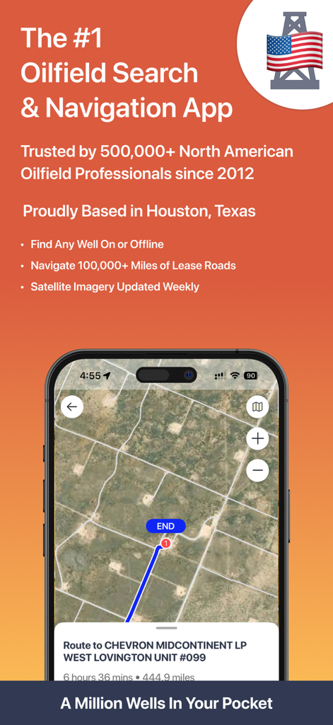
Wellsite Navigator App zeigt eine Satellitenkarte und Route zu einem Ölbohrlochstandort.
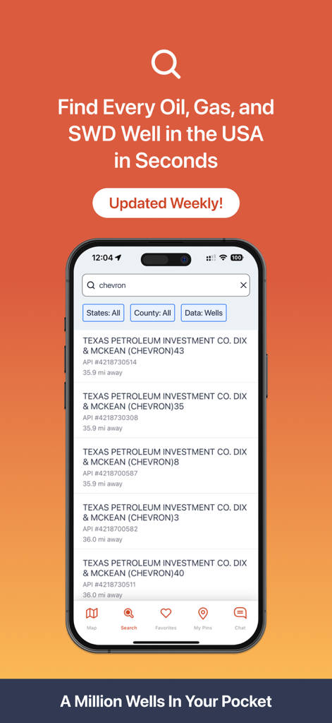
Wellsite Navigator App zeigt Suchergebnisse für Öl- und Gasbohrungen mit API-Nummern
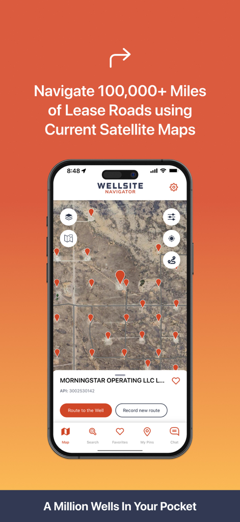
Wellsite Navigator Mobile App-Oberfläche zeigt Ölbohrlochstandorte und Satellitenkartierung für Pachtstraßen
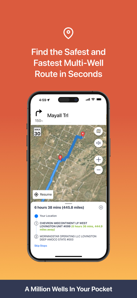
Wellsite Navigator App zeigt eine Multi-Stop-Route auf einer Satellitenkarte für die Navigation im Ölfeld.
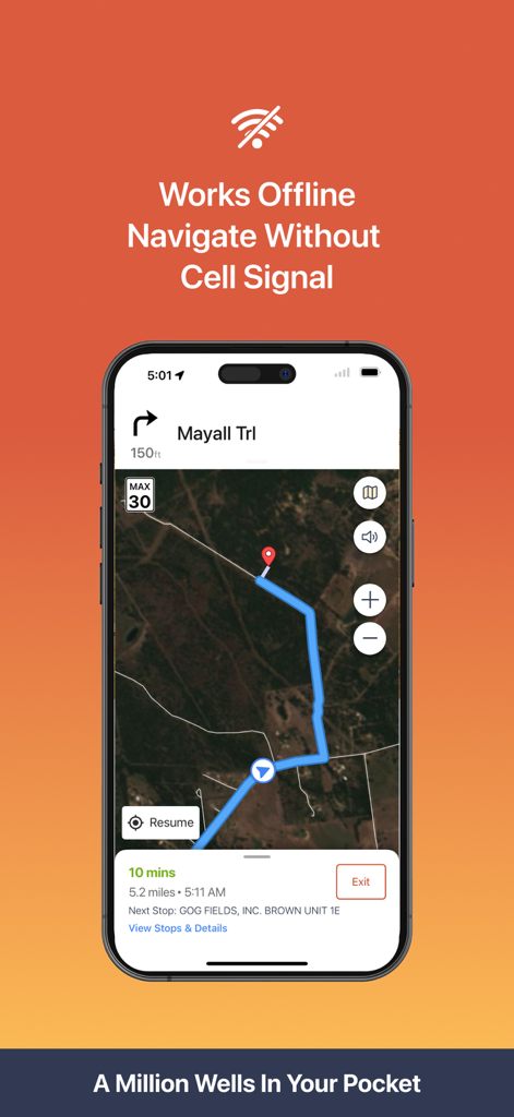
Wellsite Navigator Mobile App zeigt Offline-Satellitennavigation zu einem Ölfeldstandort ohne Mobilfunksignal
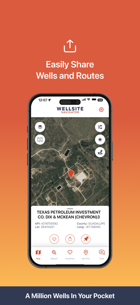
Smartphone zeigt die Wellsite Navigator App mit einem Bohrlochstandort auf einer Satellitenkarte und Freigabeoptionen.
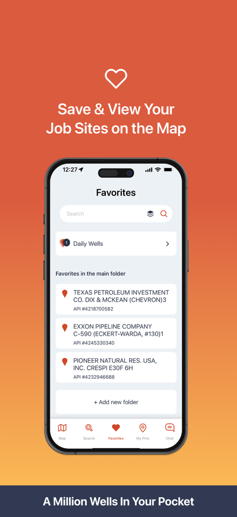
Wellsite Navigator Mobile App Favoriten-Bildschirm zeigt gespeicherte Ölfeld-Arbeitsstandorte mit API-Nummern
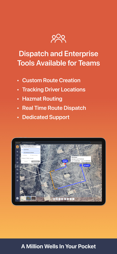
Wellsite Navigator App-Bildschirm zeigt Enterprise-Dispatch-Tools und Routenverfolgung für Ölfeldteams.

Werbebildschirm für Wellsite Navigator mit Live-Kunden-Support aus Houston und ihrem Director of Client Success
Beschreibung
Download
Ähnliche Apps
Apps mit ähnlichen Funktionen und Nutzererfahrung


Diese Seite ist keine offizielle Seite der App oder ihres Entwicklers, sondern eine unabhängige redaktionelle Veröffentlichung, die zu Informations- und Kommentarzwecken erstellt wurde. Sofern nicht ausdrücklich anders angegeben, sind weder die App noch ihr Entwickler mit MWM, Apple, Google Play, dem App-Herausgeber oder dem Entwickler der App verbunden, von ihnen unterstützt, gesponsert, autorisiert oder anderweitig offiziell verbunden, und nichts auf dieser Seite impliziert, dass die App unter Verwendung der Dienste von MWM entwickelt wurde. Alle Marken, Logos, Screenshots und andere Inhalte bleiben Eigentum ihrer jeweiligen Inhaber.